National Weather Summary for Wednesday, April 6, 2016
by David Moran, on Apr 6, 2016 10:25:27 AM
Thunderstorms will be possible on Wednesday across portions of the Southeast ahead of a cold front. Enhanced wildfire conditions will continue across parts of the Central Plains.
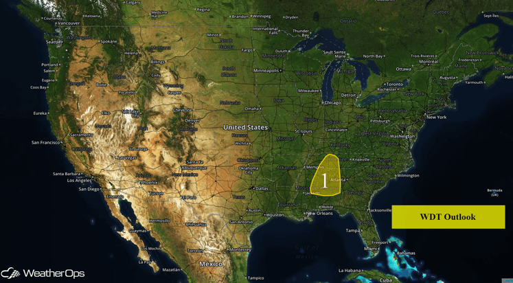
US Hazards
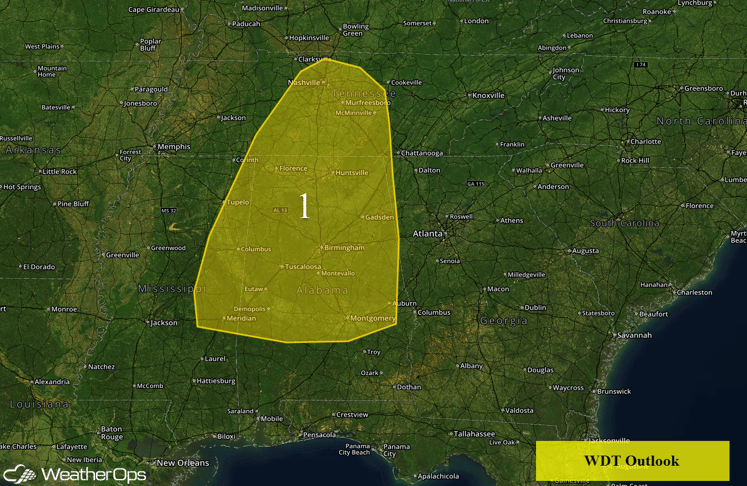
Region 1
Strong to severe thunderstorms are possible Wednesday across Region 1 ahead of an approaching cold front. An area of low pressure situated near the Iowa/Wisconsin border will continue to move eastward into the Great Lakes through this evening. The associated cold front located along western Missouri stretching southward into central Texas will move eastward into the Tennessee River Valley and Deep South by this afternoon. As this front continues to move through the region, scattered thunderstorms ahead of the front will increase in coverage and intensity and be linear in nature. These thunderstorms are capable of producing all severe weather threats with the main threats being strong wind gusts and large hail, as well as an isolated tornado.
Enhanced wildfire conditions continuing across the Plains
Enhanced wildfire conditions will continue across portions of Kansas, Oklahoma, and Southern Nebraska. Low relative humidities between 10-20% and northwesterly winds of 20-30 miles per hour with gusts in excess of 45 miles per hour will allow for extreme fire conditions. Any fires that start will have the potential to spread rapidly.
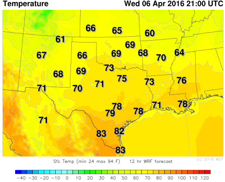
WDT WRF Temperatures 4pm CDT
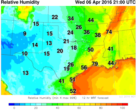
WDT WRF Relative Humidity 4pm CDT
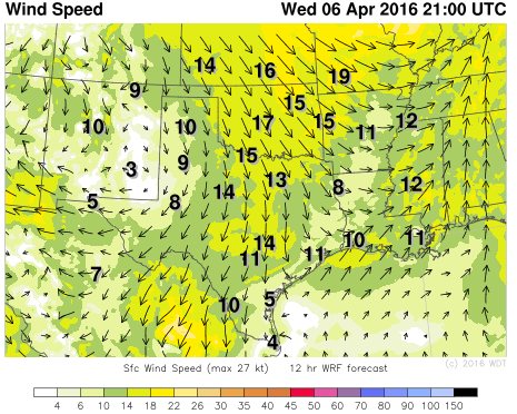
WDT WRF Winds 4pm CDT


