


by David Moran, on Apr 5, 2017 11:01:45 AM
Severe thunderstorms are expected across portions of the Southeast northward into the Ohio Valley on Wednesday ahead of a cold front moving eastward. A round of snow is expected across the Lower Peninsula of Michigan as an area of low pressure moves to the south of the region. Elevated winds and seas are expected for portions of the Gulf of Mexico in association with a passing cold front.
 US Hazards

Region 1
Much of the Ohio Valley, Southeast, and into the Mid-Atlantic will be under a threat for severe weather today as a strong low pressure system tracks through the Midwest. Ongoing severe thunderstorms across Alabama and Georgia this morning will pose a threat for large hail and damaging wind gusts, and an isolated tornado for the next few hours. The next round of thunderstorms is expected to begin during the early afternoon hours along and ahead of a cold front that will track through the outlook region during the day. Storms will develop from southern Indiana southward into western Alabama during the afternoon and increase in coverage and intensity while shifting eastward throughout the day and evening. The atmosphere will support very large hail, damaging wind gusts, and tornadoes, with the tornado threat being greatest over the Tennessee Valley. Thunderstorms will reach the Mid-Atlantic/Florida by the late evening/overnight hours with the primary hazards being damaging winds.
Update 12:42pm EDT: Tornado Warnings in effect near Atlanta and southeast of Columbus, GA.
 Radar 12:42pm EDT
Update 1:09pm EDT: Tornado Watch in effect for portions of Alabama, Florida, Georgia, and South Carolina until 8pm EDT. Hail to 2.5", damaging winds, and tornadoes, some intense, will be possible.
 Tornado Watch
Update 1:20pm EDT: Tornado Emergency declared for Sumter County in west central Georgia.
Update 1:24pm EDT: Tornado Warning west of Columbia, SC until 2pm EDT.
 Radar 1:24pm EDT
Update 1:44pm EDT: Tornado Warnings north of Albany, GA.
 Radar 1:44pm EDT
Update 2:00pm EDT: New Tornado Warning includes Columbia, SC.
 Radar 2:00pm EDT
.@GDOT_I75_s_ga traffic cams capture #tornado crossing highway between #Cordele & #Vienna @WGXAnews @WFXL pic.twitter.com/9UCP16Cyf1
— Kerri Copello (@KerriWFXL) April 5, 2017
Update 2:43pm EDT: New Tornado Warning north of Albany, GA. Large hail and tornadoes will be the primary hazards.
 Radar 2:43pm EDT
Update 2:49pm EDT: Tornado Watch in effect for portions of North Carolina and South Carolina until 8pm EDT.
 Tornado Watch
Update 2:54pm CDT: Tornado Warning SE of Columbia, SC
 Radar 2:54pm EDT
Update 2:06pm CDT: Tornado Watch for portions of Alabama, Georgia, Indiana, Kentucky, and Tennessee until 9pm CDT. Hail to 2.5", damaging winds to 70 mph, and tornadoes possible.
 Tornado Watch
Update 3:44pm EDT: Tornado Warning SE of Columbia, SC.
 Radar 3:44pm EDT
Update 3:52pm EDT: Tornado confirmed over Lowery, GA moving eastward at 35 mph.
Update 3:58pm EDT: Tornado Warning south of Columbia, SC until 4:45pm EDT.
 Radar 3:58pm EDT
PICS: Incredible damage in Americus, GA after reported #tornado [via @WTVM Facebook fan Joan Scarborough] #GAwx @wtvmweather pic.twitter.com/kyZfHxF8bE
— Shawn Reynolds (@ShawnWTVM9) April 5, 2017
Update 3:24pm CDT: Severe Thunderstorm Watch in effect until 9pm EDT for portions of Illinois, Indiana, Kentucky, and Ohio. Hail to 2 inches, damaging winds to 70 mph, and isolated tornadoes will be the main hazards.
 Severe Thunderstorm Watch
Update 4:47pm EDT: Severe thunderstorm capable of large hail east of Birmingham. May be gaining some rotation.
 Radar 4:46pm EDT
Update 5:14pm EDT: Tornado warned storm south of Oxford, AL. Rotation increasing.
 Radar 5:14pm EDT
Update 5:34pm EDT: Tornado Warning NE of Tullahoma, TN
 Radar 5:34pm EDT
Update 5:47pm EDT: Tornado Warnings south of Louisville, KY. May produce golf ball sized hail.
 Radar 5:47pm EDT
Major Cities in Region: Mobile, AL, Tallahassee, FL, Jacksonville, FL, Birmingham,AL, Atlanta,GA, Charleston, SC, Nashville, TN, Raleigh, NC, Louisville, KY, Charleston, WV, Cincinnati, OH, Indianapolis, IN
 Region 1
Region 2
An area of low pressure to the south will bring snow to the region beginning Wednesday evening and continue through Thursday. Snow will taper off Thursday evening before ending overnight. Snow accumulations of 3-6 inches with isolated higher amounts of 7 inches are forecast. In addition, winds of 20-25 mph with gusts in excess of 40 mph will allow for areas of blowing snow, visibilities of less than half a mile, and wind chills in the teens.
Major Cities in Region: Traverse City, MI, Grand Rapids, MI, Alpena, MI
 Region 2
Region 3
A cold front will move into the western portions of Gulf of Mexico Wednesday morning. Ahead of the front, winds will be southwesterly at 10-15 knots. Behind the front, winds will be northwesterly to north-northwesterly at 20-30 knots with gusts in excess of 35 knots. Swells of 5-7 feet are expected near the shore and 7-9 feet in the deep waters. Scattered showers and thunderstorms will also be possible along the front. Conditions will subside Thursday afternoon.
 Region 3
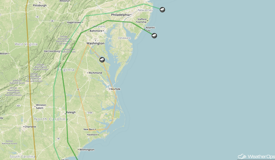
Strong to Severe Thunderstorms Possible for the Mid Atlantic on Thursday
The area of low pressure described above will continue to move northeastward into the Northeast. The associated warm front will continue to lift northward, pulling warm moist air into the Mid Atlantic ahead of a cold front. This will allow for thunderstorm activity ahead of the front. With strong wind shear and forcing ahead of the front, large hail and damaging winds will be the primary hazards, but a few tornadoes cannot be ruled out. In addition, heavy rainfall amounts of 1-2 inches with isolated amounts in excess of 3 inches are expected.
Major Cities in Region: Wilmington, NC, Raleigh, NC, Norfolk, VA, Richmond, VA, Washington, DC, Baltimore, MD
 SPC Convective Outlook for Thursday
Excessive Rainfall Possible for Portions of California on Friday
As a Pacific low slowly tracks eastward its associated cold front will track into California. Ahead of the low pressure, ample moisture will be pulled northward into California and with the front providing strong lift across the region moderate to heavy rainfall will be likely across California. Rain will continue into Saturday morning with rainfall amounts of 2-4 inches with isolated higher amounts in excess of 5 inches will be possible. With the heavy rain falling across the region excessive runoff and localized flooding will be possible in the valleys of California.
Major Cities in Region: Eureka, CA, San Francisco, CA, Sacramento, CA
 Excessive Rainfall Risk Outline for Friday
Strong to Severe Thunderstorms Possible for the Pacific Northwest on Friday
Instability and strong wind shear ahead of a cold front will result in an increase in shower and thunderstorm activity during the afternoon on Friday. Some of this activity may become strong to severe with large hail the primary hazard but there may be a few isolated instances of damaging winds.
Major Cities in Region: Spokane, WA
 SPC Convective Outlook for Friday
A Look Ahead
An area of low pressure will move out of the Intermountain West and into the Plains. Ahead of the low, warm moist air will move northward. Ahead of this low, instability will build during the day. With wind shear increasing across the region, thunderstorms are expected. With any thunderstorms that develop, large hail, damaging winds, and tornadoes will be possible.
This is just a brief look at current weather hazards. We can provide you site-specific weather forecast information for the purpose of protecting your personnel and assets and to assess your weather risk. Try a 7-day demo right away and learn how timely precision weather information can enhance your bottom line.
