National Weather Summary for Wednesday, April 19, 2017
by David Moran, on Apr 19, 2017 10:29:13 AM
An area of low pressure moving through the Plains and Midwest will allow for the development of thunderstorms on Wednesday. Further east, a few thunderstorms may develop across Michigan and Ohio along a stalled front.
- Severe Thunderstorms Expected Wednesday from the Upper Midwest to Southern Plains
- Strong to Severe Thunderstorms Possible Thursday from Southern Plains to Ohio Valley
- Risk for Strong to Severe Thunderstorms for Southern Plains on Friday
- Excessive Rainfall Possible Friday for Southern Plains
Severe Thunderstorms Expected Wednesday from the Upper Midwest to Southern Plains
A cold front moving southward across the Great Lakes and an intensifying surface low moving out of the Plains will provide a focus for thunderstorm development across much of Region 1 today. Thunderstorms are currently ongoing from far western Illinois westward into Nebraska. Most of this activity remains below severe limits, but an isolated severe storm cannot be ruled out. By the afternoon and evening as instability increases and additional thunderstorms develop, there will be a greater threat for severe thunderstorms. Some of this activity will continue through the overnight hours. Large hail, damaging winds, and tornadoes will all be possible with any storms that develop. The greatest risk for severe impacts will be centered over Iowa.
Update 1:08pm CDT: Thunderstorms producing frequent lightning and small hail in NW Iowa.
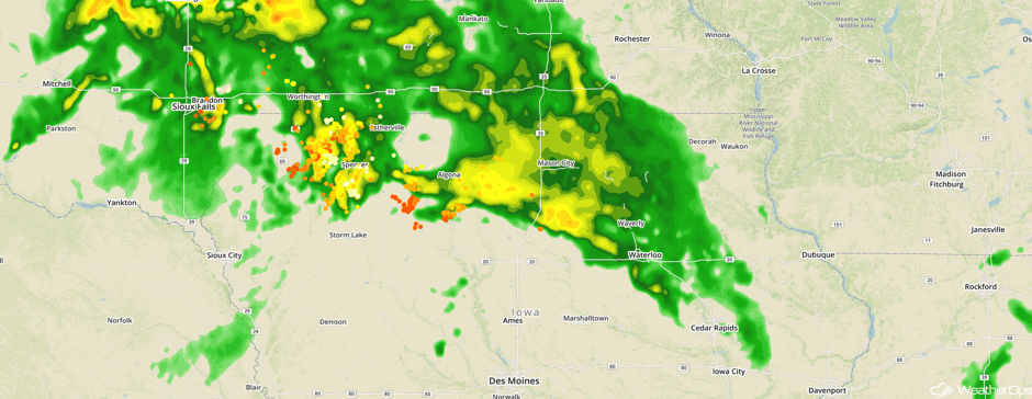 Radar 1:08pm CDT
Update 1:47pm CDT: Thunderstorm capable of frequent lightning and small hail north of Lafayette, IN.
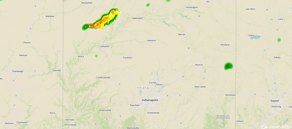 Radar 1:47pm CDT
Major Cities in Region: Wichita, KS, Topeka, KS, Omaha, NE, Kansas City, MO, Des Moines, IA, Milwaukee, WI, Chicago, IL, Detroit, MI, Cleveland, OH, Pittsburgh, PA
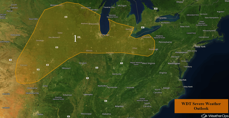 Region 1
Strong to Severe Thunderstorms Possible Thursday from Southern Plains to Ohio Valley
An upper level low is forecast to amplify over the Great Lakes on Thursday. Meanwhile, a cold front stretching from Southern Michigan into Northwest Texas is expected to stall by mid to late afternoon. Thunderstorm development is expected ahead of the front by early afternoon. These storms will track eastward into the Ohio Valley, Western Pennsylvania, and Western New York by nightfall. Storms will pose a primary threat of severe winds. While instability will be higher across the Southern Plains, storm development will be conditional. If storms are able to develop, large hail and damaging winds will be the primary hazards.
Major Cities in Region: Amarillo, TX, Oklahoma City, OK, Tulsa, OK, Fort Smith, AR, Springfield, MO, St. Louis, MO, Indianapolis, IN, Detroit, MI, Cleveland, OH, Pittsburgh, PA
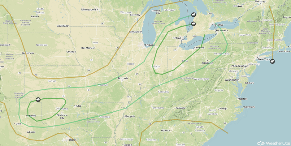 SPC Convective Outlook for Thursday
Risk for Strong to Severe Thunderstorms for Southern Plains on Friday
Another area of low pressure is expected to move through the Southern Plains on Friday. While there is a high degree of uncertainty, there will be a potential for severe thunderstorms Friday afternoon and evening. Storms that develop will have the potential for large hail, damaging winds, and tornadoes.
Major Cities in Region: Oklahoma City, OK, Denton, TX, Tulsa, OK, Fort Smith, AR
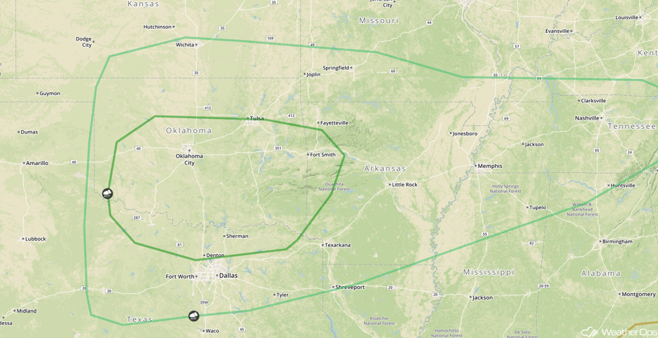 SPC Convective Outlook for Friday
Excessive Rainfall Possible Friday for Southern Plains
In addition to the severe weather, there will also be a threat for excessive rainfall on Friday. Showers and thunderstorms will likely persist into the late evening. Rainfall totals may exceed 3 inches in some locations, resulting in a threat for flooding and local runoff.
Major Cities in Region: Tulsa, OK, Joplin, MO, Springfield, MO, St. Louis, MO
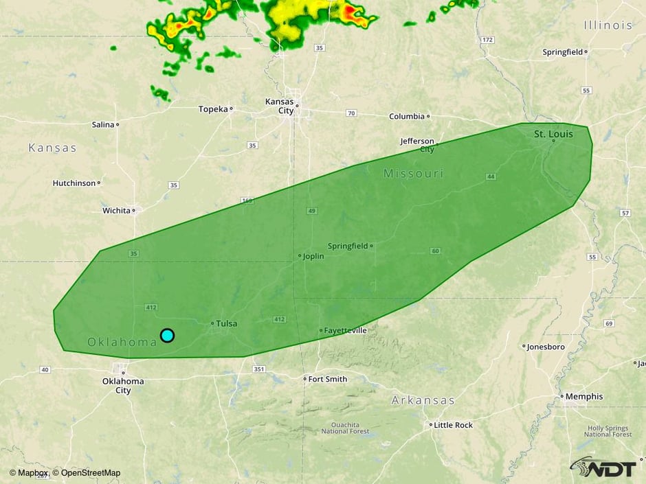 Excessive Rainfall Risk Outline for Friday
A Look Ahead
As the area of low pressure described above continues to move eastward on Saturday, thunderstorms are expected to develop across the Mid Mississippi and Ohio Valleys. Large hail, damaging winds, and tornadoes will be possible with any storms that develop.
This is just a brief look at current weather hazards. We can provide you site-specific weather forecast information for the purpose of protecting your personnel and assets and to assess your weather risk. Try a 7-day demo right away and learn how timely precision weather information can enhance your bottom line.


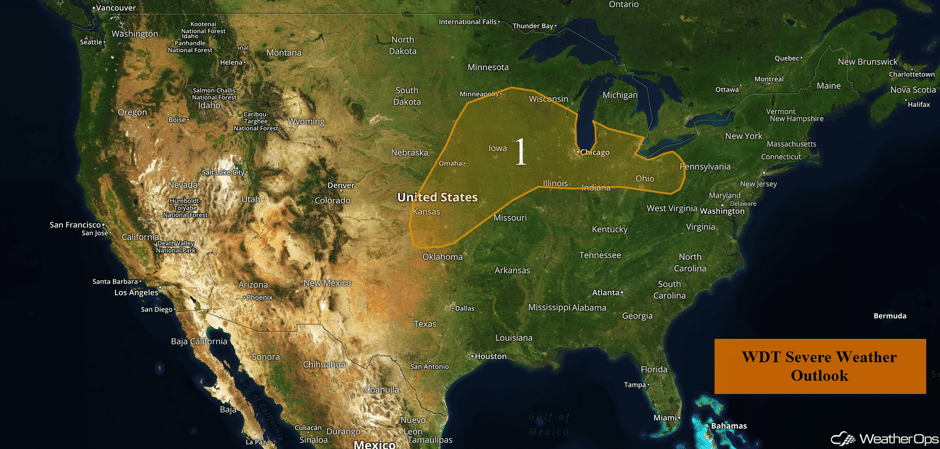 US Hazards

