National Weather Summary for Wednesday, April 12, 2017
by David Moran, on Apr 12, 2017 11:05:03 AM
A weak upper level system will provide lift for thunderstorms across portions of the Southern Plains on Wednesday. Thunderstorms may develop across portions of the Plains Wednesday afternoon as a warm front lifts northward.
- Strong to Severe Thunderstorms Possible for Portions of the Plains on Wednesday
- Thunderstorm Potential for New Mexico and West Texas on Thursday
- Excessive Rainfall Possible for Portions of Northwestern Texas and Western Oklahoma on Thursday
- Strong to Severe Thunderstorms Possible from Central Plains into West Texas Friday
- Excessive Rainfall Possible Friday for Portions of Central Plains
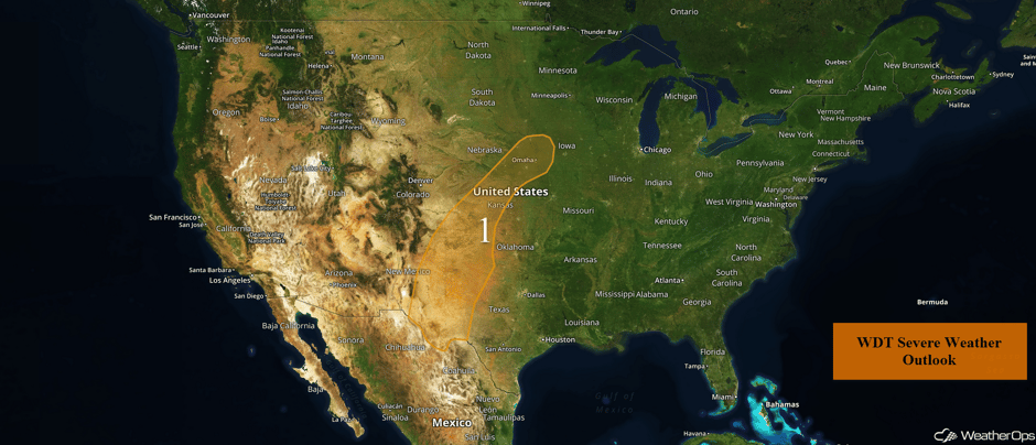 US Hazards
Strong to Severe Thunderstorms Possible for Portions of the Plains on Wednesday
An upper level trough will move into the Southern High Plains this afternoon. At the surface, plentiful moisture should be in place along and ahead of a dryline. While wind shear should be weak, instability should be sufficient for the development of strong to severe thunderstorms. Hail and damaging winds will be the primary hazards with any storm, but an isolated tornado or two cannot be ruled out. The higher threat will be across New Mexico and Texas, but a secondary threat will exist from Kansas into Nebraska and Iowa,
Update 12:08pm MDT: Severe thunderstorm capable of large hail and damaging winds north of Alamogordo, NM.
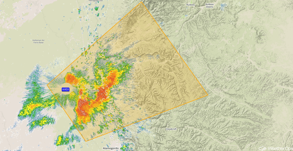 Radar 12:08pm MDT
Update 1:33pm CDT: Thunderstorm capable of large hail northwest of Beloit, KS.
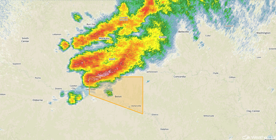 Radar 1:33pm CDT
Radar 1:50pm CDT: Thunderstorm capable of large hail and damaging winds southwest of Pecos, TX.
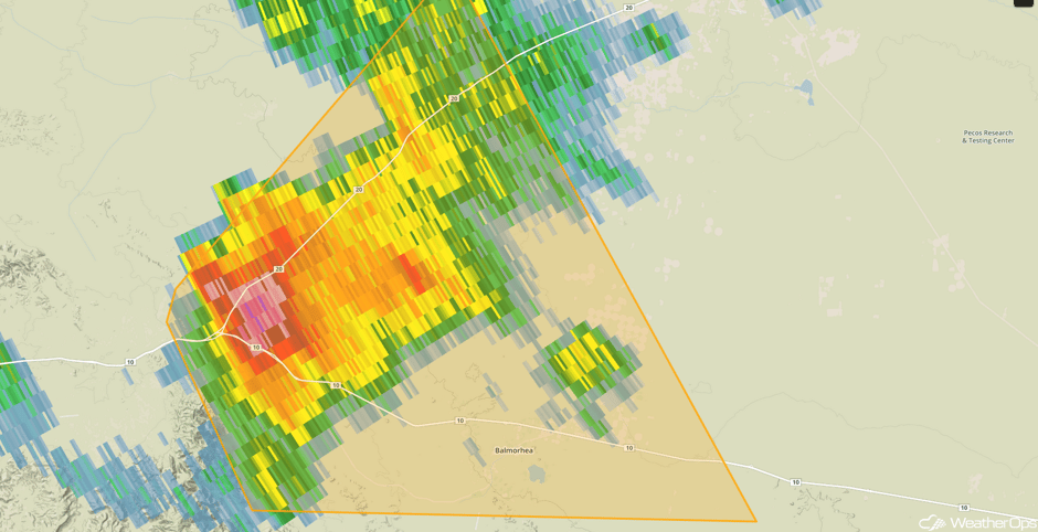 Radar 1:50pm CDT
Update 1:55pm CDT: Severe thunderstorm capable of large hail and damaging wind northeast of Hobbs, NM.
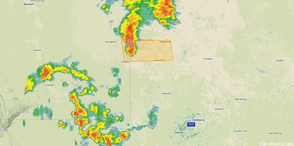 Radar 1:55pm CDT
Major Cities in Region: Odessa, TX, Lubbock, TX, Amarillo, TX, Dodge City, KS, Omaha, NE
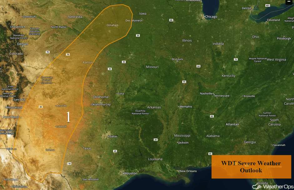 Region 1
Thunderstorm Potential for New Mexico and West Texas on Thursday
Isolated strong to severe thunderstorms will be possible into Thursday afternoon and evening over West Texas and eastern New Mexico. Even though there will be thunderstorms in the morning, instability is expected to build through the afternoon as skies clear. Strong wind gusts and large hail will be the primary hazards with any thunderstorms that develop.
Major Cities in Region: Roswell, NM, Carlsbad, NM
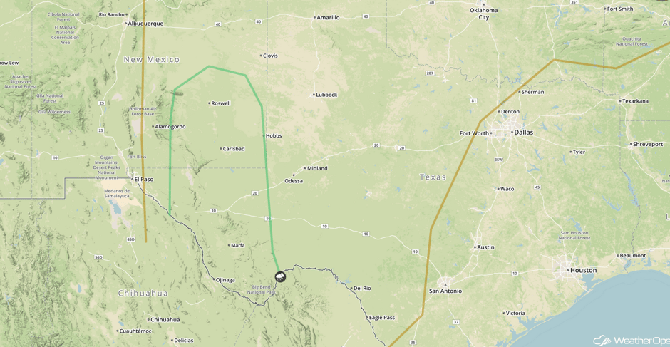 SPC Convective Outlook for Thursday
Excessive Rainfall Possible for Portions of Northwestern Texas and Western Oklahoma on Thursday
An ongoing cluster of heavy rain and thunderstorms from Wednesday night is forecast to move through northwestern Texas into western Oklahoma on Thursday. The cluster of precipitation and thunderstorms will limit overall instability and the potential for additional thunderstorm development in the afternoon. However, heavy to excessive rainfall may lead to flooding and/or flash flooding. Rainfall amounts of 2-3 inches with locally higher amounts in excess of 5 inches are forecast.
Major Cities in Region: Altus, OK, Lawton, OK, Woodward, OK
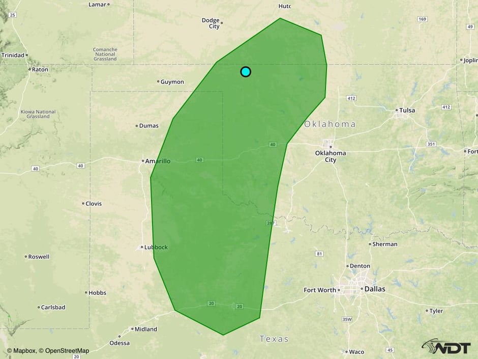 Excessive Rainfall Risk Outline for Thursday
Strong to Severe Thunderstorms Possible from Central Plains into West Texas Friday
Moisture return is forecast on Friday across the Central Plains and West Texas ahead of a cold front and dryline. Daytime heating will allow instability to build throughout the day. Across the Central Plains with the cold front and upslope flow, strong to severe thunderstorms capable of hail and damaging winds may develop. Further south into West Texas, thunderstorms may develop ahead of the dryline. If thunderstorms are able to develop, gusty winds and large hail will be the primary hazards.
Major Cities in Region: Amarillo, TX, Dodge City, KS, Goodland, KS, Omaha, NE
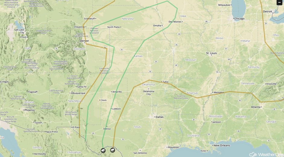 SPC Convective Outlook for Friday
Excessive Rainfall Possible Friday for Portions of Central Plains
Thunderstorms will evolve into a complex Friday evening and into early Saturday morning. As the complex progresses over eastern Nebraska and western Iowa, heavy to excessive rainfall will be possible. Total rainfall accumulations of 2-3 inches with locally heavier amounts in excess of 4 inches are forecast.
Major Cities in Region: Topeka, KS, Kansas City, MO, Omaha, NE, Des Moines, IA
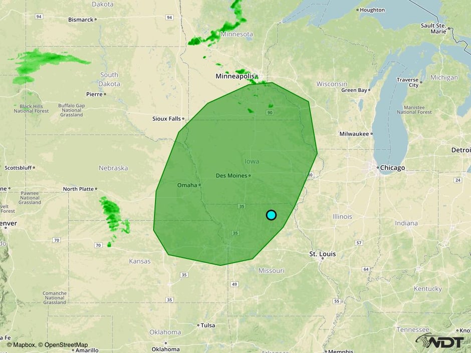 Excessive Rainfall Risk Outline for Friday
A Look Ahead
The cold front moving across the Plains will continue moving over the region on Saturday, allowing for a potential for strong to severe thunderstorms across the Plains. Gusty winds and hail will be the primary hazards with these storms. There will be the potential for thunderstorms across portions of the Northern Plains as an area of low pressure and warm front moves northward.
This is just a brief look at current weather hazards. We can provide you site-specific weather forecast information for the purpose of protecting your personnel and assets and to assess your weather risk. Try a 7-day demo right away and learn how timely precision weather information can enhance your bottom line.


