National Weather Summary for Tuesday, October 3, 2017
by David Moran, on Oct 3, 2017 11:15:11 AM
Thunderstorms may develop across portions of New Mexico on Tuesday as a weak disturbance tracks through the Four Corners region.
- Thunderstorms for Portions of New Mexico on Tuesday
- Snow Continuing Tuesday across Montana
- Elevated Winds and Seas Continue for the Gulf of Mexico Through Thursday
- Excessive Rainfall Wednesday for Eastern New Mexico
- Risk for Excessive Rainfall across Oklahoma Wednesday
- Excessive Rainfall Potential Thursday for the Missouri Valley
- Tropical Update - What's next?
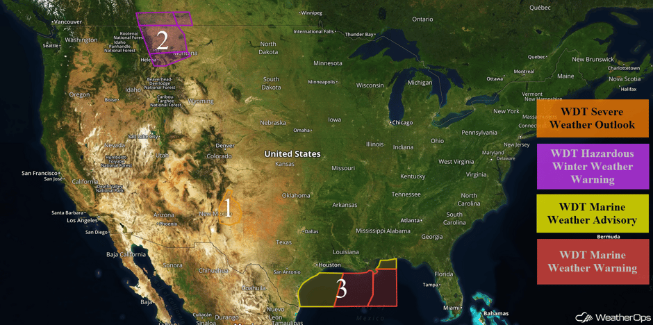 US Hazards
Thunderstorms for Portions of New Mexico on Tuesday
Upslope flow along with some convergence in northern New Mexico near a stalled front and area of low pressure should allow for scattered thunderstorms. Some thunderstorms will be strong to severe with large hail, damaging winds, and tornadoes all potential hazards,
Major Cities in Region: Roswell, NM, Tucumcari, NM
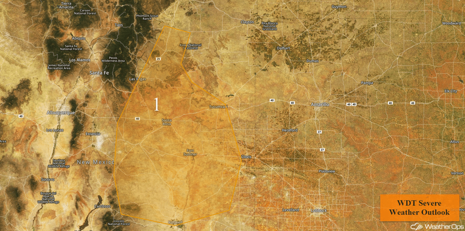 Region 1
Snow Continuing Tuesday across Montana
Snow will continue across portions of Montana through the morning. Total accumulations of 6-10 inches with locally higher amounts in excess of a foot are forecast. Higher elevations may pick up 8-12 inches with locally higher amounts in excess of 14 inches.
Major Cities in Region: Helena, MT, Great Falls, MT
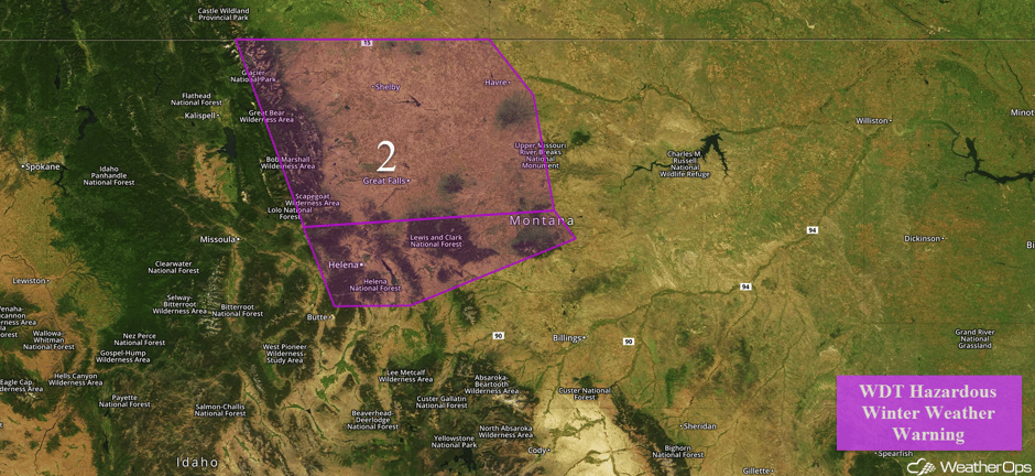 Region 2
Elevated Winds and Seas Continue for the Gulf of Mexico Through Thursday
High pressure is forecast to build across the southeastern United States over the next several days. At the same time, a monsoonal low will be situated over the Yucatan Peninsula. These features will increase the winds and seas across the region. Across the western areas, winds of 20-25 knots with gusts in excess of 35 knots as well as seas of 6-9 feet are forecast. For eastern areas, winds of 25-30 knots with gusts in excess of 40 knots are expected as well as seas ranging 9-11 feet.
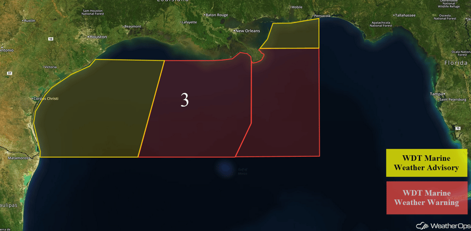 Region 3
Excessive Rainfall Wednesday for Eastern New Mexico
A nearly stationary front draped across the Central US will remain positioned between two areas of high pressure. Shower activity should be more pronounced than on Tuesday, owing to increasing moisture lifting northward from the Gulf of Mexico. As a result, there will a risk of minor flooding and runoff.
Major Cities in Region: Albuquerque, NM, Santa Fe, NM, Roswell, NM, Carlsbad, NM
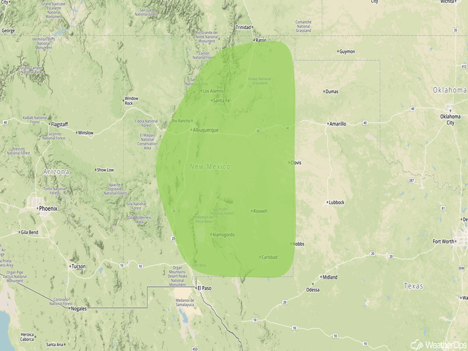 Excessive Rainfall Risk Outline for Wednesday
Risk for Excessive Rainfall across Oklahoma Wednesday
The same front will allow for a risk of excessive rainfall across Oklahoma. Some areas may see one to two inches of rainfall through early Thursday morning with minor flooding and runoff possible.
Major Cities in Region: Lawton, OK, Oklahoma City, OK, Tulsa, OK, McAlester, OK
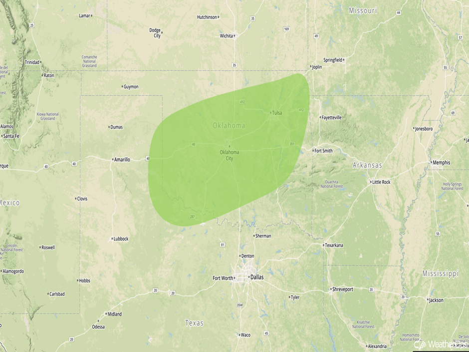 Excessive Rainfall Risk Outline for Wednesday
Excessive Rainfall Potential Thursday for the Missouri Valley
A minimal threat for severe weather will continue into Thursday. A new area of low pressure is not expected to intensify much during the day. However, showers and thunderstorms are expected along and south of a warm front stretching from Nebraska into Illinois. Rainfall amounts of 1-2 inches with locally higher amounts are forecast from Thursday into early Friday. There will be a risk for flooding and runoff across the region.
Major Cities in Region: Grand Island, NE, Topeka, KS, Sioux City, IA, Omaha, NE, Kansas City, MO, Des Moines, IA
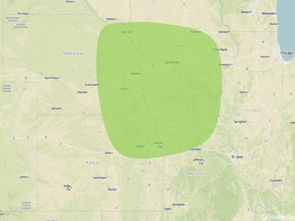 Excessive Rainfall Risk Outline for Thursday
Tropical Update
A trough of low pressure moving over southern Florida is producing showers and gusty winds. Upper level winds are not favorable for tropical cyclone development.
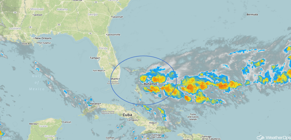 Enhanced Infrared Tropical Satellite
A Look Ahead
Showers and thunderstorms may develop across the Missouri Valley and Midwest on Friday as an area of low pressure strengthens. Shower activity will also increase over Florida; this activity will continue through the weekend. From the Great Lakes into the Southern Plains, thunderstorms may develop ahead of a front on Saturday.
This is just a brief look at current weather hazards. We can provide you site-specific weather forecast information for the purpose of protecting your personnel and assets and to assess your weather risk. Try a 7-day demo right away and learn how timely precision weather information can enhance your bottom line.


