National Weather Summary for Tuesday, October 24, 2017
by David Moran, on Oct 24, 2017 10:52:51 AM
Strong to severe thunderstorms are forecast across portions of the Northeast on Tuesday ahead of a cold front. Elevated winds and seas are expected across the Gulf of Mexico through Wednesday morning.
- Thunderstorms for Portions of the Northeast on Tuesday
- Elevated Winds and Seas Expected through Wednesday across the Gulf of Mexico
- Excessive Rainfall for Portions of New England on Wednesday and Thursday
- Tropical Update
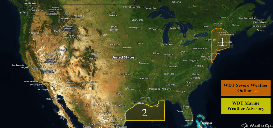 US Hazards
Thunderstorms for Portions of the Northeast on Tuesday
There will be a chance for a few strong to severe thunderstorms across portions of the Northeast Tuesday afternoon as a cold front moves through the region. Ongoing showers and thunderstorms this morning may increase in intensity this afternoon as conditions become more favorable across New Jersey, New York City, and into the Hudson Valley. The primary hazards with these storms will be strong wind gusts and an isolated tornado or two during the afternoon and early evening.
Major Cities in Region Philadelphia, PA, Atlantic City, NJ, New York, NY, Boston, MA
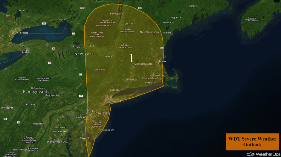 Region 1
Elevated Winds and Seas Expected through Wednesday across the Gulf of Mexico
A cold front will continue to move across the Gulf on Tuesday. Winds of 25-30 knots with gusts in excess of 35 knots are expected in the wake of the front. Swells will be 3-6 feet near the shore and 7-10 feet in the deeper waters. Conditions will begin to improve Wednesday afternoon and evening.
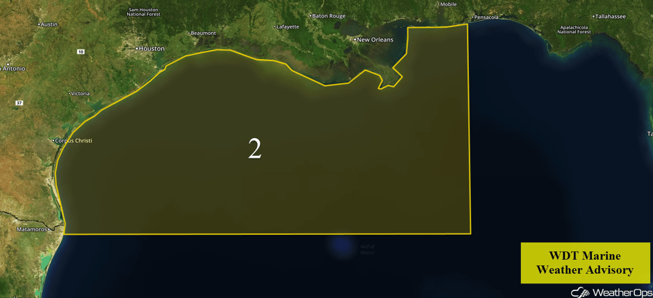 Region 2
Excessive Rainfall for Portions of New England on Wednesday and Thursday
Heavy rainfall is forecast to continue across portions of the New England region Wednesday into Thursday as a slow moving cold front continues to track toward the East Coast. In addition to the slow moving front, an area of low pressure is forecast to develop off the Delmarva Peninsula. This area of low pressure will track northward across the frontal boundary possibly enhancing the heavy rainfall across the region. Rainfall will continue into Thursday with two day rainfall totals of 3-5 inches and locally higher amounts in excess of 6 inches forecast. This will lead to the potential for widespread flooding.
In addition to the heavy rainfall, some isolated strong to severe thunderstorms may develop on Wednesday. Deep moisture will remain in place across the region; with forcing and strong wind shear in place, thunderstorms may develop during the afternoon. Damaging winds will be the primary hazards with these storms.
Major Cities in Region: Boston, MA, Portland, ME, Augusta, ME, Caribou, ME
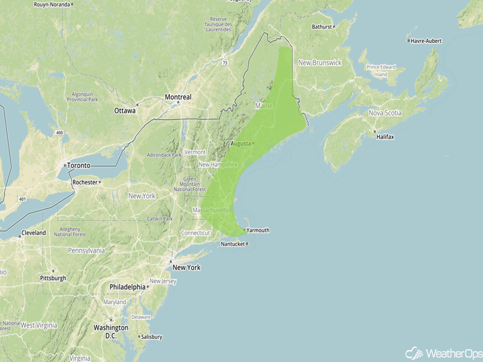 Excessive Rainfall Risk Outline for Wednesday and Thursday
Tropical Update
Widespread cloudiness and showers associated with a broad area of low pressure are located over the western Caribbean Sea, near the Central American coast. Close proximity to land is likely to limit the development of this system for the next day or two. However, environmental conditions are expected to be conducive for some development to occur while the system moves slowly northward over the northwestern Caribbean Sea.
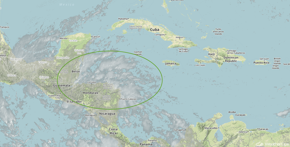 Visible Tropical Satellite
A Look Ahead
Light to moderate snow is expected across portions of the Great Lakes on Friday. Snowfall amounts of 2-4 inches are forecast across portions of Minnesota and northern Wisconsin. Rain and snow will continue across the Great Lakes into Saturday.
This is just a brief look at current weather hazards. We can provide you site-specific weather forecast information for the purpose of protecting your personnel and assets and to assess your weather risk. Try a 7-day demo right away and learn how timely precision weather information can enhance your bottom line.


