


by David Moran, on Oct 23, 2018 10:39:40 AM
Showers and thunderstorms are expected across portions of Arizona and New Mexico on Tuesday as an upper level trough moves over the region. Snow is forecast across portions of northern Maine through Thursday as an area of low pressure moves eastward. Elevated winds and seas will continue for the western Gulf of Mexico through early Wednesday morning.
- Thunderstorms for Arizona and New Mexico on Tuesday
- Snow through Thursday across Northern Maine
- Elevated Winds and Seas across the Western Gulf of Mexico through early Wednesday Morning
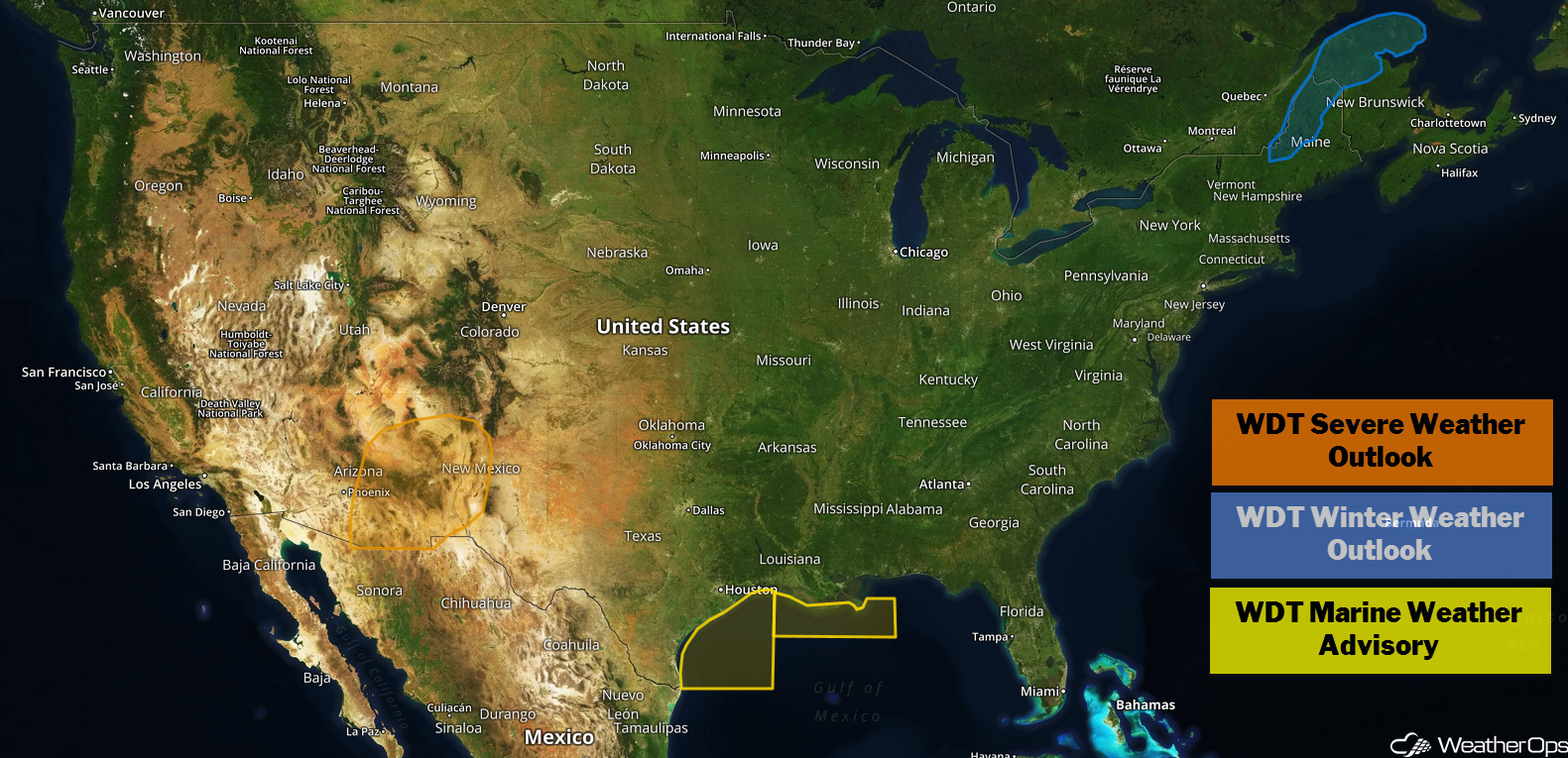
US Hazards
Thunderstorms for Arizona and New Mexico on Tuesday
Scattered showers and thunderstorms will increase in coverage throughout the day as an upper level trough moves across the region. By the late afternoon and evening, a few storms could become strong to severe. Widespread severe weather is not anticipated, but stronger storms could produce gusty winds and hail.
Major Cities in Region: Phoenix, AZ, Tucson, AZ, Truth or Consequences, NM
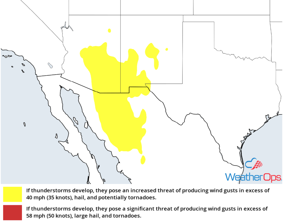
Thunderstorm Risk for Tuesday
Snow through Thursday across Northern Maine
A strong area of low pressure will move across portions of Maine beginning later tonight. Precipitation will begin as rain but quickly transition to snow. Widespread snowfall amounts of 3-6 inches are likely with locally higher amounts in excess of 8 inches. Further south, warmer temperatures could allow for some light icing. This low will move northeastward late tomorrow night.
Major Cities in Region: Presque Isle, ME
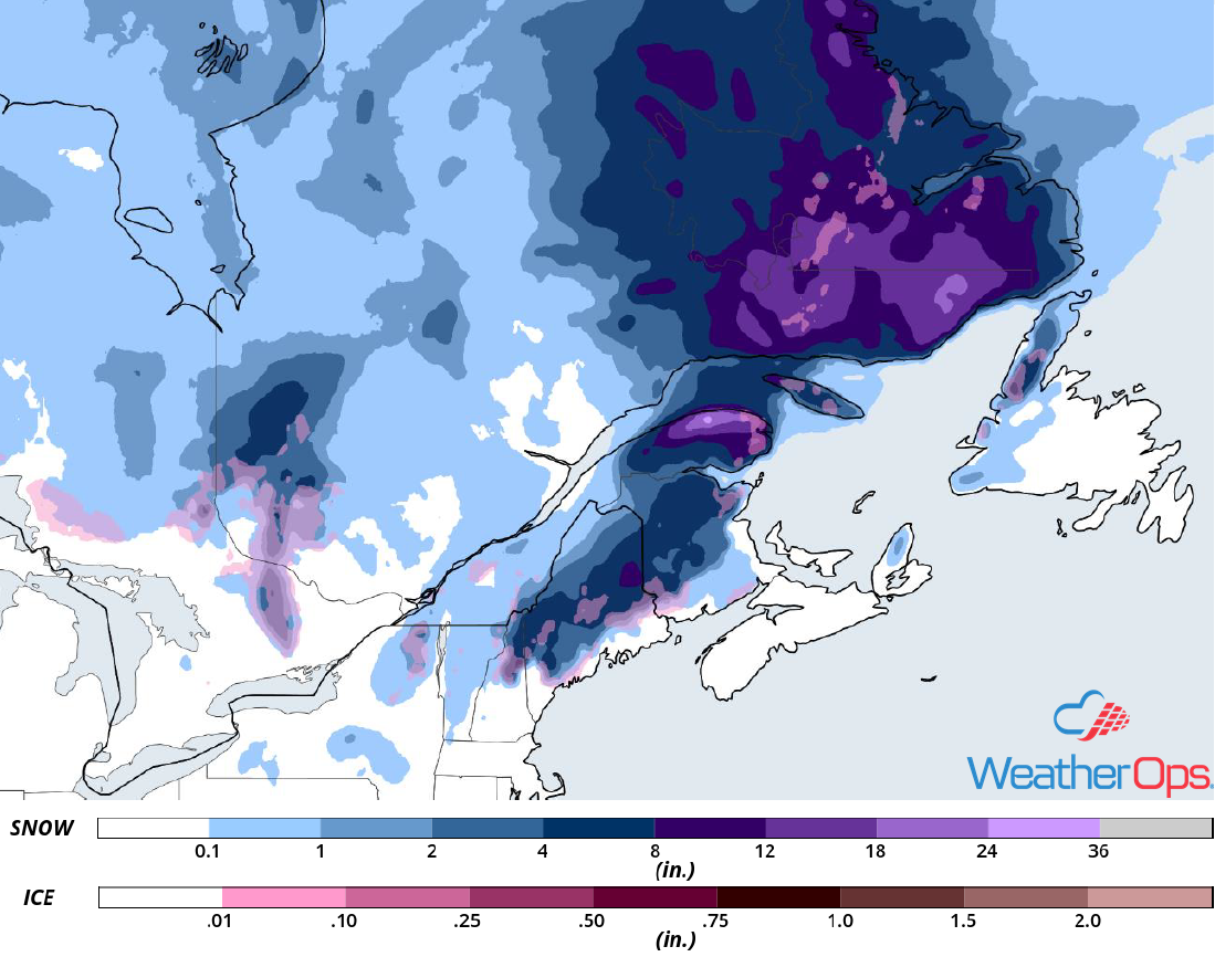
Snow and Ice Accumulation through Thursday
Elevated Winds and Seas across the Western Gulf of Mexico through early Wednesday Morning
A persistent area of low pressure and warm front have set up over the Gulf of Mexico, southeast of Texas, and continue to bring elevated winds and seas to the western Gulf. Seas between 6-9 feet can be expected today along the southeast Texas coast, mainly in the deeper waters. Winds 20-25 knots with gusts in excess of 30 knots are expected. Further east, seas will range 4-7 feet.
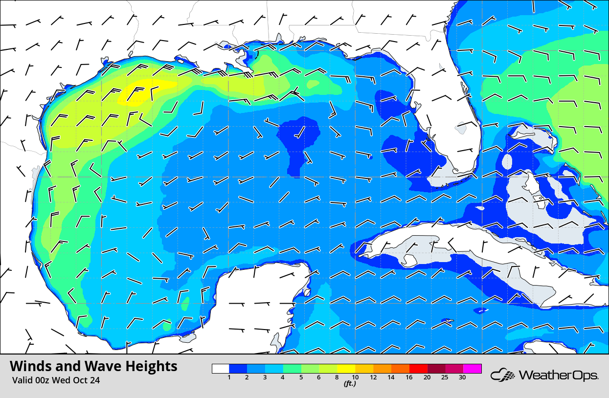
Winds and Wave Heights 7pm CDT Tuesday
A Look Ahead
The remnants of Hurricane Willa will continue moving eastward along the northern Gulf Coast on Friday, bringing rain to portions of the Southeast. By the weekend, this remnant low will move northward along the East Coast, producing a mixture of wintry precipitation from eastern New York into eastern Maine late Saturday into Sunday. Light snow may develop across portions of western New York on Monday.
