


by David Moran, on Nov 27, 2018 10:15:21 AM
Snow will continue across the Northeast through Wednesday as an area of low pressure moves across the region. An area of low pressure will produce freezing rain and snow across North Dakota through Wednesday.
- Snow for the Northeast through Wednesday
- Freezing Rain and Snow through Wednesday across North Dakota
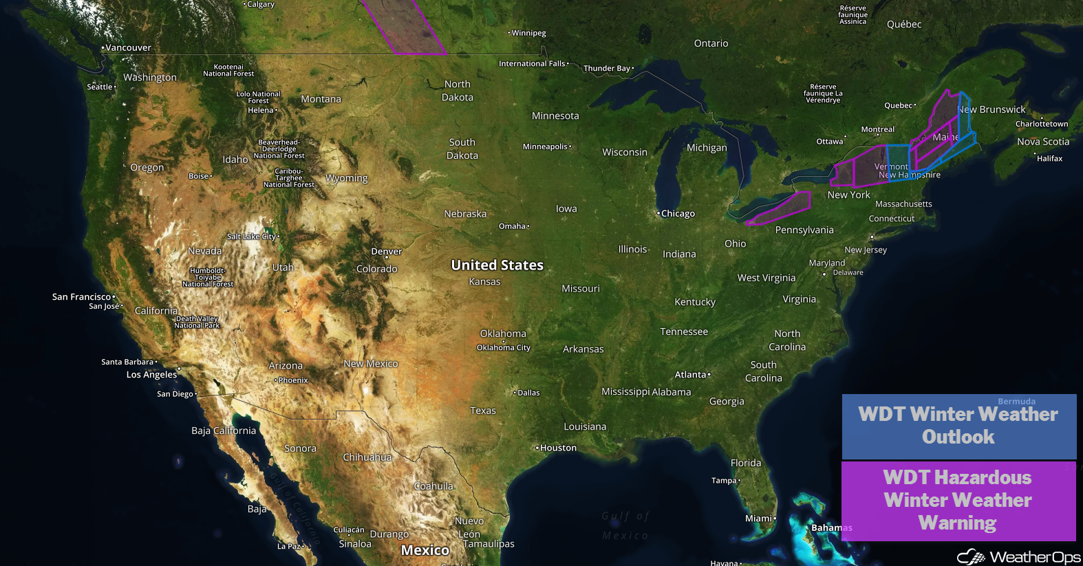
US Hazards
Snow for the Northeast through Wednesday
A strong area of low pressure moving across the Northeast will continue to produce snow across the region. Widespread totals of 4-8 inches with locally higher amounts in excess of a foot are expected across the higher elevations. as well as western New York.
Major Cities in Region: Buffalo, NY, Syracuse, NY, Albany, NY, Burlington, VT, Presque Isle, ME
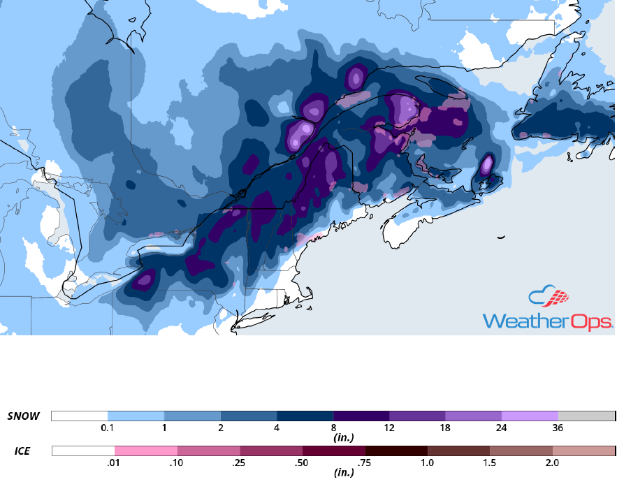
Snowfall Accumulation through Wednesday
Freezing Rain and Snow through Wednesday across North Dakota
Snow and some freezing rain are expected across portions of North Dakota through Wednesday as an area of low pressure moves eastward. Snowfall amounts will range 2-6 inches. Freezing rain accumulations up to 0.10 inch are expected.
Major Cities in Region: Minot, ND, Grand Forks, ND
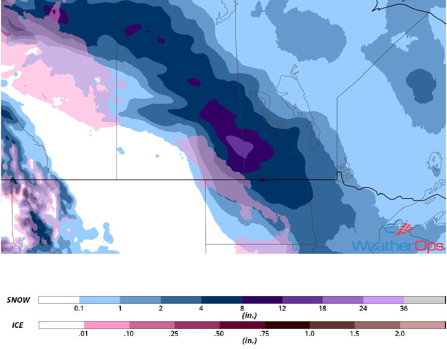
Snowfall Accumulation through Wednesday
A Look Ahead
An area of low pressure will produce snow across the Central Rockies on Friday. By late Friday and into Saturday, rain is forecast from the Plains into the Mid Mississippi Valley as an area of low pressure develops over the Plains. Snow is expected from the High Plains northeastward into Iowa and Minnesota Saturday into Sunday. Another round of snow may develop over the Rockies on Sunday as an upper level trough moves across the region. As this system continues to move eastward, snow is forecast across the Central Plains on Monday.
