


by David Moran, on May 8, 2018 10:25:17 AM
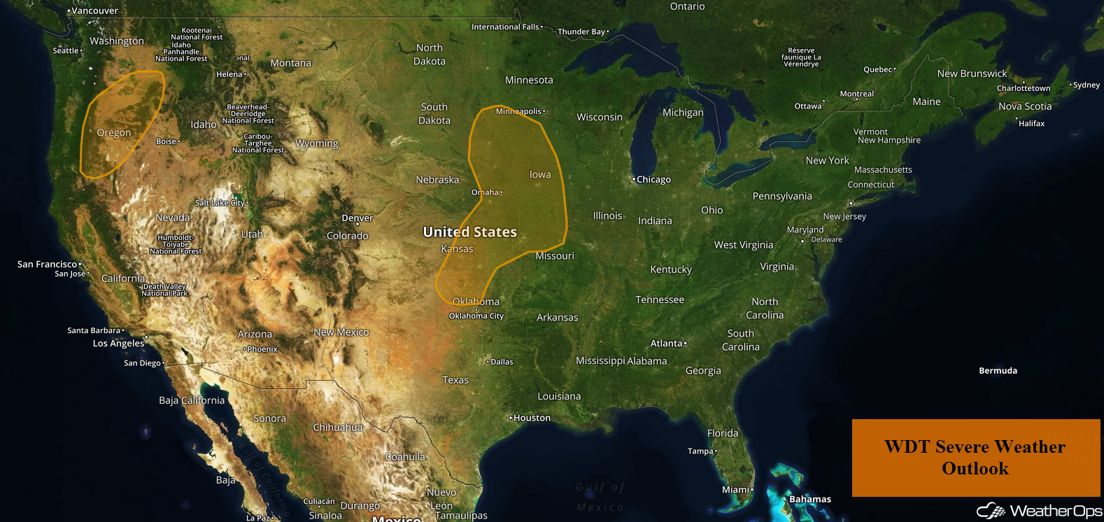
Thunderstorms may develop across portions of the Plains on Tuesday as an area of low pressure intensifies across the region. An upper level trough moving onto the west coast may allow for the development of thunderstorms across Oregon.
- Thunderstorms for the Plains on Tuesday
- Potential for Thunderstorms Tuesday across Oregon
- Risk for Thunderstorms for the Central Mississippi Valley and Midwest on Wednesday
- Thunderstorms Thursday from the Central Appalachians to the Great Lakes
- Thunderstorm Potential for the Central Plains Thursday
 US Hazards

Thunderstorms for the Plains on Tuesday
An upper level system will be moving slowly southeastward across the Central Rockies and into the Plains today. A surface low is expected to develop in the lee of the Rockies in response to the upper level system. This will allow moisture to be pulled northward. A cold front will also develop and move across the region. Isolated to scattered thunderstorms may develop along and ahead of the front from Kansas and Missouri northward into South Dakota and Minnesota. Damaging winds will be the primary hazard with these storms, but some large hail cannot be ruled out.
Major Cities in Region: Sioux Falls, SD, Omaha, NE, Kansas City, MO, Des Moines, IA
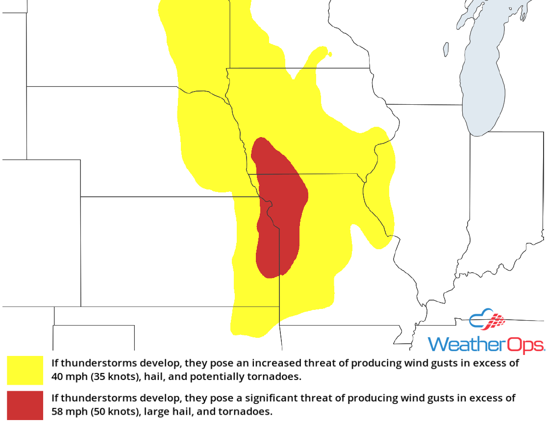 Thunderstorm Risk for Tuesday
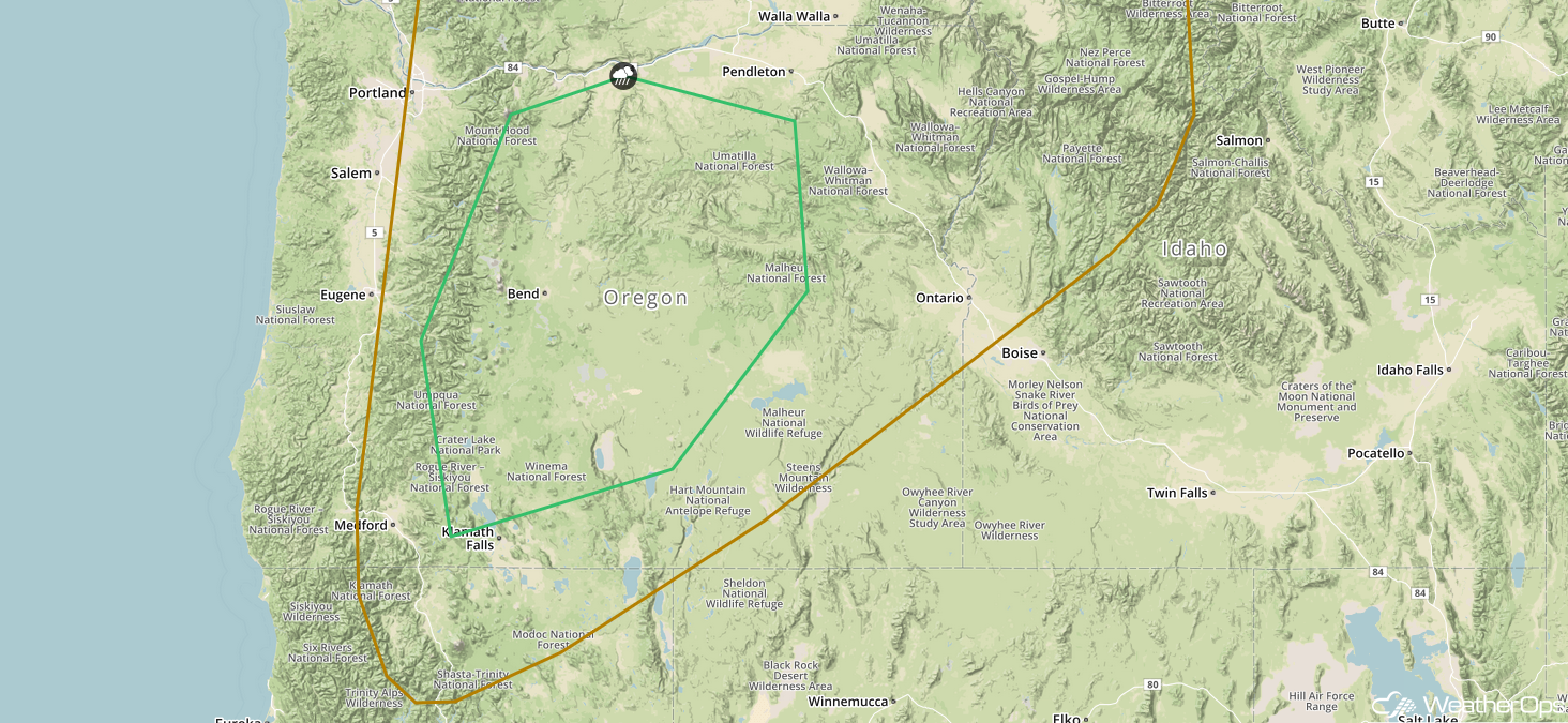
Potential for Thunderstorms Tuesday across Oregon
A strong upper low will be moving slowly onto the west coast today. Instability should be sufficient for the development of isolated severe thunderstorms, especially in central Oregon. Gusty winds and hail will be the primary hazards. Storms are expected to develop in the afternoon and continue into the evening hours.
Major Cities in Region: Bend, OR
 SPC Convective Outlook for Tuesday
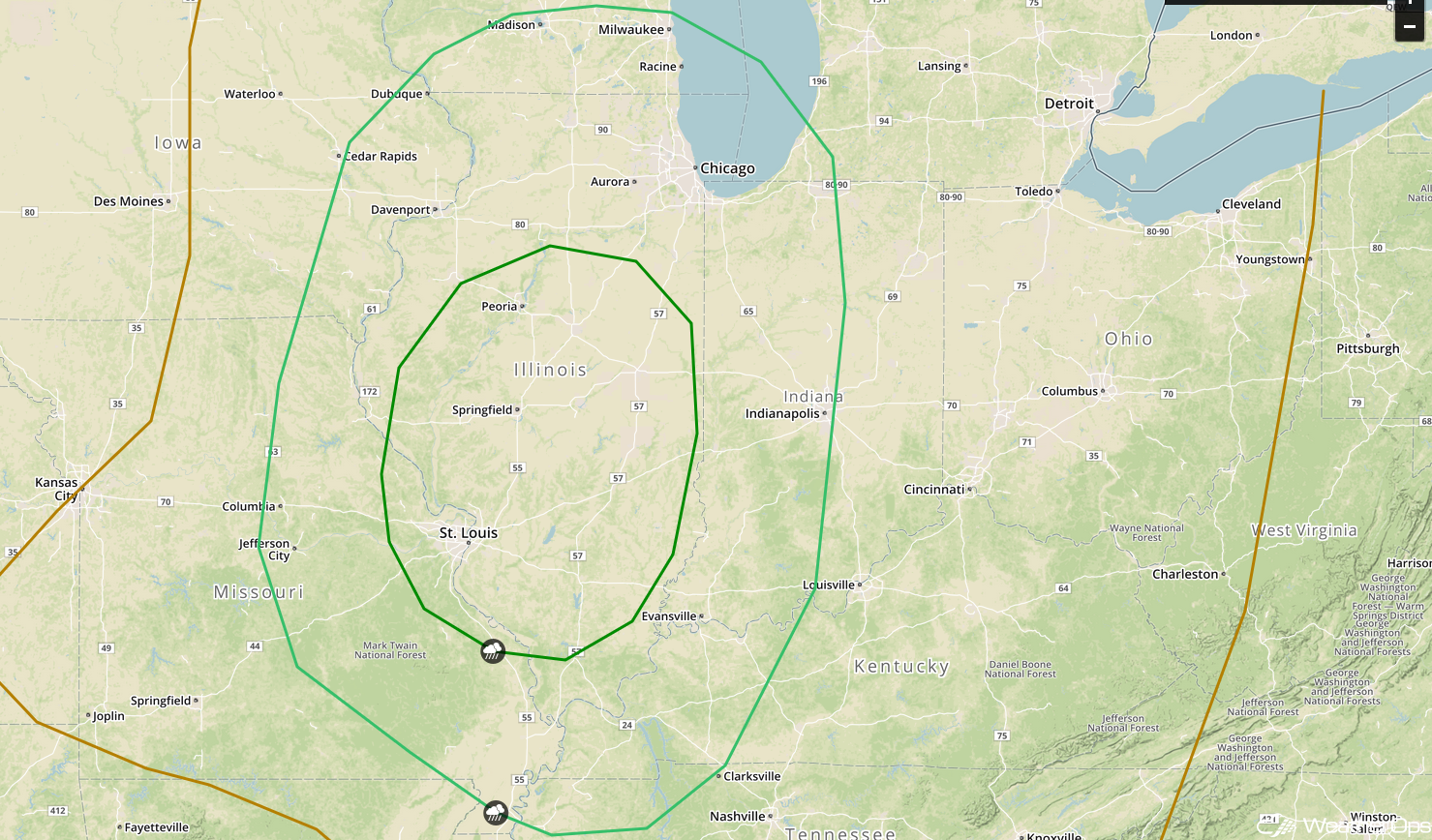
Risk for Thunderstorms for the Central Mississippi Valley and Midwest on Wednesday
An area of low pressure is forecast to move from Minnesota toward eastern Canada on Wednesday, and its trailing cold front should move slowly southeastward across the central Mississippi Valley and into the Midwest. An upper level system will be moving eastward over the region as well. Storms will likely be ongoing early Wednesday, but activity should increase in coverage and intensity during the late afternoon and evening. Damaging winds and large hail will be the primary hazards, but an isolated tornado or two cannot be ruled out.
Major Cities in Region: St. Louis, MO, Milwaukee, WI, Chicago, IL, Indianapolis, IN
 SPC Convective Outlook for Wednesday
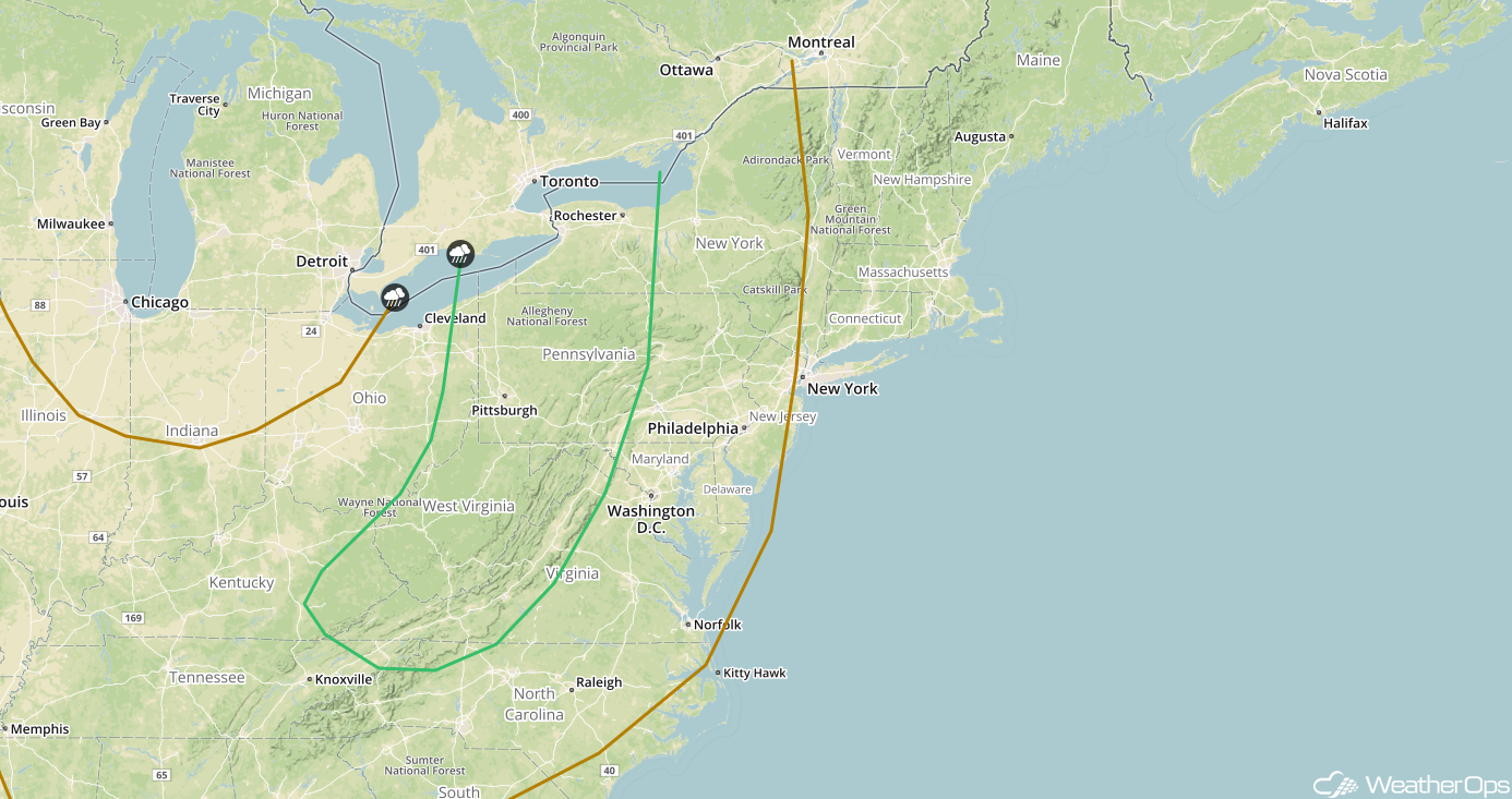
Thunderstorms Thursday from the Central Appalachians to the Great Lakes
The cold front and upper level system that is expected to bring severe weather to the Plains will slowly move eastward on Thursday. The upper level system will weaken, but storms should continue to develop along and ahead of the front. Storms will likely be ongoing during the morning hours, but additional thunderstorms are expected during the afternoon as instability increases ahead of the front. Damaging winds will be the primary hazard with these storms.
Major Cities in Region: Charleston, WV, Pittsburgh, PA, Buffalo, NY, Rochester, NY
 SPC Convective Outlook for Thursday
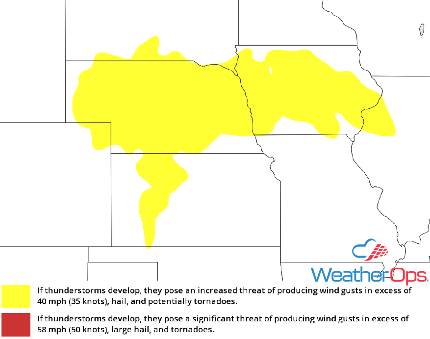
Thunderstorm Potential for the Central Plains Thursday
The upper level trough moving onshore the west coast today will continue to move over the Rockies on Thursday. This will allow a surface low to develop in northern Colorado and southern Wyoming, allowing for the development of thunderstorms across Nebraska and Iowa southward into Kansas. The storms across Nebraska and Iowa will develop along the warm front associated with the surface low. Across Kansas, thunderstorms will develop along a dry line. Storms will develop in the mid to late afternoon with damaging winds and large hail the primary hazards.
Major Cities in Region: North Platte, NE, Dodge City, KS, Omaha, NE, Des Moines, IA
 Thunderstorm Risk for Thursday
A Look Ahead
Storms across the Plains from Thursday will move northeastward into the Great Lakes on Friday. An upper level system moving through the Rockies may bring some high elevation snow to portions of the Northern Rockies on Saturday. Further east, showers and thunderstorms may develop Saturday from the Northeast westward into the Plains ahead of a cold front.
This is just a brief look at current weather hazards. We can provide you site-specific weather forecast information for the purpose of protecting your personnel and assets and to assess your weather risk. Try a 7-day demo right away and learn how timely precision weather information can enhance your bottom line.
