by David Moran, on Mar 29, 2016 11:29:39 AM

by David Moran, on Mar 29, 2016 11:29:39 AM
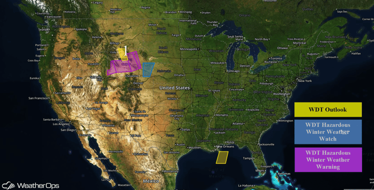
A rain/snow mix, strong northerly winds, and blizzard or near blizzard conditions will continue on Tuesday across portions of the Rockies and the High Plains.

US Hazards
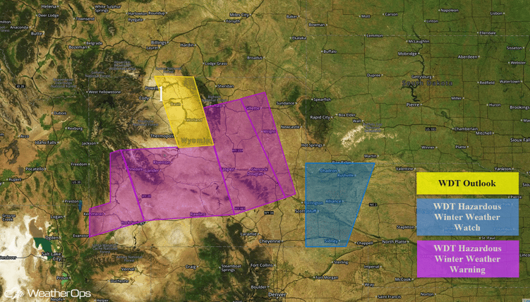
A potent winter storm is moving across Region 1 and bringing a rain/snow mix to the region. The precipitation will change to all snow tonight and continue into Wednesday afternoon. Snow will be heavy at times, with gusty northerly to northeasterly winds causing blizzard conditions at times. Snow accumulations of 12-18 inches can be expected with locally higher amounts exceeding two feet in higher elevations. Travel will likely be hazardous with snow-packed roads, drifting snow, and reduced visibilities. Across portions of Southeastern Wyoming and Western Nebraska, snowfall accumulations of 3-6 inches with locally higher amounts, northerly winds of 25-35 miles per hour with gusts in excess of 50 miles per hour, and near zero visibilities will be possible.

Region 1
This is where you give the visitor a brief introduction to both this blog and your company. Keep it short. More →