


by David Moran, on Mar 13, 2018 10:50:22 AM
Heavy snow and strong winds will continue across the Northeast Tuesday into Wednesday as an area of low pressure continues to intensify off the New England coast.
- Heavy Snow and Strong Winds Continuing across the Northeast through Wednesday
- Snow Thursday for the Northern High Plains
 US Hazards

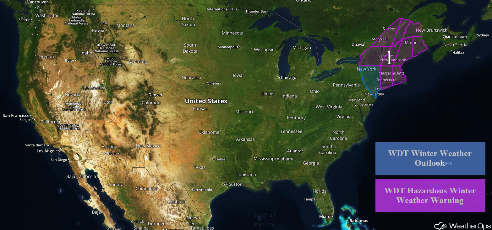
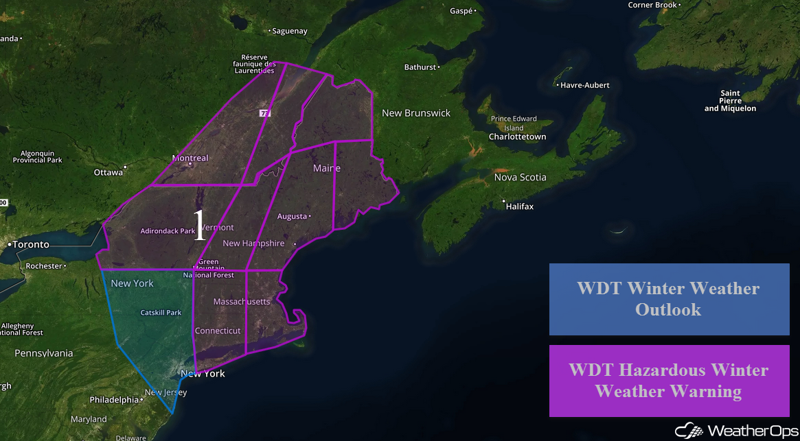
Heavy Snow and Strong Winds Continuing across the Northeast through Wednesday
A Nor'easter is currently rapidly intensifying off the Mid Atlantic coast this morning, allowing for continued moderate to heavy snow across portions of the Northeast into Wednesday. The greatest impacts are expected from eastern Massachusetts into southern Maine where snowfall totals in excess of a foot are expected, in addition to blizzard conditions and coastal flooding. Moderate to heavy snow and strong gusty winds will move into coastal areas of Maine later in the day on Tuesday into Wednesday. Light to moderate snow will continue across the region through Thursday. Widespread travel disruptions and power outages will be possible.
Across portions of east central and southeastern New York, 2-5 inches of snow are expected. From northeastern New York into northern Vermont, snow accumulations will range 8-12 inches with locally higher amounts in excess of 16 inches. For portions of southern Vermont to northern New Hampshire, 8-14 inches of snow are forecast with locally higher amounts in excess of 18 inches. For much of Connecticut and western Massachusetts, 6-10 inches with locally higher amounts in excess of a foot are expected.
Major Cities in Region: Syracuse, NY, Albany, NY, New York City, NY, Burlington, VT, Boston, MA, Portland, ME, Augusta, ME, Bangor, ME, Caribou, ME
 Region 1
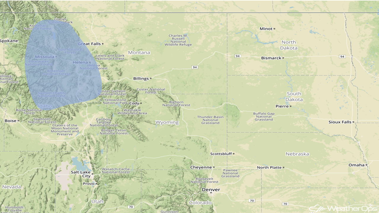
Snow Thursday for the Northern High Plains
There will be a potential for moderate to heavy snow across portions of the High Plains of Montana on Thursday as a weak area of low pressure moves through the region. An area of moderate to locally heavy snow will move northward throughout the day and evening. Snow accumulations of 2-4 inches with locally higher amounts in excess of 6 inches are forecast.
Major Cities in Region: Missoula, MT, Helena, MT
 Significant Snowfall Risk Outline for Thursday
A Look Ahead
An area of low pressure moving through the Plains will bring the potential for freezing rain and snow to the region on Friday. Heavy snowfall is expected across the region, leading to travel impacts.
That is a brief look at current weather hazards. We can provide you site-specific weather forecast information to protect your staff and assets and to assess your weather risk. Try a 7-day demo right away and learn how timely precision weather information can enhance your bottom line.
