National Weather Summary for Tuesday, June 28, 2016
by David Moran, on Jun 28, 2016 10:42:00 AM
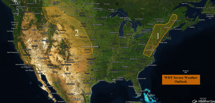
Instability building across portions of the Plains will allow for the development of strong to severe thunderstorms on Tuesday. Across the New England and Mid Atlantic regions, thunderstorms will be possible ahead of a cold front. Thunderstorms will once again be possible on Wednesday across portions of the Northern and Central Plains ahead of a cold front. The cold front pushing through New England will allow for the potential for thunderstorms across portions of the region.
US Hazards
Region 1
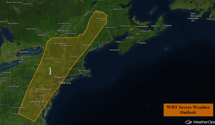
Thunderstorms will develop this afternoon ahead of a cold front pushing into the Northeast. A threat for severe weather will exist through a long, but narrow corridor extending from central Virginia, through the Mid Atlantic, into New England. The primary severe weather hazard will be damaging wind gusts in excess of 60 mph. A few thunderstorms may also produce small hail. These storms will likely develop over the western edges of the outlook area during the mid afternoon hours and track eastward through the late afternoon and evening hours. The severe weather threat should diminish by midnight.
Region 1
Region 2
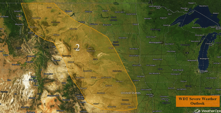
Clusters of thunderstorms are expected to develop this afternoon across Region 2. A warm, moist, and unstable air mass across the region, combined with modest wind shear will allow for some thunderstorms to become severe. Large hail and damaging wind gusts will be the primary hazards. A few reports of hail larger than two inches in diameter will be possible. While the tornado threat will be low, an isolated tornado or two cannot be completely ruled out. The severe weather threat will likely begin to develop during the early to mid afternoon hours and continue into the evening and possibly overnight hours.
Region 2
Strong to Severe Thunderstorms Possible Wednesday for the Central and Northern Plains
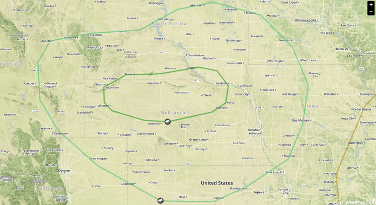
A southeastward moving cold front will track through the region on Wednesday. Ahead of this front, conditions will be favorable for the development of marginally severe thunderstorms. During the morning hours, some activity from overnight on Tuesday may be ongoing. Re-development and re-intensification or lingering thunderstorm activity is expected during the afternoon and evening hours as the front pushes through. Large hail and damaging winds will be the main threats with these storms.
SPC Convective Outlook for Wednesday
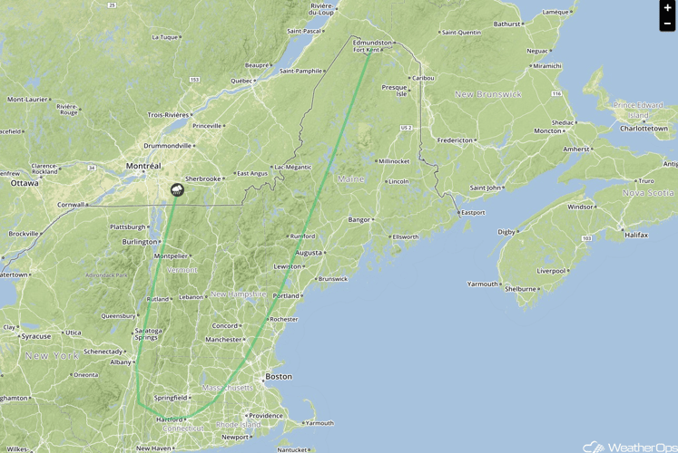
Strong to Severe Thunderstorms Possible Wednesday Across New England
By Wednesday, the cold front that pushed through the Mid Atlantic on Tuesday will track into portions of western New England. Conditions ahead of this front will remain favorable for the development of marginally severe to severe thunderstorms during mainly the afternoon and evening hours. The main threats with this activity will be damaging winds and small hail.
SPC Convective Outlook for Wednesday


