National Weather Summary for Tuesday, June 27, 2017
by David Moran, on Jun 27, 2017 10:58:11 AM
There is a potential for thunderstorms across portions of the Plains on Tuesday as a warm front moves northward.
- Risk for Thunderstorms across the Great Plains on Tuesday
- Thunderstorms Tuesday for Portions of New England
- Potential for Thunderstorms from the Midwest into the Central Plains on Wednesday
- Strong to Severe Thunderstorms Thursday from the Ohio Valley into the Central Plains
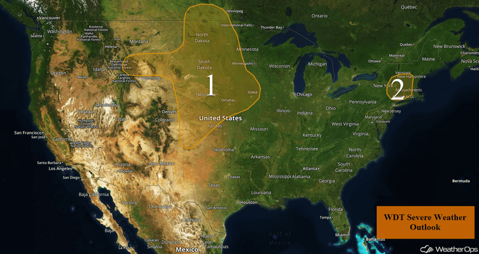 US Hazards
Risk for Thunderstorms across the Great Plains on Tuesday
An area of low pressure currently in Alberta will track eastward into Manitoba tonight. Its associated warm front stretching into the Central Plains and its associated cold front stretching southwestward into the Front Range by the late afternoon. As the afternoon and evening continues, both of these fronts will slowly track eastward. Ahead of the cold front, southerly flow will bring ample low level moisture northward. Strong wind shear will also be present and as daytime heating increases, so will instability. With these conditions in place and colder air aloft being brought in by this disturbance, clusters of thunderstorms are expected to develop ahead of the cold front this afternoon. Large hail and damaging winds will be the primary hazards, but an isolated tornado or two cannot be ruled out, especially in the evening. Heading into the evening, ongoing storms are expected to merge into a complex with the severe hazards transitioning into a damaging wind threat.
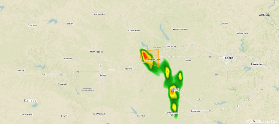
Update 1pm CDT: Severe thunderstorm SW of Manhattan, KS capable of producing large hail.
 Radar 1pm CDT
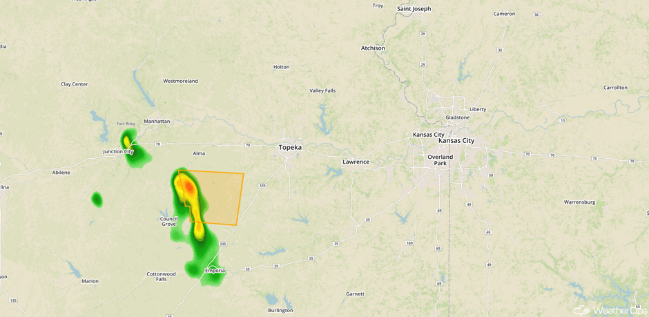
Update 1:58pm CDT: Severe thunderstorm capable of golfball sized hail SW of Topeka, KS.
 Radar 1:58pm CDT
Major Cities in Region: North Platte, NE, Bismarck, ND, Pierre, SD, Sioux Falls, SD, Omaha, NE, Des Moines, IA
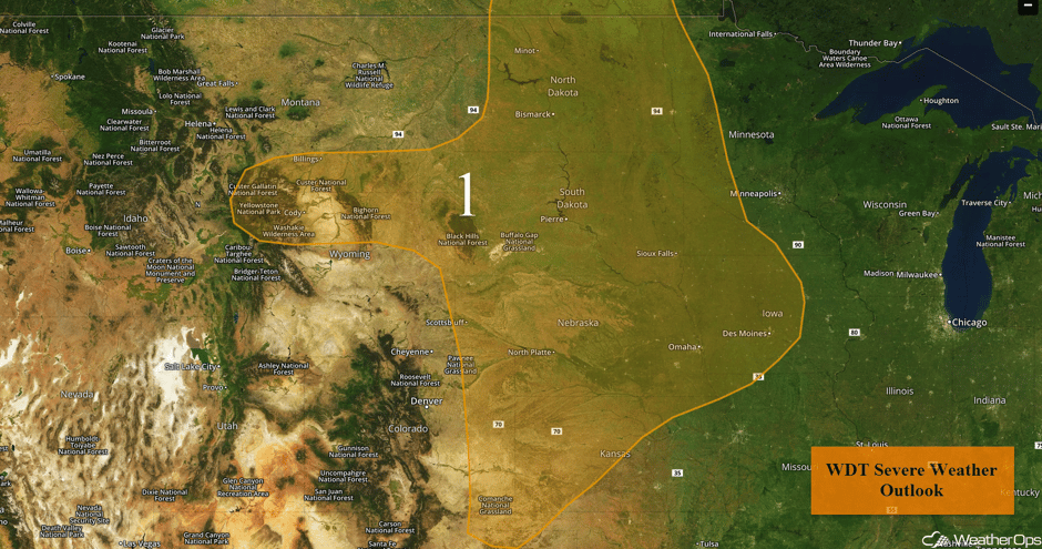 Region 1
Thunderstorms Tuesday for Portions of New England
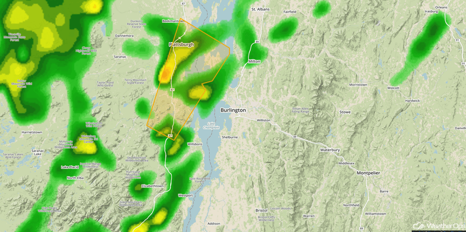
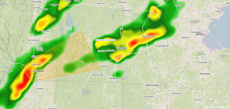
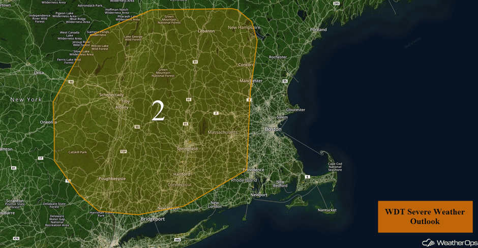
Showers and thunderstorms are expected to develop during the late morning and early afternoon across Lower New England and Upstate New York as an upper level trough moves across the region. This activity should continue into the evening hours. Despite limited moisture and instability, a few of the stronger cells may be capable of producing severe winds and small hail. Activity should weaken or dissipate before dark.
Update 1:23pm EDT: Severe thunderstorm capable of large hail and damaging winds near Burlington, VT.
 Radar 1:23pm EDT
Update 2:52pm EDT: Severe thunderstorm capable of hail and damaging winds approaching Springfield, MA.
 Radar 2:52pm EDT
Major Cities in Region: Albany, NY, Hartford, CT, Concord, NH
 Region 2
Potential for Thunderstorms from the Midwest into the Central Plains on Wednesday
The primary severe weather threat will shift eastward into the Great Lakes and Central Plains on Wednesday. An area of low pressure and associated warm and cold front will move across the region. Ongoing showers and thunderstorms are possible over the Midwest and Great Lakes during the morning in the vicinity of the warm front. This activity will clear throughout the morning, creating a favorable environment for the development of strong to severe thunderstorms across the Midwest and into the Central Plains ahead of a cold front. Scattered thunderstorms will develop along and ahead of the front during the mid to late afternoon and spread eastward through the evening. Primary hazards will be large hail and damaging winds, but an isolated tornado cannot be ruled out. Coverage should be a bit more widespread over the Great Lakes where strong wind gusts will be the primary hazards.
Major Cities in Region: Goodland, KS, Wichita, KS, Omaha, NE, Kansas City, MO, Des Moines, IA, Green Bay, WI, Milwaukee, WI, Chicago, IL
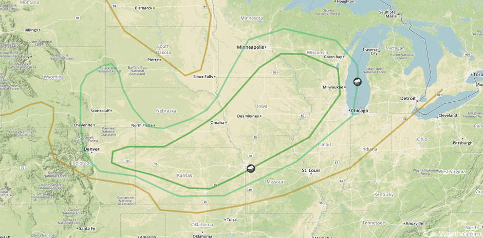 SPC Convective Outlook for Wednesday
Strong to Severe Thunderstorms Thursday from the Ohio Valley into the Central Plains
There will be a risk for severe weather and flash flooding across portions of the Ohio Valley into the Central Plains. A frontal boundary will stall across the Midwest during the day and will be the focus for thunderstorm development during the afternoon. Strong to severe thunderstorms may develop with large hail and damaging winds being the primary hazards. This activity is expected to persist into the evening and overnight hours as a complex of thunderstorms with strong winds and flash flooding the primary hazards. Rainfall amounts of 1-3 inches with locally higher amounts in excess of 4 inches are forecast over the Midwest.
Major Cities in Region: Goodland, KS, Dodge City, KS, Wichita, KS, Omaha, NE, Des Moines, IA, St. Louis, MO, Chicago, IL, Pittsburgh, PA
 SPC Convective Outlook for Thursday
A Look Ahead
Thunderstorms may develop on Friday across the Mid Mississippi Valley ahead of a cold front. While there is some uncertainty with the placement and intensity, there will be a good chance for strong to severe thunderstorms across the region.
This is just a brief look at current weather hazards. We can provide you site-specific weather forecast information for the purpose of protecting your personnel and assets and to assess your weather risk. Try a 7-day demo right away and learn how timely precision weather information can enhance your bottom line.


