National Weather Summary for Tuesday, July 12, 2016
by David Moran, on Jul 12, 2016 11:09:57 AM
Strong to severe thunderstorms and heavy rain are possible on Tuesday across the Central Plains and Midwest. Another round of thunderstorms will be possible on Wednesday across the Central and Southern Plains along and ahead of a front. By Thursday, the threat for strong to severe thunderstorms will be possible across the Plains as a front slowly moves southward. A cold front moving through the Great Lakes will be the focus for the development of thunderstorms.
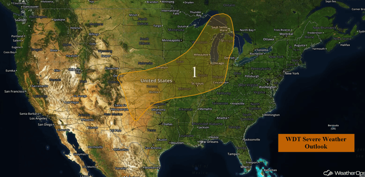
US Hazards
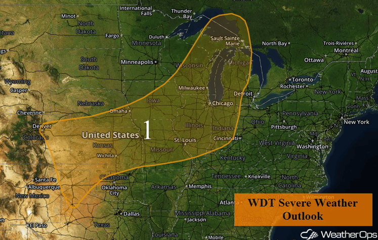
Region 1
Showers and thunderstorms, some of which may be severe, will be possible today across a portion of the country. The main severe weather potential will exist ahead of a somewhat stationary front which is currently draped across the Midwest region from the Missouri Valley into the Great Lakes. Ongoing showers and thunderstorms are expected to re-intensify or redevelop within a region of moderate instability this afternoon and evening; severe winds and large hail will be the primary hazards. An isolated tornado or two cannot be ruled out. The greatest risk for severe impacts should exist across the Missouri Valley. Further southwest, thunderstorms will also be possible as strong daytime heating results in high based thunderstorm development from the Colorado Front Range into the Texas Panhandle. Storms across this region will pose similar threats of severe winds and isolated large hail. In addition, locally heavy rainfall will also be possible, mainly across the Missouri Valley. Widespread rainfall accumulations of 1-2 inches will be possible with isolated higher amounts in excess of 3 inches.
Region 1
Strong to Severe Thunderstorms Possible on Wednesday Across the Central Plains and Great Lakes
Another round of strong to severe thunderstorms will be possible on Wednesday across the Central Plains and into the Great Lakes ahead of a stalled front. Large hail and damaging winds will be the primary hazards with these storms. The most likely time for severe weather will be during the afternoon and heating when surface heating is strongest.
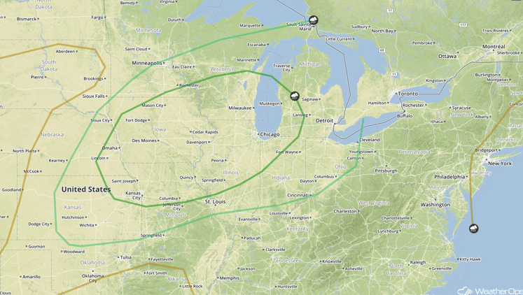
SPC Convective Outlook for Wednesday
Strong to Severe Thunderstorms Possible for Central Plains on Thursday
The threat for strong to severe thunderstorms will shift southward into portions of southern Kansas and into northern and central Oklahoma on Thursday as a front slides southward. Plentiful moisture, combined with moderate wind shear, may allow for the development of supercell thunderstorms. Large hail and perhaps a few tornadoes will be the primary hazards. These supercells will likely merge quickly into a squall line, transitioning the threat to damaging winds. In addition to this severe weather threat, locally heavy rainfall will be possible. Widespread rainfall accumulations of 1-3 inches with locally higher amounts in excess of 4 inches possible in some locations.
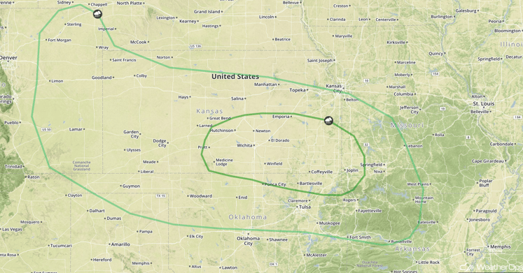
SPC Convective Outlook for Thursday
Strong to Severe Thunderstorms Possible Thursday Across the Great Lakes
Thunderstorms may develop ahead of a cold front moving through the Great Lakes region on Thursday. Conditions may be favorable for a few of these thunderstorms to become strong, with damaging winds to become the primary hazards.
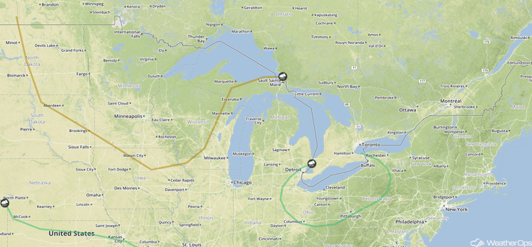
SPC Convective Outlook for Thursday
This is just a brief look at current weather hazards. We can provide you site-specific forecast information. Try a 7-day demo right away.


