


by David Moran, on Jul 10, 2018 11:20:55 AM
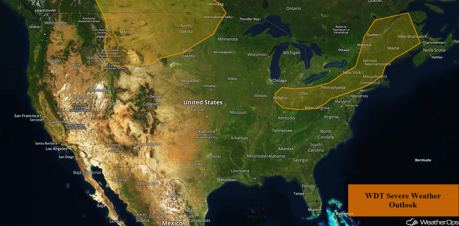
A cold front moving across the Northern Rockies and Plains on Tuesday will be the focus for the development of thunderstorms on Tuesday. Thunderstorms will develop from the Ohio Valley into the Northeast ahead of a cold front. A disturbance moving through the Southwest will bring a potential for thunderstorms and excessive rainfall.
- Thunderstorms for the Northern Rockies and Plains on Tuesday
- Potential for Thunderstorms Tuesday from the Ohio Valley into the Northeast
- Excessive Rainfall for the Southwest on Tuesday
- Risk for Thunderstorms Wednesday across the Upper Midwest
- Potential for Excessive Rainfall across the Southwest, Great Basin, and Southern Rockies on Wednesday
- Excessive Rainfall Wednesday for Northern Minnesota
- Thunderstorms for the Northern Plains and Western Great Lakes on Thursday
- Risk for Excessive Rainfall Thursday for Eastern Arizona, New Mexico, and Colorado
- Excessive Rainfall from Nebraska to Minnesota on Thursday
- Tropical Update
 US Hazards

Thunderstorms for the Northern Rockies and Plains on Tuesday
An intensifying area of low pressure will lift northeastward across central and eastern Montana today. With ample instability and wind shear, thunderstorms are expected to develop across Montana during the early afternoon. Large hail, damaging winds, and tornadoes will be potential hazards initially, however, as storms shift eastward into the late afternoon and evening, damaging winds and large hail will become the primary hazards.
Major Cities in Region: Great Falls, MT, Glasgow, MT, Minot, ND, Bismarck, ND
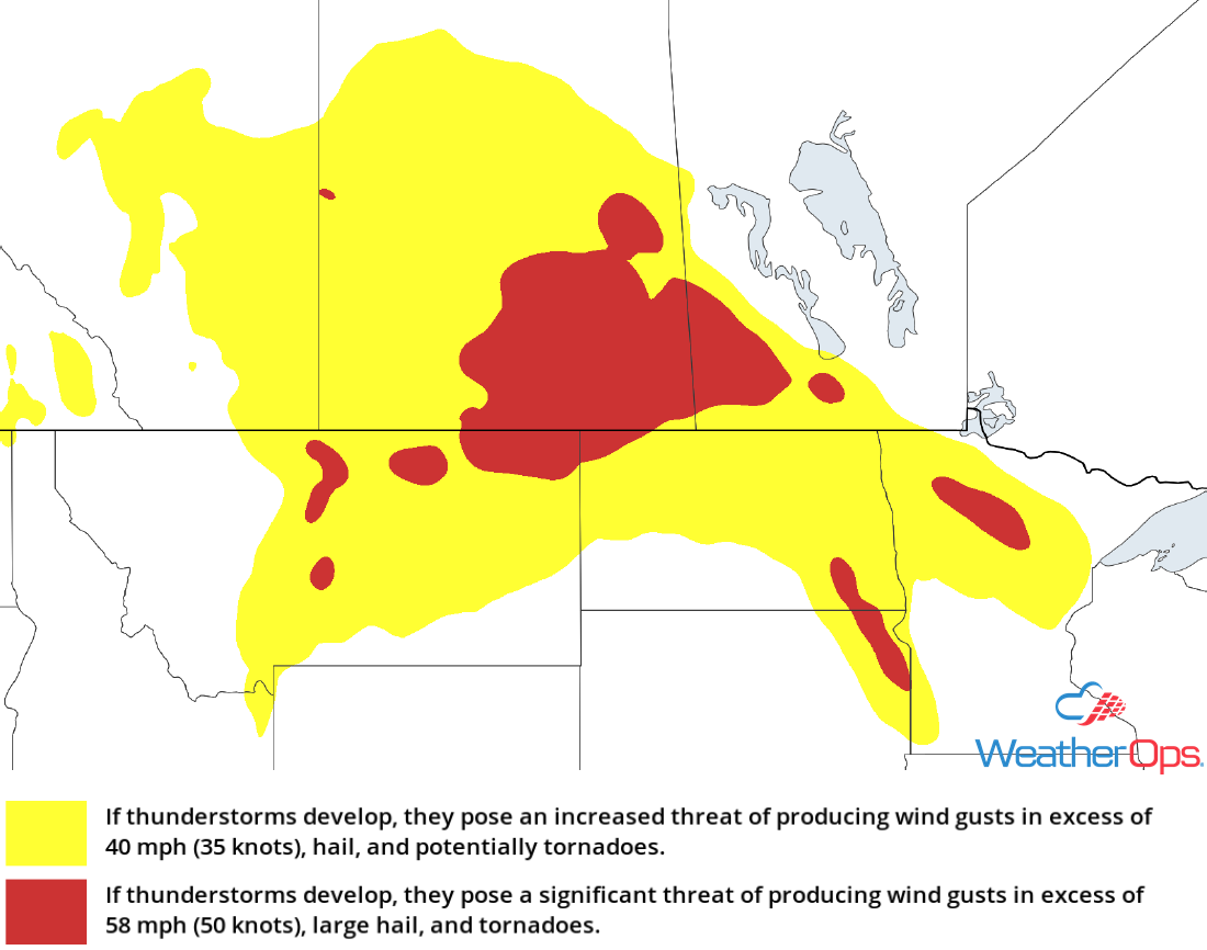 Thunderstorm Risk for Tuesday
Potential for Thunderstorms Tuesday from the Ohio Valley into the Northeast
By midday, a cold front is expected to stretch from central Maine into Illinois. Instability will develop ahead of the front, allowing thunderstorms to develop through the mid to late afternoon. Damaging winds and large hail will be the primary hazards with these storms. Activity should diminish after sunset.
Major Cities in Region: Columbus, OH, Pittsburgh, PA, Albany, NY, Burlington, VT, Manchester, NH
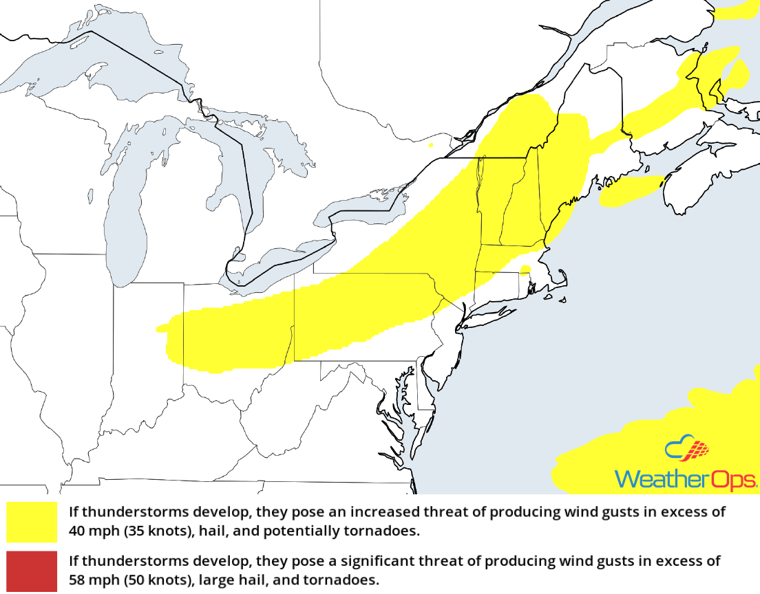 Thunderstorm Risk for Tuesday
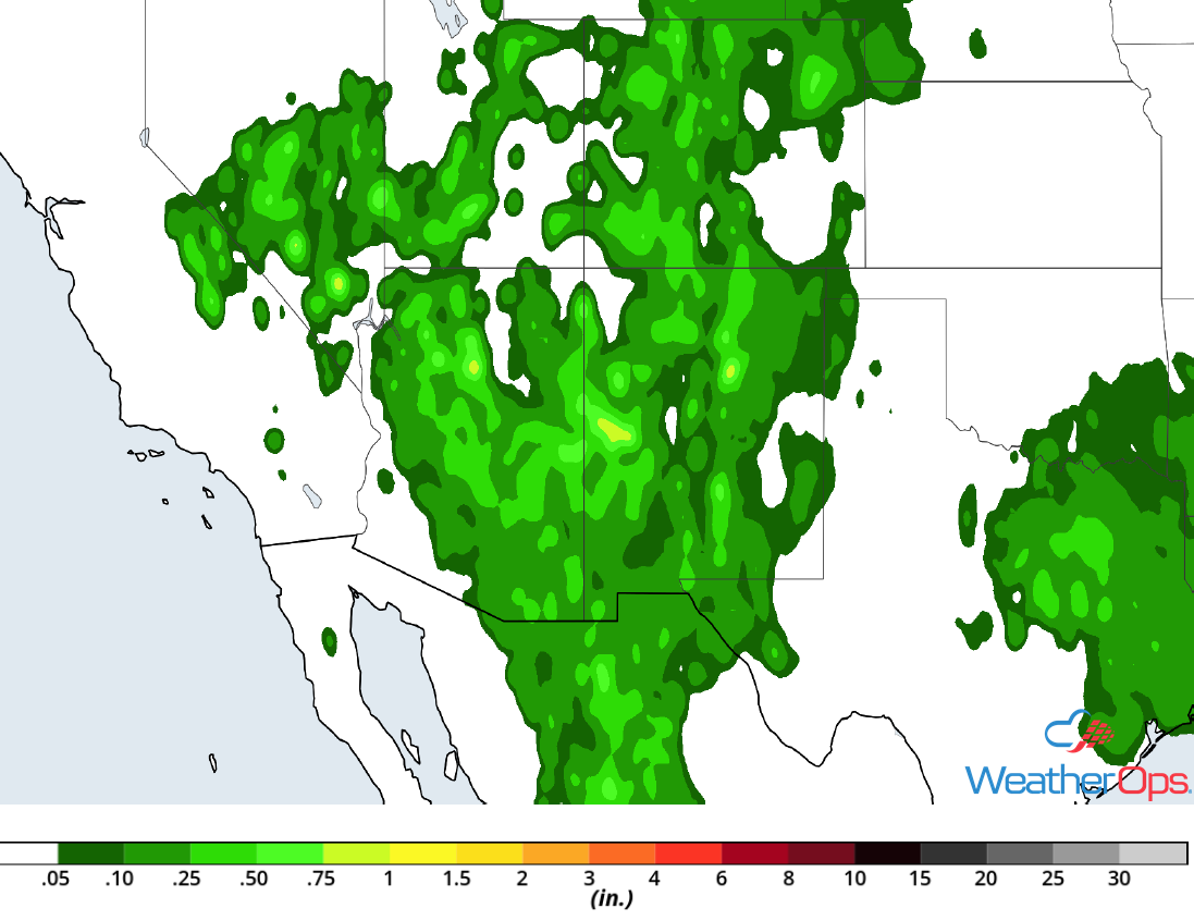
Excessive Rainfall for the Southwest on Tuesday
A disturbance moving through the Southwest will allow for the development of thunderstorms during the afternoon. With plentiful moisture in place, any thunderstorms that develop will likely produce heavy rain. Rainfall rates will be near an inch per hour. Given previous rainfall, there will be a potential for some localized flooding.
Major Cities in Region: Flagstaff, AZ, Phoenix, AZ, Tucson, AZ
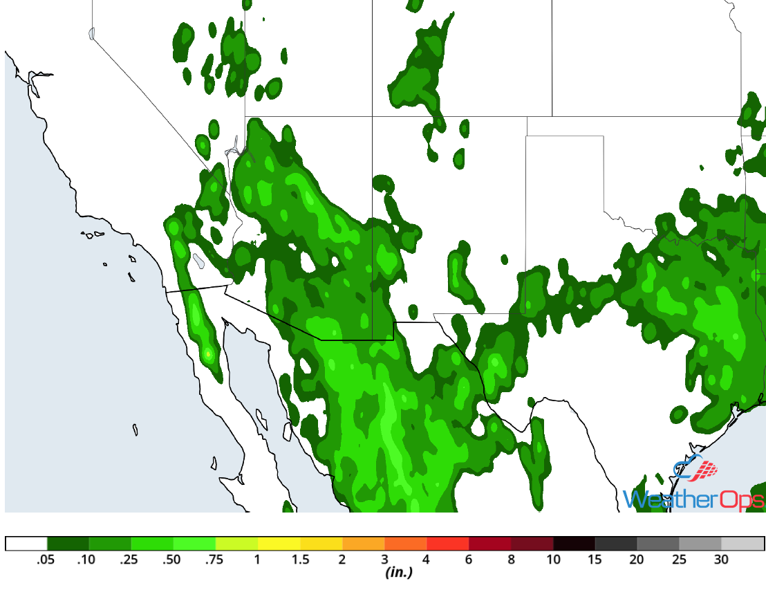 Rainfall Accumulation for Tuesday
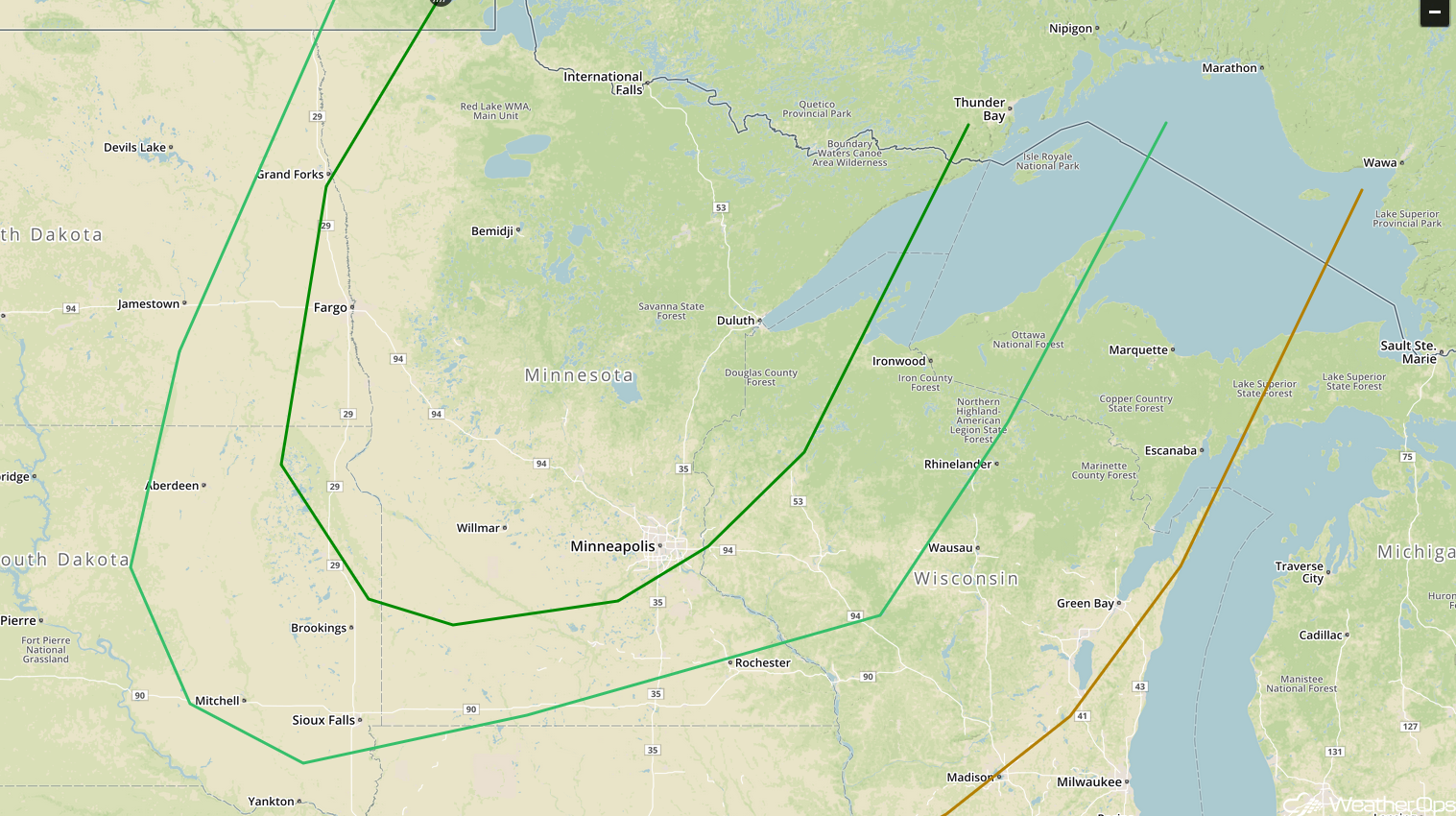
Risk for Thunderstorms Wednesday across the Upper Midwest
The upper level trough responsible for the severe weather potential across the Northern Rockies and Plains Tuesday will move into southern Canada Wednesday. A slow moving cold front should allow for the development of scattered thunderstorms across the Upper Midwest Wednesday afternoon and evening. Damaging winds and large hail will be the primary hazards with these storms.
Major Cities in Region: Sioux Falls, SD, Fargo, ND, International Falls, MN, Minneapolis, MN, Duluth, MN
 SPC Convective Outlook for Wednesday
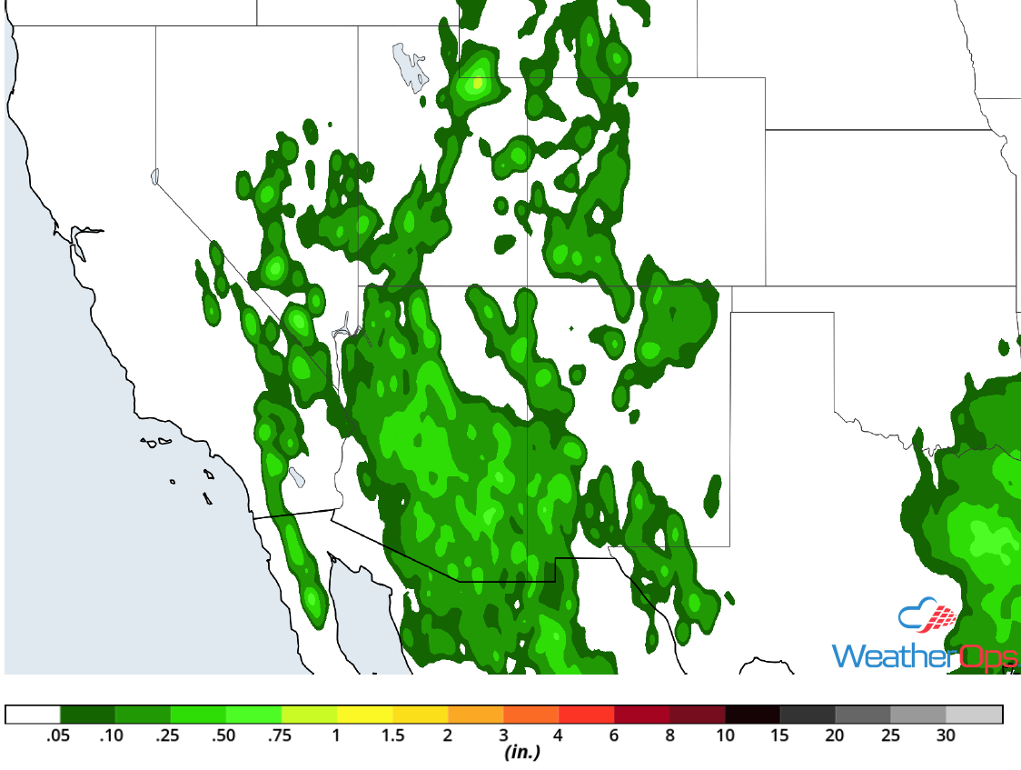
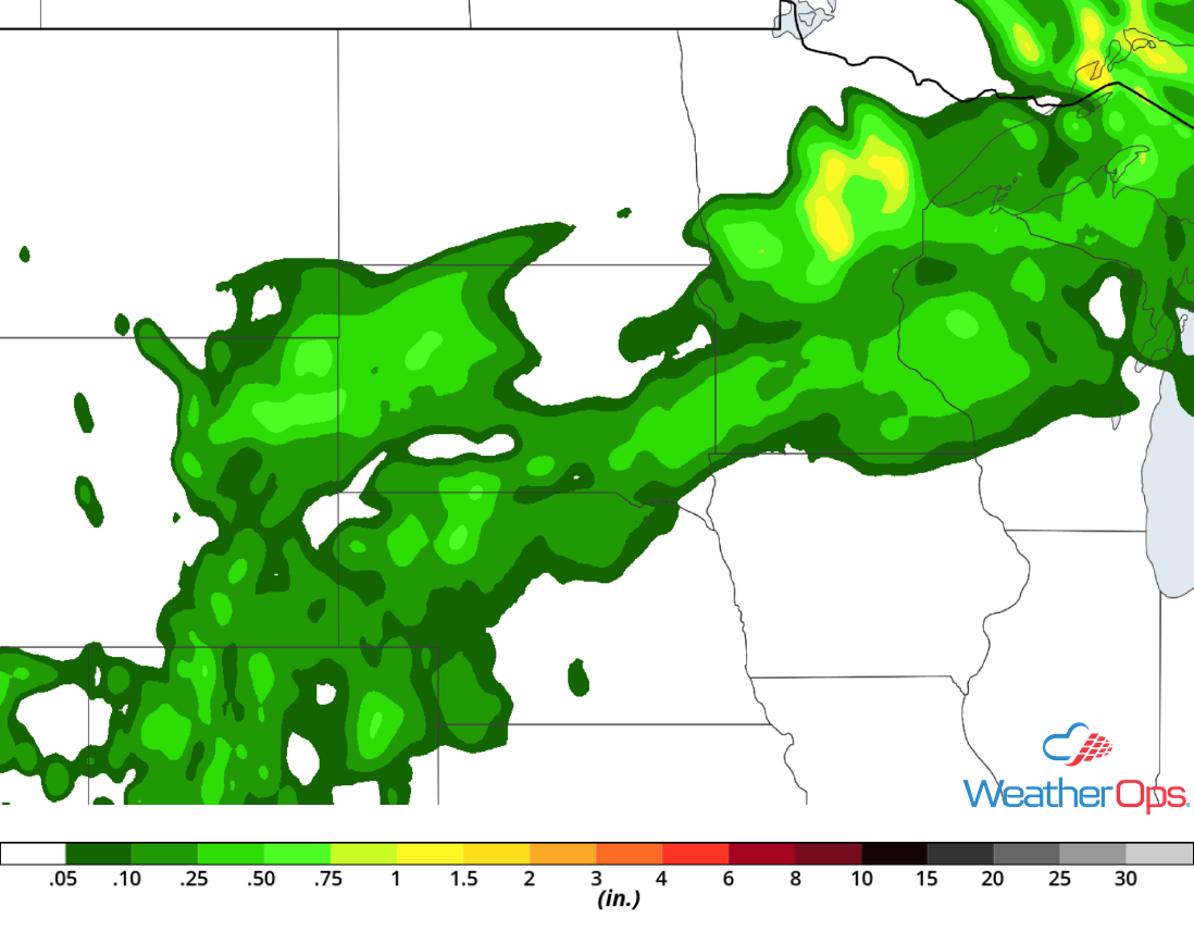
Potential for Excessive Rainfall across the Southwest, Great Basin, and Southern Rockies on Wednesday
Heavy rain will continue across the region on Wednesday as two upper level lows, one moving into southeastern Colorado and the other over southern Arizona, aid in the development of thunderstorms. Activity will likely develop during the afternoon and early evening across the higher elevations. Some of this activity may move into lower elevations. Rainfall rates near an inch per hour could allow for a slight risk for excessive rainfall.
Major Cities in Region: Flagstaff, AZ, Phoenix, AZ, Tucson, AZ, Grand Junction, CO
 Rainfall Accumulation for Wednesday
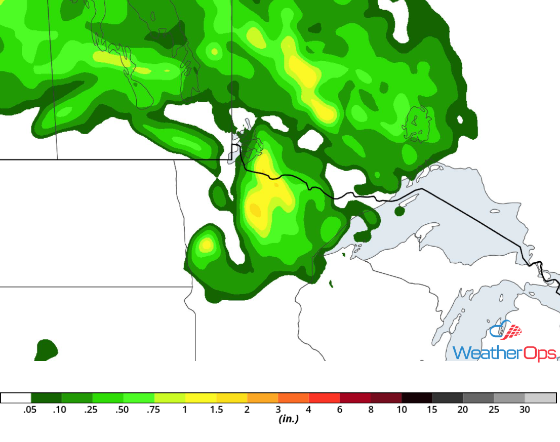
Excessive Rainfall Wednesday for Northern Minnesota
Scattered showers and thunderstorms will likely be ongoing as a cold front begins to slow across the region late Wednesday afternoon into Wednesday evening. Thunderstorms may redevelop over the same areas; with plentiful moisture in place, there will be a risk for flash flooding.
Major Cities in Region: International Falls, MN, Duluth, MN
 Rainfall Accumulation for Wednesday
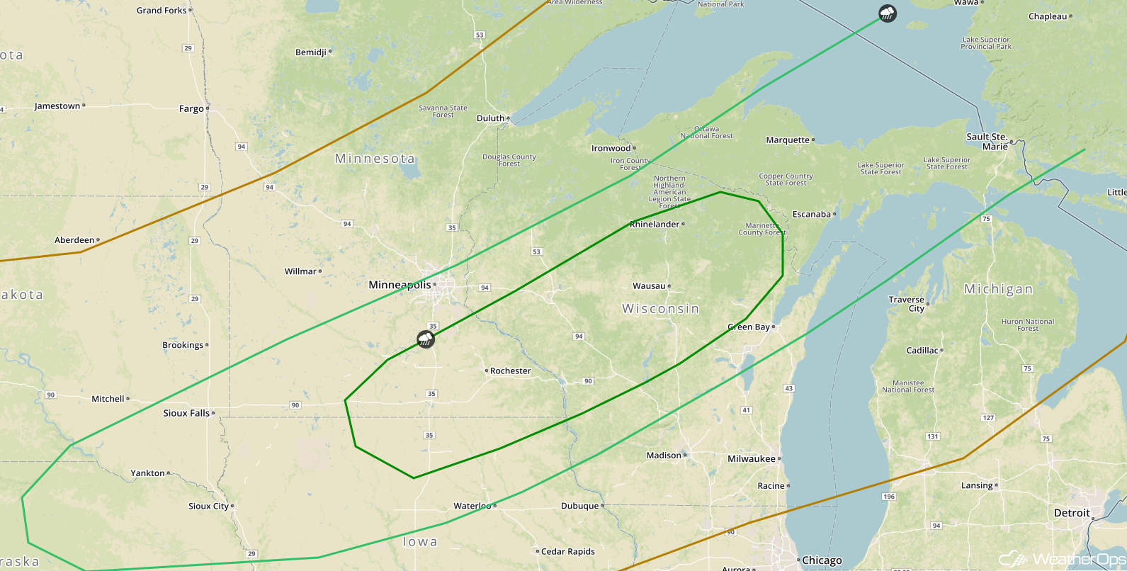
Thunderstorms for the Northern Plains and Western Great Lakes on Thursday
A front extending from the western Great Lakes into the Central Plains will promote scattered shower and thunderstorm development during the afternoon and early evening. Upper level winds and wind shear will not be particularly strong. However, moderate instability will support at least a low threat of damaging winds and large hail with any organized thunderstorms.
Major Cities in Region: Sioux Falls, SD, Sioux City, IA, Minneapolis, MN, Rochester, MN, Wausau, WI, Green Bay, WI
 SPC Convective Outlook for Thursday
Risk for Excessive Rainfall Thursday for Eastern Arizona, New Mexico, and Colorado
An upper level trough will remain nearly stationary across the Four Corners region through at least Thursday. With instability and lift in place, thunderstorms will develop through the early evening. Given that plentiful moisture will be in place, some thunderstorms could produce heavy rainfall rates near one inch per hour, resulting in a potential for flash flooding.
Major Cities in Region: Flagstaff, AZ, Phoenix, AZ, Tucson, AZ, Grand Junction, CO, Albuquerque, NM
 Rainfall Accumulation for Thursday
Excessive Rainfall from Nebraska to Minnesota on Thursday
The slow moving cold front described above will stall over north central Nebraska by Thursday afternoon. Thunderstorms may develop along the front during the mid to late afternoon. As thunderstorms develop, they will train over the same areas, allowing for a risk of flash flooding.
Major Cities in Region: Sioux Falls, SD, Duluth, MN
 Rainfall Accumulation for Thursday
Tropical Update
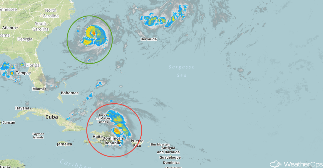
Tropical Storm Chris (green oval) is currently 200 miles southeast of Cape Hatteras, North Carolina and is moving northeastward at 9 mph. This general motion is expected to continue today with an increase in speed forecast tonight and continuing into Thursday. Maximum sustained winds are at 70 mph with higher gusts. Chris is forecast to strengthen into a hurricane today and additional strengthening is expected through Wednesday night. By Thursday night or early Friday, Chris is expected to become a post-tropical cyclone.
The remnants of Beryl (red oval) are producing gusty winds and areas of heavy rain over portions of central and eastern Hispaniola, as well as the adjacent Atlantic and Caribbean. The system is forecast to move west-northwestward across the rest of Hispaniola and the southeastern Bahamas this evening. Little development is expected during the next day or so. On Wednesday, this system is forecast to turn northward over the western Atlantic where environmental conditions could become more favorable for development. Regardless of development, locally heavy rains and gusty winds are likely over portions of Hispaniola and the Bahamas as the remnants of Beryl move through those areas.
 Enhanced Infrared Satellite
A Look Ahead
Showers and thunderstorms will extend from the Great Lakes into the Plains on Friday along a cold front; this activity will continue into Saturday. By Sunday, another round of showers and thunderstorms will develop across the Great Lakes and into the Plains as another system moves eastward. Thunderstorms will extend from the Lower Great Lakes into the Central Plains on Monday.
This is just a brief look at current weather hazards. We can provide you site-specific weather forecast information for the purpose of protecting your personnel and assets and to assess your weather risk. Try a 7-day demo right away and learn how timely precision weather information can enhance your bottom line.
