


by David Moran, on Feb 27, 2018 10:48:19 AM
Thunderstorms may develop from north Texas into the Arklatex region on Tuesday. There will be a risk for excessive rainfall across portions of Arkansas into the Tennessee Valley through Wednesday along a stalled front.
- Thunderstorms from North Texas into the Arklatex Region on Tuesday
- Excessive Rainfall through Wednesday from Arkansas into the Tennessee Valley
- Risk for Thunderstorms from Central Texas into the Mississippi Valley on Wednesday
- Snow Wednesday Evening through Thursday Evening for Northern Maine
 US Hazards

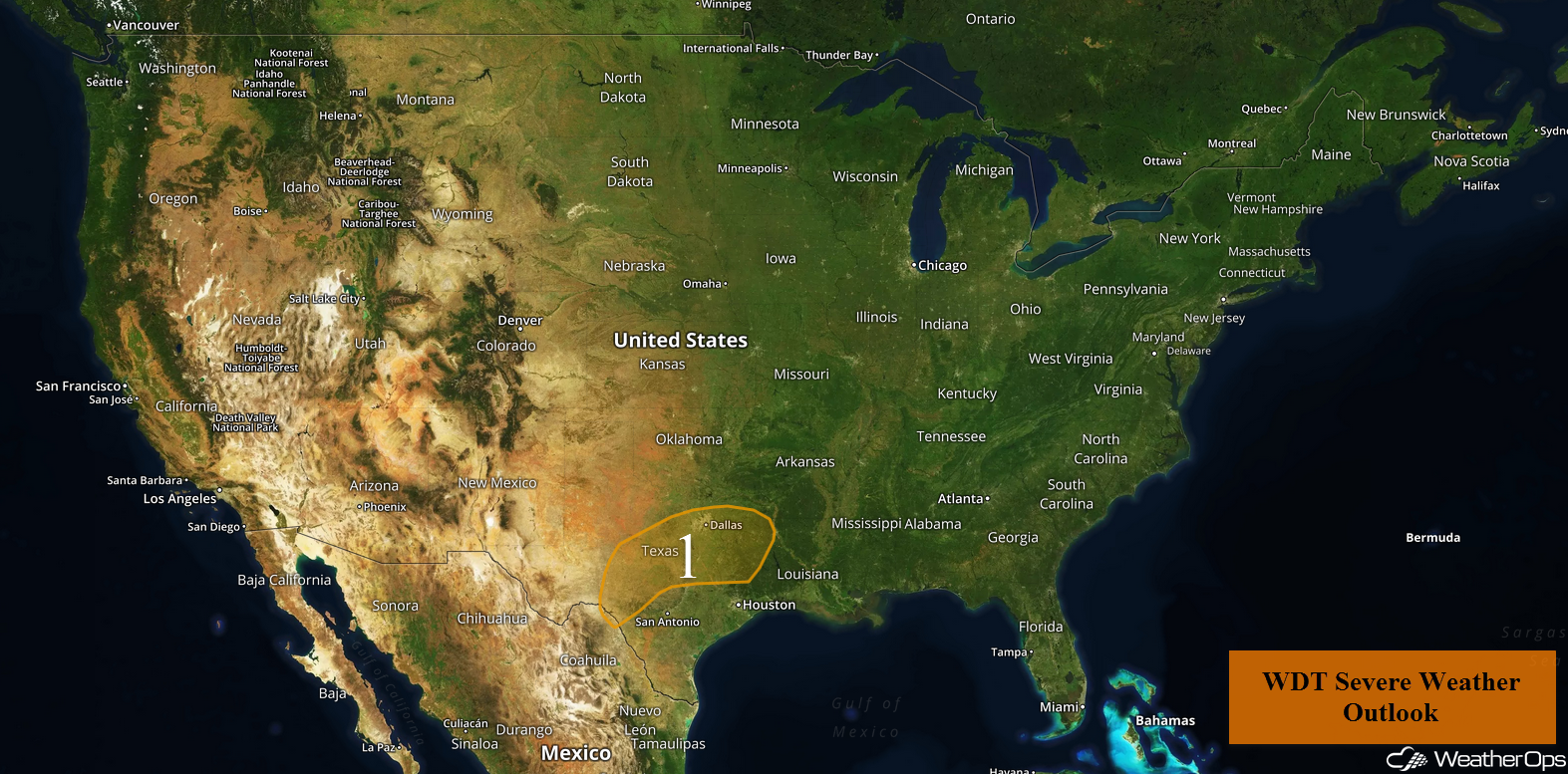
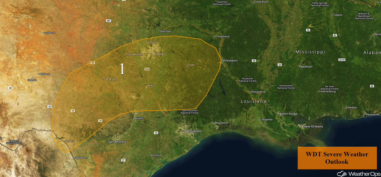
Thunderstorms from North Texas into the Arklatex Region on Tuesday
Showers and thunderstorms are forecast to increase in coverage, mostly across northeast Texas late this morning and early afternoon. This activity is in response to a warm front that will lift northward and then eastward throughout the day. Although instability will be weak, there is expected to be enough destabilization in place to allow for a low risk of hail. The risk of isolated severe storms is expected to decrease significantly with the loss of daytime heating and as the front moves out of the region tonight.
Major Cities in Region: Del Rio, TX, Waco, TX, Fort Worth, TX, Dallas, TX, Tyler, TX
 Region 1
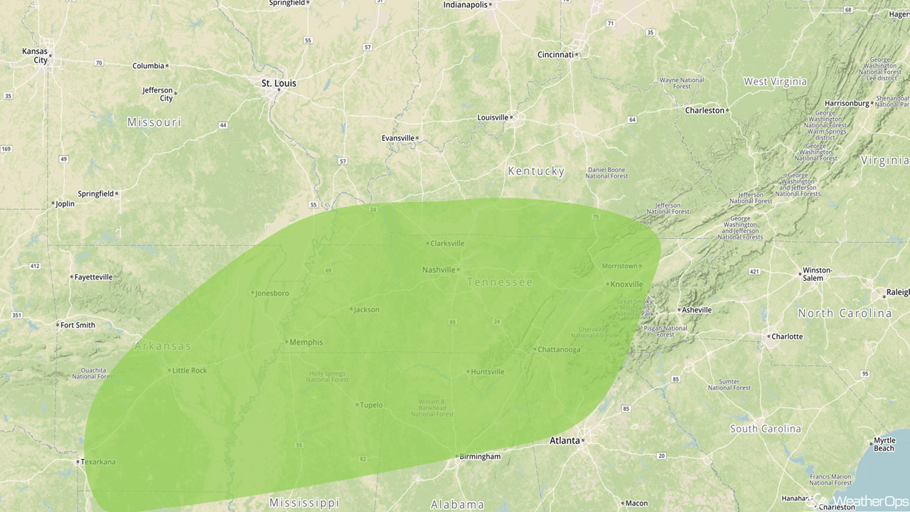
Excessive Rainfall through Wednesday from Arkansas into the Tennessee Valley
There will be a risk for excessive rainfall leading to isolated flash flooding Tuesday into Wednesday from Arkansas into the Tennessee Valley. Rain will expand into the Tennessee Valley on Wednesday. Rainfall totals will range 3-5 inches with locally higher amounts.
Major Cities in Region: Little Rock, AR, Memphis, TN, Nashville, TN, Birmingham, AL, Chattanooga, TN, Knoxville, TN
 Excessive Rainfall Risk Outline for Tuesday and Wednesday
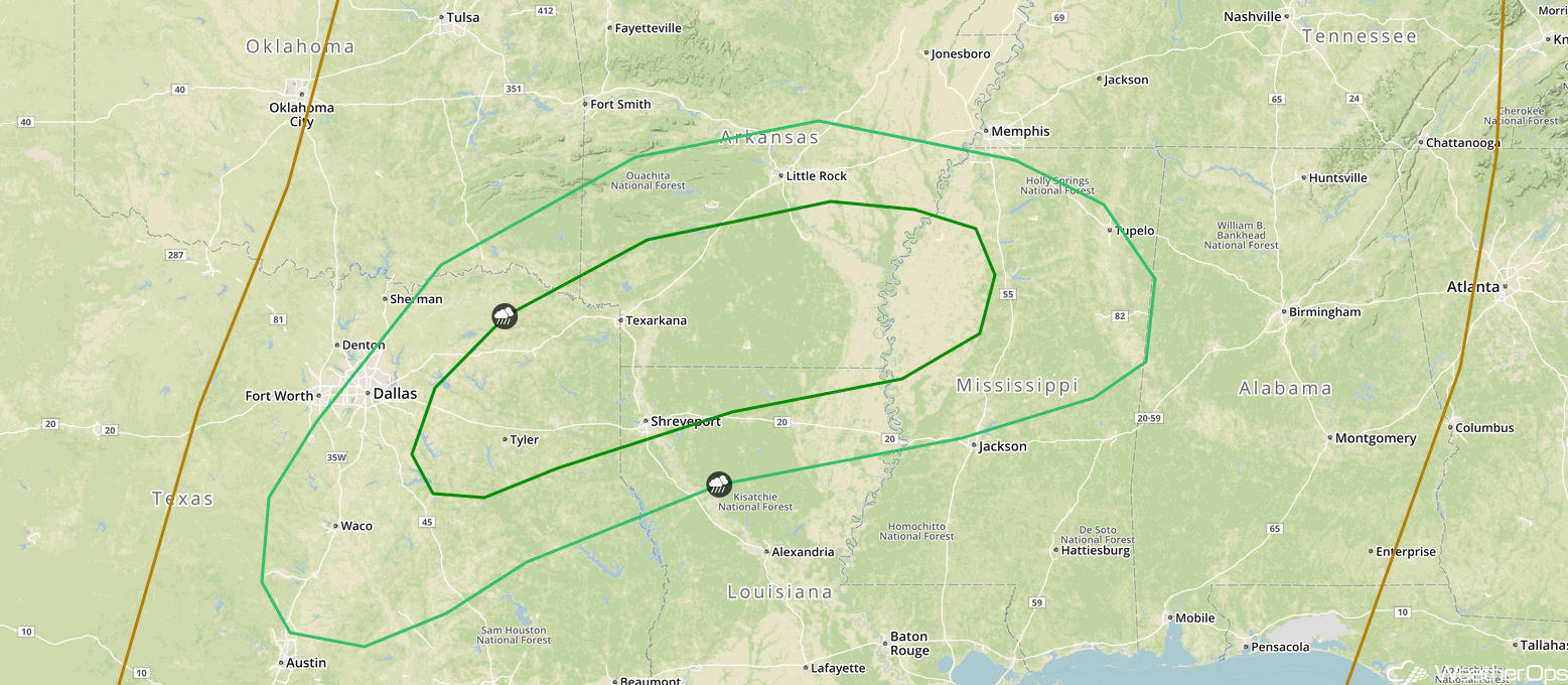
Risk for Thunderstorms from Central Texas into the Mississippi Valley on Wednesday
A more significant threat for severe weather will exist across Central Texas into the Mississippi Valley Wednesday afternoon into the evening. A developing area of low pressure tracking through the Plains will create an environment favorable for severe thunderstorms. Storms will develop along a cold front during the afternoon hours and will increase in coverage while spreading eastward through the evening. Hail and damaging winds will be the primary hazards.
Major Cities in Region: Waco, TX, Dallas, TX, Shreveport, LA, Little Rock, AR
 SPC Convective Outlook for Wednesday
Snow Wednesday Evening through Thursday Evening for Northern Maine
An upper level disturbance will bring the potential for moderate to heavy snow across portions of northern Maine Wednesday night into Thursday. Snowfall accumulations will range 4-8 inches with locally higher amounts in excess of 10 inches expected, leading to hazardous travel conditions across the region.
Major Cities in Region: Caribou, ME
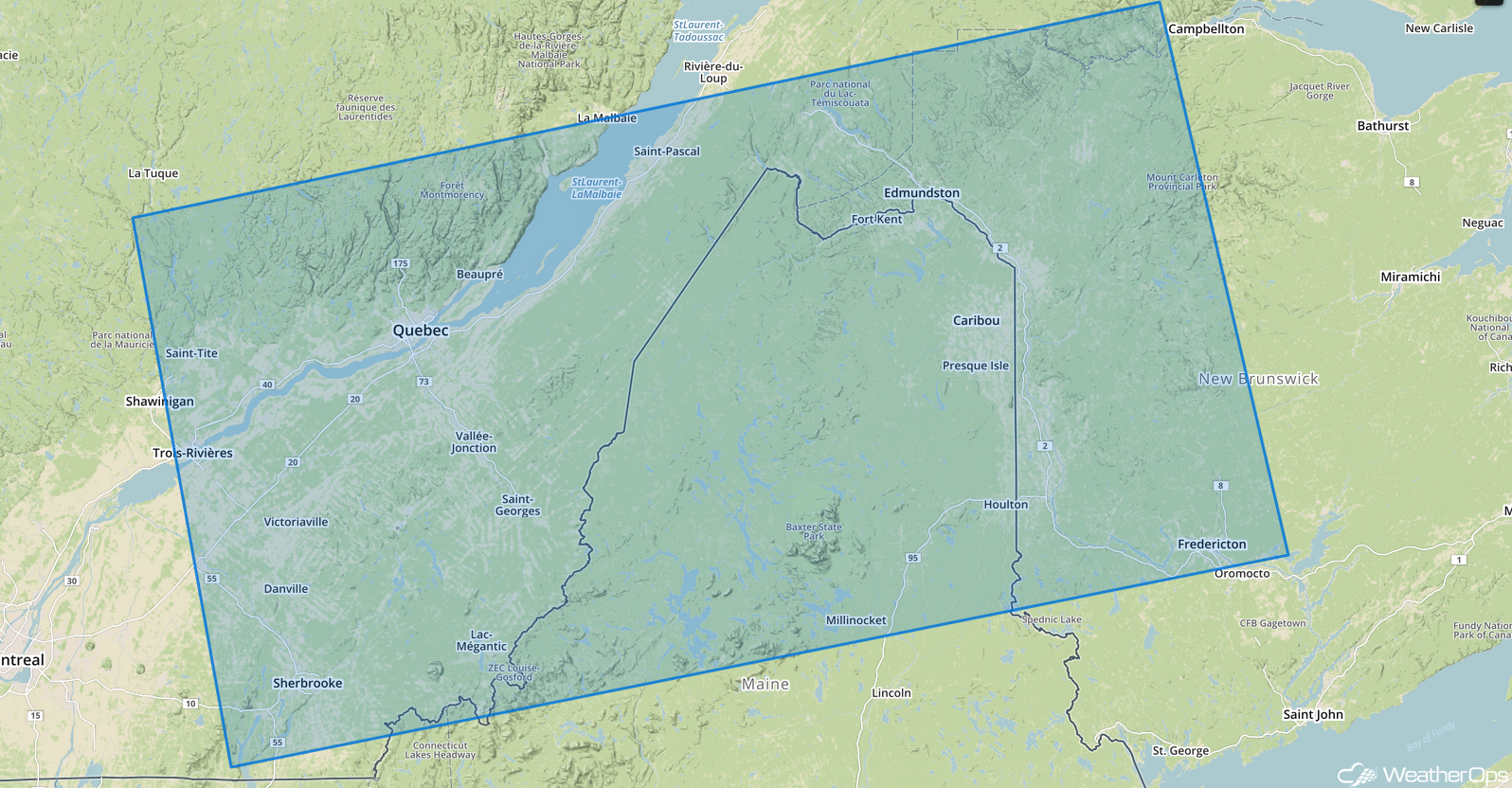 Snowfall Risk Outline for Wednesday and Thursday
A Look Ahead
Scattered showers will track across the Southeast into the Mid Atlantic on Thursday in association with an area of low pressure. Further north, light to moderate snow is forecast for the Great Lakes, with a few inches forecast. Snow will taper off across the Northeast on Friday. Further to the west, heavy rain and snow will be possible Friday for the Northwest as an area of low pressure moves into the region. Heavy snow may also develop across the higher elevations of the Coastal Ranges, Sierra Nevada, and Rockies.
That is a brief look at current weather hazards. We can provide you site-specific weather forecast information to protect your staff and assets and to assess your weather risk. Try a 7-day demo right away and learn how timely precision weather information can enhance your bottom line.
