National Weather Summary for Tuesday, December 20, 2016
by David Moran, on Dec 20, 2016 11:25:03 AM
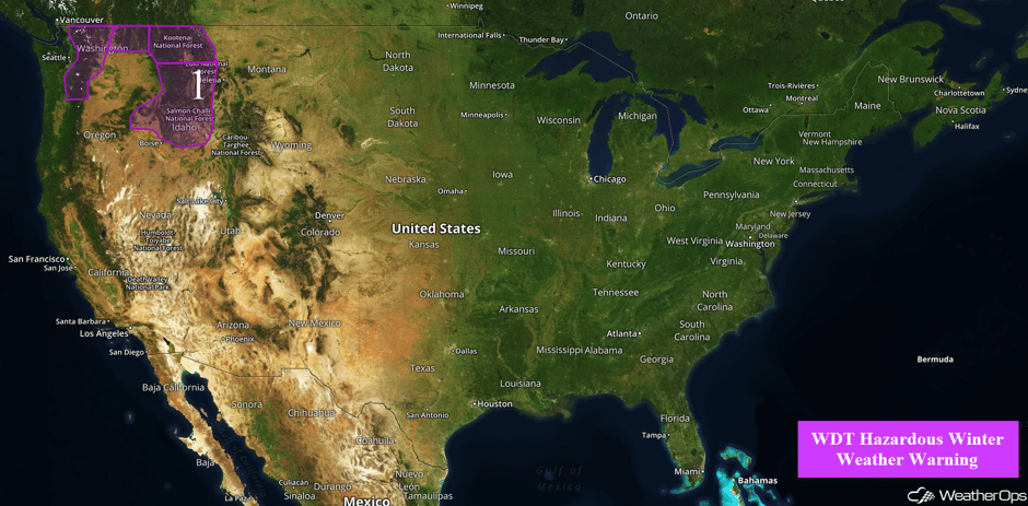
Heavy snow will continue across the Pacific Northwest through early Wednesday as an area of low pressure continues to move across the region. As this area of low pressure continues to move eastward on Wednesday, snow is expected to develop across the Great Lakes. By Thursday, a second area of low pressure will impact the Pacific Northwest, bringing snow to the Cascades.
 US Hazards
Region 1
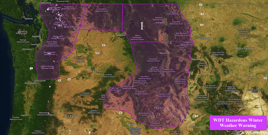
Snow will continue across the Pacific Northwest through early Wednesday as an upper level disturbance continues to move eastward across the region. Snow accumulations of 10-18 inches with locally higher amounts in excess of 20 inches are expected for portions of the Cascades. In addition to the snow, winds of 15-25 mph will reduce visibilities to less than a mile at times and allow for wind chills of 10-15 F. Across northeastern Washington, snow amounts of 2-3 inches with locally higher amounts in excess of 5 inches are forecast for the valleys. For the higher elevations, 6-8 inches with locally higher amounts in excess of 10 inches are expected. Further to the east across northern Idaho, snow accumulations of 2-5 inches with locally higher amounts in excess of 7 inches are possible for the valleys. In the higher elevations, 8-12 inches with locally higher amounts in excess of 15 inches are forecast. In addition to the snow, winds of 15-20 mph with gusts in excess of 25 mph will allow for visibilities of less than 3 miles and wind chills of 10-20 F. Further to the south across southwestern Montana and southern Idaho, snowfall amounts of 8-12 inches with locally higher amounts in excess in 15 inches are expected. Winds of 10-15 mph with gusts in excess of 20 mph will allow for visibilities below two miles and wind chills below zero at times.
Major Cities in Region: Kalispell, MT, Missoula, MT
Use caution if traveling on I-84 between Ontario and LaGrande. #orwx #idwx pic.twitter.com/jrfny1Rg1r
— NWS Boise (@NWSBoise) December 20, 2016
 Region 1
Significant Snowfall Possible Wednesday for the Great Lakes
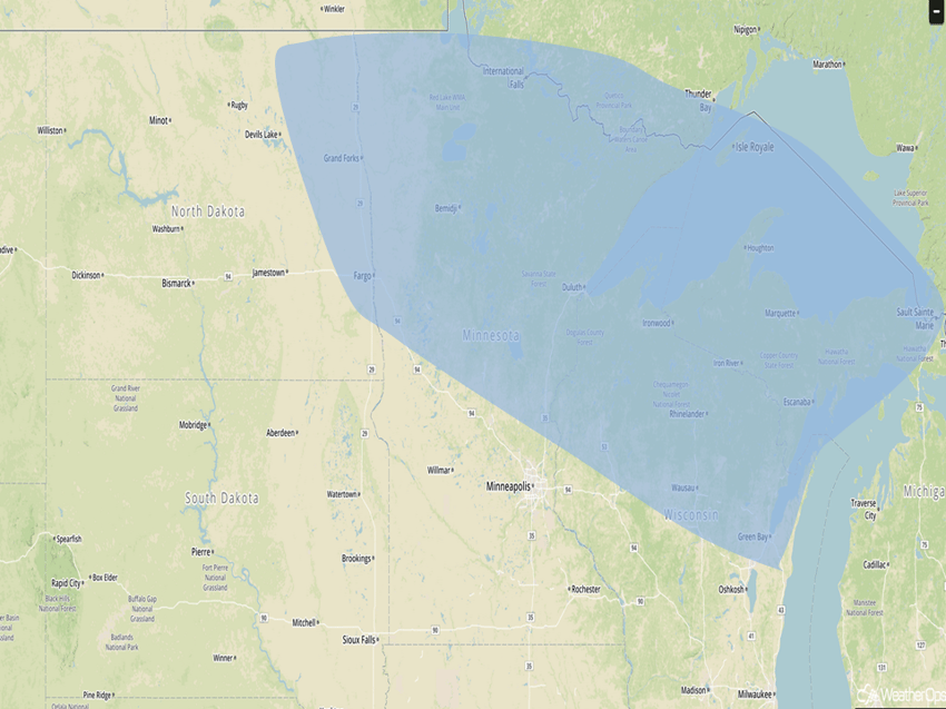
An area of low pressure will continue across the Northern US on Wednesday, allowing for snow across the Great Lakes. Snowfall amounts of 3-5 inches with isolated higher amounts in excess of 6 inches are expected.
Major Cities in Region: International Falls, MN, Green Bay, WI
 Significant Snowfall Risk Outline for Wednesday
Significant Snowfall Possible for the Cascades on Thursday
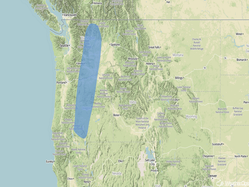
The next area of low pressure and cold front will begin to move through the Pacific Northwest on Thursday, allowing for mountainous snowfall to begin accumulating across the region. Snowfall totals for the mountain peaks could approach 6 inches with isolated higher amounts possible in the heaviest bands,
Major Cities in Region: Yakima, WA
 Significant Snowfall Risk Outline for Thursday
A Look Ahead
As the area of low pressure that is expected to move into the Pacific Northwest continues to progress eastward, heavy snow will be possible across the Sierra Nevada. Snowfall amounts of 8-12 inches with higher amounts in excess a foot are expected. By Christmas Eve, snow is forecast for portions of the Rockies and Intermountain West. While there is some uncertainty in amounts, some areas may pick up in excess of a foot of snow. Into Christmas, this area of low pressure should be moving into the Plains, bringing snow to the Northern Plains. To the south of this system, thunderstorms may develop across the Southern Plains. By Monday, snow will move into the Upper Midwest and western Great Lakes.
This is just a brief look at current weather hazards. We can provide you site-specific forecast information for the purpose of protecting your personnel and assets. Try a 7-day demo right away and learn how timely precision weather information can enhance your bottom line.


