


by David Moran, on Aug 28, 2018 10:24:12 AM
Thunderstorms are forecast to develop from the Plains into the Northeast on Tuesday ahead of a cold front. Some of this activity will have the potential to produce excessive rainfall from the Mid-Mississippi Valley into the Great Lakes.
- Thunderstorms from the Plains into the Northeast on Tuesday
- Excessive Rainfall Tuesday from the Mid-Mississippi Valley into the Great Lakes
- Potential for Thunderstorms from the Ozarks to the Northeast on Wednesday
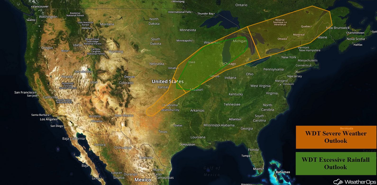
US Hazards
Thunderstorms from the Plains into the Northeast on Tuesday
A large cold front is tracking southeastward and will be the focus for the development of thunderstorms from the Central Plains into the Northeast. Thunderstorms will continue across the Great Lakes this morning with additional thunderstorms forecast this afternoon and evening. Large hail, damaging winds, and tornadoes will all be potential hazards with these storms.
Major Cities in Region: Topeka, KS, Kansas City, MO, Des Moines, IA, Wausau, WI, Green Bay, WI, Milwaukee, WI, Chicago, IL, Grand Rapids, MI, Detroit, MI, Syracuse. NY, Burlington, VT
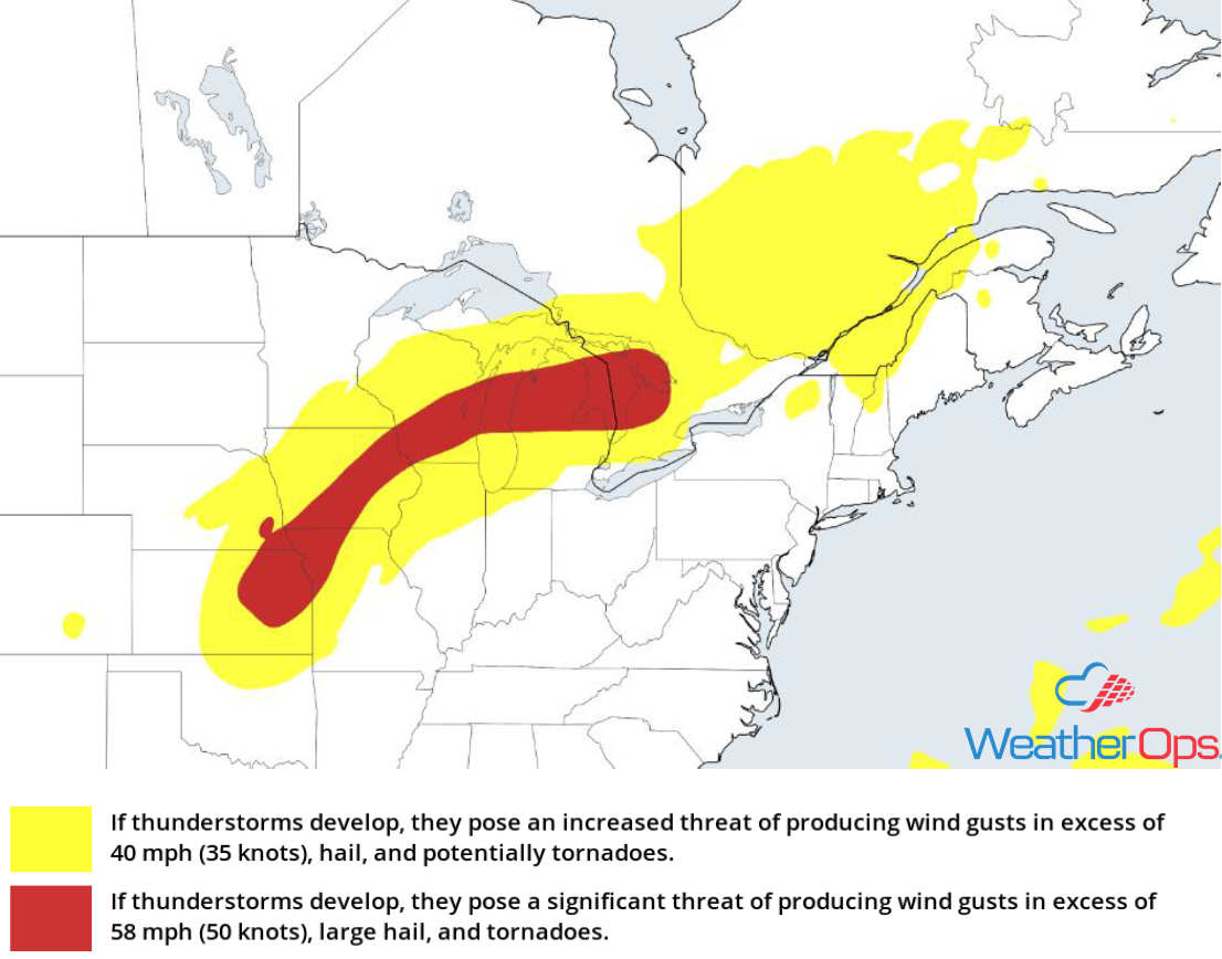
Thunderstorm Risk for Tuesday
Excessive Rainfall Tuesday from the Mid-Mississippi Valley into the Great Lakes
The thunderstorm activity described above will have the potential to produce heavy to excessive rainfall from the Mid-Mississippi River Valley into the Great Lakes. Rainfall amounts will range 2-4 inches with locally higher amounts in excess of 5 inches. This could lead to a risk for flooding, especially across northern Illinois and southern Wisconsin.
Major Cities in Region: Des Moines, IA, Cedar Rapids, IA, Green Bay, WI, Milwaukee, WI, Grand Rapids, MI, Traverse City, MI
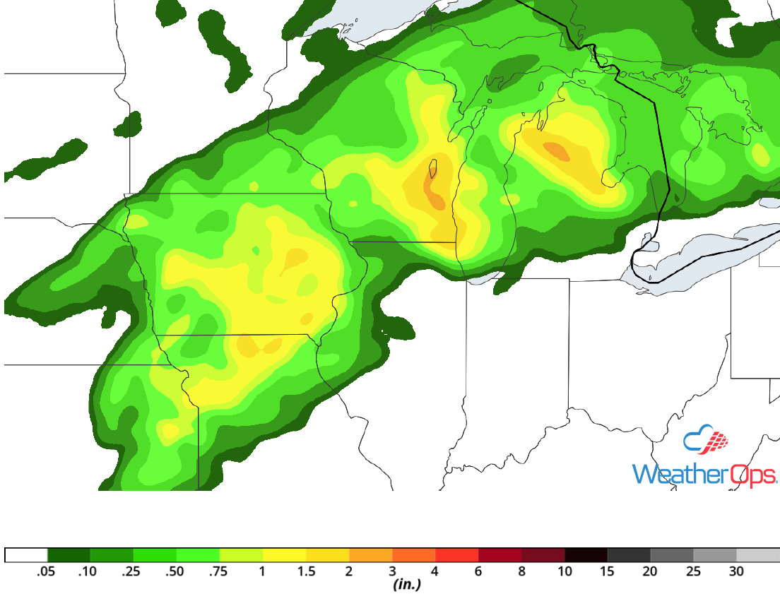
Rainfall Accumulation for Tuesday
Potential for Thunderstorms from the Ozarks to the Northeast on Wednesday
As the cold front described above continues to progress slowly southeastward from the Central US into the New England region on Wednesday, thunderstorm development is expected. While some thunderstorms are forecast along and ahead of the front during the morning, activity will increase in coverage and intensity during the afternoon and evening. A few strong to severe thunderstorms may develop with large hail, damaging winds, and tornadoes potential hazards.
Major Cities in Region: Springfield, MO, St. Louis, MO, Indianapolis, IN, Detroit, MI, Cleveland, OH, Buffalo, NY, Rochester, NY, Albany, NY, Burlington, VT, Augusta, ME
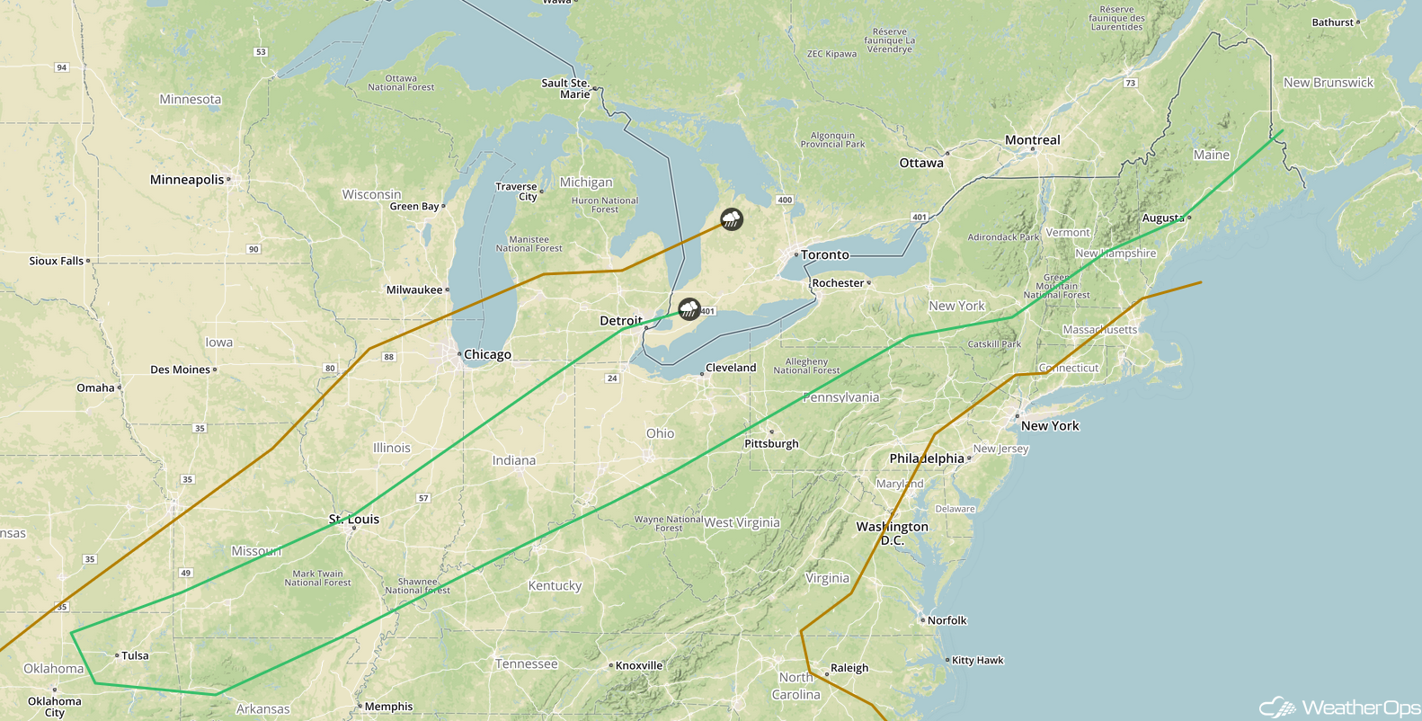
SPC Convective Outlook for Wednesday
A Look Ahead
Thunderstorms may develop across the Upper Midwest and Great Lakes on Friday ahead of a cold front. By Saturday, thunderstorm activity will extend from the Great Lakes into the Central Plains. A few thunderstorms are forecast across the Central and Northern Plains on Sunday. Early next week, a cold front may allow for the development of thunderstorms on Monday across the Northern Plains and Great Lakes.
