


by David Moran, on Aug 21, 2018 11:27:17 AM
Thunderstorms are forecast to develop from the Great Lakes into the Carolinas on Tuesday ahead of a cold front. Some of this activity will have the potential to produce excessive rainfall. Daytime heating and upslope flow will allow for the development of thunderstorms across the Southern High Plains. Heavy rain is forecast for portions of Arizona as an area of low pressure intensifies.
- Thunderstorms from the Great Lakes to the Carolinas on Tuesday
- Excessive Rainfall Tuesday across the Central Appalachians
- Risk for Thunderstorms across the Southern High Plains on Tuesday
- Potential for Excessive Rainfall Tuesday across Arizona
- Thunderstorm Potential for the Southern High Plains Wednesday
- Thunderstorms Wednesday for New England
- Risk for Thunderstorms from the Eastern Carolinas to Chesapeake Bay on Wednesday
- Potential For Thunderstorms Thursday across the Northern Plains
- Tropical Update
US Hazards
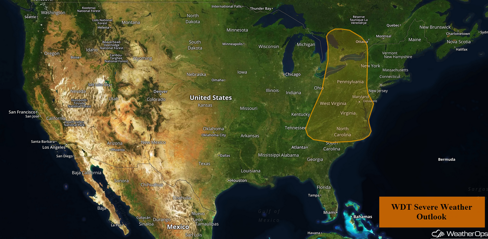
Thunderstorms from the Great Lakes to the Carolinas on Tuesday
Showers and thunderstorms, some strong to severe, are expected from the Carolinas northward into the Great Lakes on Tuesday. An upper level trough will be moving into the eastern US, providing forcing for thunderstorm development. Moist air will be in place across the region; with daytime heating, instability will build. Thunderstorms are expected to develop during the afternoon with damaging winds and large hail the primary hazards, although an isolated tornado or two cannot be ruled out.
Major Cities in Region: Columbus, OH, Charleston, WV, Cleveland, OH, Roanoke, VA
Thunderstorm Risk for Tuesday
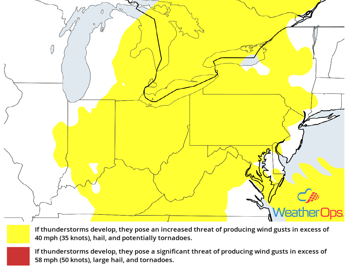
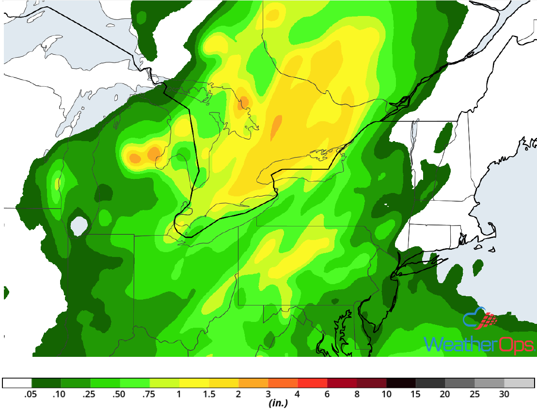
Excessive Rainfall Tuesday across the Central Appalachians
In addition to the thunderstorm risk described above, there will be a potential for excessive rainfall. Rainfall amounts of 1-2 inches with locally higher amounts in excess of 3 inches are expected.
Major Cities in Region: Pittsburgh, PA, State College, PA
Rainfall Accumulation for Tuesday
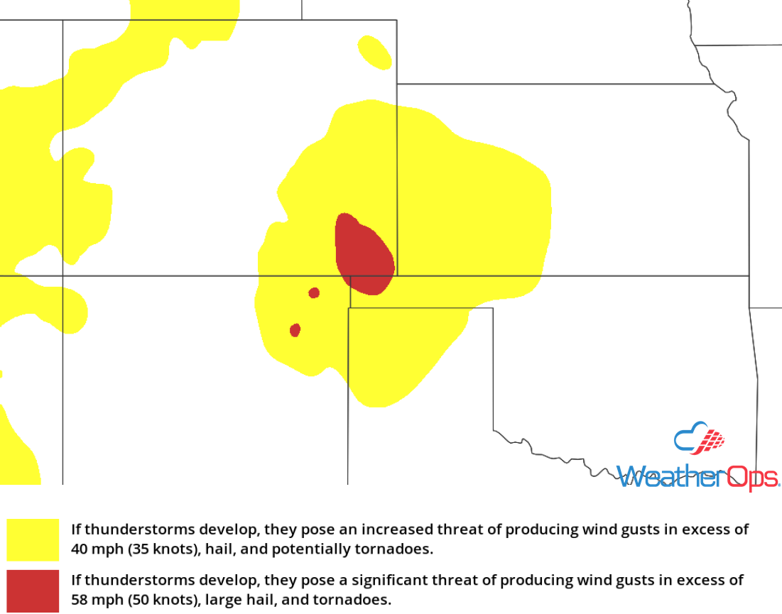
Risk for Thunderstorms across the Southern High Plains on Tuesday
Although moisture will be limited, daytime heating should allow sufficient instability to build for the development of thunderstorms. Lift will be provided by a weak upper level trough and upslope flow. Thunderstorms should develop later this afternoon with large hail and damaging winds the primary hazards. The severe weather threat should diminish after sunset with the loss of daytime heating.
Major Cities in Region: Trinidad, CO, Goodland, KS, Guymon, OK, Dodge City, KS
Thunderstorm Risk for Tuesday
Potential for Excessive Rainfall Tuesday across Arizona
Southerly winds on the east side of an area of low pressure developing near the Arizona and California border will bring moisture northward. A weak upper level wave may provide enough lift for the development of showers and thunderstorms across portions of Arizona. Some of these storms will be heavy and slow-moving, allowing for a potential for heavy rainfall. Rainfall amounts will range 0.50-1.00 inch with locally higher amounts in excess of 2 inches.
Major Cities in Region: Flagstaff. AZ, Phoenix, AZ, Tucson, AZ
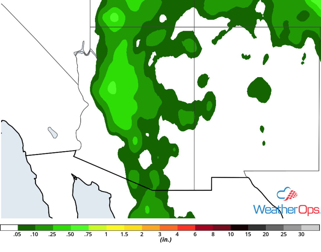
Rainfall Accumulation for Tuesday
Thunderstorm Potential for the Southern High Plains Wednesday
Additional thunderstorms are expected to develop across the Southern High Plains on Wednesday. Moisture will move into the region as southeasterly flow continues. This should allow instability to build as daytime heating increases. With strong shear in place, isolated strong to severe thunderstorms are expected to develop during the afternoon. Damaging winds and large hail will be the primary hazards with these storms.
Major Cities in Region: Trinidad, CO, Lamar, CO, Dumas, TX, Guymon, OK
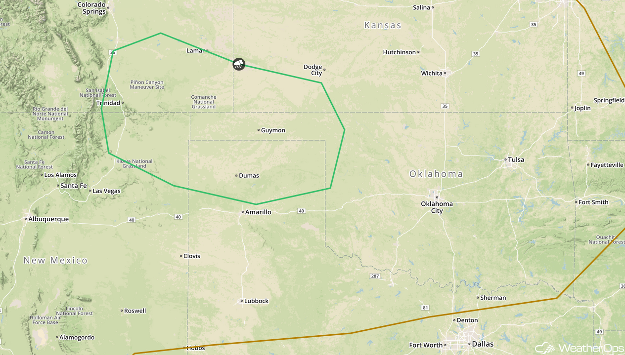
SPC Convective Outlook for Wednesday
Thunderstorms Wednesday for New England
Thunderstorms are forecast to develop ahead of a cold front on Wednesday as instability increases across the region. Damaging winds and large hail will be the primary hazards with any storms that develop.
Major Cities in Region: Hartford, CT, Concord, NH, Manchester, NH, Providence, RI, Boston, MA, Portland, ME
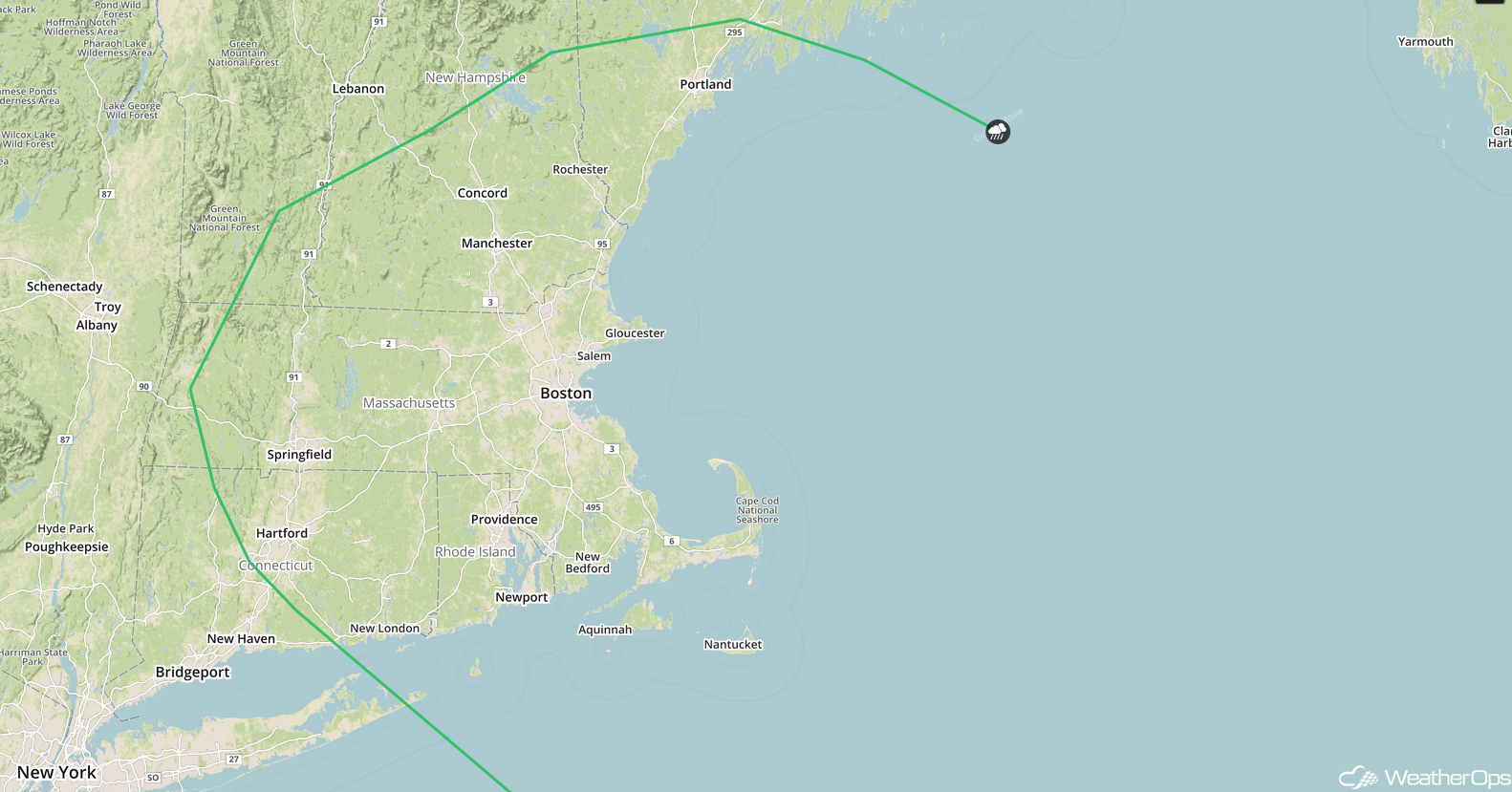
SPC Convective Outlook for Wednesday
Risk for Thunderstorms from the Eastern Carolinas to Chesapeake Bay on Wednesday
A cold front will move off the East Coast on Wednesday, but a few thunderstorms may develop along and ahead of the front before it moves off the coast. Thunderstorms should form during the afternoon with damaging winds and large hail the primary hazards.
Major Cities in Region: Myrtle Beach, SC, Wilmington, NC, Norfolk, VA, Richmond, VA
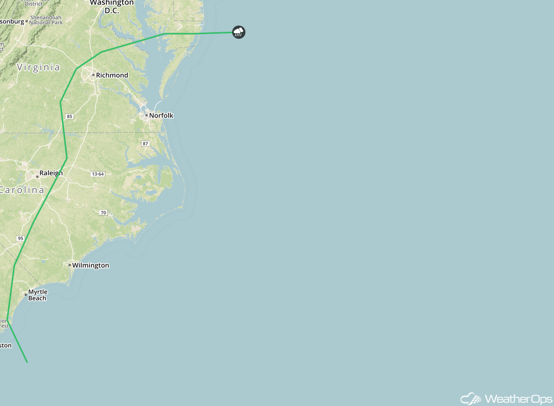
SPC Convective Outlook for Wednesday
Potential For Thunderstorms Thursday across the Northern Plains
An upper level low moving over the region will allow for the development of severe thunderstorms on Thursday. An associated surface low will be moving eastward through the region, with a cold front extending to the southwest of the low. Moisture should move northward over the Plains as southerly flow increases. Widely scattered strong to severe thunderstorms are expected to develop during the afternoon with damaging winds and large hail the primary hazards. A few isolated tornadoes cannot be ruled out.
Major Cities in Region: Pierre, SD, Sioux Falls, SD, Omaha, NE, Kansas City, MO, Des Moines, IA
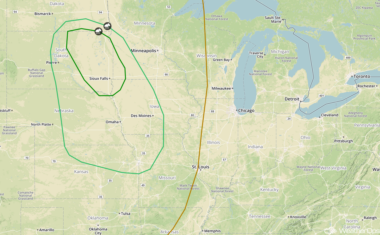
SPC Convective Outlook for Thursday
Tropical Update
Hurricane Lane is moving westward toward the Hawaiian islands as a strong category 4 hurricane. Lane is currently 620 miles southeast of Honolulu, Hawaii and is moving westward at 12 miles per hour. A turn to the northwest is expected Wednesday into Thursday. On the forecast track, the center of Lane will pass close to the islands on Thursday. Maximum sustained winds are near 150 mph with higher gusts. Slight weakening is expected over the next few days, but Lane is expected to remain a major hurricane as it moves closer to the Hawaiian Islands.
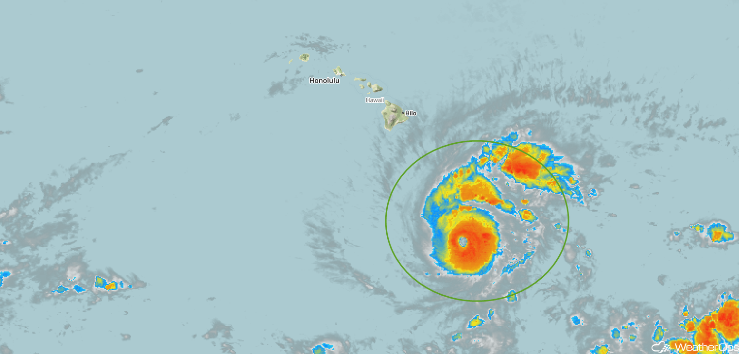
Enhanced Infrared Satellite
A Look Ahead
As the area of low pressure described above continues to move eastward on Friday, showers and thunderstorms will extend from the Great Lakes into the Ohio Valley. By late Saturday, thunderstorms may develop across the Northern Plains along a cold front. This activity will move into the Great Lakes and Upper Midwest on Sunday. Some of this activity may continue into Monday.
