National Weather Summary for Tuesday, August 2, 2016
by David Moran, on Aug 2, 2016 11:41:16 AM
Thunderstorms will be possible on Tuesday across portions of the Midwest ahead of a cold front. Further to the west, thunderstorms will be possible across the Northern High Plains as an area of low pressure develops over Montana and moves into the Plains. Monsoonal rains will continue across the Desert Southwest through Wednesday. Heavy rain will be possible across the Missouri Valley along a stalled front. On Wednesday, the area of low pressure over Montana will move into the Northern Plains, allowing for the development of thunderstorms. As the area of low pressure continues to move across the Great Plains, thunderstorms will be possible across the western Great Lakes ahead of a cold front.
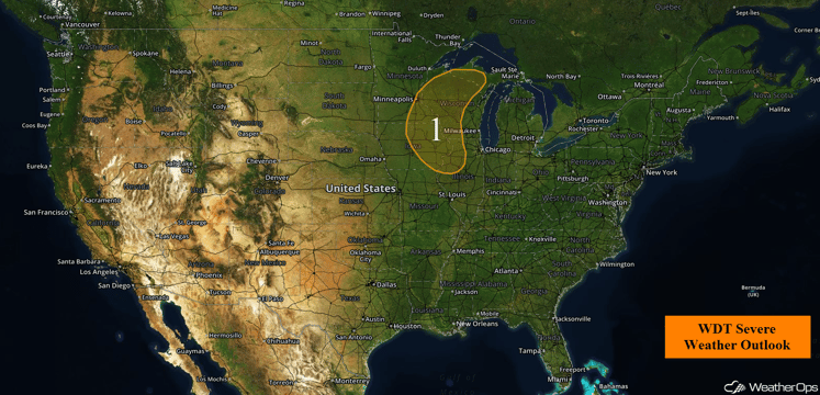
US Hazards
Region 1
There is a chance for strong to possibly severe thunderstorms across Region 1 as a cold front pushes eastward across the Northern Plains. The atmosphere is expected to become marginally conducive for severe weather by the afternoon hours, with scattered showers and thunderstorms forecast by late afternoon. Primary concerns with this activity will be strong winds and marginally severe hail. The threat will likely diminish during the early evening hours.
Major Cities in Region: Minneapolis, MN, Davenport, IA
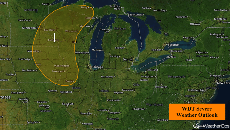
Region 1
Strong to Severe Thunderstorms Possible Across the Northern High Plains on Tuesday
Across the northern High Plains, a surface low is forecast to develop late Tuesday over Montana bringing warm moist air and instability of the High Plains to the east of the Low. This is forecast to lead to an increase in coverage and intensity of thunderstorms during the late afternoon to evening hours. The primary threat with any thunderstorms will be strong winds and large hail.
Major Cities in Region: Rapid City, SD
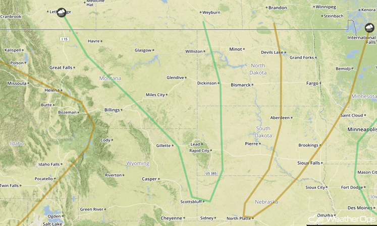
SPC Convective Outlook for Tuesday
Excessive Rainfall Possible Tuesday Across the Desert Southwest
Monsoonal conditions are expected to continue on Tuesday as showers and thunderstorms are forecast to remain across much of the region. An additional 1-2 inches of rain will be possible especially with some of the stronger thunderstorms in the area, with locally heavier amounts in excess of 3 inches possible. With the heavy rainfall, flooding and flash flooding may occur due to runoff.
Major Cities in Region: Flagstaff, AZ, Phoenix, AZ, Tucson, AZ, Albuquerque. NM
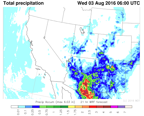
WDT WRF Total Precipitation through Midnight MDT
Excessive Rainfall Possible Across the Missouri Valley on Tuesday
An area of enhanced rainfall is forecast near a frontal boundary across the Mid-Missouri to Mid-Mississippi Valleys. Currently slow moving thunderstorm complexes are moving across parts of eastern Nebraska and western Iowa as well as portions of eastern Missouri. These thunderstorm complexes are forecast to slowly move eastward bringing the potential for heavy rain across the area. Rainfall amounts of 1-2 inches with locally higher amounts in excess of 3 inches will be possible.
Major Cities in Region: St. Louis, MO
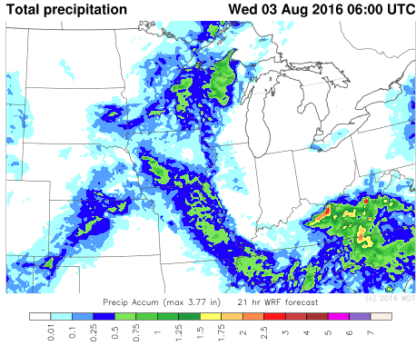
WDT WRF Total Precipitation through 1am CDT Wednesday
Strong to Severe Thunderstorms Possible Wednesday Across the Northern Plains
An area of low pressure in Montana will continue east-northeastward during the day with its associated cold front extending southwestward into South Dakota by early evening. As this cold front continues eastward, a narrow area of instability and moisture is forecast ahead of this front. Within this area, strong to severe thunderstorms are possible. As these thunderstorms develop in the afternoon, they are expected to become more linear by the evening as they continue eastward. The primary threats with any thunderstorm that develops will be strong winds and large hail. Heavy rainfall will also be possible across this region with 1-3 inches and locally higher amounts in excess of 4 inches possible especially within any heavier thunderstorms.
Major Cities in Region: Bismarck, ND, Fargo, ND, Pierre, SD
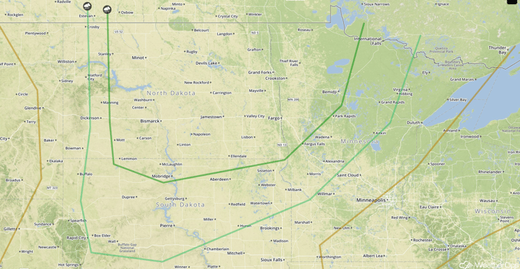
SPC Convective Outlook for Wednesday
Excessive Rainfall Possible for Wednesday Across the Desert Southwest
Monsoonal conditions are forecast to continue on Wednesday with showers and thunderstorms bringing the potential for another 1-2 inches of rainfall with locally higher amounts in excess of 3 inches possible. With the heavy rainfall, flooding and flash flooding may occur due to precipitation runoff.
Major Cities in Region Flagstaff, AZ, Phoenix, AZ, Tucson, AZ, Albuquerque, NM
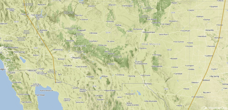
SPC Convective Outlook for Wednesday
Strong to Severe Thunderstorms Possible Across Western Great Lakes on Thursday
As an area of low pressure continues east-northeastward across southern Saskatchewan and Ontario, the associated cold front will drape southwestward across portions of the Midwest. Ahead of this front, strong to severe thunderstorms will be possible. The primary threats with any thunderstorms that form will be strong winds and large hail.
Major Cities in Region: Marquette, MI
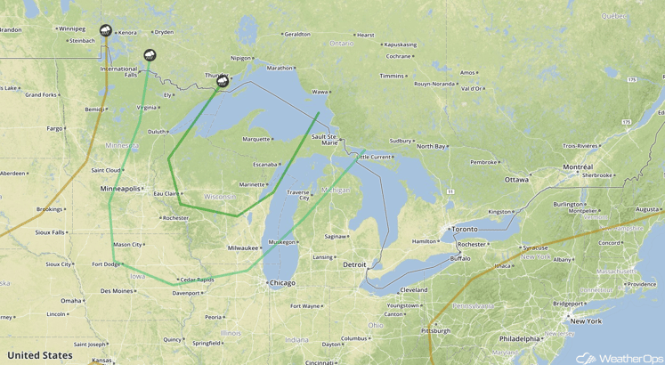
SPC Convective Outlook for Thursday
This is just a brief look at current weather hazards. We can provide you site-specific forecast information for the purpose of protecting your personnel and assets. Try a 7-day demo right away and learn how timely precision weather information can enhance your bottom line.


