National Weather Summary for Tuesday, August 1, 2017
by David Moran, on Aug 1, 2017 10:17:39 AM
Thunderstorms may develop across portions of the Northern Plains Tuesday as an area of low pressure intensifies. A stalled front across the Southwest will be the focus for excessive rainfall across the region.
- Thunderstorms for the Northern Plains on Tuesday
- Excessive Rainfall Risk Tuesday across the Southwest
- Risk for Thunderstorms across the Northern and Central Plains on Wednesday
- Thunderstorm Potential Thursday for the Midwest
- Tropical Update
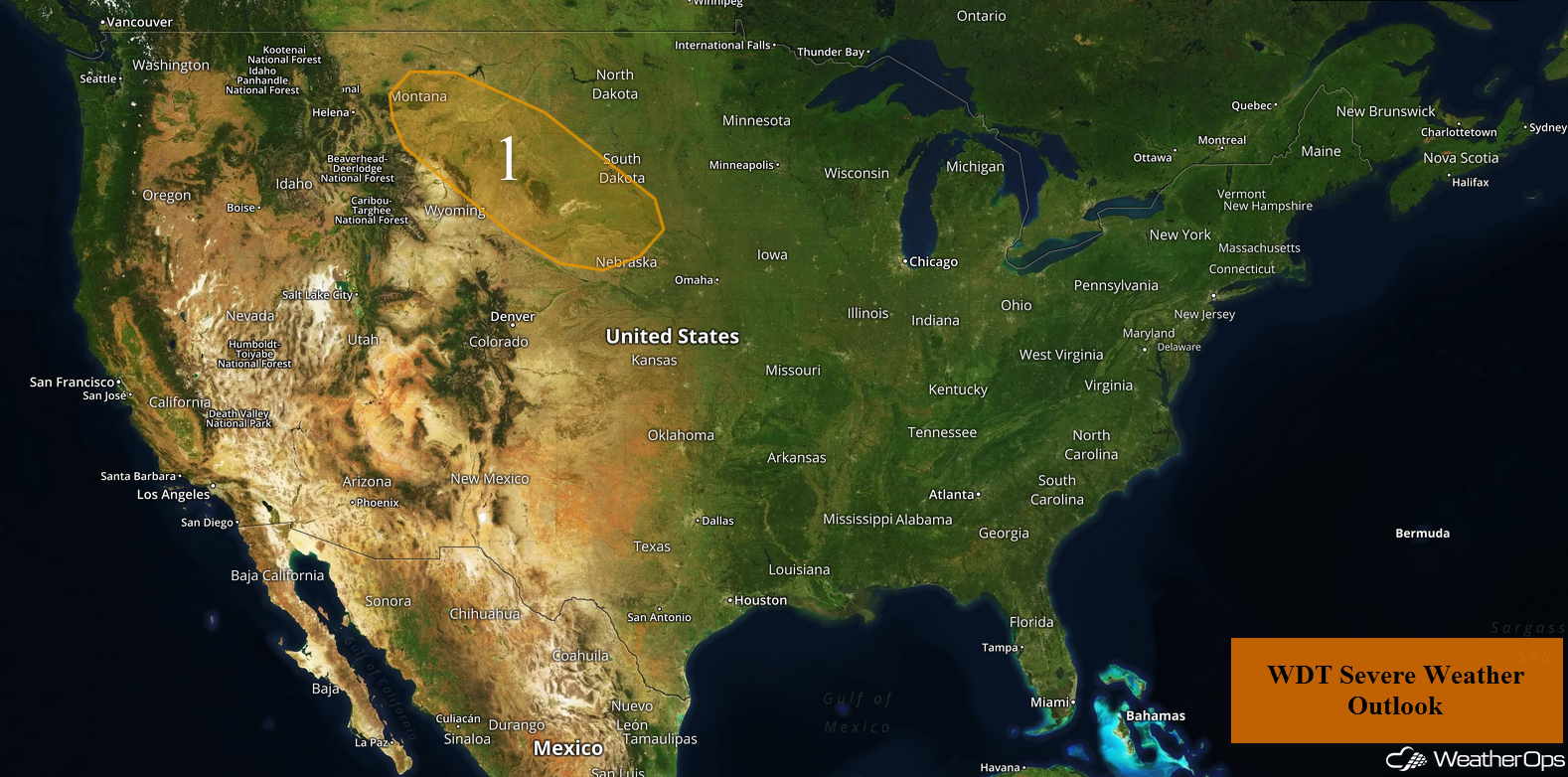
US Hazards
Thunderstorms for the Northern Plains on Tuesday
As a cold front moves southward across the Northern US today, an area of low pressure will move eastward. These features will promote the development of thunderstorms across the region, mainly by mid to late afternoon, before increasing in coverage by the early evening. Large hail and damaging winds will be the primary hazards with these storms. Activity will continue through late evening and into the overnight hours, but the severe threat should diminish with the loss of daytime heating.
Update 12:40pm CDT: Severe thunderstorm capable of hail and damaging winds south of Pierre, SD.
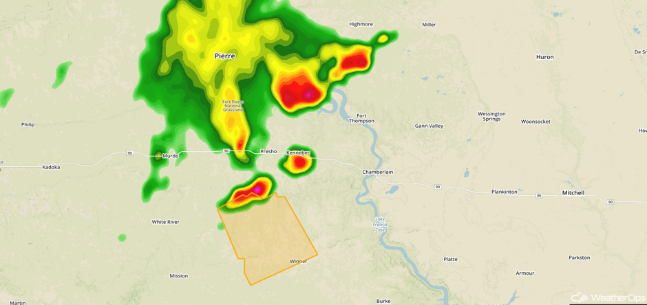 Radar 12:40pm CDT
Major Cities in Region: Billings, MT, Rapid City, SD, Pierre, SD
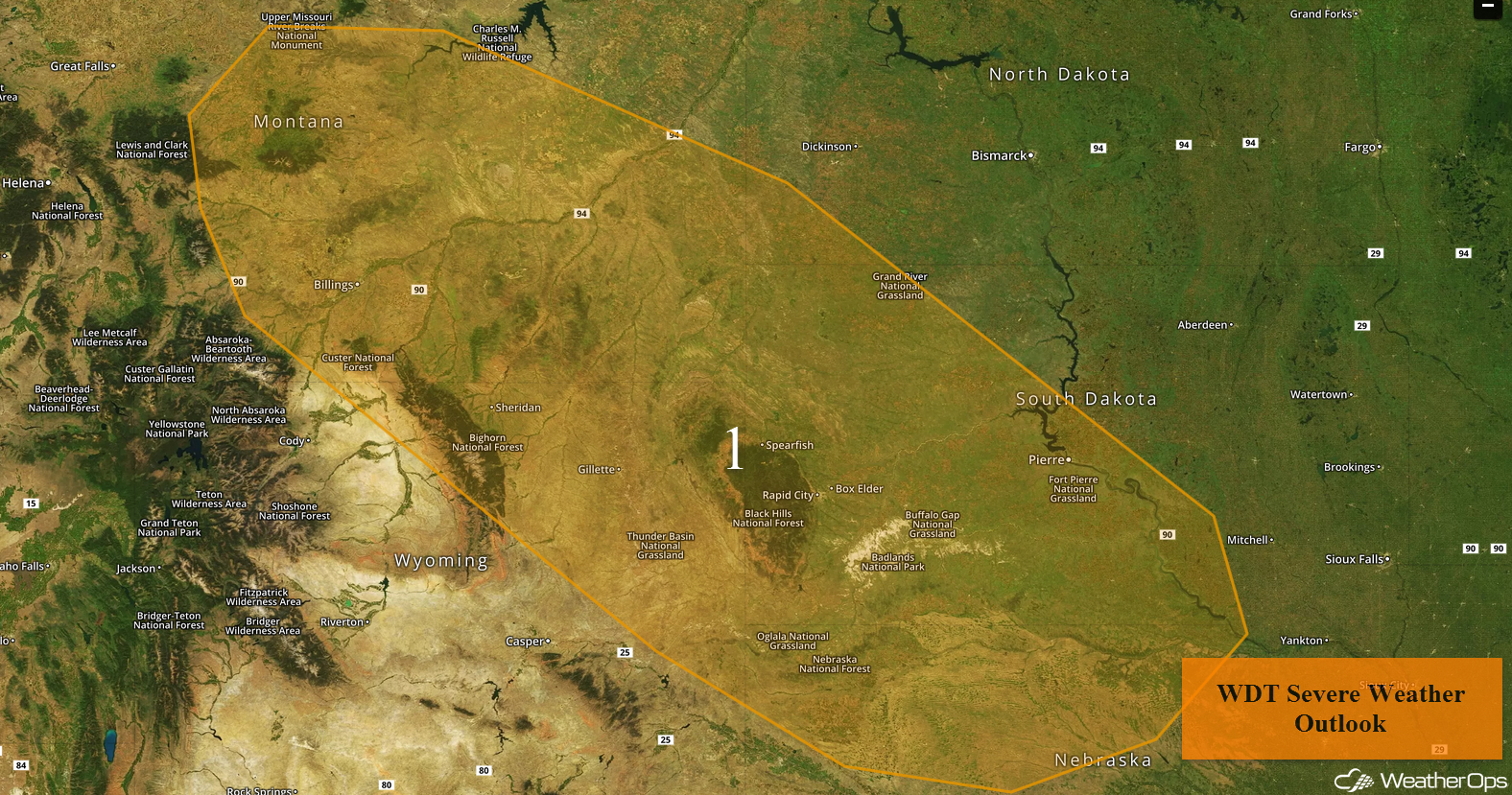 Region 1
Excessive Rainfall Risk Tuesday across the Southwest
A stalled front will be the focus for thunderstorm development across the Southwest on Thursday. Additional rainfall is forecast with amounts of 1-2 inches forecast and locally higher amounts of 2.5 inches. With the additional rainfall, there will be the potential for flooding and flash flooding.
Major Cities in Region: Tucson, AZ, El Paso, TX, Midland, TX, Lubbock, TX
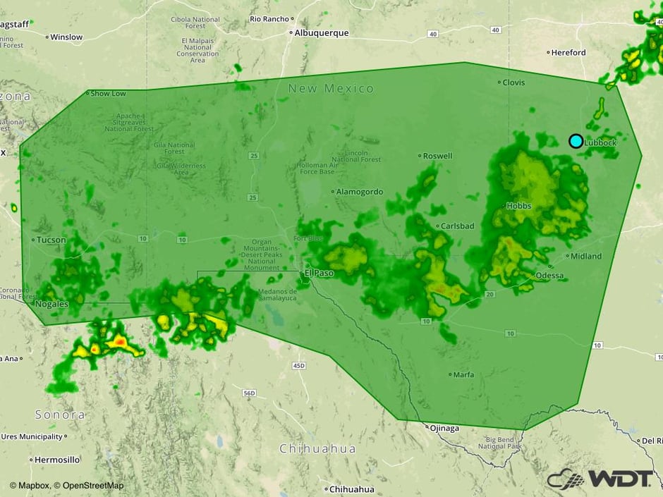 Excessive Rainfall Risk Outline for Tuesday
Risk for Thunderstorms across the Northern and Central Plains on Wednesday
As a shortwave trough moves through the Northern Plains on Wednesday, an area of low pressure is expected to develop and move eastward. The cold front will track eastward throughout the day with warm, moist air ahead of the front. This will lead to the development of strong to severe thunderstorms capable of strong winds and large hail.
Major Cities in Region: Rapid City, SD, Pierre, SD, Sioux Falls, SD, Sioux City, IA, Omaha, NE
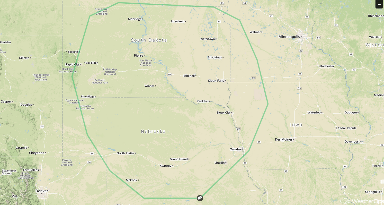 SPC Convective Outlook for Wednesday
Thunderstorm Potential Thursday for the Midwest
Strong to severe thunderstorms are expected to develop across portions of the Midwest on Thursday. An area of low pressure is forecast to continue to develop and track to the east throughout the day with the support of an upper level trough. With increased moisture and an intensifying area of low pressure, heavy to excessive rainfall is forecast to develop. Ahead of the low and cold front, isolated thunderstorms will quickly evolve into lines of storms. Large hail and damaging winds will be the primary hazards with these storms.
Major Cities in Region: St. Louis, MO, Milwaukee, WI, Chicago, IL, Indianapolis, IN, Detroit, MI
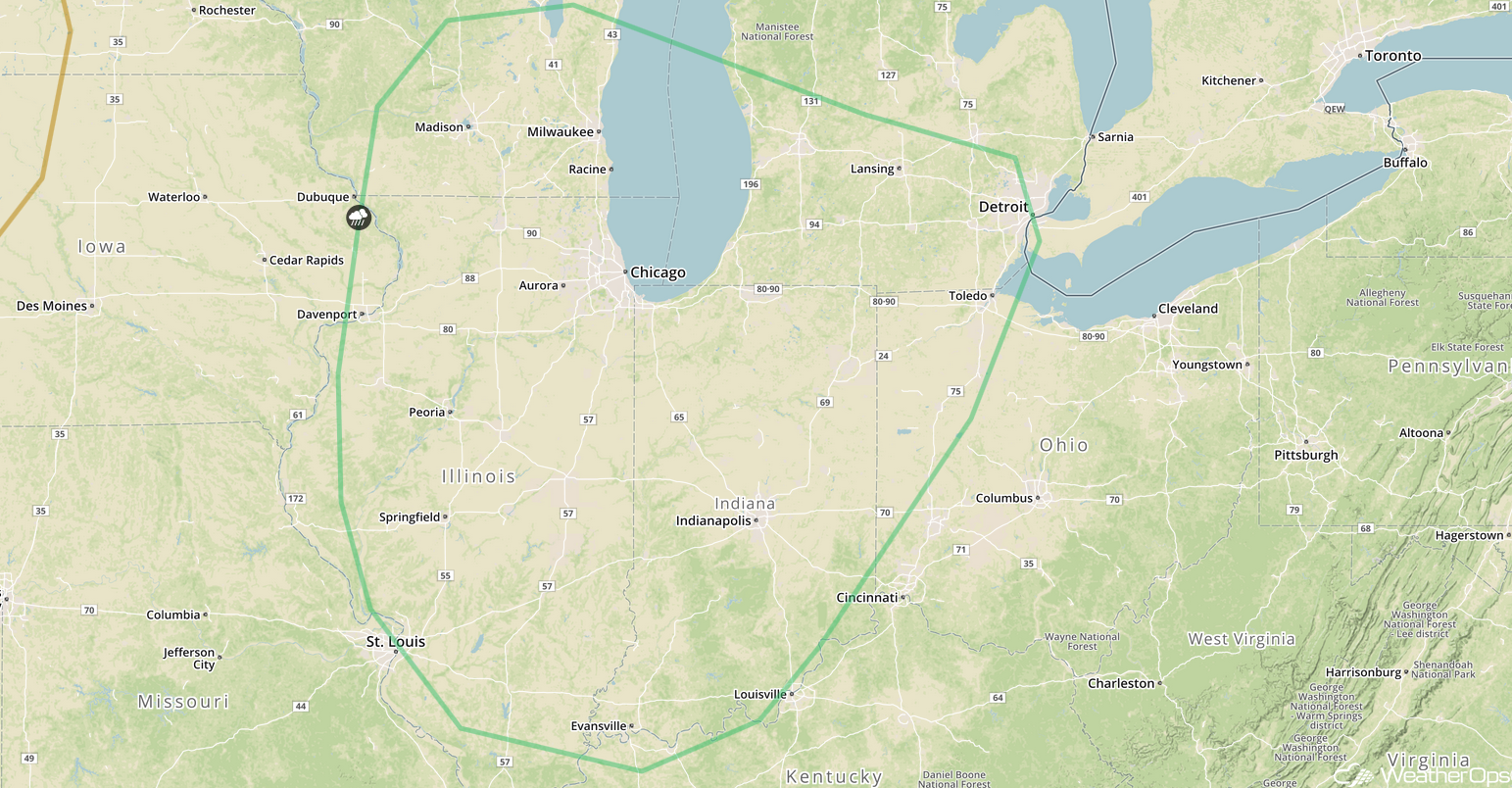 SPC Convective Outlook for Thursday
Tropical Update
Emily is now a Tropical Depression and is continuing to move toward the northeast at 14 mph. This general motion is expected to continue for the next couple of days. While some strengthening is possible, it is expected to lose its tropical characteristics within a day or two.
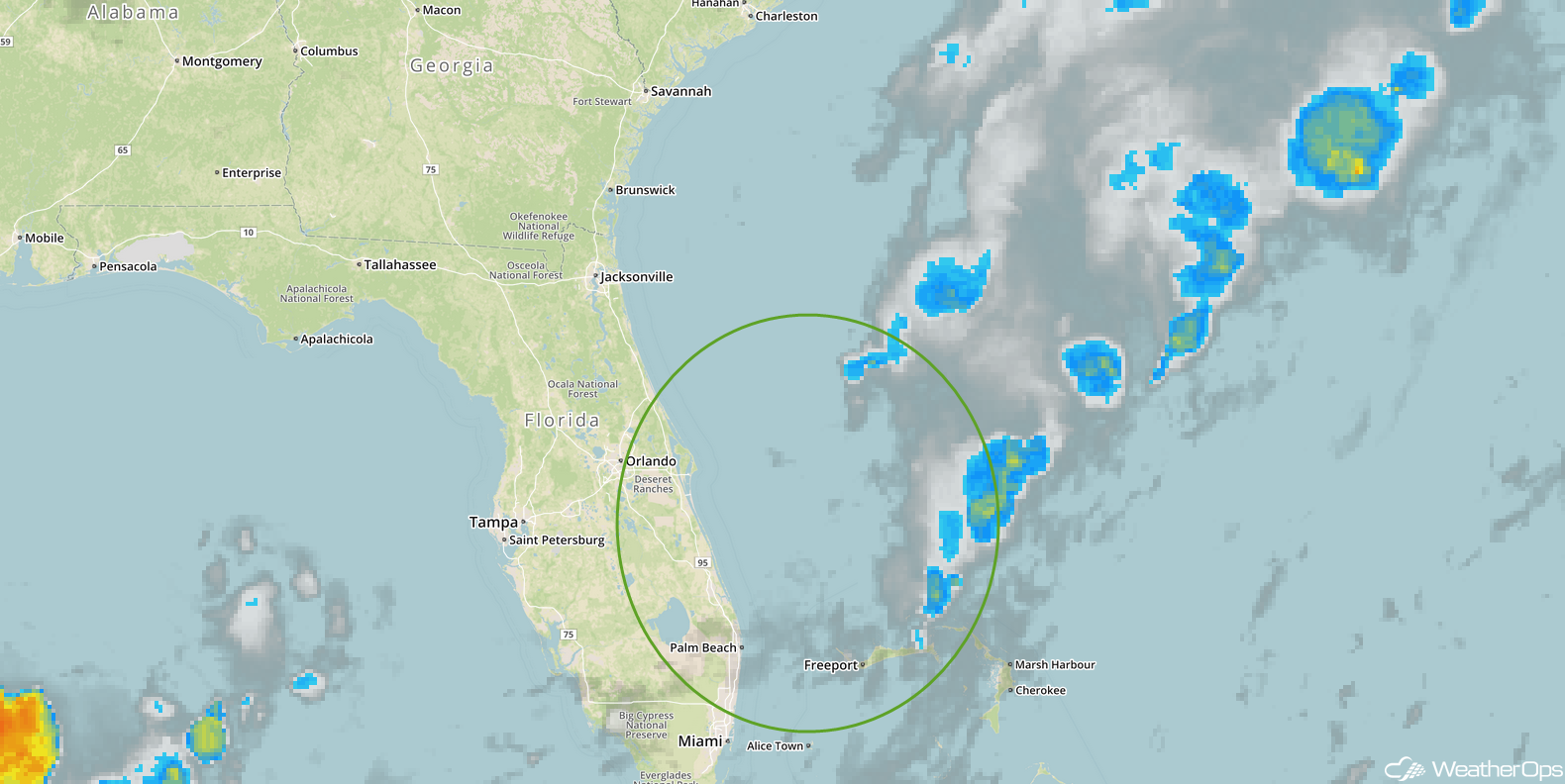 Enhanced Infrared Tropical Satellite
A Look Ahead
As the area of low pressure across the Midwest continues to move eastward on Friday, thunderstorms may develop across the Northeast; hail and damaging winds will be the potential hazards with these storms.
This is just a brief look at current weather hazards. We can provide you site-specific weather forecast information for the purpose of protecting your personnel and assets and to assess your weather risk. Try a 7-day demo right away and learn how timely precision weather information can enhance your bottom line.


