National Weather Summary for Tuesday, April 5, 2016
by David Moran, on Apr 5, 2016 10:45:13 AM
Strong thunderstorms are possible on Tuesday for portions of the Central Plains. Elevated wildfire conditions are expected across much of the Southern Plains.
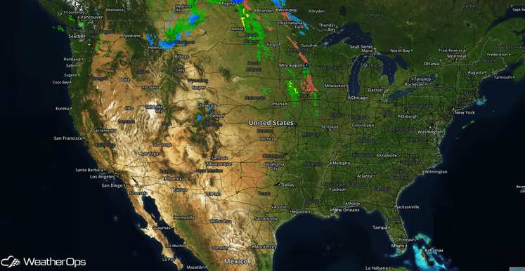
US Hazards
Strong thunderstorms possible for portions of the Plains
A few strong thunderstorms are expected to develop late Tuesday afternoon and into the evening across portions of the Central Plains ahead of a cold front moving through the region. As thunderstorms develop, a few could become strong, with the primary hazard being wind gusts in excess of 50 miles per hour. Small hail may be possible with a few storms.
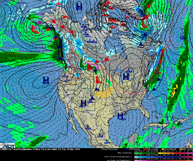
Hazards Assessment and Frontal Analysis
Wildfire Conditions Across the Central and Southern Plains
Red Flag Warnings are in effect from portions of the Southern Rockies eastward into the Central and Southern Plains. Low relative humidity values of 5-12% and southwesterly winds of 25-35 miles per hour with gusts up to 50 miles per hour will be possible. A cold front will begin to move through western portions of Kansas, Oklahoma, and Texas early in the evening. As the cold front moves through, winds will become northeasterly at 15-25 miles per hour with gusts near 35 miles per hour. Wildfire conditions will improve as the front passes through the region.
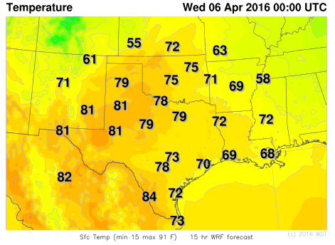
WDT WRF Temperatures 7pm CDT Tuesday
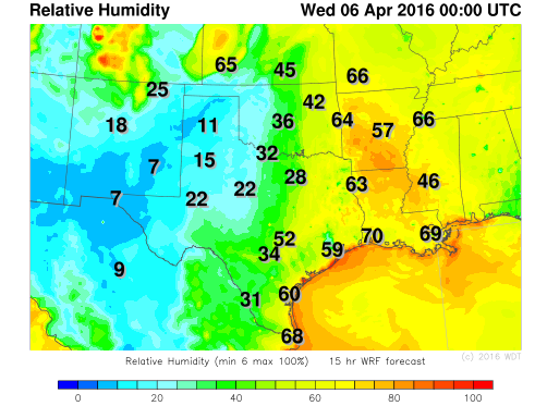
WDT WRF Relative Humidity 7pm CDT Tuesday
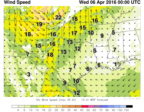
WDT WRF Winds 7pm CDT Tuesday


