


by David Moran, on Apr 3, 2018 11:02:57 AM
Snow will continue from the Northern Plains into the Great Lakes through Wednesday morning as an area of low pressure moves eastward. Thunderstorms will continue to develop from Texas into the Ohio Valley on Tuesday ahead of a cold front.
- Snow Continuing from the Northern Plains into the Great Lakes through Wednesday Morning
- Thunderstorms Tuesday from Southeast Texas into the Ohio Valley
- Potential for Thunderstorms across the Mid Atlantic on Wednesday
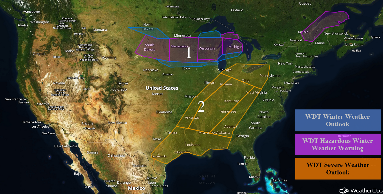 US Hazards

Snow Continuing from the Northern Plains into the Great Lakes through Wednesday Morning
Moderate to heavy snow is continuing across the Northern Plains and is forecast to extend across southern Minnesota, central Wisconsin, and northern Michigan through Wednesday morning. Snowfall totals of 4-8 inches with locally higher amounts in excess of a foot are forecast across the Northern Plains. Further east across the Great Lakes, 6-10 inches of snow with locally higher amounts in excess of a foot are expected. In addition, freezing rain accumulations up to 0.05 inch are expected. Winds of 30-40 mph may result in blowing snow and low visibilities.
Major Cities in Region: Rapid City, SD, Bismarck, ND, Pierre, SD, Sioux Falls, SD, Minneapolis, MN, Green Bay, WI, Milwaukee, WI, Traverse City, MI
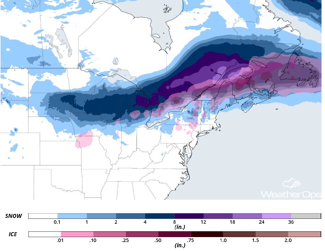 Snowfall Accumulation through Wednesday
Thunderstorms Tuesday from Southeast Texas into the Ohio Valley
Thunderstorms will continue to develop from Texas into the Ohio Valley ahead of a cold front on Tuesday. Strong winds, large hail, and tornadoes will all be potential hazards with these storms. Later in the day, thunderstorms will become linear with large hail and strong winds the primary hazards, but isolated tornadoes may also develop along the leading edge of the line.
Major Cities in Region: San Antonio, TX, Austin, TX, Houston, TX, Shreveport, LA, Little Rock, AR, St. Louis, MO, Memphis, TN, Jackson, MS, New Orleans, LA, Birmingham, AL, Nashville, TN, Indianapolis, IN, Detroit, MI, Cleveland, OH, Pittsburgh, PA
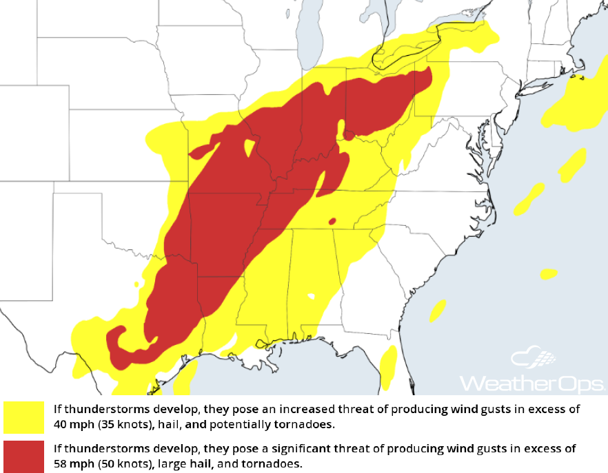 Thunderstorm Forecast for Tuesday
Potential for Thunderstorms across the Mid Atlantic on Wednesday
As an area of low pressure continues to move off to the northeast, a few thunderstorms may develop ahead of the trailing cold front. While impacts will be isolated, severe winds and hail will be the main hazards, but isolated tornadoes cannot be ruled out.
Major Cities in Region: Savannah, GA, Columbia, SC, Raleigh, NC, Washington, DC, Philadelphia, PA
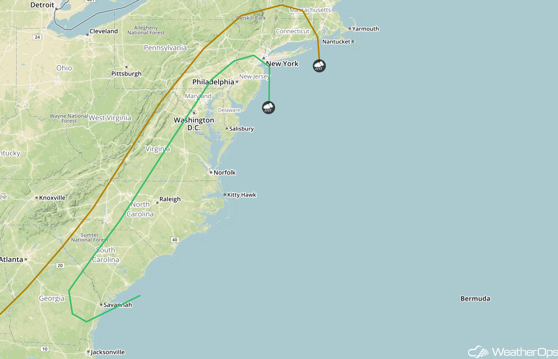 SPC Convective Outlook for Wednesday
A Look Ahead
An area of low pressure may bring light to moderate snow to portions of the Northeast on Friday. Further to the west, another round of snow and freezing rain is forecast Friday across the Northern Rockies and into the Central and Northern Plains. Into the weekend, a mix of wintry precipitation is forecast from the Plains into the Mid Atlantic on Saturday. An area of low pressure may bring snow to the Northern Plains and Upper Midwest Sunday into Monday.
This is just a brief look at current weather hazards. We can provide you site-specific weather forecast information for the purpose of protecting your personnel and assets and to assess your weather risk. Try a 7-day demo right away and learn how timely precision weather information can enhance your bottom line.
