National Weather Summary for Tuesday, April 18, 2017
by David Moran, on Apr 18, 2017 11:03:21 AM
Thunderstorms are expected Tuesday across the Central Plains as an area of low pressure develops. Daytime heating will allow for the development of thunderstorms across portions of the Great Basin. A line of thunderstorms that pushed off the Texas Gulf Coast will persist through the morning. A stationary front will be the focus for the development of thunderstorms across portions of the Tennessee Valley and Southeast.
- Thunderstorms Expected Across Central Plains on Tuesday
- Strong to Severe Thunderstorms Possible Tuesday for Great Basin
- Thunderstorm Activity Continuing for Northwestern Gulf of Mexico Tuesday
- Potential for Thunderstorms Tuesday for Southeast and Tennessee Valley
- Strong to Severe Thunderstorms Possible for Missouri Valley and Upper Midwest Wednesday
- Thunderstorm Potential from Southern Plains to Ohio Valley on Thursday
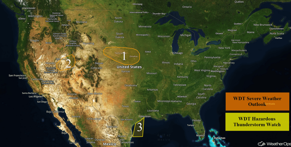 US Hazards
Thunderstorms Expected Across Central Plains on Tuesday
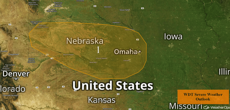
An area of low pressure across the Rockies will promote the development of thunderstorms this afternoon and evening across portions of the Plains. Thunderstorm development is expected during the afternoon across Wyoming and into Nebraska before a low level jet strengthens during the evening. Large hail will be the primary risk with these storms with a lower risk for damaging winds.
Major Cities in Region: North Platte, NE, Grand Island, NE, Lincoln, NE, Omaha, NE
 Region 1
Strong to Severe Thunderstorms Possible Tuesday for Great Basin
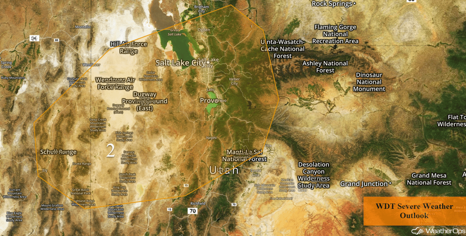
Thunderstorm activity is forecast for the Great Basin on Tuesday, some of which could be severe. Although cloud cover and ongoing thunderstorm activity should limit destabilization across the region, a few thunderstorms capable of damaging winds may develop.
Major Cities in Region: Salt Lake City, UT
 Region 2
Thunderstorm Activity Continuing for Northwestern Gulf of Mexico Tuesday
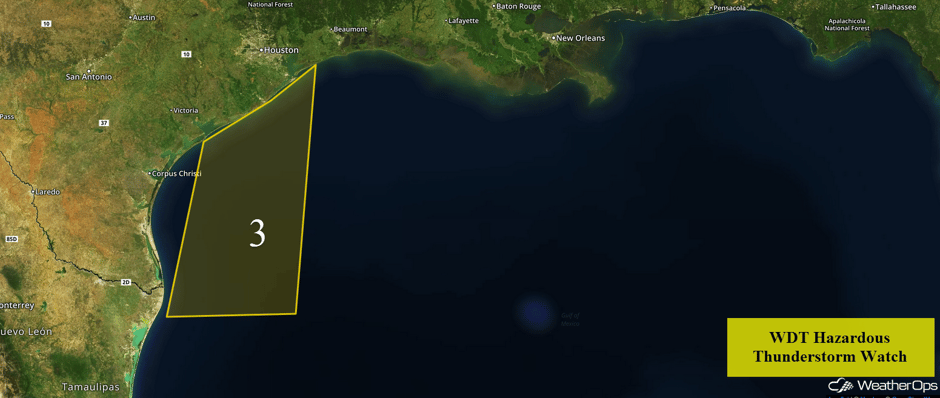
A broken line of showers and thunderstorms has pushed offshore of the Texas coast this morning. This line is expected to fill in with more showers and thunderstorm development through the morning hours as it continues to push eastward and northeastward. While widespread severe impacts are not anticipated, wind gusts in excess of 35 knots will be the primary hazard with these storms.
 Region 3
Potential for Thunderstorms Tuesday for Southeast and Tennessee Valley
A stationary front over the Tennessee Valley and the Southeast will promote the increase of showers and thunderstorms later in the day. Severe winds and hail will be the main hazards with the stronger storms.
Major Cities in Region: Evansville, IN, Nashville, TN, Louisville, KY, Cincinnati, OH, Knoxville, TN, Charleston, WV, Savannah, GA, Charleston, SC
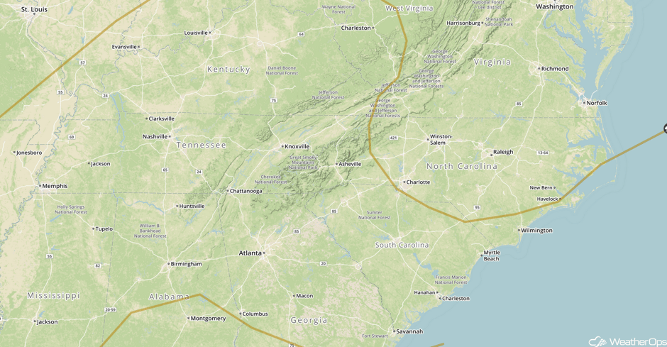 SPC Convective Outlook for Tuesday
Strong to Severe Thunderstorms Possible for Missouri Valley and Upper Midwest Wednesday
The threat for severe weather will increase on Wednesday as a new area of low pressure develops over the Plains. At the surface, a warm front is expected to lift northward into Iowa through the afternoon while a dryline to the west is overtaken by a cold front over Nebraska and Kansas. Thunderstorm activity is expected along the dryline. Meanwhile, shower and thunderstorm activity will likely be ongoing during the morning hours to the north of an area of low pressure and attendant warm front. As daytime heating builds into the afternoon, new thunderstorm activity will be possible along and south of the warm front. Moderate instability will combine with favorable wind shear to promote the development of severe thunderstorms capable of large hail and damaging winds. A tornado threat may also develop from southeastern Nebraska into northwestern Illinois along the warm front. Elsewhere, storms may develop southward into northeastern Kansas by the early evening with storms potentially stretching from Wisconsin southwestward to the Kansas/Oklahoma border by midnight. The greatest threat for severe weather will remain across northeastern Kansas, southeastern Nebraska, Iowa, and northern Illinois before and just after dark.
Major Cities in Region: Wichita, KS, Kansas City, NO, Omaha, NE, Des Moines, IA, Milwaukee, WI, Chicago, IL
 SPC Convective Outlook for Wednesday
Thunderstorm Potential from Southern Plains to Ohio Valley on Thursday
A cold front will stretch from the Oklahoma/Kansas border, northeastward, into the Ohio Valley during the morning hours on Thursday. Showers and thunderstorms will develop along the cold front throughout the day. Modest to moderate instability and wind shear along the cold front will allow for the development of isolated strong to severe thunderstorms. Large hail and damaging winds will be the primary hazards, but an isolated tornado or two cannot be ruled out.
Major Cities in Region: Tulsa, OK, St. Louis, MO, Memphis, TN, Jackson, MS, Nashville, TN, Indianapolis, IN, Knoxville, TN
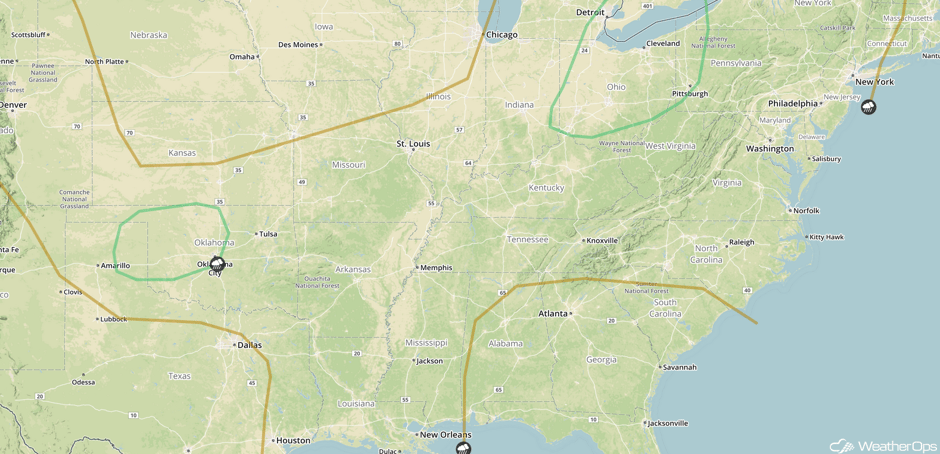 SPC Convective Outlook for Thursday
A Look Ahead
There will be a risk for severe thunderstorms across the Southern Plains on Friday. Large hail will be the primary risk with any storms that develop. Further to the north, heavy rainfall will be possible for portions of Kansas, Oklahoma, Missouri, and Arkansas along a stalled front. Rainfall amounts of 1-3 inches with isolated higher amounts in excess of 4 inches are expected and may lead to flooding and local runoff. By Saturday, the severe weather potential will extend from the Mid Mississippi Valley into the Ohio Valley.
This is just a brief look at current weather hazards. We can provide you site-specific weather forecast information for the purpose of protecting your personnel and assets and to assess your weather risk. Try a 7-day demo right away and learn how timely precision weather information can enhance your bottom line.


