


by David Moran, on Apr 17, 2018 10:15:40 AM
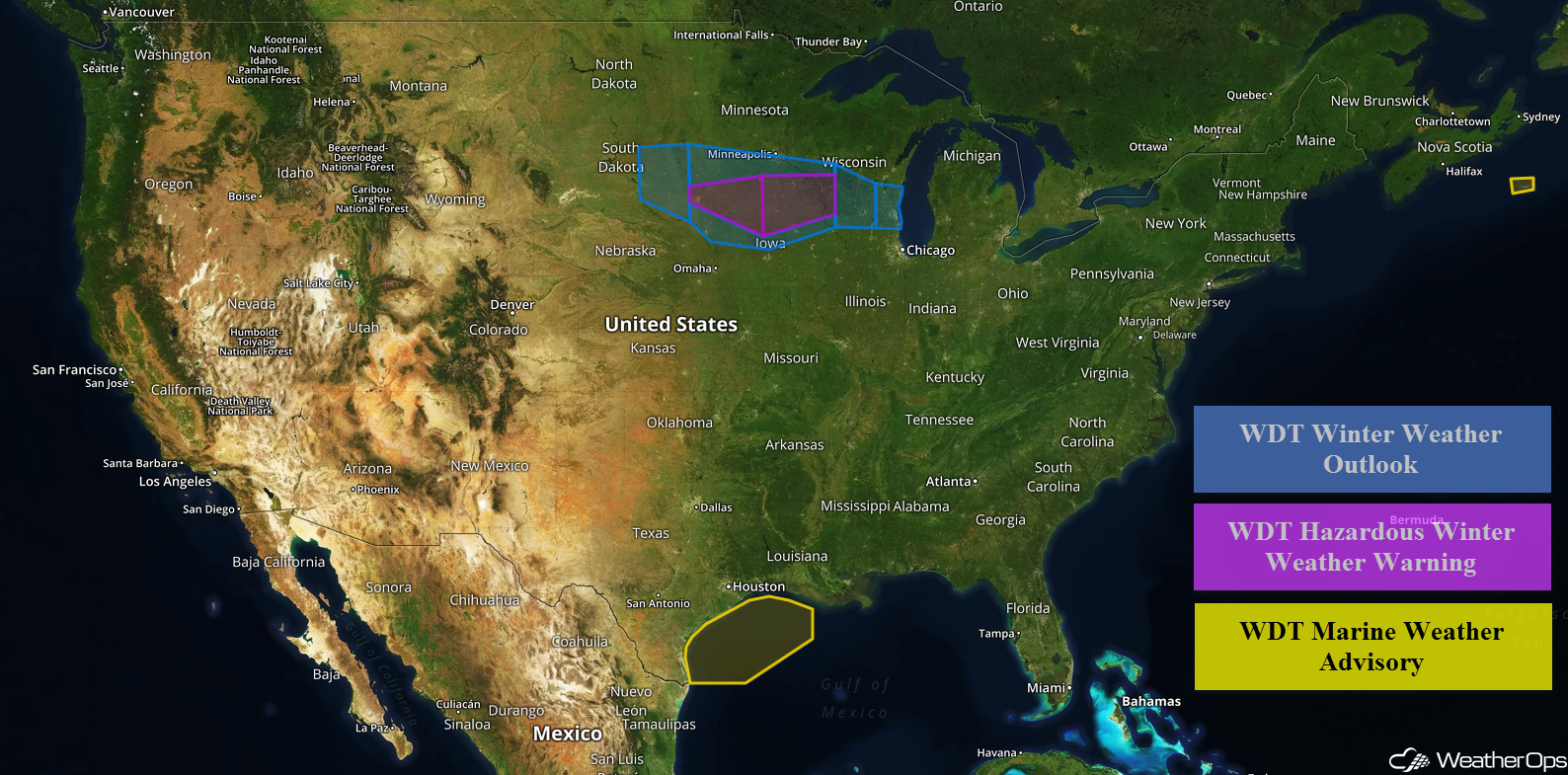
Snow is expected for portions of the Upper Midwest Tuesday into Wednesday as an area of low pressure tracks through the region. Elevated winds and seas are forecast across western portions of the Gulf of Mexico late Tuesday through early Wednesday afternoon.
- Freezing Rain and Snow for the Upper Midwest Tuesday Evening into Wednesday
- Elevated Conditions Late Tuesday into Wednesday for the Western Gulf of Mexico
 US Hazards

Freezing Rain and Snow for the Upper Midwest Tuesday Evening into Wednesday
An area of low pressure is forecast to track to the east-northeast through the Central Plains and into the Upper Midwest Tuesday night into Wednesday. With temperatures at the surface below freezing and warmer temperatures aloft, precipitation is expected to begin in the form of freezing rain. Ice accumulations up to 0.10 inch are expected. As temperatures aloft cool, precipitation will transition to snow. Snowfall accumulations of 4-6 inches with locally higher amounts in excess of 8 inches are forecast. Winds will range 20-25 mph with gusts in excess of 30 mph.
Major Cities in Region: Sioux Falls, SD, Minneapolis, MN, Waterloo, IA, Madison, WI, Milwaukee, WI
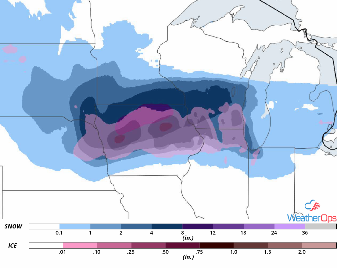 Snow and Ice Accumulations Tuesday and Wednesday
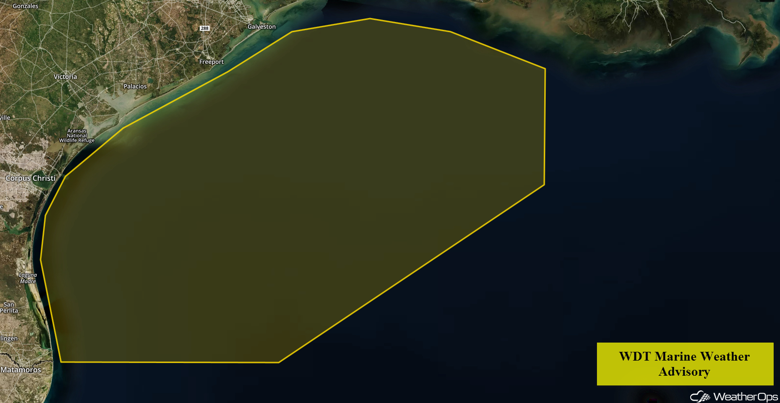
Elevated Conditions Late Tuesday into Wednesday for the Western Gulf of Mexico
Enhanced southerly winds are forecast to develop along and offshore of the Lower and Central Texas coast Tuesday evening, eventually expanding westward across much of the western Gulf during the overnight hours. Sustained winds of 20-25 knots with gusts in excess of 35 knots are expected, in addition to seas of 7-9 feet. Conditions will subside through the morning hours on Wednesday.
 WDT Marine Weather Advisory
A Look Ahead
An area of low pressure developing in the lee of the Rockies will bring snow to portions of Colorado on Friday. Snowfall accumulations of 6-12 inches are expected. As an upper level trough moves into the Plains, there will be the potential for thunderstorms across portions of south Texas Friday and Saturday.
This is just a brief look at current weather hazards. We can provide you site-specific weather forecast information for the purpose of protecting your personnel and assets and to assess your weather risk. Try a 7-day demo right away and learn how timely precision weather information can enhance your bottom line.
