


by David Moran, on Apr 10, 2018 11:00:23 AM
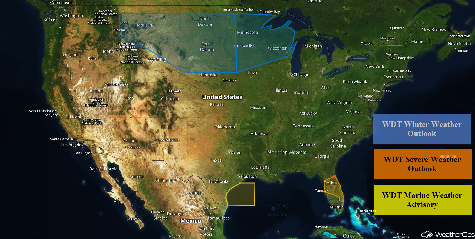
Thunderstorms are expected for much of Florida on Tuesday as a cold front moves across the state. These thunderstorms will also have the potential to produce excessive rainfall. Elevated winds and seas will continue across the western Gulf of Mexico through Tuesday evening. Moderate to heavy snow is expected from the Northern Rockies into the Great Lakes beginning on Thursday and continuing through Sunday.
- Thunderstorms across Florida on Tuesday
- Excessive Rainfall Tuesday for Florida
- Elevated Winds and Seas for the Western Gulf of Mexico through Tuesday
- Snow Thursday through Sunday from the Northern Rockies into the Great Lakes
 US Hazards

Thunderstorms across Florida on Tuesday
An upper level trough moving across the region will provide lift for the development of showers and thunderstorms along a cold front. Daytime heating should cause enough instability for some storms to become severe. Damaging winds will be the primary hazard, but some large hail cannot be ruled out.
Major Cities in Region: Tampa, FL, Orlando, FL, Daytona Beach, FL
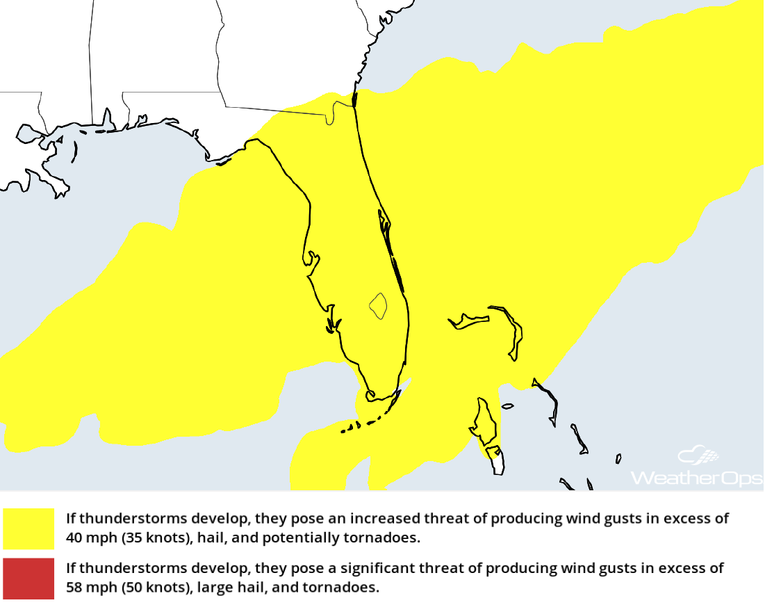 Thunderstorm Risk for Tuesday
Excessive Rainfall Tuesday for Florida
As thunderstorms continue to develop over the Gulf of Mexico and move inland over Florida, heavy rain is expected with these storms. Rainfall amounts of 1-3 inches with locally heavier amounts in excess of 4 inches are forecast. Given the recent heavy rains, there will be the potential for flash flooding,
Major Cities in Region: Tampa, FL, Orlando, FL, Daytona Beach, FL
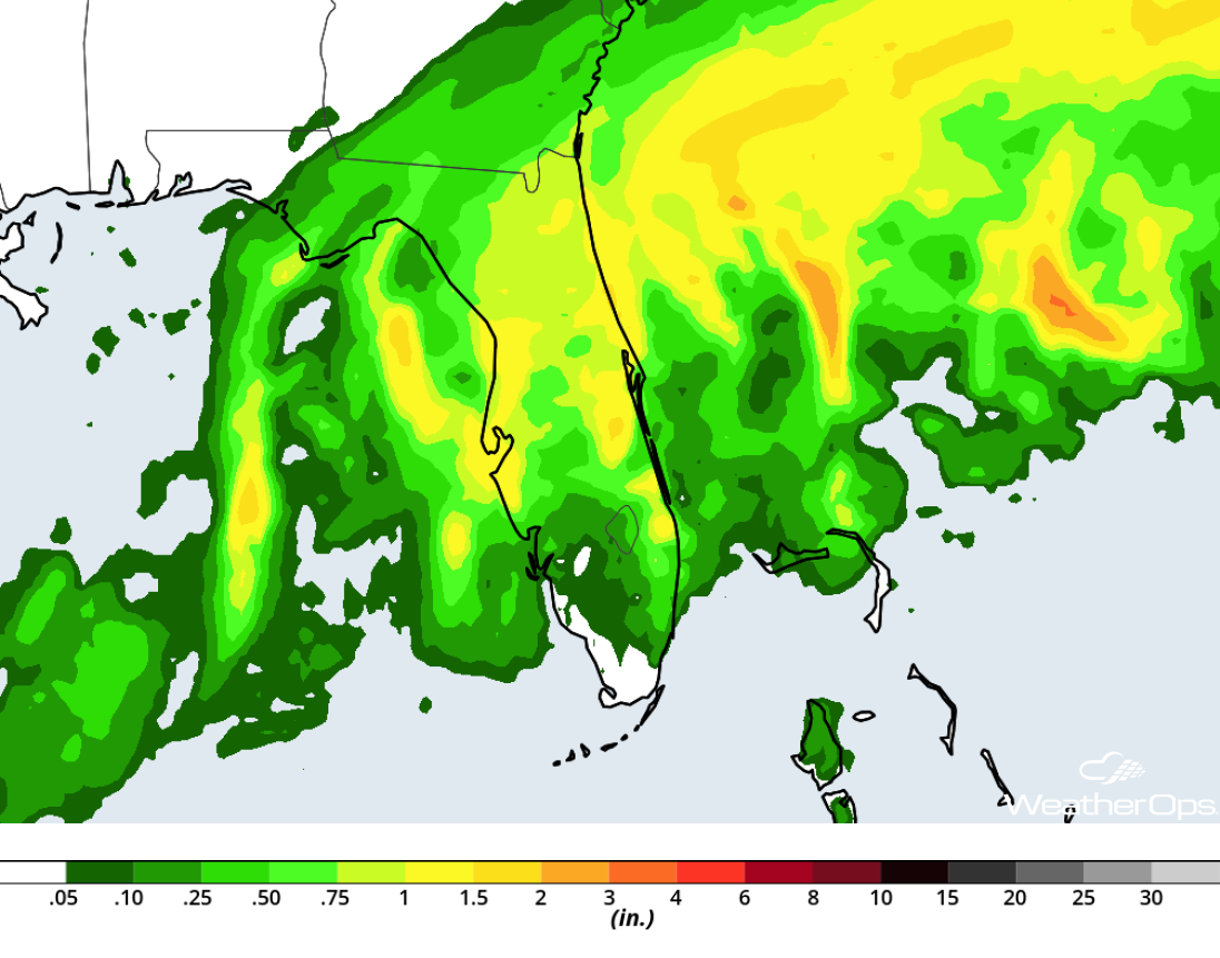 Rainfall Accumulation for Tuesday
Elevated Winds and Seas for the Western Gulf of Mexico through Tuesday
High pressure building across the central US and an area of low pressure in the Southeast will act to increase winds and seas across the western Gulf of Mexico on Tuesday. Winds will be northeasterly at 20-30 knots with gusts in excess of 35 knots. Seas will range 6-9 feet. Conditions should improve late Tuesday afternoon and evening.
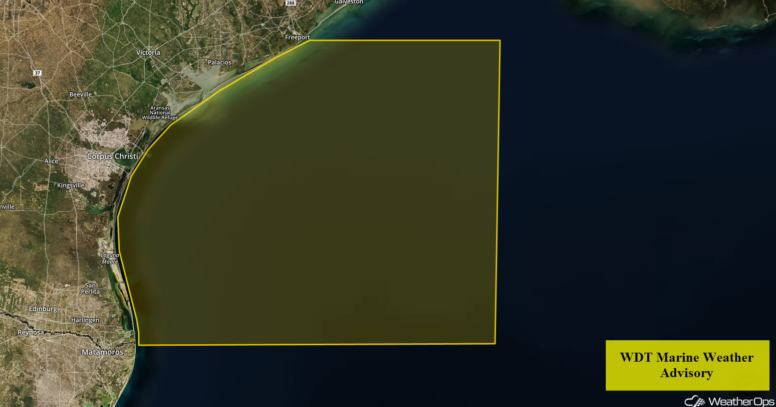 WDT Marine Weather Advisory
Snow Thursday through Sunday from the Northern Rockies into the Great Lakes
Several days of heavy snow will begin over the Northern Rockies on Thursday. Accumulations of 4-8 inches with locally higher amounts in excess of a foot are expected across the Northern Rockies on Thursday. Snow will move into the Plains ahead of a strong upper level system on Friday. Winds of 20-30 mph will allow for wind chills in the single digits, as well as blowing snow and low visibilities.
By Friday, precipitation will move into the Northern Plains, Upper Midwest, and Great Lakes. Moderate to heavy snow is forecast from Friday through Sunday, in addition to some light freezing rain across the Upper Midwest and Great Lakes.
Major Cities in Region: Helena, MT, Great Falls, MT, Billings, MT, Bismarck, ND, Pierre, SD, Sioux Falls, SD, Minneapolis, MN, Green Bay, WI
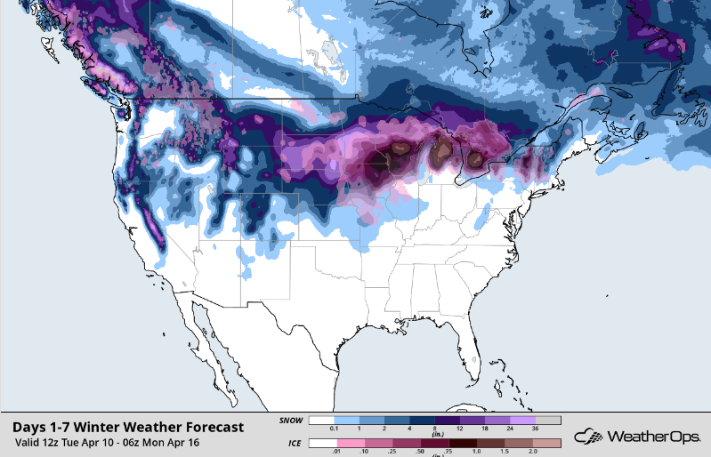 Snow Accumulation through Sunday
A Look Ahead
Thunderstorms may develop over portions of the Southern Plains on Friday as a cold front moves through the region. By Saturday, the thunderstorm risk will shift eastward into the Ohio Valley and Southeast.
This is just a brief look at current weather hazards. We can provide you site-specific weather forecast information for the purpose of protecting your personnel and assets and to assess your weather risk. Try a 7-day demo right away and learn how timely precision weather information can enhance your bottom line.
