National Weather Summary for Thursday, September 29, 2016
by David Moran, on Sep 29, 2016 11:51:53 AM
Scattered thunderstorms will continue throughout the day on Thursday across the Ohio Valley and Mid Atlantic as an upper level low remains situated over the Ohio Valley. In addition, heavy rain is likely from portions of Ohio to the Delmarva peninsula Thunderstorms are expected to develop across portions of Arizona as an upper level trough moves across the region. On Friday, thunderstorms will be possible across from Ohio to North Carolina as the low over the Ohio Valley persists. Excessive rainfall will be likely in association with the upper level low from the Midwest into the Northeast. This rainfall will continue into Saturday along the coastal areas of the Northeast.
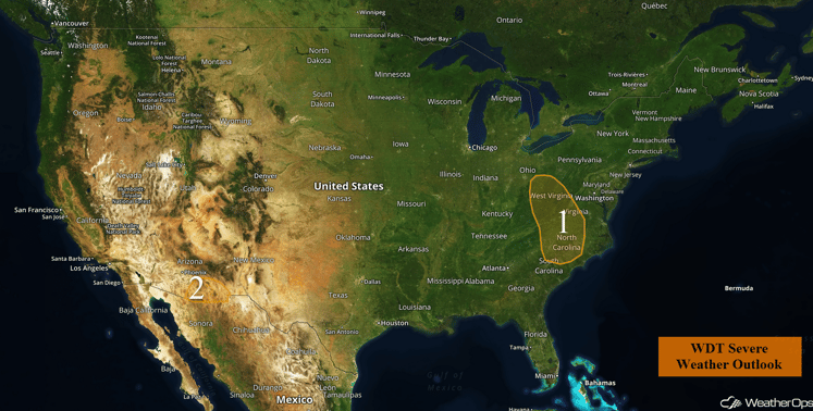
US Hazards
Region 1
A warm front will lift north through the Carolinas and into Virginia this afternoon. Warm temperatures and plentiful moisture will allow instability to build to the south of the front. Combined with strong wind shear, some of the thunderstorms that develop are likely to become severe. A few storms will have the potential to become supercellular with hail, damaging winds, and tornadoes possible. The most likely time for severe weather will be during the late afternoon and evening hours.
Update 2:28pm EDT: Severe thunderstorms producing hail moving through portions of Virginia.
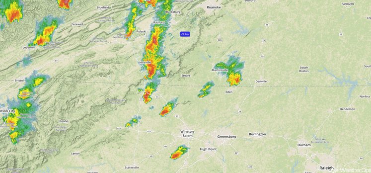
Radar 2:28pm EDT
Update 3:02pm EDT: Severe thunderstorms capable of large hail and damaging winds southeast of Charleston.
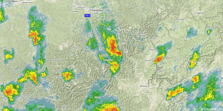
Radar 3:02pm EDT
Update 3:34pm EDT: Tornado Warning east of Wheeling, WV.
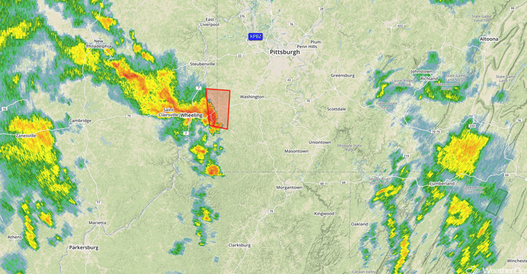
Radar 3:34pm EDT
Major Cities in Region: Charleston, WV, Charlotte, NC, Raleigh, NC
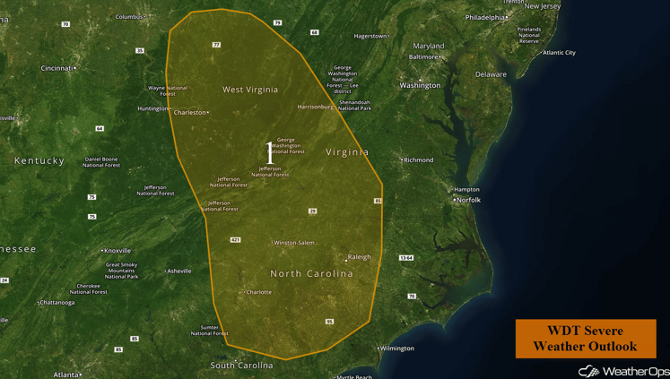
Region 1
Region 2
An upper level low over coastal California will provide lift needed to initiate thunderstorm development over southern Arizona later today. Modest instability and deep moisture in place over the region may allow for a few thunderstorms to become strong, with wind gusts in excess of 50 mph expected to be the primary hazard. Thunderstorms that remain below severe limits will be capable of producing frequent lightning and heavy downpours. The most likely time for severe weather will be from the mid-afternoon through the evening hours.
Major Cities in Region: Tucson, AZ
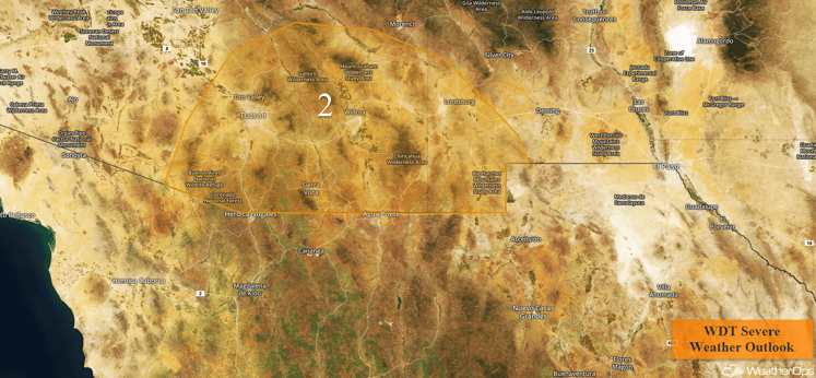
Region 2
Excessive Rainfall Possible Thursday from Ohio to the Delmarva Peninsula
In addition to the potential for thunderstorms across the Ohio Valley and Mid Atlantic, there will be a threat for excessive rainfall. Rainfall amounts of 1-2 inches with locally higher amounts in excess of 3 inches will be possible, especially across the higher terrain of the Central Appalachians. This will pose an elevated risk for flooding and local runoff through Friday morning.
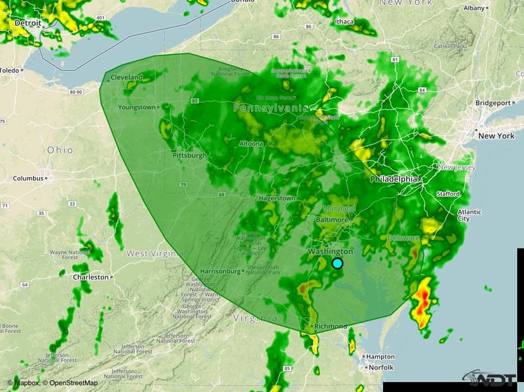
Excessive Rainfall Risk Outline for Thursday
Strong to Severe Thunderstorms Possible from Ohio to North Carolina on Friday
A low threat for severe weather will continue into Friday from Ohio to North Carolina as a low continues to stall over the Ohio Valley. A line of strong to marginally severe thunderstorms will be possible from Ohio into North Carolina by early afternoon. While significant severe impacts are not expected, a few storms could produce isolated severe wind gusts.
Major Cities in Region: Cleveland, OH, Pittsburgh, PA, Charleston, WV, Richmond, VA, Raleigh, NC
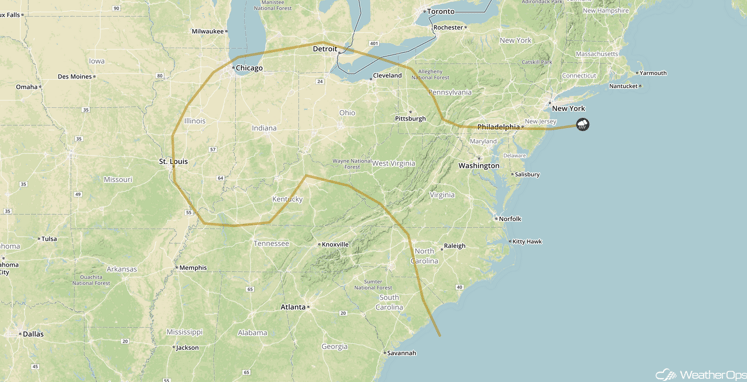
SPC Convective Outlook for Friday
Excessive Rainfall Possible from the Midwest into the Northeast on Friday
Excessive rainfall will remain possible on Friday, though rainfall amounts will be less. Scattered showers will overspread much of the region in association with an area of low pressure. Rainfall amounts of 1-1.50 inches, with locally higher amounts in excess of 2 inches possible.
Major Cities in Region: Detroit, MI, Cleveland, OH, Pittsburgh, PA, Washington, DC, Philadelphia, PA, New York, NY, Boston, MA
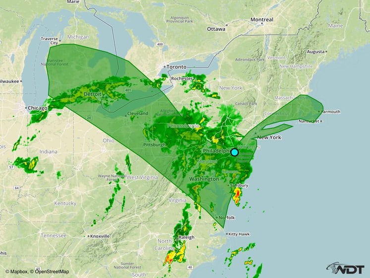
Excessive Rainfall Risk Outline for Friday
Excessive Rainfall Possible along the Northeast Coast on Saturday
By Saturday, the upper level low will begin to slowly move into the Northeast. Showers and thunderstorms will remain possible from the Great Lakes into Lower New England. The heaviest rainfall totals are expected along the coastal regions where local amounts could approach 2 inches through early Sunday morning. This may lead to a small risk for flooding and local runoff.
Major Cities in Region: Washington, DC, Philadelphia, PA, New York, NY, Boston, MA
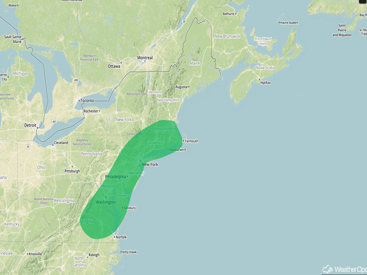
Excessive Rainfall Risk Outline for Saturday
Tropical Update
Tropical Storm Matthew is located south of Puerto Rico and is continuing to move toward the west at 15 mph. A general westward track is expected over the next few days with a decrease in forward speed. Maximum sustained winds are near 70 mph with higher gusts. Additional strengthening is expected over the next 48 hours and Matthew is expected to become a hurricane later today or tonight.
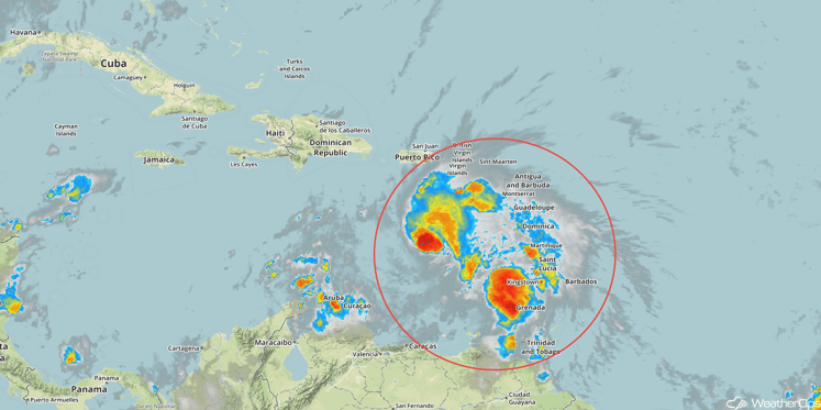
Tropical Infrared Satellite
A Look Ahead
An area of low pressure will develop in the lee of the Rockies early next week, allowing for the potential for strong to severe thunderstorms across portions of the Plains on Tuesday and Wednesday.
This is just a brief look at current weather hazards. We can provide you site-specific forecast information for the purpose of protecting your personnel and assets. Try a 7-day demo right away and learn how timely precision weather information can enhance your bottom line.


