National Weather Summary for Thursday, September 28, 2017
by David Moran, on Sep 28, 2017 10:39:35 AM
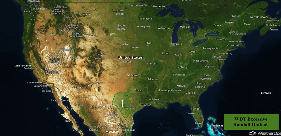
Heavy to excessive rainfall will continue across portions of Southwest Texas ahead of a cold front.
- Excessive Rainfall Continuing for Southwest Texas on Thursday
- Tropical Update
 US Hazards
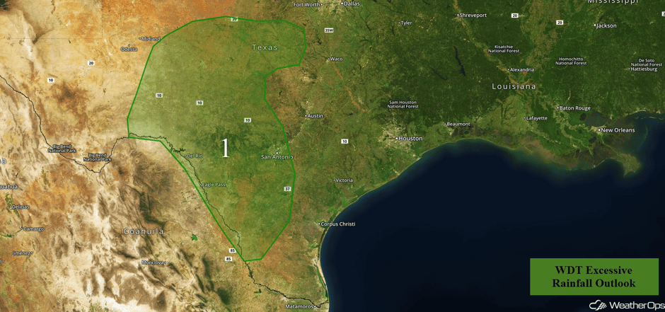
Excessive Rainfall Continuing for Southwest Texas on Thursday
A frontal boundary will be pushing off the east coast today, extending southwestward toward the Gulf Coast into west Texas near the Big Bend area. The front will remain nearly stationary and therefore any ongoing shower and thunderstorm activity will not move much throughout the day. Rainfall amounts of 1-2 inches with locally higher amounts in excess of 3 inches are forecast. Given recent heavy rainfall that has occurred over the past few days, widespread flooding will remain a concern.
714am - An off-duty forecaster sent us this photo from Canutillo this morning. #ElPaso #TXwx #flooding pic.twitter.com/Rku16moWgf
— NWS El Paso (@NWSElPaso) September 28, 2017
Major Cities in Region: Del Rio, TX, San Antonio, TX
 Region 1
Tropical Update
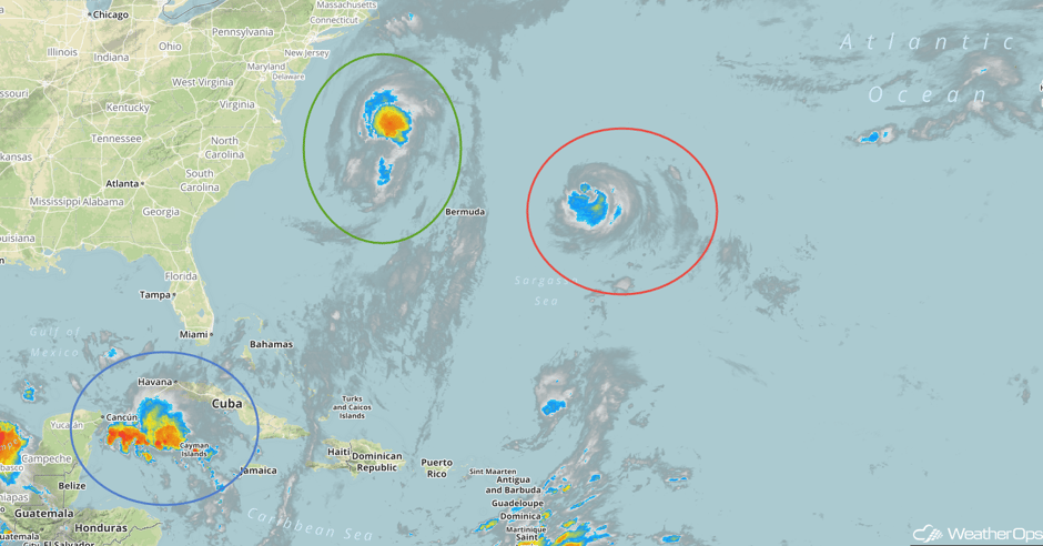
Tropical Storm Maria (green oval) is 275 miles east-northeast of Cape Hatteras, North Carolina and is moving east-northeastward at 8 mph. Maria is expected to turn toward the east and increase in forward speed through tonight before turning east-northeastward on Friday with an additional increase in forward speed. On the forecast track, Maria will move away from the East Coast and pass well to the south of Atlantic Canada during the next couple of days. Maximum sustained winds have decreased to near 70 mph. Little change in strength is forecast during the next couple of days.
Hurricane Lee (red oval) is moving toward the north at 9 mph and is 445 miles east of Bermuda. A faster motion toward the north-northeast or northeast is expected to begin later today. Maximum sustained winds are at 110 mph with higher gusts. Gradual weakening is forecast during the next 48 hours.
A large area of cloudiness and showers (blue oval) extending from the northwestern Caribbean Sea across Cuba to the Bahamas is associated with a broad area of low pressure interacting with an upper level low. A weak area of low pressure is likely to form while it moves northward across Cuba and near the east coast of the Florida Peninsula over the next few days. Environmental conditions appear conducive for development before upper level winds become less favorable early next week. Regardless of development, this system is likely to produce locally heavy rainfall over portions of Cuba, southern Florida, the Florida Keys, and the Bahamas during the next several days.
 Enhanced Infrared Tropical Satellite
A Look Ahead
Beyond Thursday, no hazardous weather is expected. A few showers may develop across the Great Lakes as an area of low pressure moves across the region on Friday. The disturbance offshore the east coast of Florida on Saturday will bring a risk for heavy rain and thunderstorms across portions of eastern Florida and coastal areas of Georgia and South Carolina, Further west, a cold front will allow for some showers across the Pacific Northwest. Scattered thunderstorms may develop across portions of the Plains on Sunday as a cold front moves across the region. Showers and thunderstorms will continue across Florida into Sunday. An area of low pressure moving across the Northern Plains will allow for a risk of showers and thunderstorms Monday through Wednesday.
This is just a brief look at current weather hazards. We can provide you site-specific weather forecast information for the purpose of protecting your personnel and assets and to assess your weather risk. Try a 7-day demo right away and learn how timely precision weather information can enhance your bottom line.


