National Weather Summary for Thursday, September 14, 2017
by David Moran, on Sep 14, 2017 10:43:38 AM
Daytime heating will allow for the development of thunderstorms Thursday across the Four Corners region. Thunderstorms may develop along a cold front from the Dakotas through Minnesota on Thursday.
- Thunderstorms for the Four Corners Region on Thursday
- Potential for Thunderstorms Thursday from the Dakotas to Minnesota
- Risk for Thunderstorms from the Plains to the Midwest on Friday
- Thunderstorms Saturday across the Midwest
- Tropical Update
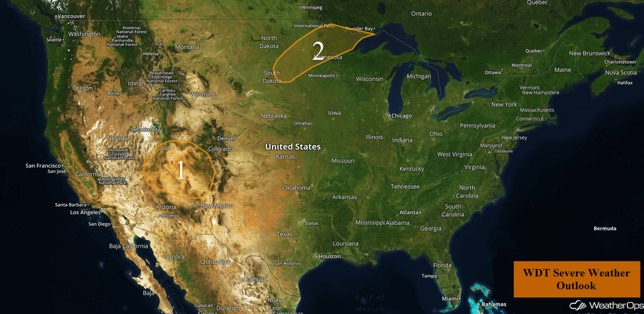 US Hazards
Thunderstorms for the Four Corners Region on Thursday
Ongoing thunderstorm activity this morning will slowly track northeastward throughout the day in association with an incoming upper level disturbance. Daytime heating across the region will result in modest instability across the region. Combined with forcing from the upper level disturbance, thunderstorms will increase in coverage. Some of these storms could be strong to severe with large hail and damaging winds the primary hazards. An isolated tornado cannot be ruled out.
Update 12:26pm MDT: Severe thunderstorm capable of hail and damaging winds in northern Arizona.
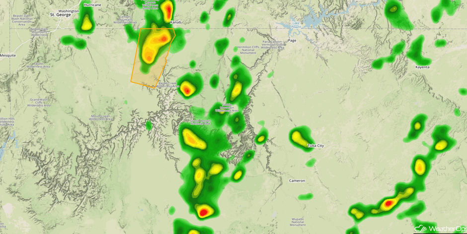 Radar 12:26pm MDT
Major Cities in Region: Grand Junction, CO
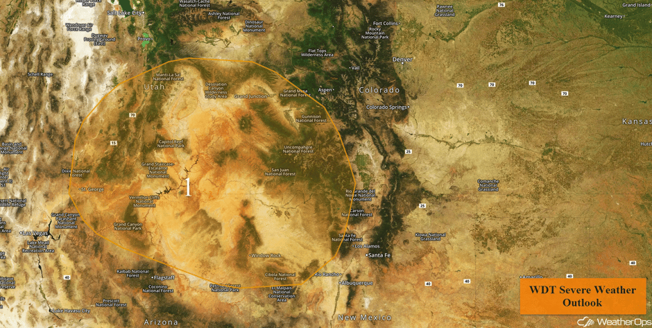 Region 1
Potential for Thunderstorms Thursday from the Dakotas to Minnesota
A weak frontal zone will be moving northeastward throughout the day today across the Northern Plains and Upper Midwest. Ahead of this front, low level southerly flow will bring moisture northward. With daytime heating creating modest instability across the region, thunderstorms are expected to develop ahead of the front during the afternoon and evening. A few storms could become strong to severe with small hail and damaging winds the primary hazards.
Major Cities in Region: Aberdeen, SD, Fargo, ND, International Falls, MN, Duluth, MN
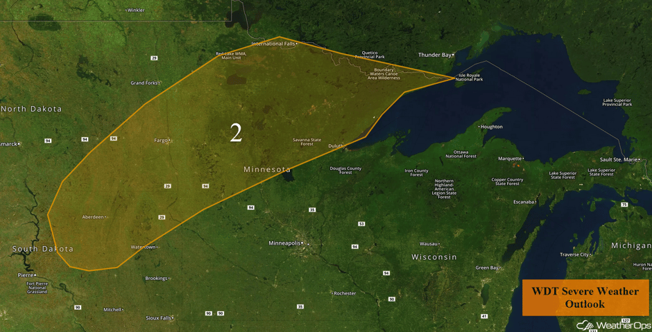 Region 2
Risk for Thunderstorms from the Plains to the Midwest on Friday
Thunderstorms may develop along a stalled front on Friday. A few high-based thunderstorms may develop during the afternoon or evening, with a risk for large hail and damaging winds. This risk will continue into the late evening and overnight hours as the low-level jet strengthens.
Major Cities in Region: Sioux Falls, SD, Sioux City, IA, Minneapolis, MN
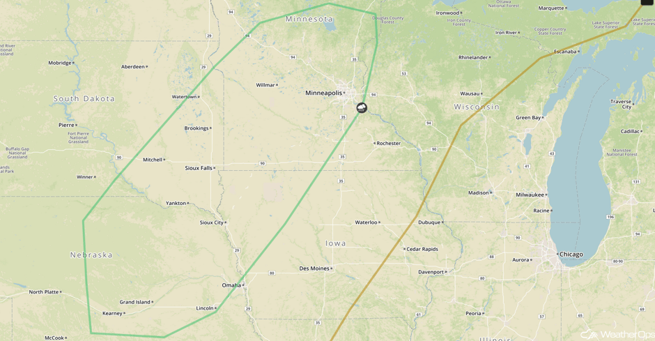 SPC Convective Outlook for Friday
Thunderstorms Saturday across the Midwest
A marginal risk for thunderstorms will continue across portions of the Midwest on Saturday as a cold front continues to move eastward. A few strong to severe thunderstorms may develop ahead of the front with strong winds and hail being the primary hazards with these storms. Activity should diminish after dark.
Major Cities in Region: Lincoln, NE, Omaha, NE, Sioux Falls, SD, Minneapolis, MN, International Falls, MN
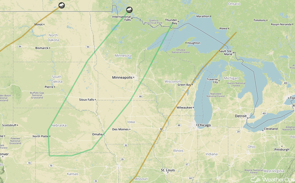 SPC Convective Outlook for Saturday
Tropical Update
Tropical Storm Jose (green oval) is 435 miles east-northeast of the Bahamas and is moving west-northwestward at 7 mph. This motion is expected to continue through Friday, followed by a turn to the northwest on Saturday. Maximum sustained winds are near 70 mph with higher gusts. Some restrengthening is expected and Jose will likely become a hurricane again by the weekend.
A tropical wave located about 800 miles southwest of the Cabo Verde Islands (red oval) continues to produce widespread showers and thunderstorms. Environmental conditions are expected to be conducive for gradual development of this system and a tropical depression could develop early next week while it moves westward at 15 mph.
Another tropical wave, located between the west coast of Africa and the Cabo Verde Islands (blue oval), is producing a large area of disorganized shower and thunderstorm activity. Some development of this system is forecast over the next few days before upper level winds become less favorable. This system will move westward at 10-15 mph for the next several days.
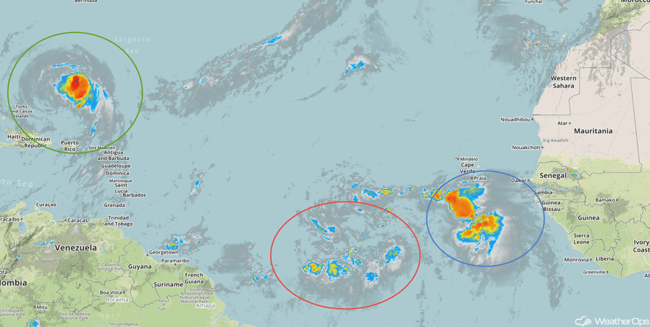 Enhanced Infrared Tropical Satellite
A Look Ahead
Generally calm conditions are expected early next week as high pressure builds into much of the country. Model guidance indicates the potential for Hurricane Jose to approach the East Coast, however, the official WDT forecast track lies to the east of the region. That said, a westward shift in the track cannot be ruled out.
This is just a brief look at current weather hazards. We can provide you site-specific weather forecast information for the purpose of protecting your personnel and assets and to assess your weather risk. Try a 7-day demo right away and learn how timely precision weather information can enhance your bottom line.


