National Weather Summary for Thursday, October 26, 2017
by David Moran, on Oct 26, 2017 10:57:41 AM
Snow is likely for portions of the Northern Plains on Thursday as an area of low pressure moves through the region. Heavy rain will continue across portions of New England along a stalled front.
- Significant Snowfall for the Northern Plains on Thursday
- Excessive Rainfall Thursday for Portions of New England
- Thunderstorms for the Southeast on Friday
- Excessive Rainfall Saturday Across Florida
- Tropical Update
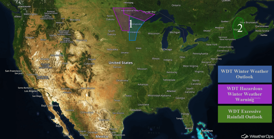 US Hazards
Significant Snowfall for the Northern Plains on Thursday
A strong area of low pressure will move through eastern North Dakota and Minnesota Thursday and Friday, bringing the potential for snow and strong winds to the region. Snow accumulations of 1-3 inches with locally higher amounts in excess of 4 inches are forecast across portions of North Dakota and Minnesota. Across far northern portions Minnesota, accumulations of 4-6 inches with locally higher amounts in excess of 8 inches are expected. Wintry accumulation should continue through midday Friday. In addition to the snow, winds will range 30-40 mph with gusts in excess of 50 mph. Of greatest concern is the potential for blizzard conditions and blowing snow. Visibilities will be less than a quarter of a mile at times with travel becoming impossible. Wind chills will fall to 15-20°F.
Major Cities in Region: Grand Forks, ND, Fargo, ND, International Falls, MN, Duluth, MN
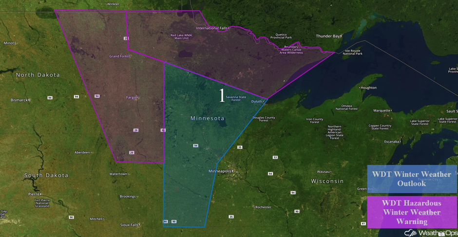 Region 1
Excessive Rainfall Thursday for Portions of New England
An area of low pressure is forecast to develop along a stalled cold front over portions of New England. With the development of this low and onshore flow bringing rich moisture to the area, heavy to excessive rainfall is expected throughout the day. Rainfall amounts of 2-3 inches with locally higher amounts of 4 inches are forecast.
Major Cities in Region: Bangor, ME, Caribou, ME
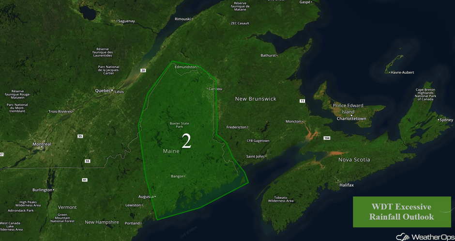 Region 2
Thunderstorms for the Southeast on Friday
Moisture and instability will increase during the afternoon across the Southeast ahead of a front. While the instability will not be particularly significant, marginal support for strong to severe thunderstorms will be in place with the potential for an isolated supercell. Strong wind gusts and an isolated tornado will be the primary hazards.
Major Cities in Region: Jackson, MS, Birmingham, AL
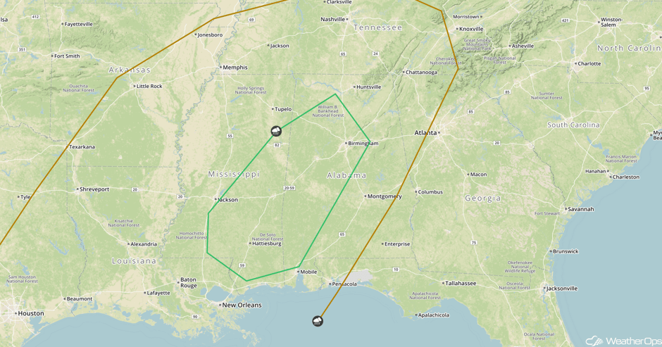 SPC Convective Outlook for Friday
Excessive Rainfall Saturday Across Florida
As Invest 93L begins to accelerate to the northeast along and ahead of the cold front moving through the Gulf of Mexico, heavy to excessive rainfall is forecast for portions of Florida. Regardless of if Invest 93L becomes a tropical depression or tropical storm, high amounts of tropical moisture will lead to widespread rainfall due to interactions with the approaching front. Total rainfall accumulations of 4-5 inches with locally heavier amounts in excess of 7 inches are forecast.
Major Cities in Region: Tampa, FL, Orlando, FL, Miami, FL, Palm Beach, FL
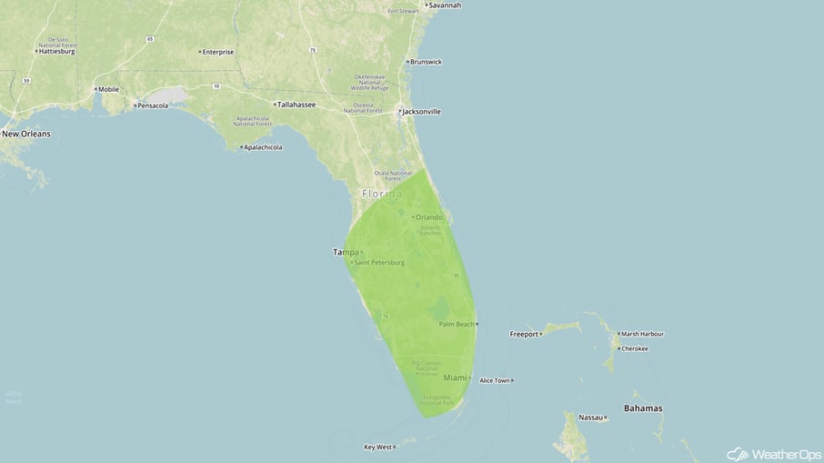 Excessive Rainfall Risk Outline for Saturday
Tropical Update
A broad area of low pressure over the western Caribbean Sea and Central America continues to produce disorganized showers and thunderstorms. Close proximity to land is likely to limit development over the next 24 hours. However, environmental conditions are expected to be conducive for the system to become better organized Friday and Saturday as it moves slowly northward over the northwestern Caribbean Sea. Strong upper level winds associated with an approaching cold front will make conditions less favorable by Sunday. This system is expected to produce locally heavy rainfall over portions of Central America and Cuba during the next couple of days. These rains are forecast to spread northward across portions of South Florida and the Keys on Saturday.
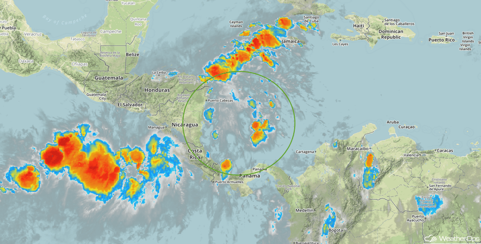 Enhanced Infrared Tropical Satellite
A Look Ahead
An area of low pressure moving across the Northeast will bring a risk for excessive rainfall on Sunday. Rainfall amounts of 3-4 inches with locally higher amounts in excess of 5 inches are forecast. Across the Northern Plains, snow is forecast for Monday as an area of low pressure moves across the region. Snowfall accumulations of 2-4 inches with locally higher amounts are expected.
This is just a brief look at current weather hazards. We can provide you site-specific weather forecast information for the purpose of protecting your personnel and assets and to assess your weather risk. Try a 7-day demo right away and learn how timely precision weather information can enhance your bottom line.


