National Weather Summary for Thursday, October 12, 2017
by David Moran, on Oct 12, 2017 10:56:08 AM
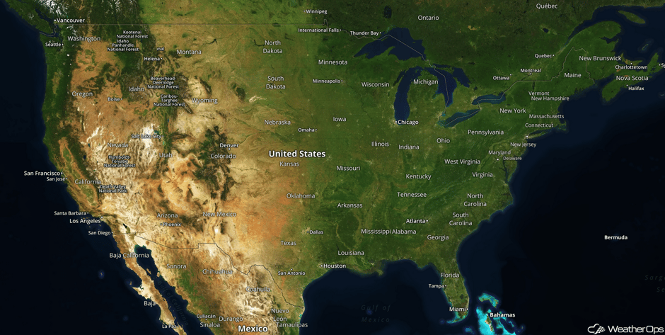
Snow is expected for portions of the Northern Rockies on Friday as an area of low pressure moves through the region.
- Snow for the Northern Rockies on Friday
- Thunderstorms Saturday from the Plains into the Midwest
- Tropical Update
 US Hazards
Snow for the Northern Rockies on Friday
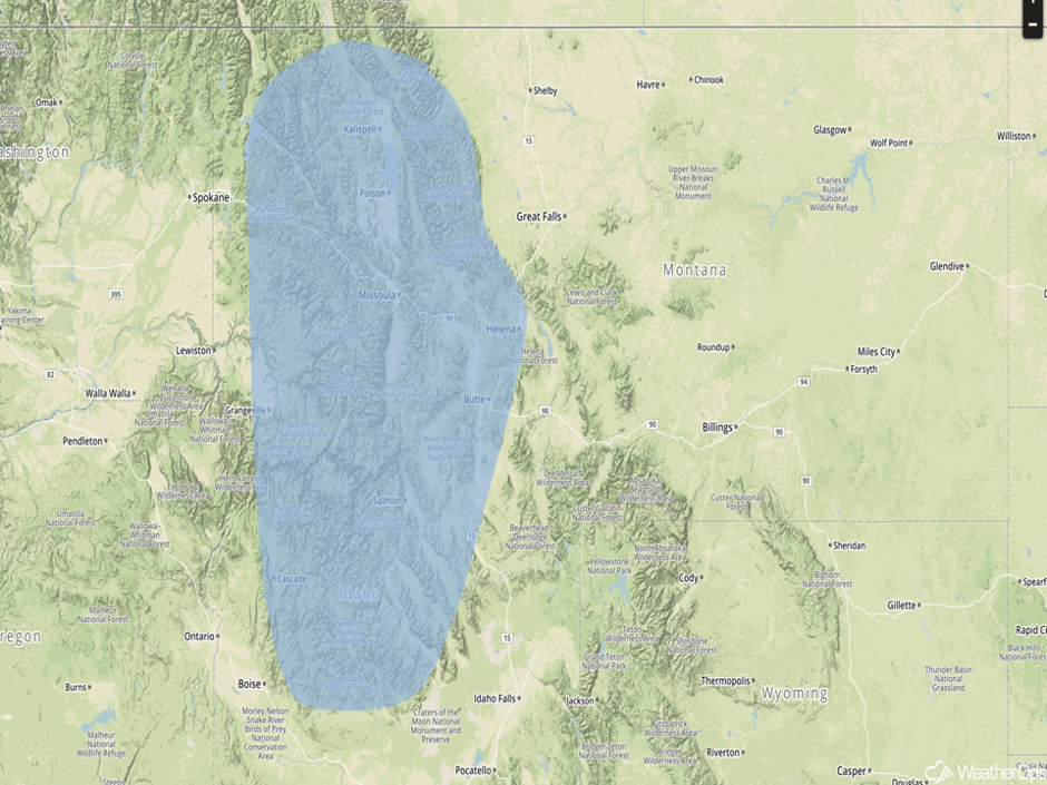
A strong area of low pressure will move quickly through the Northern Rockies on Friday, bringing the potential for some significant snowfall over the high terrain. Snow accumulations of up to six inches are expected over the high terrain with lighter accumulations down to 3000 feet. This will make roads slick over some mountain passes. Snow will taper off Friday night.
Major Cities in Region: Missoula, MT, Butte, MT, Helena, MT
 Snowfall Risk Outline for Friday
Thunderstorms Saturday from the Plains into the Midwest
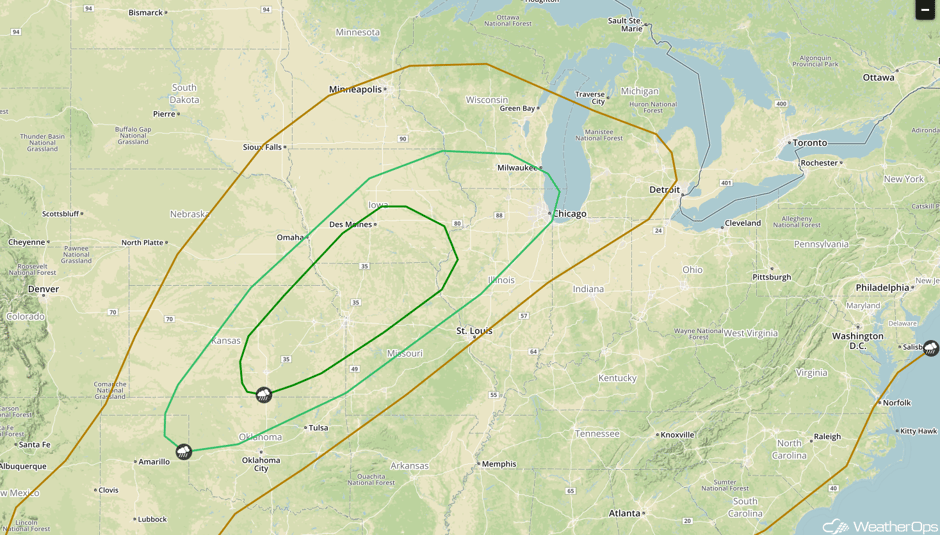
The threat for severe weather is increasing across a large area from the southern Great Lakes into the Central Plains on Saturday. An area of low pressure will quickly develop across the Central Plains during the day and track northeastward into the Midwest. Scattered showers and general thunderstorms will develop for much of the day across the Midwest and Great Lakes where the primary hazard will be flash flooding by the evening. By the afternoon, conditions will be favorable for the development of severe thunderstorms as a cold front moves south and eastward across the region. Large hail and damaging winds will be the primary hazards with these storms. By the evening, a line of thunderstorms will move through the region with damaging winds the primary hazard.
In addition to the severe weather threat, flash flooding will be likely. Rainfall amounts of 2-3 inches with locally heavier amounts in excess of 4 inches forecast over the Great Lakes. Flash flooding will also be a concern across the Plains and Midwest where a couple inches of rain may fall over a short period of time.
Major Cities in Region: Woodward, OK, Wichita, KS, Topeka, KS, Kansas City, MO, Des Moines, IA, Milwaukee, WI, Chicago, IL
 SPC Convective Outlook for Saturday
Tropical Update
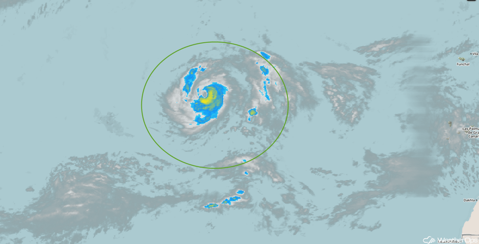
Hurricane Ophelia is 725 miles southwest of the Azores and is moving northeastward at 3 mph. This general motion is expected to continue today followed by an acceleration to the east-northeast or northeast on Friday. Maximum sustained winds are near 85 mph with higher gusts. Some strengthening is possible over the next day or two.
 Enhanced Infrared Tropical Satellite
A Look Ahead
A few thunderstorms may develop across the Northeast on Sunday ahead of a cold front. As the front pushes off the East Coast on Monday, high pressure will build over the eastern US. Showers and thunderstorms may develop over portions of Florida ahead of a weak front Monday into Tuesday.
This is just a brief look at current weather hazards. We can provide you site-specific weather forecast information for the purpose of protecting your personnel and assets and to assess your weather risk. Try a 7-day demo right away and learn how timely precision weather information can enhance your bottom line.


