


by David Moran, on Nov 8, 2018 10:25:17 AM
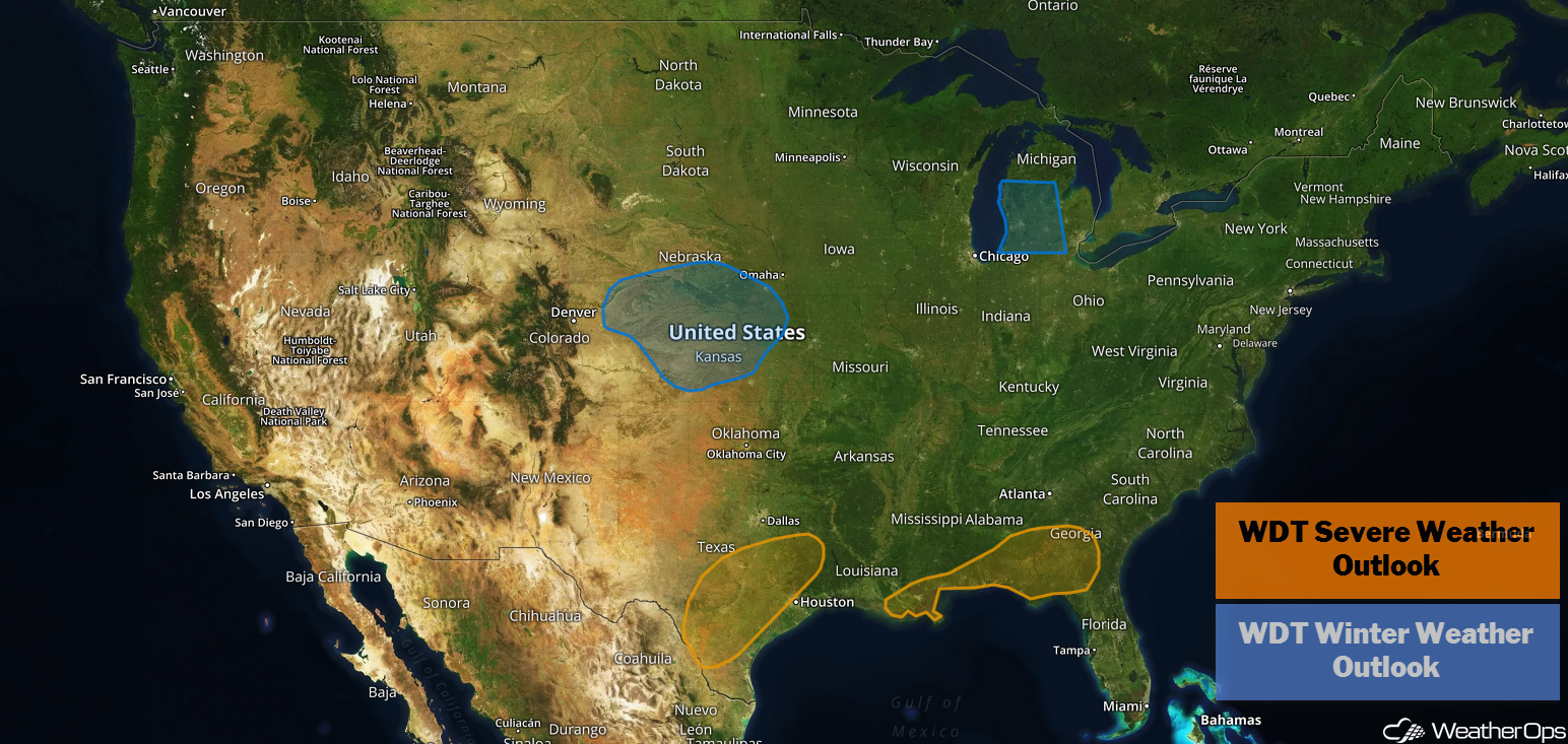
A stalled front will be the focus for the development of thunderstorms across the Southeast on Thursday. Thunderstorms are expected to develop across portions of Texas as a cold front moves eastward. Snow will continue across portions of the Central Plains throughout the day.
- Thunderstorms across the Southeast on Thursday
- Potential for Thunderstorms Thursday across Texas
- Snow for the Central Plains on Thursday
- Risk for Thunderstorms Friday across the Southeast
- Potential for Snow across Michigan Friday and Saturday
- Snow Friday and Saturday across New England
US Hazards
Thunderstorms across the Southeast on Thursday
Thunderstorms are expected across the Southeast on Thursday along a stalled front. An upper level disturbance moving eastward will provide forcing for the development of thunderstorms from the Florida Panhandle into southeast Alabama and southwest Georgia. Some storms may become strong to severe. Gusty winds will be the primary hazard with this activity.
Major Cities in Region: New Orleans, LA, Mobile, AL, Pensacola, FL, Montgomery, AL, Albany, GA, Macon, GA
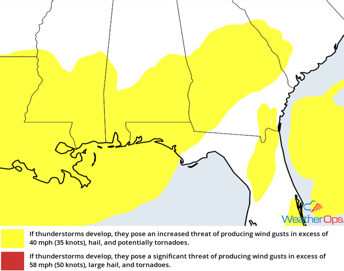
Thunderstorm Risk for Thursday
Potential for Thunderstorms Thursday across Texas
A cold front will allow for the development of thunderstorms across eastern and southern Texas Thursday evening. Activity may continue into the overnight hours with hail being the primary hazard.
Major Cities in Region: San Antonio, TX, Austin, TX, Lufkin, TX
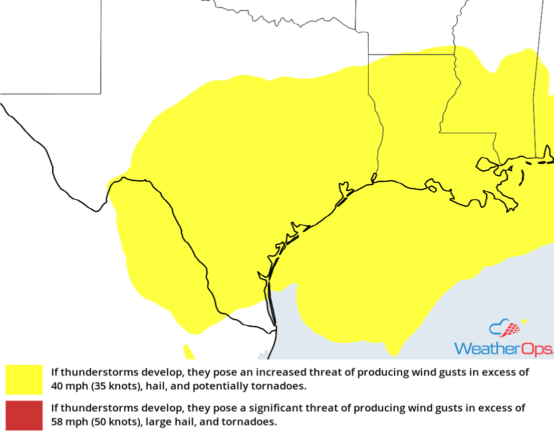
Thunderstorm Risk for Thursday
Snow for the Central Plains on Thursday
Snow has developed over the Central Plains and this activity should continue through the afternoon before tapering off this evening. Accumulations of 2-4 inches with locally higher amounts in excess of 5 inches are expected across Kansas and southern Nebraska.
Major Cities in Region: Goodland, KS, North Platte, NE, Salina, KS, Lincoln, NE, Topeka, KS, Omaha, NE, Kansas City, KS
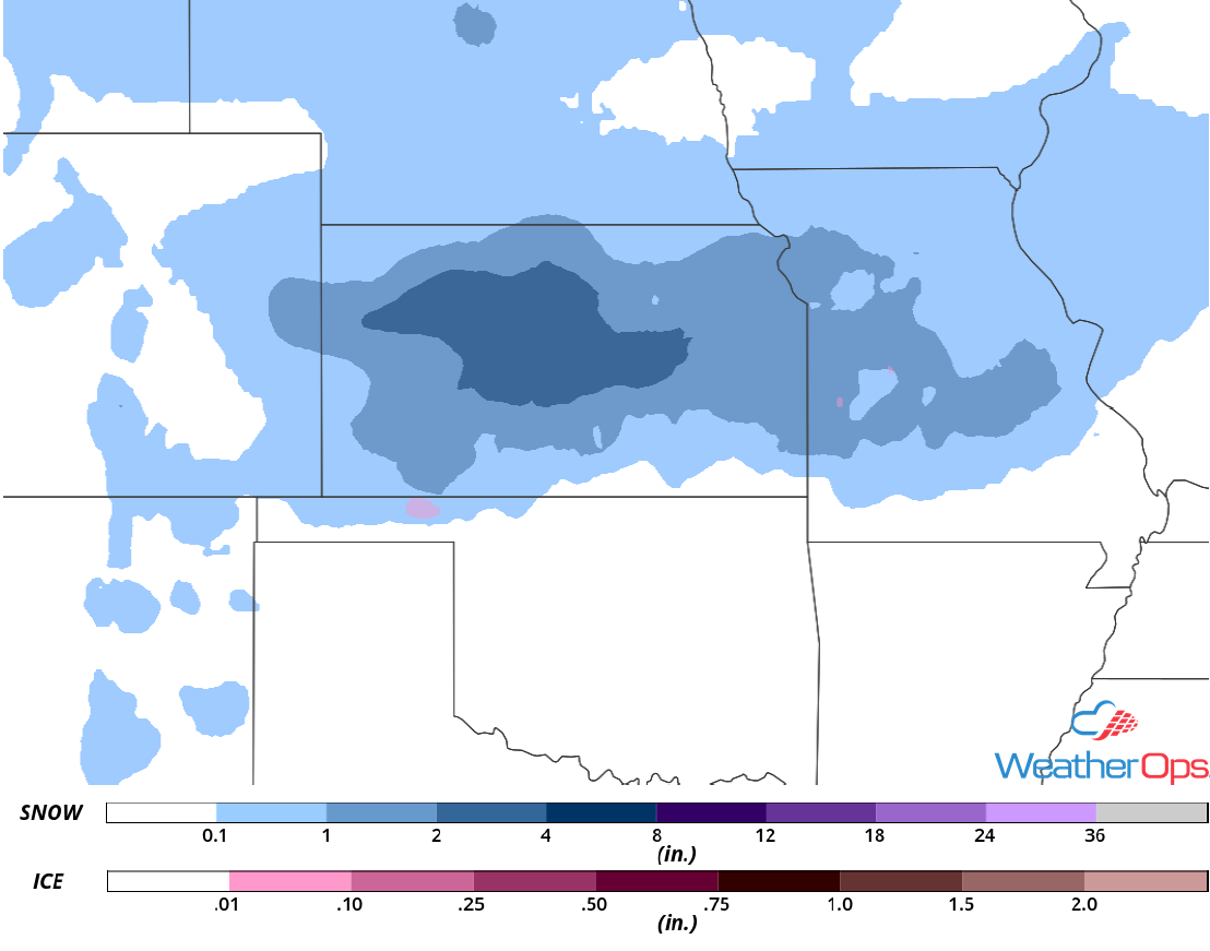
Snow Accumulation for Thursday
Risk for Thunderstorms Friday across the Southeast
As an area of low pressure lifts northeastward toward the Ohio Valley, a trailing cold front is forecast to track eastward through the Southeast on Friday. Thunderstorms may develop along and ahead of the front during the afternoon and early evening before dissipating after sunset. A few storms may be strong to severe with gusty winds and brief tornadoes the primary hazards.
Major Cities in Region: Savannah, GA, Charleston, SC, Myrtle Beach, SC, Wilmington, NC
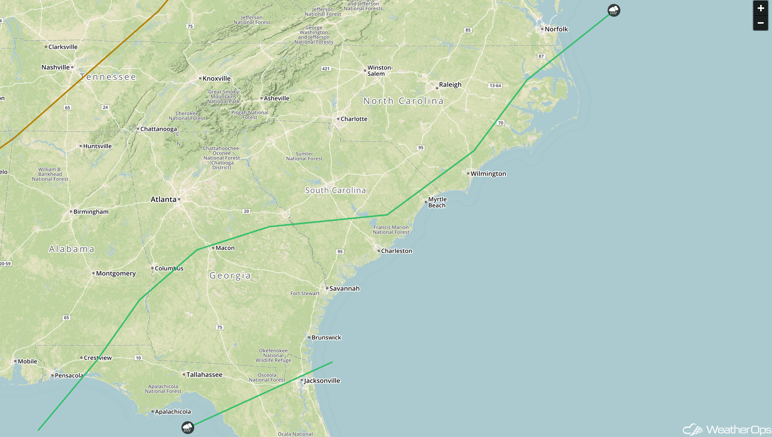
SPC Convective Outlook for Friday
Potential for Snow across Michigan Friday and Saturday
Light to moderate snow is forecast to develop over portions of the Michigan Lower Peninsula Friday into Saturday as an area of low pressure moves northeastward. Snowfall totals of 2-4 inches with locally higher amounts in excess of 5 inches are expected. Some lake effect enhancement may lead to higher totals right along the coast of Lake Michigan.
Major Cities in Region: Traverse City, MI, Grand Rapids, MI, Lansing, MI, Alpena, MI, Detroit, MI
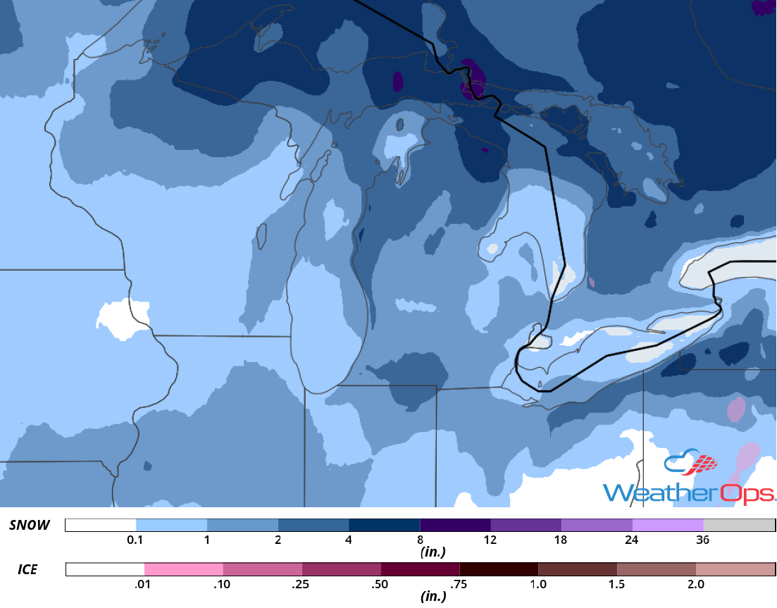
Snow Accumulation for Friday and Saturday
Snow Friday and Saturday across New England
An intensifying area of low pressure is forecast to lift across the Northeast on Friday and Saturday, bringing a risk for heavy snow and gusty winds. Snowfall accumulations of 5-10 inches with locally higher amounts in excess of a foot are forecast. Wind gusts in excess of 35 mph are expected, leading to blowing snow and hazardous travel conditions. Snow should taper off during the afternoon and evening on Saturday.
Major Cities in Region: Burlington, VT, Bangor, ME, Presque Isle, ME
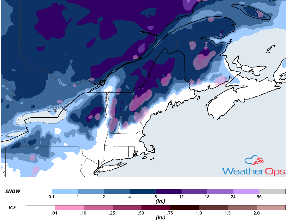
Snow Accumulation for Friday and Saturday
A Look Ahead
Light to moderate rain may develop across East Texas and Louisiana on Sunday ahead of a cold front. An area of low pressure may bring light snow from portions of the Northern Plains into the Great Lakes. Snow may develop across western portions of Oklahoma and Texas on Monday. By Tuesday, snow could extend from Upstate New York to the Tennessee Valley. Light to moderate snow may continue across portions of New York on Wednesday.
