National Weather Summary for Thursday, November 16, 2017
by David Moran, on Nov 16, 2017 10:37:00 AM
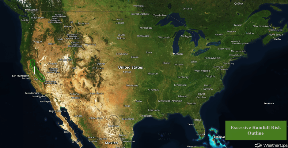
Excessive rainfall is forecast for the Sierra Nevada range on Thursday as an upper level system approaches the West Coast.
- Excessive Rainfall for the Sierra Nevadas on Thursday
- Thunderstorm Potential Saturday for the Tennessee and Ohio Valleys
- Tropical Update
 US Hazards
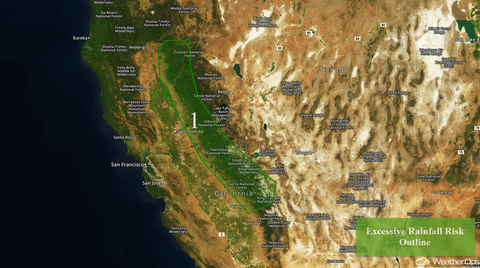
Excessive Rainfall for the Sierra Nevadas on Thursday
Deep moisture associated with an upper level storm system will continue to generate periods of rain and showers across the mountainous terrain of eastern California today. Widespread rainfall amounts of 2-4 inches with locally higher amounts in excess of 5 inches are forecast, There will be an increased risk of runoff and mudslides due to recent heavy rains. Above 6000 feet, precipitation will likely be mainly snow with amounts in excess of a foot expected.
Major Cities in Region: Chico, CA
 Region 1
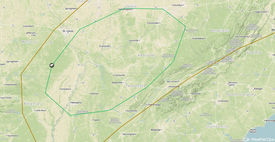
Thunderstorm Potential Saturday for the Tennessee and Ohio Valleys
An intensifying area of low pressure and its associated cold front are forecast to track across the Tennessee and Ohio Valleys on Saturday. Widespread rain and showers are forecast to develop near the low, with isolated thunderstorms developing along and ahead of the cold front. If enough instability develops, there will be the potential for a few strong to severe thunderstorms capable of producing gusty winds,
Major Cities in Region: Memphis, TN, Evansville, IN, Nashville, TN, Louisville, KY, Cincinnati, OH
 SPC Convective Outlook for Saturday
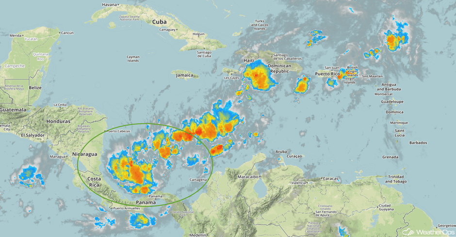
Tropical Update
An elongated area of low pressure that extends from southwest to northeast across the Caribbean Sea is producing a large area of disorganized shower and thunderstorm activity. While strong upper level winds are expected to prevent any significant development, heavy rainfall is forecast over portions of the northwestern coast of Colombia, Hispaniola, and Puerto Rico during the next few days. The low will meander over the central Caribbean Sea while it interacts with an upper level trough.
 Enhanced Infrared Tropical Satellite
A Look Ahead
The cold front responsible for the severe weather potential on Saturday will continue to move eastward, bringing showers to the Northeast and Mid Atlantic on Sunday. Meanwhile, rain and snow is expected for portions of the Pacific Northwest on Sunday as another system moves inland.
This is just a brief look at current weather hazards. We can provide you site-specific weather forecast information for the purpose of protecting your personnel and assets and to assess your weather risk. Try a 7-day demo right away and learn how timely precision weather information can enhance your bottom line.


