National Weather Summary for Thursday, November 10, 2016
by David Moran, on Nov 10, 2016 10:06:30 AM
No WeatherOps hazards are currently in effect. Thunderstorms will be possible across portions of west Texas and southern New Mexico Thursday near the tail end of a cold front.

US Hazards
Thunderstorms Possible across west Texas and southern New Mexico Thursday and Friday
A few thunderstorms will be possible across portions of west Texas and southern New Mexico as daytime heating increases across the region. On Friday, an upper level low will move into southeastern New Mexico, allowing for another risk for thunderstorms on Friday. No severe weather is anticipated.

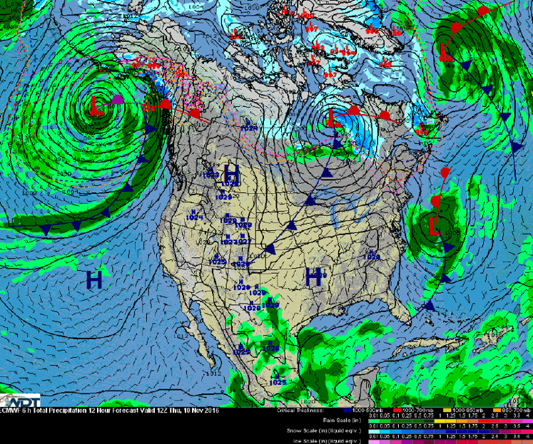
Frontal Analysis for Thursday
Tropical Update
No tropical activity expected during the next 48 hours.
A Look Ahead
A weak upper level low will move into the Pacific Northwest on Saturday, bringing a chance for rainfall to the region; rainfall amounts should remain below an inch. By early next week, another area of low pressure will approach the Pacific Northwest, bringing heavy rainfall to coastal areas of Washington and snow to the peaks of the Olympic Mountains. Rainfall amounts of 2-4 inches with isolated higher amounts in excess of 6 inches possible.
This is just a brief look at current weather hazards. We can provide you site-specific forecast information for the purpose of protecting your personnel and assets. Try a 7-day demo right away and learn how timely precision weather information can enhance your bottom line.


