


by David Moran, on Mar 8, 2018 10:48:09 AM
Heavy snow will continue across the Northeast through Friday as the Nor'Easter continues to slowly pull away from the region.
- Heavy Snow and Strong Winds Continuing across the Northeast through Friday
- Thunderstorms Friday for the Southeast Texas Coast
- Potential for Thunderstorms across the Southern Plains and Lower Mississippi Valley on Saturday
 US Hazards

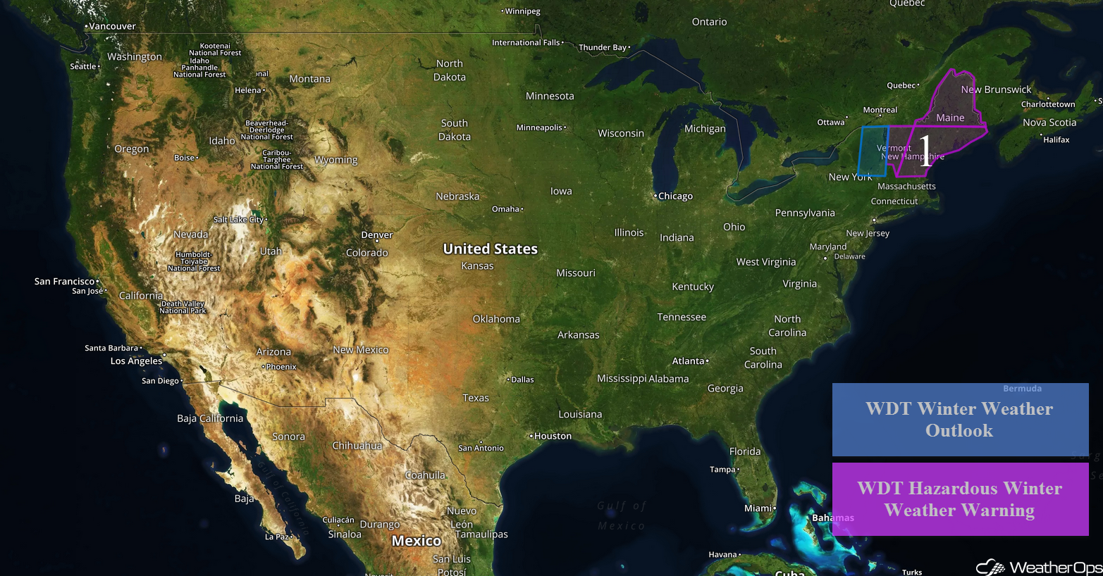
Heavy Snow and Strong Winds Continuing across the Northeast through Friday
Heavy snow will continue to move northward across the region today as the Nor'Easter continues to move northeastward. From eastern New York into southern Maine, snowfall amounts will range 2-4 inches through Friday. Across northern portions of Vermont and New Hampshire, 4-8 inches of snow are forecast. For the interior portions of Maine, 18-24 inches are expected. Winds will range from 15-20 mph inland and 20-30 mph along the coast.
Major Cities in Region: Burlington, VT, Portland, ME, Augusta, ME, Bangor, ME, Caribou, ME
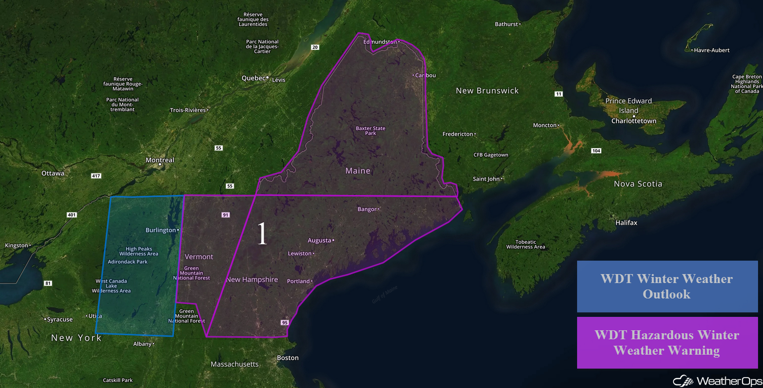 Region 1
Thunderstorms Friday for the Southeast Texas Coast
Instability should build across portions of southeastern Texas on Friday as southerly winds bring moisture northward. This instability, combined with weak impulses aloft, will allow for the development of thunderstorms. Large hail will be the primary hazard, but a few storms may produce some damaging winds.
Major Cities in Region: Corpus Christi, TX, Houston, TX
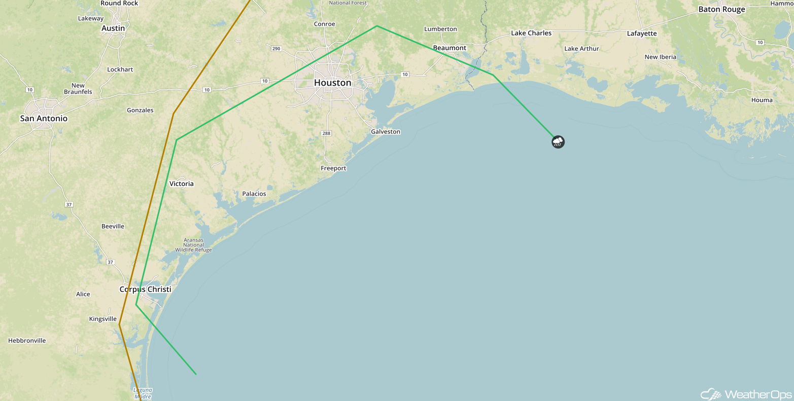 SPC Convective Outlook for Friday
Potential for Thunderstorms across the Southern Plains and Lower Mississippi Valley on Saturday
A developing area of low pressure will move across the region on Saturday. With moist air moving northward to the east of the low, instability should be sufficient for the development of scattered strong to severe thunderstorms. Some thunderstorms may be ongoing during the morning and will move eastward throughout the day. Large hail will be the primary hazard, but a few storms may produce damaging winds.
Major Cities in Region: Texarkana, AR, Shreveport, LA, Little Rock, AR, Jackson, MS
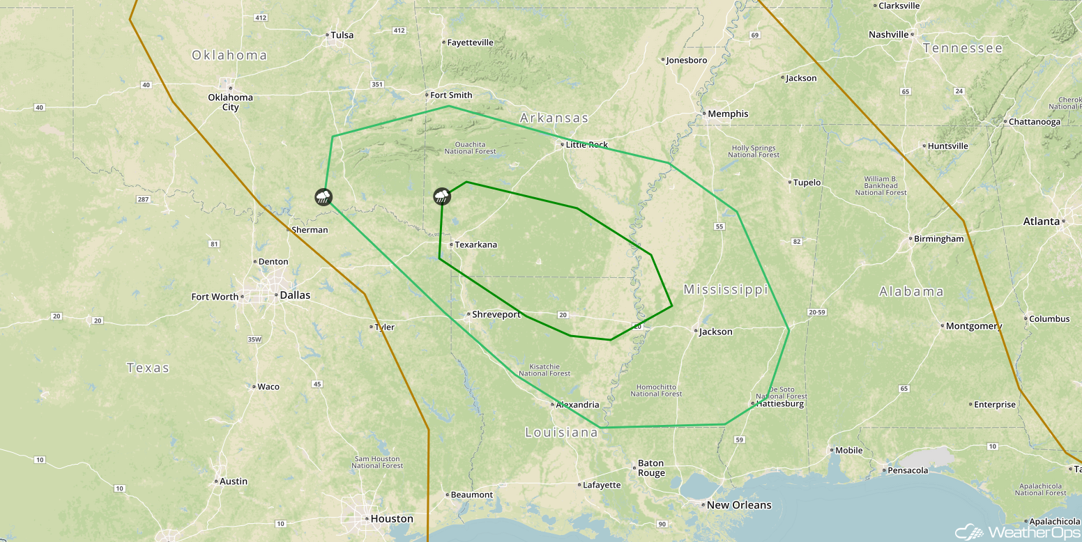 SPC Convective Outlook for Saturday
A Look Ahead
An upper level disturbance moving across the western US may bring some snow to the Central Rockies Sunday through Tuesday. While there is still some uncertainty in model guidance, current forecasts indicate three day snowfall totals could range 3-6 inches with locally higher amounts.
That is a brief look at current weather hazards. We can provide you site-specific weather forecast information to protect your staff and assets and to assess your weather risk. Try a 7-day demo right away and learn how timely precision weather information can enhance your bottom line.
