


by David Moran, on Mar 15, 2018 11:02:06 AM
Snow will continue across portions of the Northern High Plains into the Midwest through Saturday morning as an area of low pressure develops over portions of the Plains.
- Snow from the Northern High Plains through the Midwest through Saturday Morning
- Thunderstorms Friday for the Lower Mississippi Valley
- Risk for Thunderstorms across the Arklatex Region on Saturday
 US Hazards

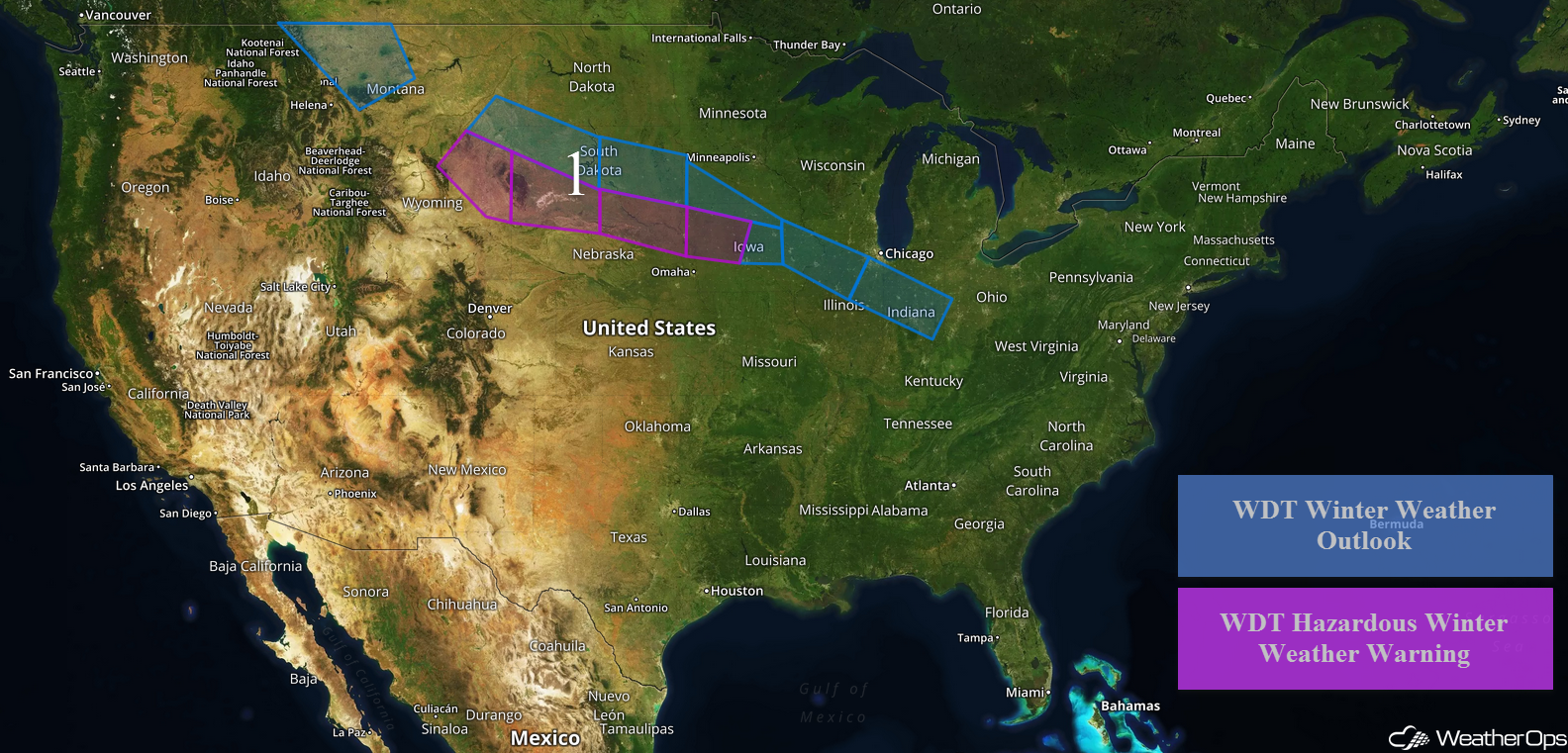
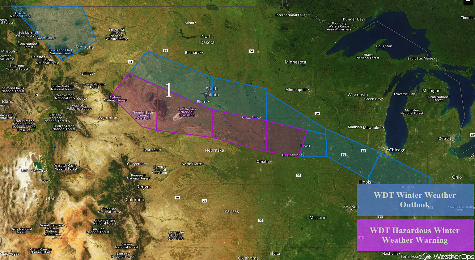
Snow from the Northern High Plains through the Midwest through Saturday Morning
Snow has developed across portions of Montana as an area of low pressure continues to intensify. This activity will increase in coverage and intensity through the day. Snow accumulations will range 3-6 inches with locally higher amounts in excess of 8 inches.
The area of low pressure and associated cold front will continue to move eastward on Friday, bringing snow to the Northern High Plains and Central Plains. Snow accumulations will range 2-4 inches across most of South Dakota, but across southwestern and south central portions of South Dakota snow accumulations of 6-10 inches are forecast. In addition to the snow, freezing rain may develop along the South Dakota/Nebraska border with ice accumulations of 0.10-0.20 inch expected through Friday evening.
Further east across southern Minnesota and northern and central Iowa, snow accumulations of 1-3 inches with locally higher amounts in excess of 4 inches are expected through Saturday morning. In addition, ice accumulations will range 0.05-0.15 inch. From southeastern Iowa eastward into east central Indiana, ice accumulations of 0.05-0.15 inch are forecast.
Major Cities in Region: Great Falls, MT, Rapid City, SD, Pierre, SD, Sioux Falls, SD, Des Moines, IA, Peoria, IL, Indianapolis, IN
 Region 1
Thunderstorms Friday for the Lower Mississippi Valley
Thunderstorms are forecast to develop across the Lower Mississippi Valley on Friday as an upper level disturbance moves across the region. With plentiful moisture and daytime heating, thunderstorms will likely develop during the afternoon. Large hail and damaging winds will be the primary hazards, but an isolated tornado or two cannot be ruled out. The greatest threat will stretch across northern Louisiana, eastern Arkansas, and northwestern Mississippi.
Major Cities in Region: Shreveport, LA, Little Rock, AR, Memphis, TN
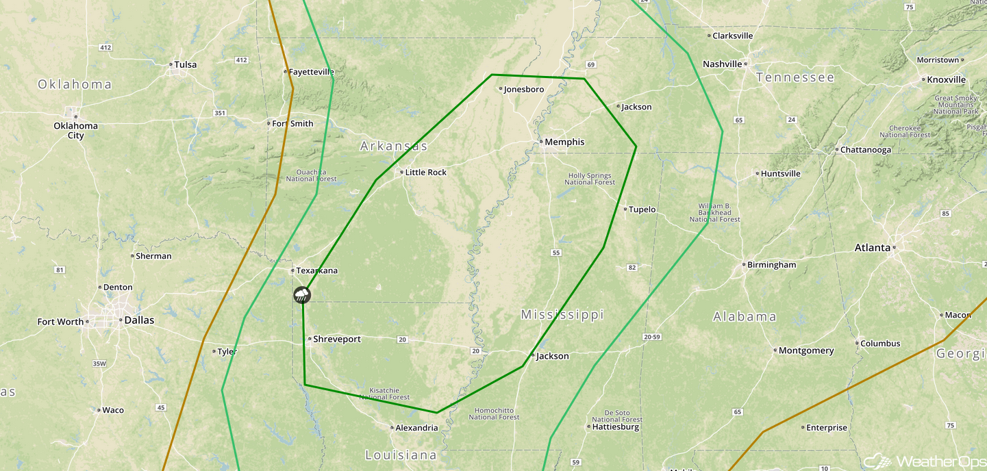 SPC Convective Outlook for Friday
Risk for Thunderstorms across the Arklatex Region on Saturday
A dryline across Central Texas and an area of low pressure moving through the region on Saturday will support the development of showers and thunderstorms during the afternoon on Saturday. Large hail and severe winds will be the primary hazards, but an isolated tornado cannot be ruled out. Activity should weaken after dark.
Major Cities in Region: Dallas, TX, Shreveport, LA, Jackson, MS
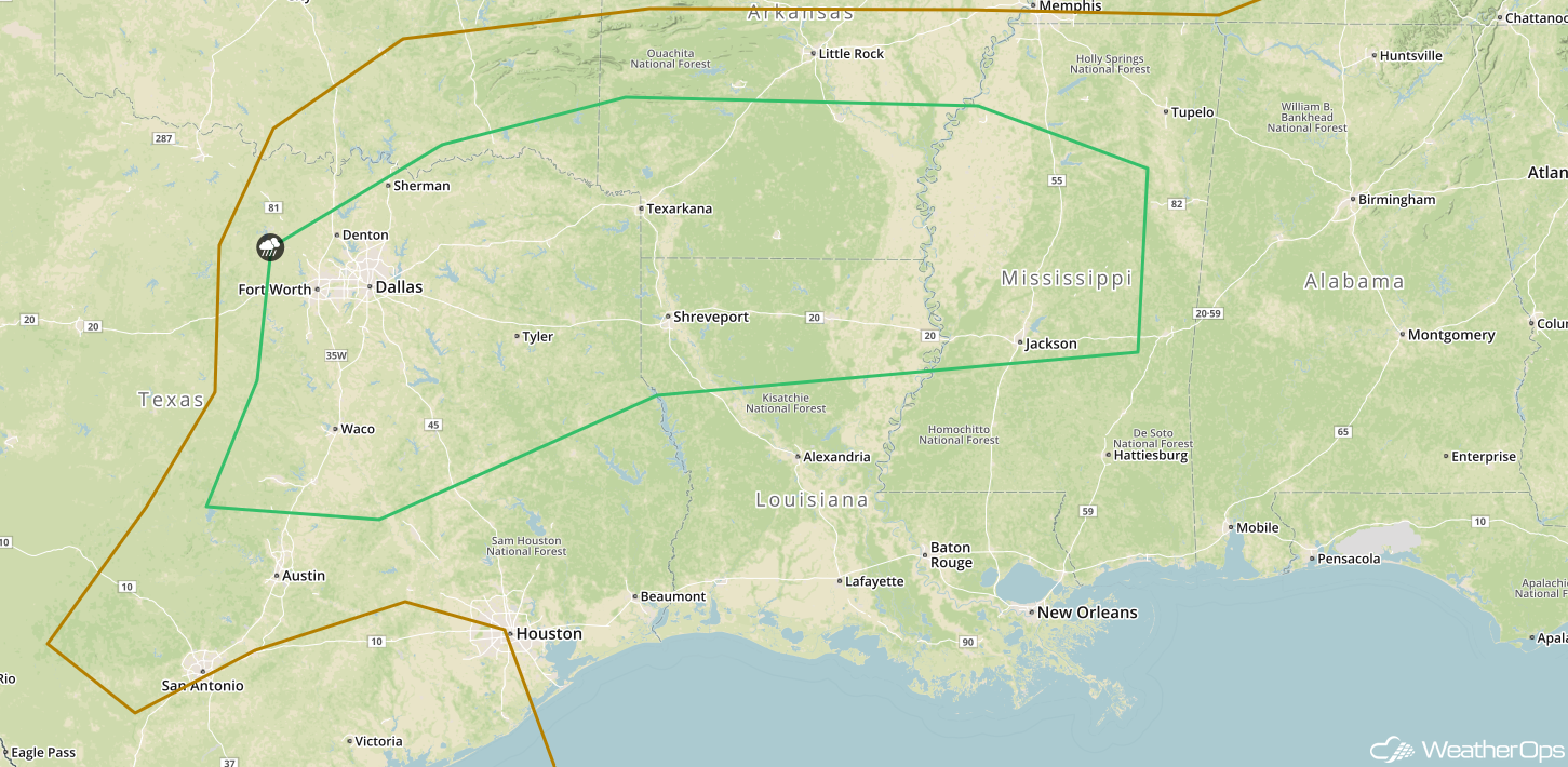 SPC Convective Outlook for Saturday
A Look Ahead
An area of low pressure pushing through portions of the Midwest and Great Lakes will bring the potential for significant snowfall Tuesday night into Wednesday. While exact amounts are unknown at this time, there appears to be the potential for several inches of snow.
That is a brief look at current weather hazards. We can provide you site-specific weather forecast information to protect your staff and assets and to assess your weather risk. Try a 7-day demo right away and learn how timely precision weather information can enhance your bottom line.
