National Weather Summary for Thursday, June 30, 2016
by David Moran, on Jun 30, 2016 11:37:40 AM
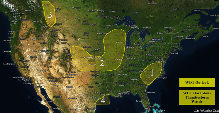
A weak area of low pressure will move northeastward on Thursday, bringing the potential for thunderstorms to portions of the Carolinas and Mid Atlantic. Across the Plains and Midwest, thunderstorms will be possible ahead of a warm front. During the afternoon, thunderstorms will be possible for portions of Montana along a stationary front. On Friday, a cold front moving through the Northeast will be the focal point for the development of thunderstorms during the afternoon and evening, Thunderstorms and excessive rainfall will be possible for portions of the Plains. A cold front moving through portions of the Carolinas and Mid Atlantic may lead to the development of thunderstorms on Saturday. Across the Plains, thunderstorms will be possible as an area of low pressure develops over the High Plains. This area of low pressure may also allow for widespread heavy rainfall across portions of the Central US.
US Hazards
Region 1
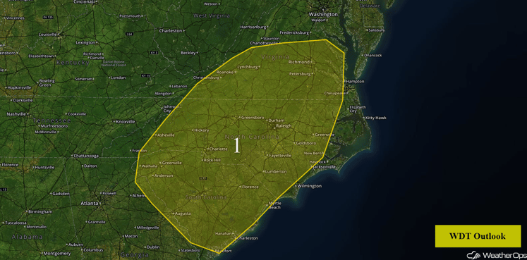
A surface front, along with some support from weak upper level waves, will provide enough forcing for the development of isolated severe thunderstorms. These storms should begin to develop in the afternoon and continue into the evening hours, with strong winds becoming the primary hazard.
Region 1
Region 2
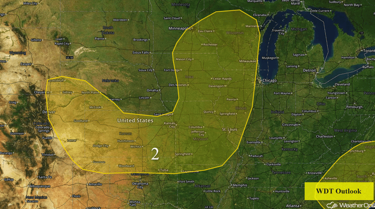
Thunderstorms are expected across Region 2 today. A surface front, an upper level disturbance and instability will allow for the development of severe thunderstorms this afternoon and evening. Further to the west, a front will move into the High Plains and daytime heating will lead to the development of thunderstorms this afternoon and evening, with the potential for heavy rainfall in eastern Colorado and western Kansas.
Region 2
Region 3
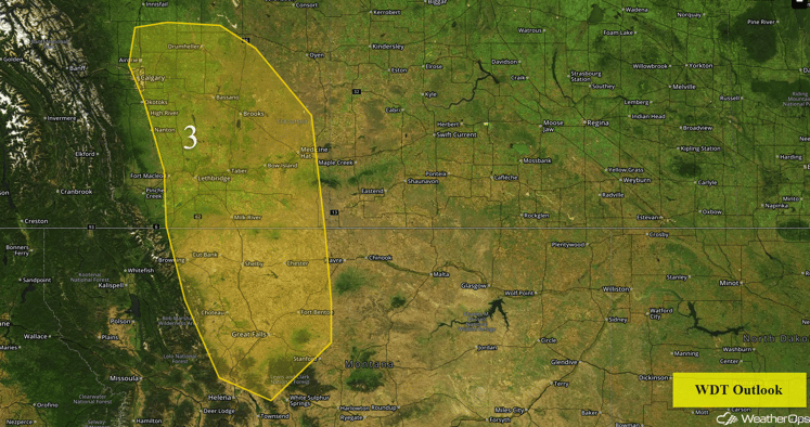
An upper level trough will move over Region 3 this afternoon and help initiate the development of thunderstorms along a front, The primary threat from these storms will be strong winds although isolated large hail is not out of the question. These storms will develop during the afternoon and persist into the evening.
Region 3
Region 4
Thunderstorm activity is expected to increase in coverage across the northwest Gulf of Mexico this morning. Activity may continue to strengthen through the morning. Gusty winds in excess of 40 knots, lightning, isolated waterspouts, and locally enhanced seas will be the primary impacts within some of the stronger thunderstorm activity.
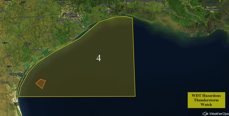
Region 4
Strong to Severe Thunderstorms Possible for the Northeast on Friday
A cold front, associated with a surface low pressure area over southeastern Canada, is forecast to track across the Northeast on Friday. Thunderstorms are expected to develop along and ahead of the front Friday afternoon and evening, with a few strong to severe thunderstorms capable of producing gusty winds possible.
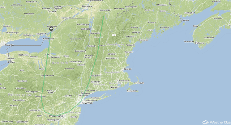
SPC Convective Outlook for Friday
Strong to Severe Thunderstorms Possible for Portions of the Plains on Friday
An upper level disturbance is forecast to track eastward across the Central Plains on Friday. With the surface front continuing to push across the Plains, thunderstorms are again expected to develop and/or continue across the region. Strong to severe thunderstorms could produce gusty winds and hail. In addition, excessive rainfall will be possible for portions of Northeast Kansas and southeast Nebraska. Rainfall amounts of 1-2 inches with locally higher amounts in excess of 3 inches will be possible.
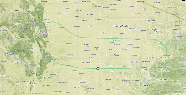
SPC Convective Outlook for Friday
Strong to Severe Thunderstorms for the Carolinas and Mid Atlantic on Saturday
Increasing instability is expected to spread across much of the Carolinas and into southeast Virginia on Saturday ahead of a cold front. The front should become nearly stationary by the afternoon and lead to the development of thunderstorms through the evening and into the overnight hours. A few strong storms capable of producing gusty winds will be possible.
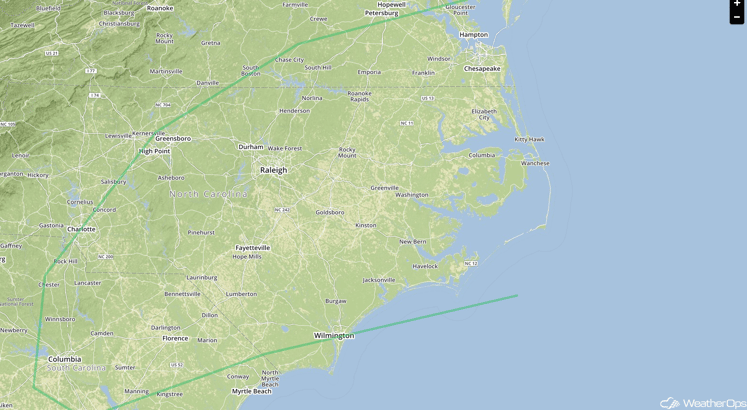
SPC Convective Outlook for Saturday
Strong to Severe Thunderstorms Possible for Central and Southern Plains on Saturday
A developing surface low over the Central Plains is forecast to track eastward on Saturday. As instability increases, thunderstorms are expected to develop over Kansas and southward into northwest Oklahoma, the Texas Panhandle, and into northeast New Mexico. Gusty winds and hail will be the main threats. In addition, heavy rainfall will be possible from eastern Kansas into the Mid Mississippi Valley region. Rainfall totals of 1-3 inches with isolated higher amounts in excess of 4 inches will be possible, leading to the potential for flooding.
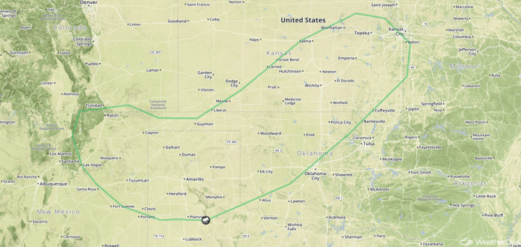
SPC Convective Outlook for Saturday
Strong to Severe Thunderstorms Possible Saturday for Northern Plains
An upper level disturbance combined with a developing surface low over the High Plains is expected to produce isolated thunderstorms across eastern Montana and western North Dakota by Saturday afternoon or evening. A few storms could be strong to severe with hail and gusty winds possible.
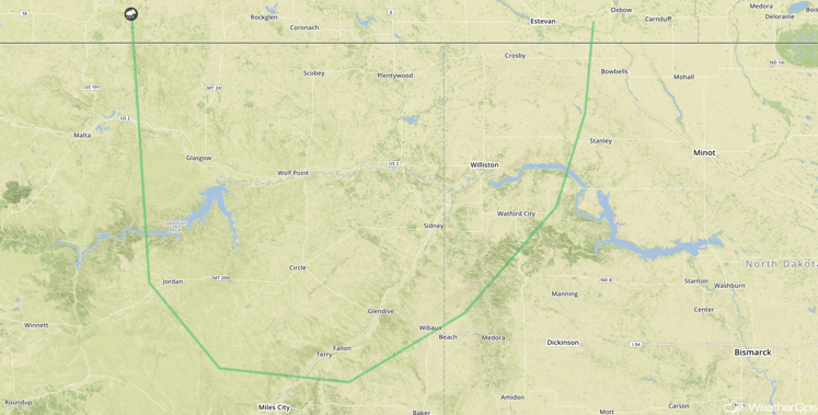
SPC Convective Outlook for Saturday
This is just a brief look at current weather hazards. We can provide you site-specific forecast information. Try a 7-day demo right away.


