National Weather Summary for Thursday, June 22, 2017
by David Moran, on Jun 22, 2017 10:58:08 AM
A cold front progressing through the Plains will be the focus for the development of thunderstorms from the Plains to the Great Lakes on Thursday. Heavy rain and severe weather associated with Tropical Storm Cindy will continue Thursday across the Lower Mississippi Valley. Elevated conditions will continue across the Gulf of Mexico through Thursday afternoon as a result of Tropical Storm Cindy.
- Thunderstorm Potential Thursday from the Great Lakes into the High Plains
- Severe Weather and Excessive Rainfall Continuing across the Lower Mississippi Valley on Thursday
- Elevated Conditions Continuing Thursday for the Gulf of Mexico
- Risk for Thunderstorms on Friday across the Northeast
- Strong to Severe Thunderstorms from the Ohio Valley to Southern Plains on Friday
- Potential for Thunderstorms for the Southeast on Friday
- Risk for Thunderstorms on Saturday across the South
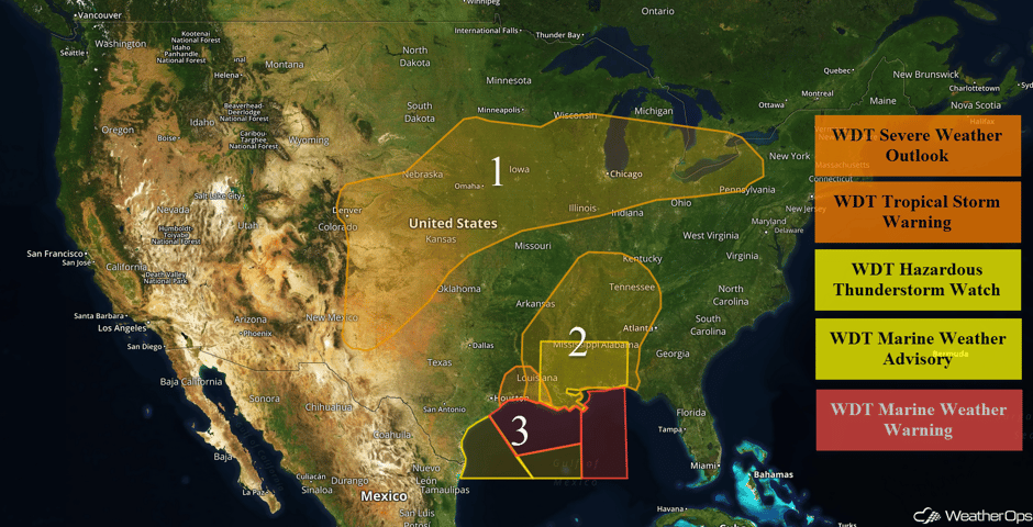 US Hazards
Thunderstorm Potential Thursday from the Great Lakes into the High Plains
Thunderstorms are forecast from the Great Lakes into the southern High Plains. A large upper level low will bring a cold front across the region with isolated to scattered thunderstorms forecast to develop or reintensify across the region. Damaging winds will be the primary hazard with activity becoming more widespread during the evening. Additional thunderstorms, perhaps more isolated, are forecast across the High Plains of the Colorado Front Range, southward, into New Mexico and the Texas Panhandle. Storms that develop will pose a threat for large hail and severe winds through the evening hours.
Update 12:39pm EDT: Severe thunderstorm capable of hail and damaging winds north of Pittsburgh, PA.
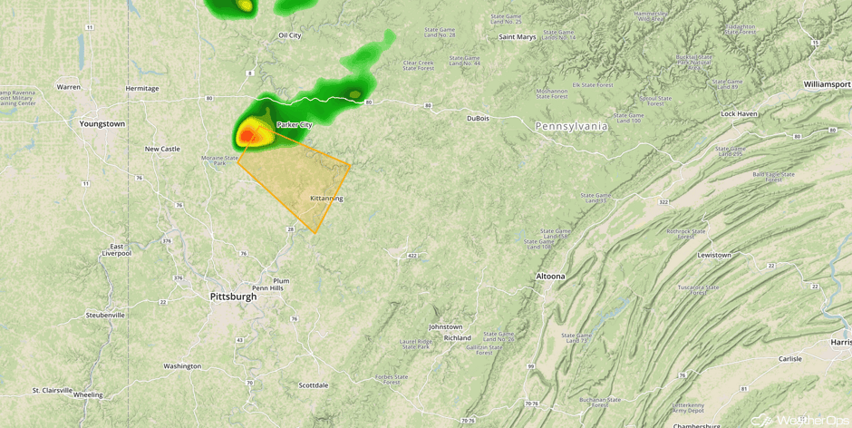 Radar 12:39pm EDT
Major Cities in Region: Denver, CO, Amarillo, TX, Wichita, KS, Sioux Falls, SD, Omaha, NE, Des Moines, IA, Green Bay, WI, Milwaukee, WI, Detroit, MI, Cleveland, OH
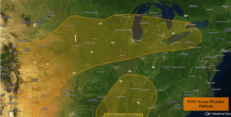 Region 1
Severe Weather and Excessive Rainfall Continuing across the Lower Mississippi Valley on Thursday
The severe weather and flooding threat associated with Tropical Storm Cindy will continue on Thursday. Waves of showers and heavy thunderstorms will impact the region for the morning, afternoon, and evening. As previous days, the primary hazard will be isolated tornadoes across the region, especially during the afternoon hours when the air becomes more unstable. The tornado threat will likely persist into the evening hours.
In addition to the tornado threat, heavy rainfall leading to flash flooding will be a major threat across the region through Thursday. Widespread 1 to 3 inches can be expected across the Lower Mississippi Valley, with local areas of 6+ inches possible, especially along the path of the remnant low pressure tracking through eastern Texas, northern Louisiana and southern Arkansas. In that region, rainfall on Thursday of 10-12 inches will be very possible, leading to a high threat of life threatening flooding. Storm Totals across the Gulf Coast will be 10-15 inches in some areas after Thursday. Flash flooding will be a concern across the entire threat region.
Update 11:49am CDT: Tornado Warnings in eastern Louisiana and southwestern Mississippi.
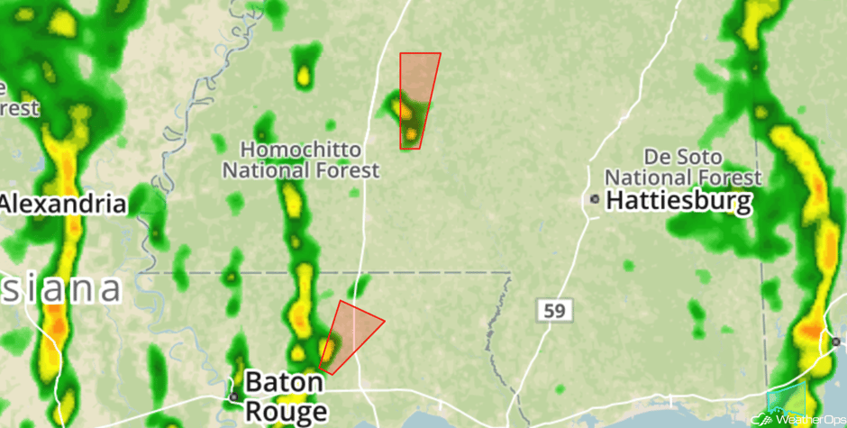 Radar 11:49am CDT
Update 12:49pm CDT: Tornado Warning for the Birmingham, AL metro.
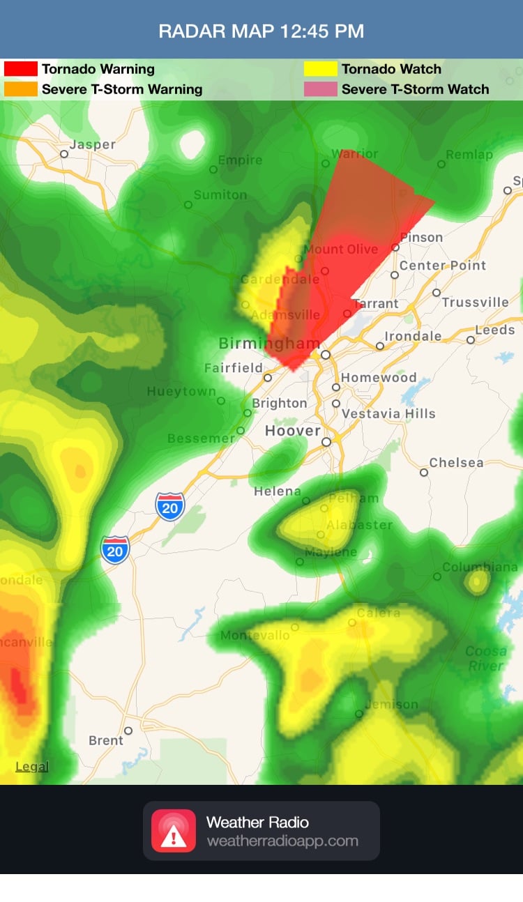 Radar 12:49pm CDT
Update 1:16pm CDT: Tornado Watch for portions of Alabama, Arkansas, Louisiana, and Mississippi until 10pm CDT.
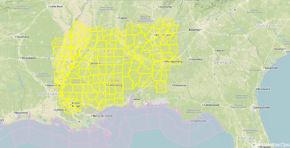 Tornado Watch
Major Cities in Region: Beaumont, TX, Lafayette, LA, Baton Rouge, LA, Memphis, TN, Jackson, MS, New Orleans, LA, Birmingham, AL, Nashville, TN, Chattanooga, TN
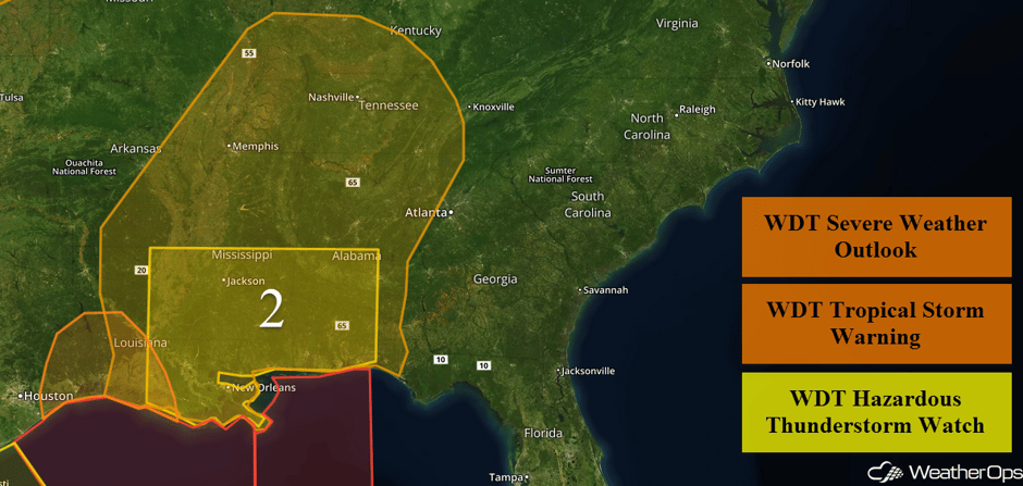 Region 2
Elevated Conditions Continuing Thursday for the Gulf of Mexico
Elevated conditions will continue throughout the day following Tropical Storm Cindy making landfall. Winds will range from 25 to 35 knots with gusts in excess of 45 knots at times. Swells are expected to be 10-14 feet in central portions of Region 4 with swells as high as 20 feet in the far eastern portions of the region. In the far western portions, winds will become southerly at 20-25 knots with swells of 6-8 feet.
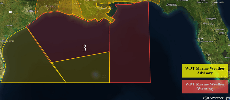 Region 3
Risk for Thunderstorms on Friday across the Northeast
There will be a chance for scattered strong to severe thunderstorms across portions of the Northeast on Friday as a warm front lifts through the region, bringing warm and moist air as far north as Maine. An upper-level trough will then move through during the day, providing the lift necessary for showers and storms. Primary hazards will be damaging wind gusts and isolated large hail, with a threat for isolated tornadoes over Maine. The threat is expected to diminish during the early evening.
Major Cities in Region: Cleveland, OH, Pittsburgh, PA, Philadelphia, PA, New York, NY
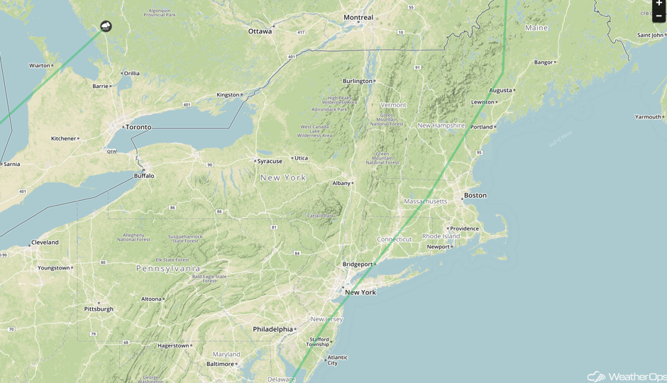 SPC Convective Outlook for Friday
Strong to Severe Thunderstorms from the Ohio Valley to Southern Plains on Friday
A cold front associated with a low pressure over the northern Great Lakes will push through the Plains and Midwest during the day, providing a focus for thunderstorm development across the Ohio Valley into Oklahoma during the afternoon. Activity will be scattered to widespread along and ahead of the cold front, with the strong to severe threat to be maximized during the afternoon. Primary hazards will be damaging wind gusts and large hail.
Over the portions of the Ohio, Tennessee, and Lower Mississippi River Valleys there will be a elevated threat for excessive rainfall leading to flooding, as well. The remnant low pressure of Cindy will track along the western facing slopes of the Appalachian Mountains through the day and evening, with heavy rainfall forecast to occur along the path as the extreme moisture content interacts with an eastward moving cold front. A large swath of 3 to 5 inches will be possible across western Tennessee into the Ohio Valley, with locally higher amounts possible. This will likely lead to large areas of flooding on Friday.
Major Cities in Region: Dallas, TX, Little Rock, AR, Memphis, TN, Cincinnati, OH
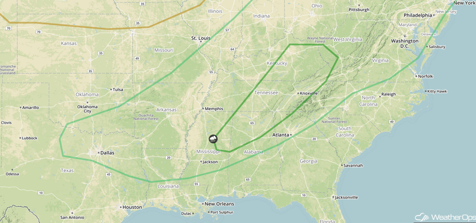 SPC Convective Outlook for Friday
Potential for Thunderstorms for the Southeast on Friday
There will be chances for scattered thunderstorms across the South on Friday as the remnant low of Cindy pushes a frontal boundary through the region. The primary hazards will be isolated damaging wind gusts and a couple of tornadoes, with the threat to diminish during the early evening.
Major Cities in Region: Jackson, MS, Birmingham, AL, Atlanta, GA
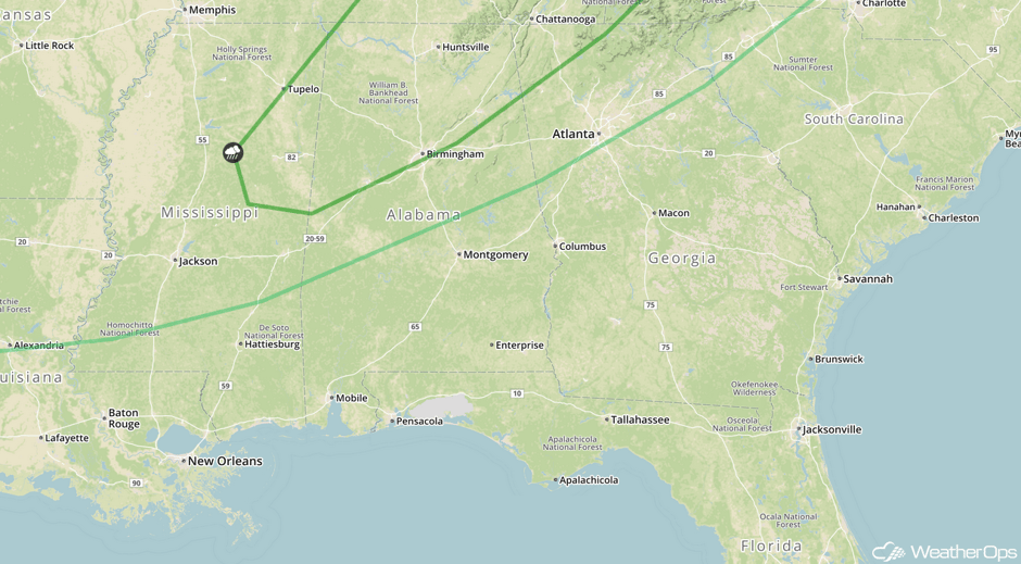 SPC Convective Outlook for Friday
Risk for Thunderstorms on Saturday across the South
There will be a chance for strong to possibly severe thunderstorms over eastern Texas into the Gulf States on Saturday. A frontal boundary will stall across the region, and scattered showers and thunderstorms will be possible during the afternoon across the outlook area. Conditions will not be overly conducive for severe weather, however, some thunderstorms may become strong with damaging wind gusts being the primary hazard. The threat is expected to diminish during the early evening.
Due to the previous days’ rains from Tropical Storm Cindy, flooding may be possible along the Gulf Coast even though rainfall totals should only be on the 1 to 2 inch range across much of the region. The saturated ground will only need a couple of inches to produce a flash flooding threat.
Major Cities in Region: Houston, TX, New Orleans, LA, Jackson, MS
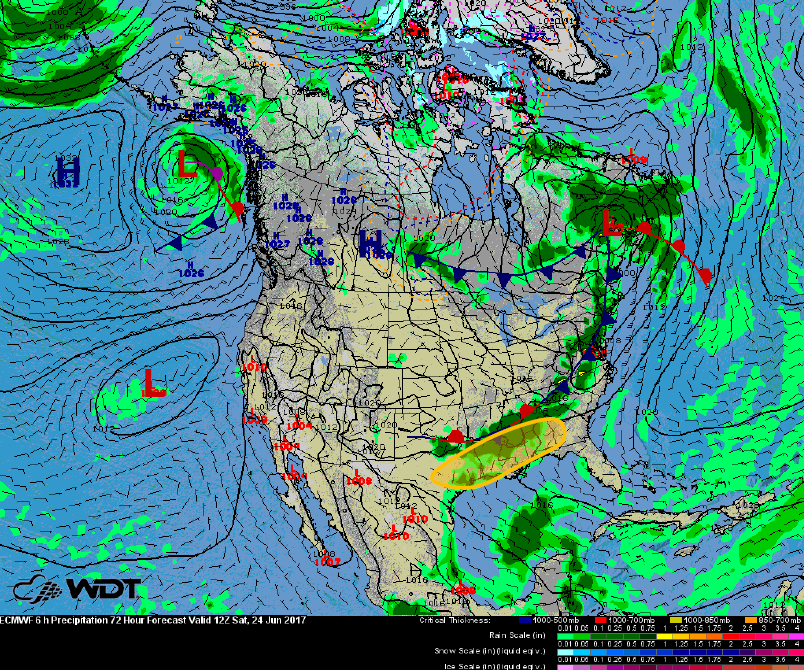 Thunderstorm Risk Outline for Saturday
A Look Ahead
A ridge of high pressure will build into the central CONUS on Sunday, which will produce upslope flow along the Continental Divide for much of the day. The upslope flow with provide the lift necessary for thunderstorms to form over the High Plains during the afternoon. Activity should be scattered in nature and will likely shift southeastward into the evening. Primary hazards will be large hail, damaging winds, and an isolated tornado or two.
This is just a brief look at current weather hazards. We can provide you site-specific weather forecast information for the purpose of protecting your personnel and assets and to assess your weather risk. Try a 7-day demo right away and learn how timely precision weather information can enhance your bottom line.


