


by David Moran, on Jun 2, 2016 12:28:39 PM
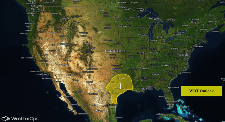
Heavy to excessive rainfall will be possible on Thursday across portions of the Southern Plains; rainfall amounts of 1-3 inches with locally higher amounts in excess of 4 inches will be possible. Strong to severe thunderstorms will be possible across portions of the Great Lakes, Ohio Valley, and Appalachians. Severe thunderstorms will be possible for portions of the Northern Rockies and Northern Plains. Going into Friday, heavy to excessive rainfall will continue across southeast Texas with rainfall amounts of 1-2 inches and locally higher amounts in excess of 4 inches possible. Strong to severe thunderstorms will be possible across the Northern Plains and Upper Mississippi Valley. Heavy rain will continue across portions of Texas on Saturday. Strong to severe thunderstorms will be possible for the Upper Great Lakes and Lower Mississippi Valley.
US Hazards
Excessive Rainfall Possible for Southern Plains on Thursday
A weak upper level system will form over southeast Texas. This will focus shower and thunderstorm formation over areas that have already received large amounts of rain. Total additional accumulation of 1-3 inches of rain with locally higher amounts in excess of 4 inches will be possible.
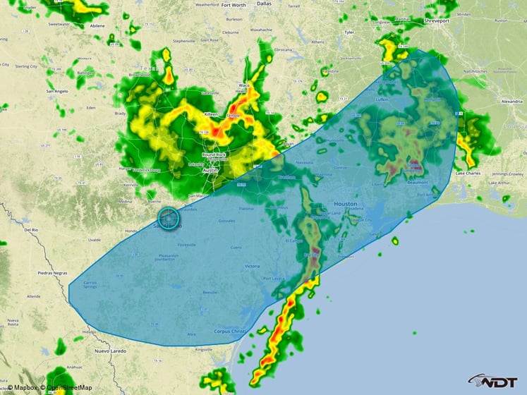
Region 1
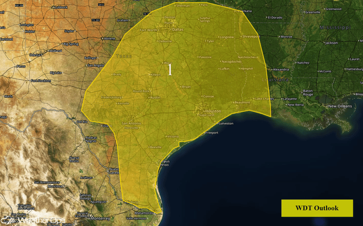
Strong to Severe Thunderstorms Possible Across South Texas on Thursday
Strong to severe thunderstorms will be possible across portions of far South Texas into the afternoon. While hail and damaging winds will be possible, heavy to excessive rainfall will be the primary threat. With the saturated ground from previous rainfall from the last few days, flooding and flash flooding will be likely to occur with any thunderstorm.
SPC Convective Outlook for Thursday
Strong to Severe Thunderstorms Possible Thursday for Portions of the Great Lakes, Ohio Valley, and Appalachians
Widely scattered thunderstorms are expected across the Great Lakes, Ohio Valley, and Appalachians as a cold front approaches from the west. Although the severe threat is isolated, some thunderstorms may be strong enough to produce damaging winds.
SPC Convective Outlook for Thursday
Strong to Severe Thunderstorms Possible for the Northern Rockies and Northern Plains on Thursday
An upper level trough moving across the Northern Rockies and Plains allow for the development of isolated severe thunderstorms this afternoon into the evening. Large hail and damaging winds will be the primary hazards with these storms.
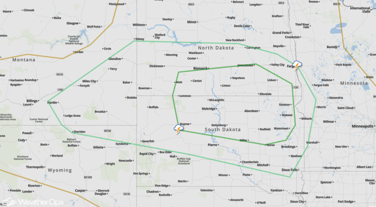
SPC Convective Outlook for Thursday
Strong to Severe Thunderstorms Possible for Northern Plains and Upper Mississippi Valley on Friday
As an upper level trough continues to move across the Northern Plains, thunderstorms will be possible across portions of Minnesota, Wisconsin, Iowa, and northeastern Nebraska. While there is some uncertainty, there will be the potential for strong to severe thunderstorms. As thunderstorms develop, large hail, damaging winds, frequent lightning, heavy rain, and tornadoes will be possible.
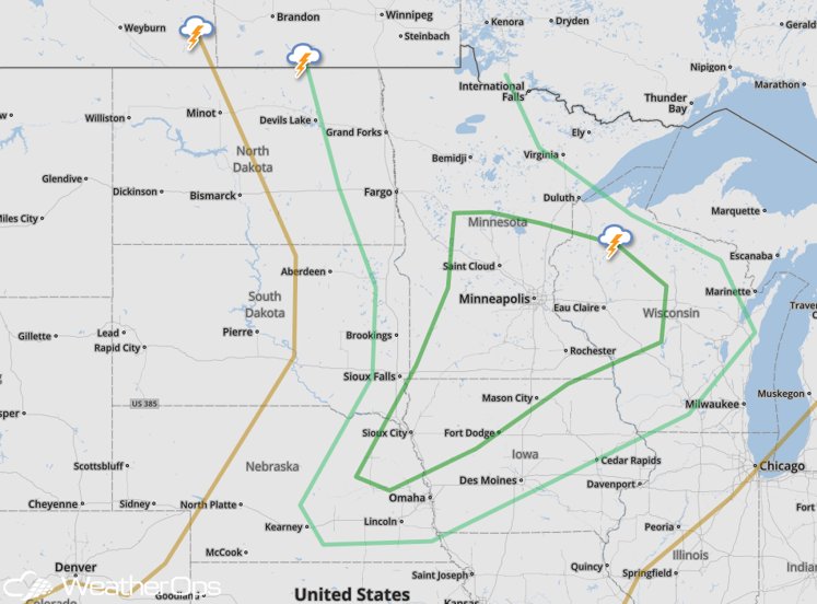
SPC Convective Outlook for Friday
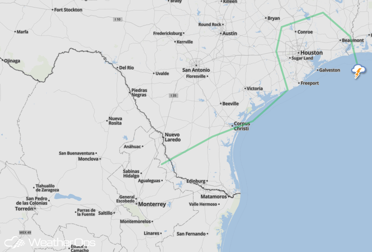
Heavy to Excessive Rainfall Possible for Southeast Texas on Friday
The slow moving upper level system will continue to bring heavy rain to eastern Texas and western Louisiana. New rainfall amounts of 1-2 inches will be possible with locally higher amounts in excess of 3 inches possible. With heavy rainfall from previous days, flooding and flash flooding will continue to be a possibility with any additional rainfall.
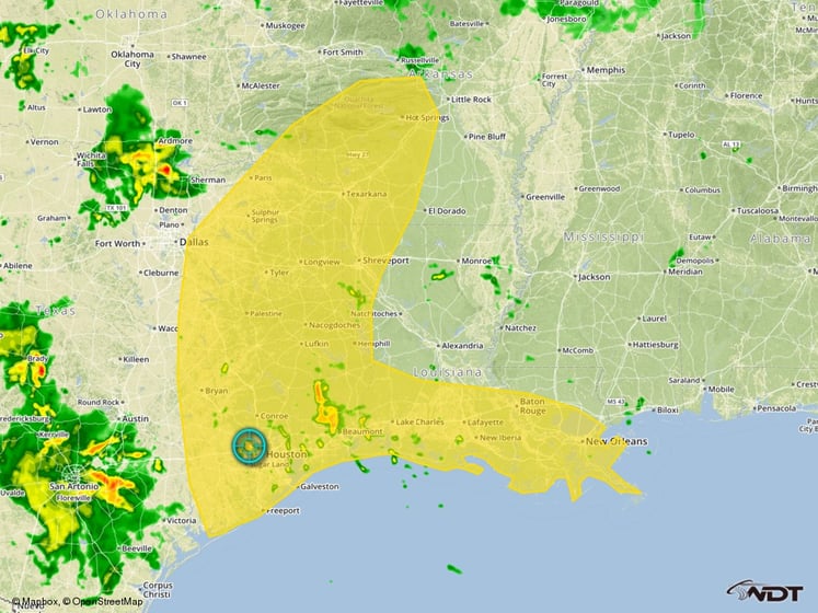
Excessive Rainfall Threat Outline for Friday
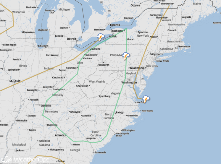
Strong to Severe Thunderstorms Possible for Upper Great Lakes and Lower Mississippi Valley on Saturday
As an upper level low and attendant surface low continues to move slowly to to the northeast, thunderstorms will be possible along and ahead of the cold front associated with the surface low, particularly in the late afternoon and early evening. While the threat for severe weather is fairly low, the primary impact from any severe storms that develop would be damaging winds.
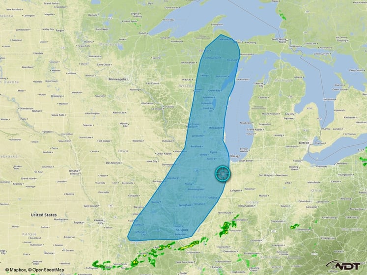
Thunderstorm Threat Outline for Saturday
Excessive Rainfall Continues for Portions of Texas on Saturday
With a very moist tropical air mass in place over south Texas, rainfall amounts of 1-2 inches will be possible just inland from the Texas Gulf Coast, with some locally higher amounts in excess of 3 inches possible.
Excessive Rainfall Threat Outline for Saturday
