


by David Moran, on Jul 5, 2018 11:04:11 AM
Thunderstorms will continue for portions of the western Gulf of Mexico on Thursday as an area of low pressure moves westward. A stalled front will be the focus for thunderstorm development across the Central and Northern High Plains. Thunderstorms may develop across southeastern Texas and southwestern Louisiana in association with the area of low pressure described above. Increasing instability and wind shear will allow for the development of thunderstorms from the Ohio Valley into the Northeast. Some of this activity will have the potential to produce heavy to excessive rainfall.
- Continued Thunderstorms for the Western Gulf of Mexico Thursday
- Thunderstorms Thursday across the Central and Northern High Plains
- Risk for Thunderstorms across Southeastern Texas and Southwestern Louisiana on Thursday
- Thunderstorm Potential Thursday across the Ohio Valley into the Northeast
- Excessive Rainfall from the Ohio Valley into the Northeast on Thursday
- Potential for Thunderstorms Friday across New England
- Thunderstorms across North Dakota and Minnesota on Saturday
- Tropical Update
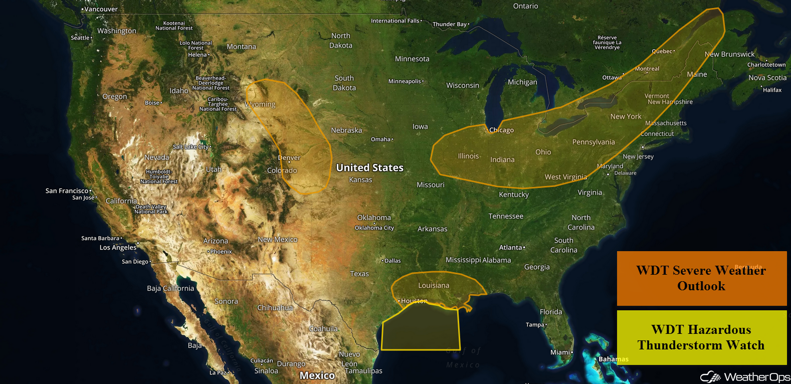 US Hazards

Continued Thunderstorms for the Western Gulf of Mexico Thursday
Thunderstorms will continue through the early evening as an area of low pressure continues to move westward along the northern Gulf Coast. Winds over 35 knots, heavy rain, frequent lightning, and waterspouts will be potential hazards with these storms.
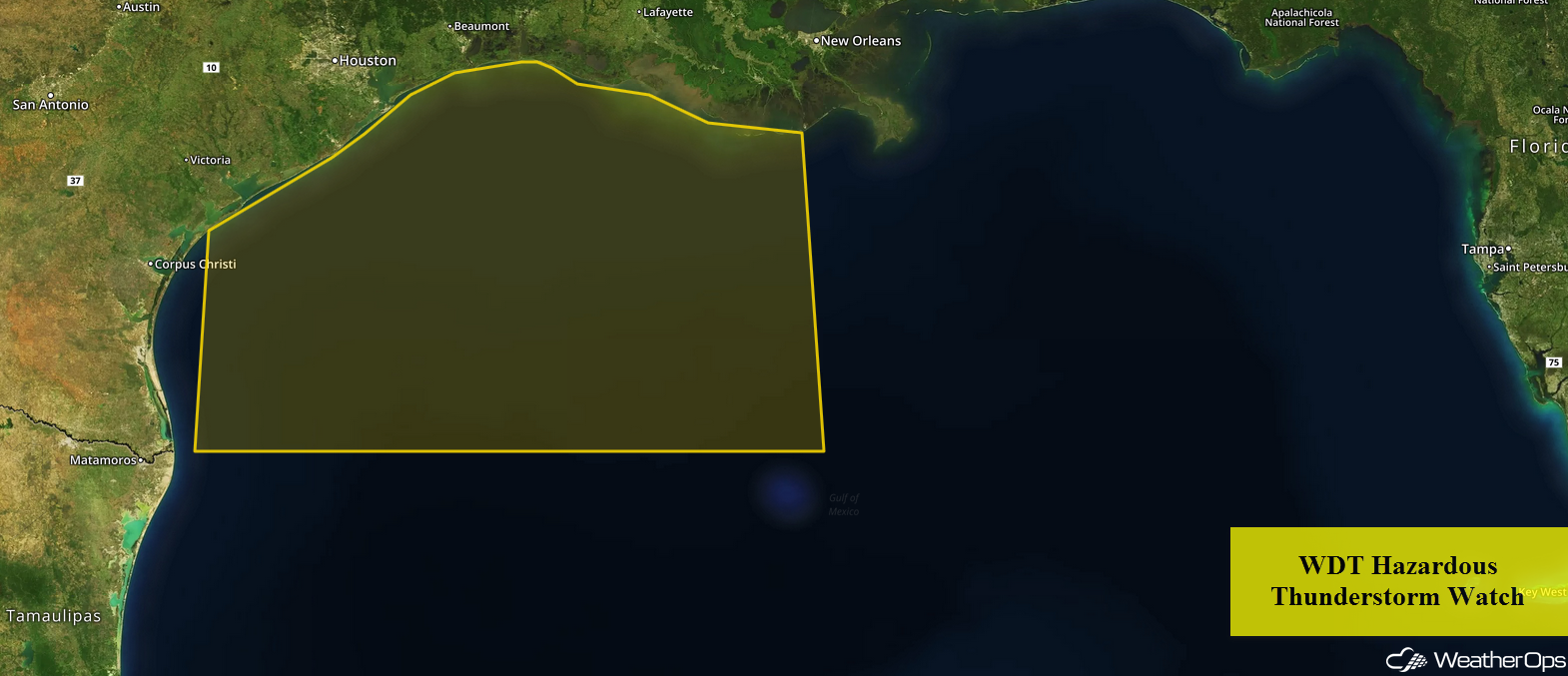 WDT Hazardous Thunderstorm Watch
Thunderstorms Thursday across the Central and Northern High Plains
A few thunderstorms may develop along a stalled front this afternoon as instability builds. Any storms that develop will have the potential to produce damaging winds and large hail. Activity should diminish between 10 pm and Midnight.
Major Cities in Region: Rapid City, SD, Scottsbluff, NE, Goodland, KS
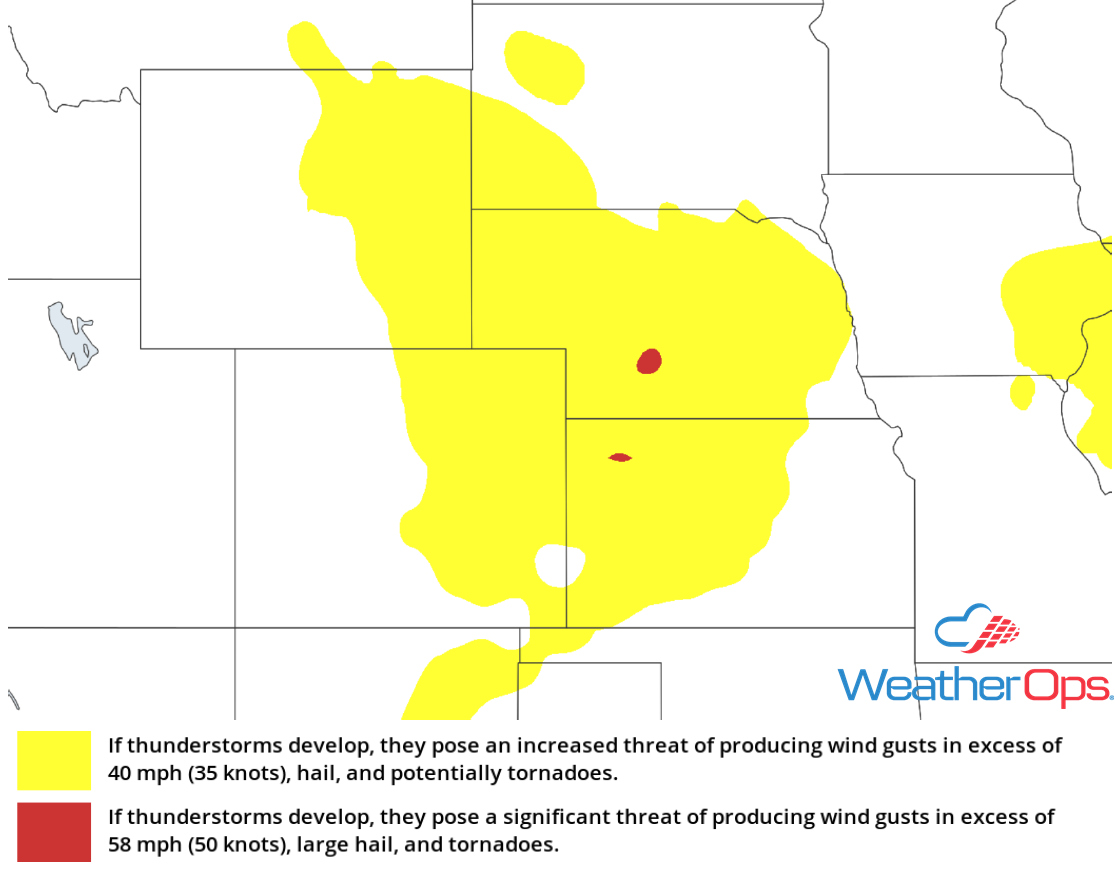 Thunderstorm Risk for Thursday
Risk for Thunderstorms across Southeastern Texas and Southwestern Louisiana on Thursday
A weak area of low pressure moving westward along the Gulf Coast may allow for a few thunderstorms this afternoon and early evening. Damaging winds will be the primary hazard with the stronger storms.
Major Cities in Region: Beaumont, TX, Lake Charles, LA
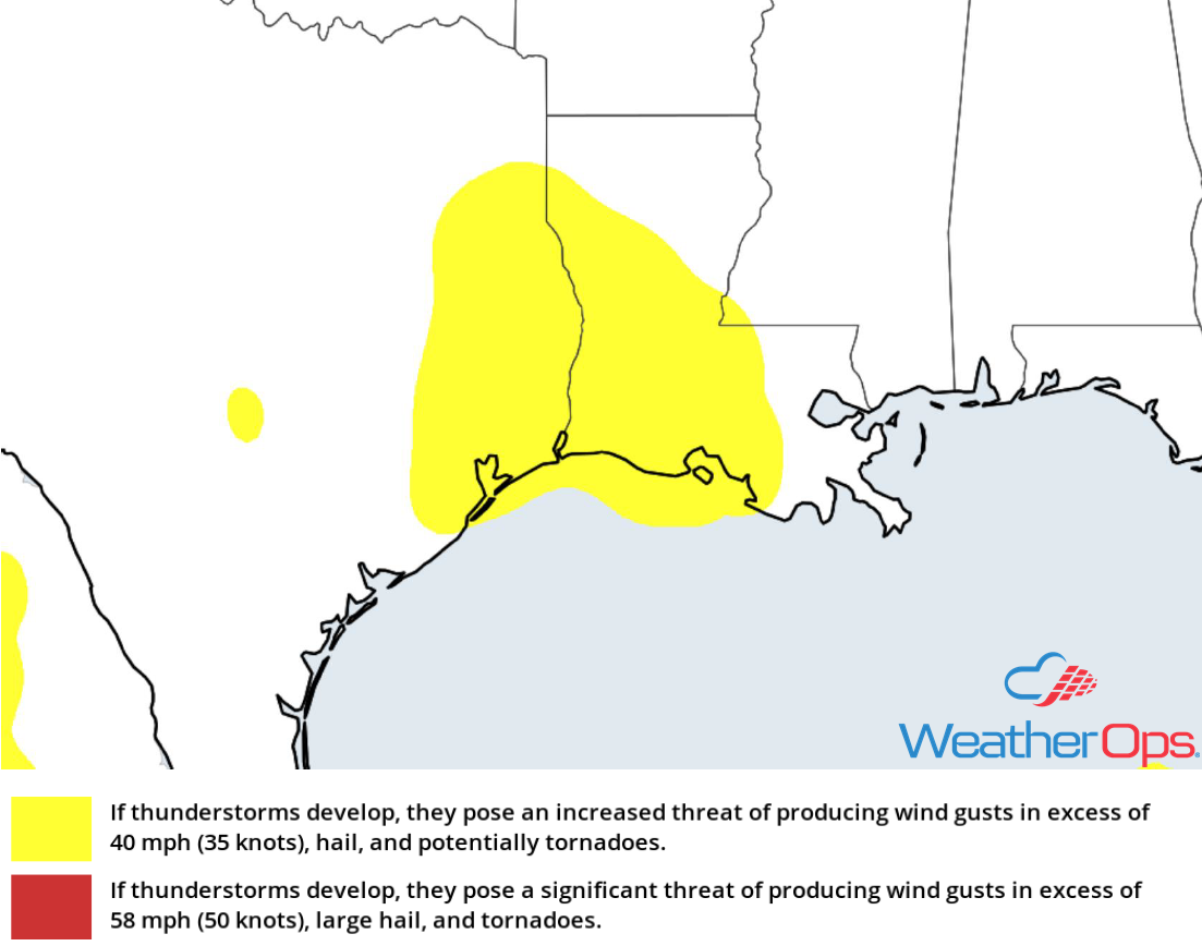 Thunderstorm Risk for Thursday
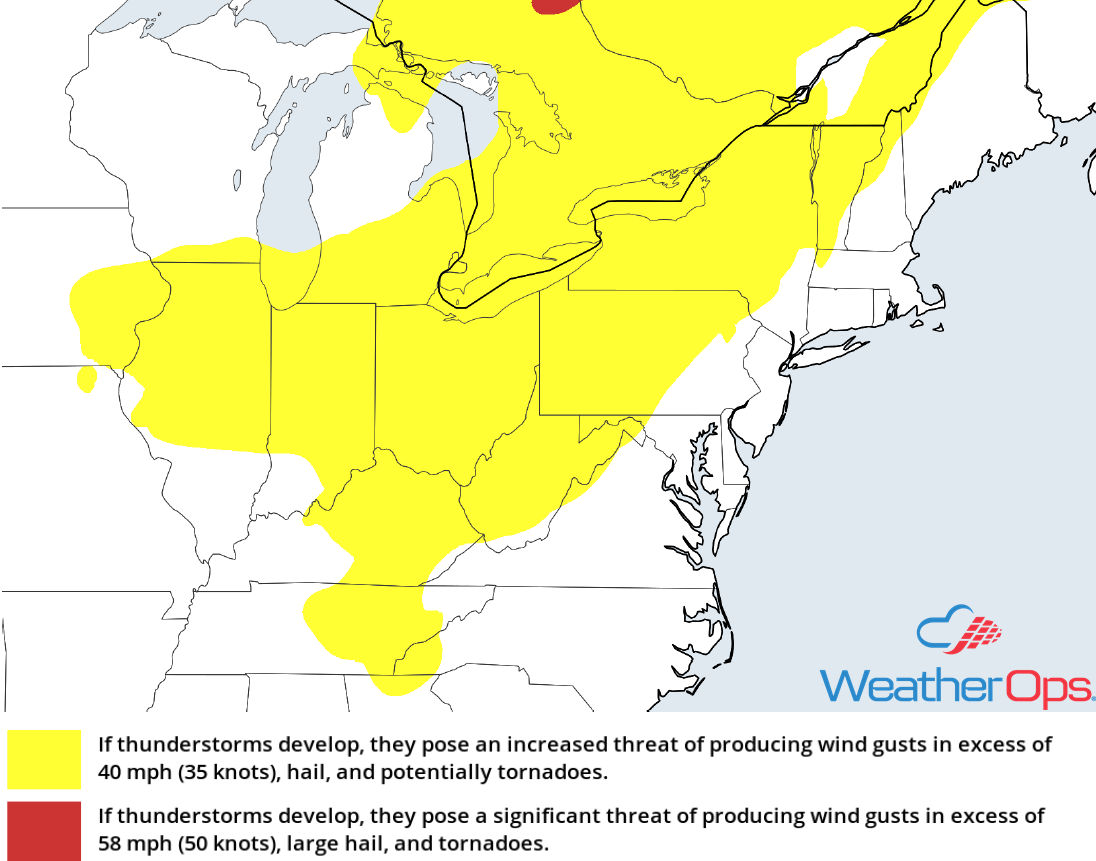
Thunderstorm Potential Thursday across the Ohio Valley into the Northeast
Increasing instability and wind shear ahead of a cold front will support the development of scattered thunderstorms across the region this afternoon and evening. Damaging winds and large hail will be the primary hazards with the stronger storms. Clusters of thunderstorms are expected to shift eastward into the Northeast after sunset.
Major Cities in Region: Columbus, OH. Cleveland, OH, Pittsburgh, PA, Buffalo, NY, Rochester, NY
 Thunderstorm Risk for Thursday
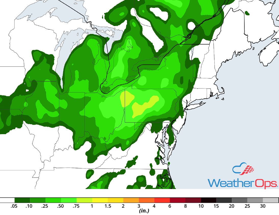
Excessive Rainfall from the Ohio Valley into the Northeast on Thursday
The thunderstorms described above will also have the potential to produce heavy rainfall during the early evening. Rainfall amounts of 1-3 inches with locally higher amounts are forecast, allowing for a possibility for excessive rainfall and flash flooding.
Major Cities in Region: Cleveland, OH, Pittsburgh, PA, State College, PA
 Rainfall Accumulation for Thursday
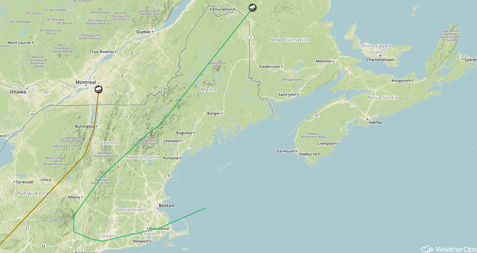
Potential for Thunderstorms Friday across New England
As the cold front described above continues to move eastward on Friday, thunderstorms may develop across portions of New England during the morning. Though remnant showers and cloud cover could limit instability, a few strong thunderstorms may develop. Hail and damaging winds will be the primary hazards with these storms. Storms will likely move offshore by mid-afternoon.
Major Cities in Region: Providence, RI, Boston, MA, Portland, ME, Augusta, ME, Bangor, ME
 SPC Convective Outlook for Friday
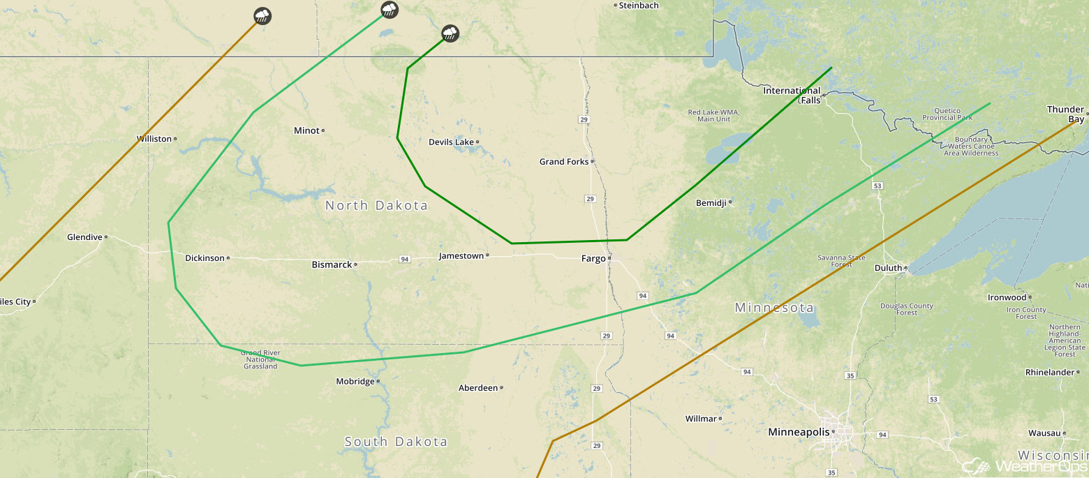
Thunderstorms across North Dakota and Minnesota on Saturday
An area of low pressure will intensify across southern Canada on Saturday. To the east and southeast of the low, warm temperatures and abundant moisture will be present across the Dakotas. With strong instability and winds aloft, thunderstorms capable of large hail and damaging winds are expected to develop. An isolated tornado or two cannot be ruled out.
Major Cities in Region: Minot, ND, Bismarck, ND, Grand Forks, ND, Fargo, ND, International Falls, MN
 SPC Convective Outlook for Saturday
Tropical Update
Tropical Depression Two (red oval) has developed east-southeast of the Lesser Antilles and is moving westward at 16 mph. This motion is expected to continue through the weekend. Further intensification into a tropical storm is expected later today or Friday before weakening over the weekend.
Showers and thunderstorms associated with a weak area of low pressure (green oval) are a few hundred miles southwest of Bermuda. Environmental conditions are still conducive for some development before the end of the week while the system moves west-northwestward and then northward. The disturbance is forecast to interact with a frontal system on Sunday, which should limit any additional development.
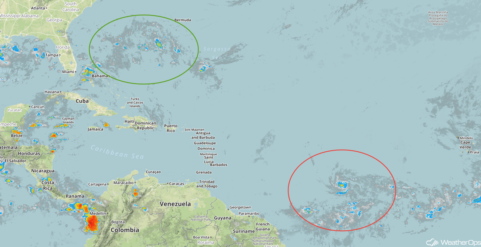 Enhanced Infrared Satellite
A Look Ahead
Showers and thunderstorms may develop across portions of the Southeast on Sunday as daytime heating increases across the region. Additional thunderstorms are expected to develop on Monday. Late Monday, thunderstorms may develop across portions of the Southern Plains as an area of low pressure intensifies. On Tuesday, the forecast shows thunderstorms across the Lower Mississippi Valley. A cold front moving across the Upper Midwest may allow for the development of thunderstorms on Wednesday.
This is just a brief look at current weather hazards. We can provide you site-specific weather forecast information for the purpose of protecting your personnel and assets and to assess your weather risk. Try a 7-day demo right away and learn how timely precision weather information can enhance your bottom line.
