National Weather Summary for Thursday, January 5, 2017
by David Moran, on Jan 5, 2017 11:33:40 AM
Light to moderate snow is expected for portions of the Rockies on Thursday as an area of low pressure moves through the region. By Thursday evening, snow will begin to move into portions of Texas and Oklahoma. Snow will continue across portions of the Ohio Valley through Friday morning as an area of low pressure moves eastward. As an area of low pressure develops across the Southeast, wintry precipitation is likely to develop from Alabama eastward into the Carolinas Friday and Saturday.
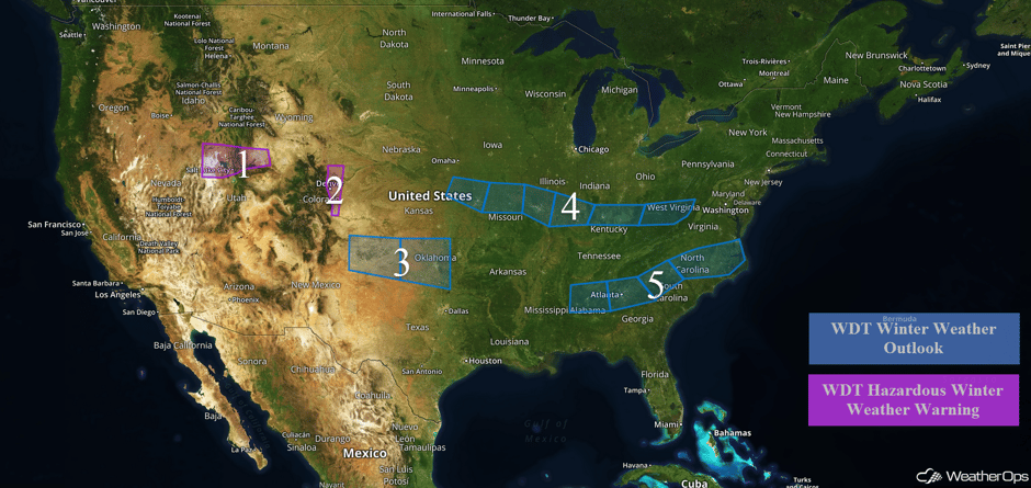 US Hazards
Region 1
Snow will continue across Region 1 through Thursday afternoon as an area of low pressure moves across the region. Total snowfall accumulations of 4-6 inches with locally higher amounts are expected in the valleys. In the higher elevations, over a foot of snow is forecast.
Major Cities in Region: Salt Lake City, UT
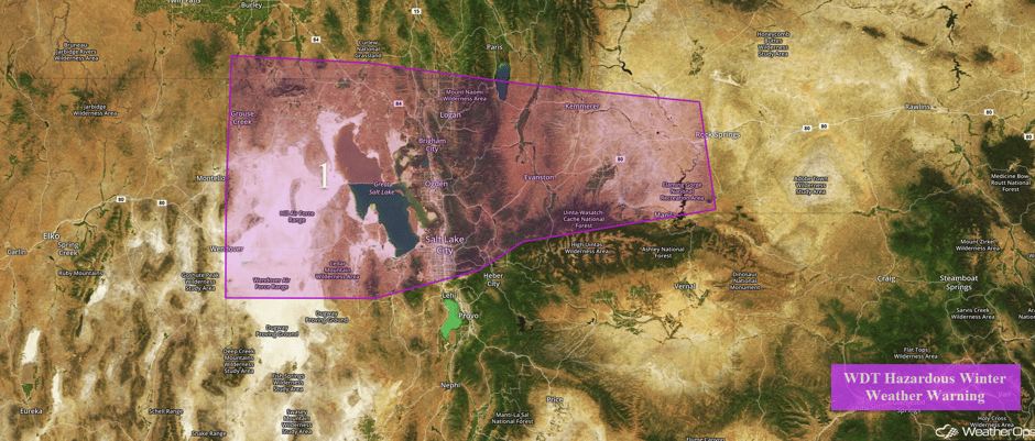 Region 1
Region 2
Significant snowfall will continue along the Front Range of Colorado through Thursday morning as an area of low pressure continues to move through the region. Snow accumulations of 4-6 inches with locally higher amounts in excess of 8 inches are forecast. In addition, wind chills will be as low as -10F.
Major Cities in Region: Denver, CO
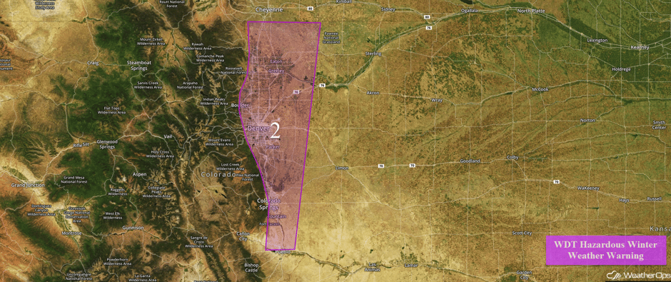 Region 2
Region 3
As the area of low pressure described above continues to progress eastward, snowfall is expected across portions of Texas and Oklahoma Thursday night into Friday morning. Snowfall accumulations of 3-6 inches are expected across the Oklahoma and Texas Panhandles. Further east, across western and central Oklahoma, snowfall accumulations of 1-2 inches with locally higher amounts in excess of 3 inches are possible.
Major Cities in Region: Amarillo, TX, Guymon, OK, Oklahoma City, OK
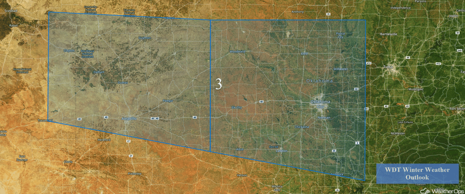 Region 3
Region 4
An upper level system is expected to move across portions of the Plains and into the Ohio Valley, bringing snow to these regions, Snowfall amounts of 2-3 inches with locally higher amounts in excess of 4 inches are forecast for much of the region. For portions of southeastern Ohio, northeastern Kentucky, and West Virginia, snowfall amounts of 2-4 inches with locally higher amounts in excess of 5 inches are expected. Wind chills of 15-25F are also forecast. By Thursday evening, light snow will move into the Washington, DC and Baltimore areas with 1-2 inches of snow expected.
Major Cities in Region: Columbia, MO, St. Louis, MO, Evansville, IN, Louisville, KY, Charleston, WV, Washington, DC, Baltimore, MD
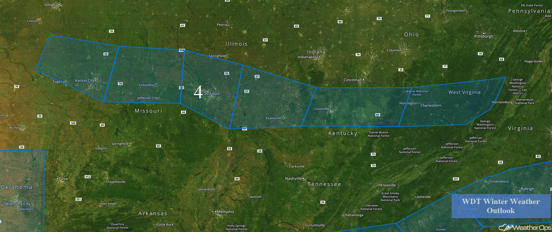 Region 4
Region 5
As a surface low develops to the south of Region 5, wintry precipitation is forecast to develop to the north of the warm front associated with the low. As temperatures fall rapidly below freezing, precipitation is expected to fall mainly as snow, with some sleet mixed in. Snowfall amounts of 1-3 inches, as well as some sleet, are expected through Saturday morning. Further to the east across northern Georgia, snowfall amounts of 1-3 inches with locally higher amounts of 4 inches is expected. Snow will begin across the Carolinas Friday evening and continue into Saturday where 2-4 inches and locally higher amounts in excess of 5 inches are expected.
Major Cities in Region: Birmingham, AL, Atlanta, GA, Charlotte, NC, Raleigh, NC, Norfolk, VA
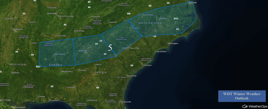 Region 5
Excessive Rainfall Possible for Northern California on Saturday
A system moving into the western US will bring the potential for excessive rainfall across portions of northern California. Rainfall amounts of 2-4 inches with locally higher amounts in excess of 5 inches will be possible along the northern California coast.
Major Cities in Region: Eureka, CA, San Francisco, CA
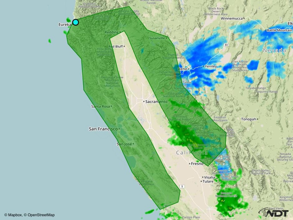 Excessive Rainfall Risk Outline for Saturday
Significant Snowfall Possible for Sierra Nevada on Saturday
Another storm system will be moving ashore on Saturday, bringing deep moisture with it. Heavy snowfall is expected across the Sierra Nevada beginning late Friday. Snowfall amounts of 8-10 inches with locally higher amounts in excess of 12 inches are expected.
Major Cities in Region: Reno, NV
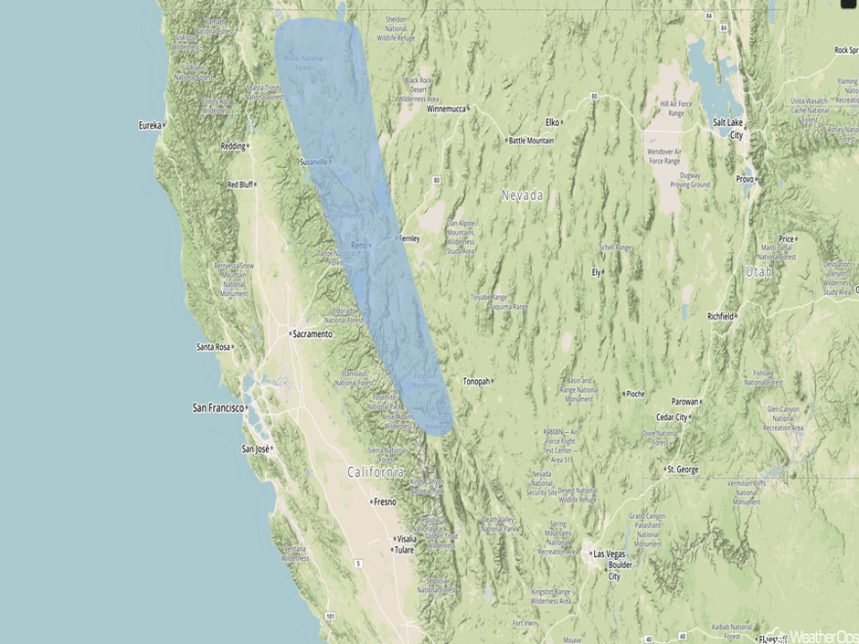 Significant Snowfall Risk Outline for Saturday
A Look Ahead
Snow will continue for the Sierra Nevada on Sunday, bringing snowfall totals over two feet in the highest peaks. In the lower elevations of northern California and Southern Oregon, heavy rain is expected Sunday into Monday with two day rainfall totals of 4-6 inches with locally higher amounts in excess of 8 inches expected.
This is just a brief look at current weather hazards. We can provide you site-specific forecast information for the purpose of protecting your personnel and assets. Try a 7-day demo right away and learn how timely precision weather information can enhance your bottom line.


