National Weather Summary for Thursday, January 4, 2018
by David Moran, on Jan 4, 2018 11:03:26 AM
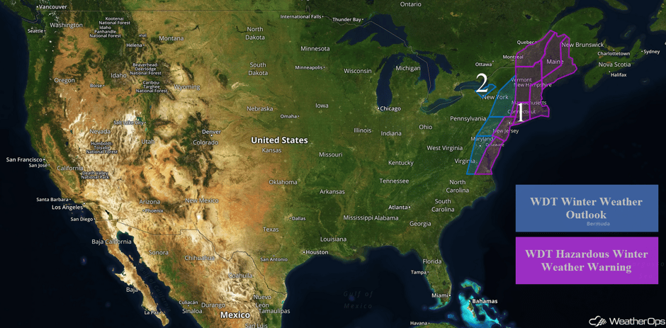
Snow and light freezing rain will continue for portions of the Mid Atlantic and Northeast through Friday as an area of low pressure moves northward. Lake effect snow will continue for portions of western New York through Saturday.
- Wintry Precipitation Continuing for the Mid Atlantic and Northeast through Friday
- Snow Continuing through Saturday across Western New York
 US Hazards
Wintry Precipitation Continuing for the Mid Atlantic and Northeast through Friday
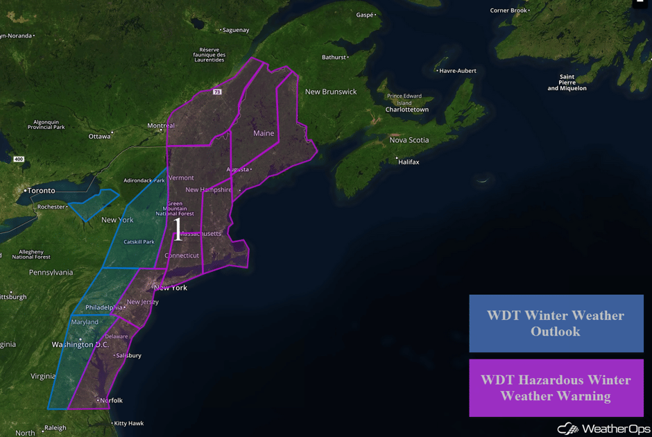
Snow and light freezing rain will continue for portions of the Mid Atlantic and Northeast through Friday as an area of low pressure tracks northward along the East Coast. From southern Virginia into the Delmarva Peninsula, snow accumulations of 4-7 inches with locally higher amounts in excess of 10 inches are expected. Further inland across Virginia into Maryland, snow accumulations of 1-3 inches with locally higher amounts in excess of 4 inches are forecast. Some light freezing rain may also develop. In addition, winds of 15-20 mph with gusts in excess of 25 mph are expected. Across eastern Pennsylvania, snow accumulations of 2-4 inches with locally higher amounts in excess of 5 inches are forecast. Winds will range 20-35 mph with gusts in excess of 40 mph, allowing for low visibilities. From New Jersey into southern New York, 4-7 inches of snow with locally higher amounts in excess of 9 inches are expected. With winds of 25-40 mph and gusts in excess of 45 mph, there will be the potential for blowing snow and reduced visibilities.
Further north across northeast Pennsylvania into eastern New York, 2-4 inches of snow with locally higher amounts in excess of 5 inches are forecast. Winds of 20-35 mph with gusts in excess of 40 mph are expected in addition to the snow. From Long Island into central Massachusetts, 7-11 inches of snow are forecast with locally higher amounts in excess of a foot. Winds of 20-40 mph and gusts in excess of 50 mph will allow for blowing snow, reduced visibilities, and wind chills of -15 to -25 F. For portions of eastern New York, western Connecticut, Vermont, and New Hampshire, snow accumulations will range 4-8 inches. From Rhode Island northward into southern Maine, 8-14 inches of snow with locally higher amounts in excess of 16 inches are expected. Across much of southeastern Maine, snow accumulations of 10-14 inches with locally higher amounts in excess of 20 inches are forecast. Winds along the coast will be 40-50 mph with gusts in excess of 60 mph, resulting in wind chills below -30F. Across northern Maine, 8-12 inches with locally higher amounts in excess of 15 inches are expected.
Major Cities in Region: Norfolk, VA, Washington, DC, Philadelphia, PA, New York, NY, Albany, NY, Boston, MA, Augusta, ME, Bangor, ME
 Region 1
Snow Continuing through Saturday across Western New York
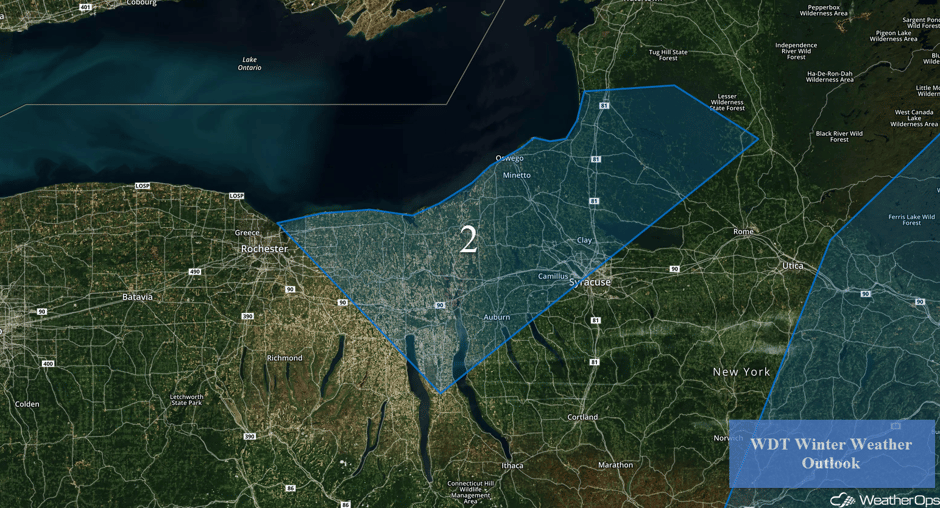
Northwesterly winds building on the southwest side of an area of low pressure will promote some moderate to heavy lake effect snow through Saturday. Accumulations of 4-8 inches with locally higher amounts in excess of 9 inches are forecast. In addition, blowing snow will reduce visibility and make travel difficult.
Major Cities in Region: Rochester, NY, Syracuse, NY
 Region 2
A Look Ahead
An area of low pressure developing across the Central US will move into the Mississippi Valley on Sunday, producing mixed wintry precipitation for the Central and Northern US. For the Midwest, mixed winter precipitation, including freezing rain and snow, is expected. At this time, accumulations don't look particularly hazardous, but some icing accumulations could cause areas of difficult travel in some areas. Accumulations will generally be near a tenth of an inch.
This is just a brief look at current weather hazards. We can provide you site-specific weather forecast information for the purpose of protecting your personnel and assets and to assess your weather risk. Try a 7-day demo right away and learn how timely precision weather information can enhance your bottom line.


