National Weather Summary for Thursday, February 9, 2017
by David Moran, on Feb 9, 2017 11:44:21 AM
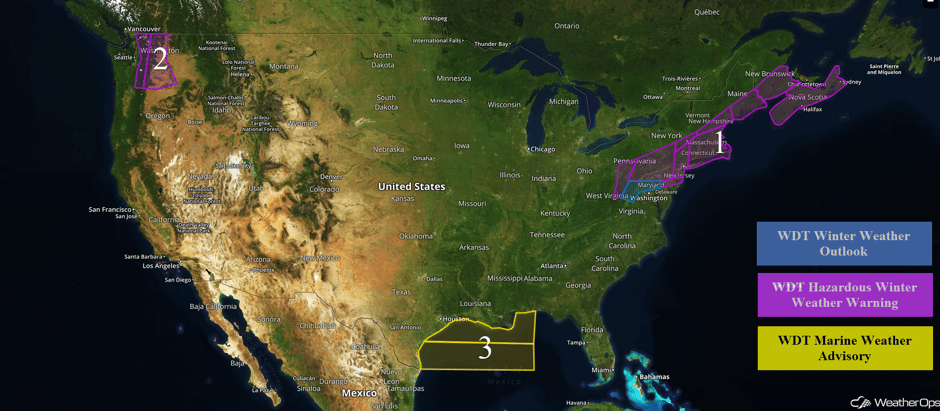
Heavy snow will continue across the Northeast through Friday as an area of low pressure moves through the region. Across portions of Washington, snow will wind down as warmer air moves into the region. Elevated winds and seas are expected across portions of the Gulf of Mexico as a cold front moves southward.
 US Hazards
Region 1
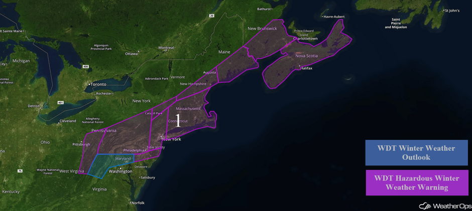
As an area of low pressure moves along the Northeast coast, snow will continue across the Northeast through early Friday.
- For portions of Maryland, Delaware, and New Jersey, snow accumulations of 4-6 inches are forecast. In addition to the snow, northerly winds of 15-25 mph with gusts in excess of 35 mph are expected.
- By midday, snow will mix with some sleet, possibly allowing for hazardous travel. Across northern New Jersey, and portions of New York, including the New York City area, moderate to heavy snow will continue through early afternoon. This activity will move eastward by late afternoon. Snow accumulations of 8-12 inches with locally higher amounts are expected.
- Further to the northeast across portions of Connecticut and Massachusetts, heavy snow and strong winds are expected through late Thursday evening. Snowfall amounts of 10-14 inches are expected with locally higher amounts are forecast. In addition to the snow, northerly winds 15-25 mph with gusts excess of 40 mph will be possible; wind gusts will be higher along the coast.
- Snow will persist across Maine until early Friday morning where 6-9 inches of snow are expected with locally higher amounts.
Full-on whiteout in Fitchburg, MA right now! Updated snowfall total shortly. #noaacoop #skywarnspotter #mawx @WX1BOX @NWSBoston @ericfisher pic.twitter.com/1L8qx6zKMz
— Greg Forrister (@GregForrister) February 9, 2017
Holy smokes! Over 300 cloud-to-ground #lightning strikes have occurred with #thundersnow over Southern New England. #CTwx #RIwx #MAwx pic.twitter.com/uMMk35xUVl
— Jeff Buck (@Jeff_Buck) February 9, 2017
LIVE CAM - Wenham, MA
— Weather Webcam (@ActiveWxCams) February 9, 2017
21° with HEAVY snow and winds gusting 30+ mph in northeast Mass. #mawxhttps://t.co/xPDDpUTsax pic.twitter.com/SJ55QxGbx3
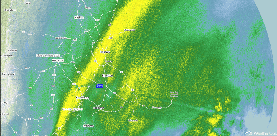
Update 3pm EST: Heavy snow moving through Boston.
 Radar 3pm EST
Massachusetts Power Outages: 25,000+ as of 332 PM centered in Cape Cod and the Southern Plymouth County Mass Area. #mawx
— NWS Taunton Skywarn (@WX1BOX) February 9, 2017
Major Cities in Region: New York City, NY, Boston, MA, Portland, ME, Augusta, ME, Bangor, ME
 Region 1
Region 2
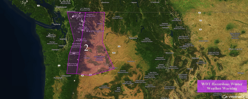
Snow will wind down across portions of Washington Thursday morning as temperatures begin to rise above freezing. Above elevations of 5000 feet, total accumulations of 16-18 inches of snow are expected with locally higher amounts in excess of 24 inches. In the valleys, 2-4 inches of snow with isolated higher amounts in excess of 6 inches are forecast. In addition, freezing rain accumulations between a tenth and a quarter of an inch are possible.
Major Cities in Region: Yakima, WA
 Region 2
Region 3
Elevated winds and seas will continue throughout the day on Thursday as a cold front moves southeastward across the Gulf of Mexico. Ahead of the front, winds will be southwesterly at 15-20 knots. In the wake of the front, winds will be northeasterly to north-northeasterly of 20-25 knots with gusts in excess of 35 knots. Seas of 4-6 feet near the shore and 6-9 feet in the deeper waters are expected.
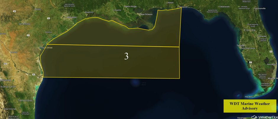 Region 3
Excessive Rainfall Possible for the Pacific Northwest on Thursday
A Pacific front is expected to move onshore with heavy to excessive rainfall expected from northern California into Oregon. Total rainfall accumulations of 3-4 inches with isolated higher amounts in excess of 5 inches are forecast.
Major Cities in Region: Portland, OR, Eureka, CA
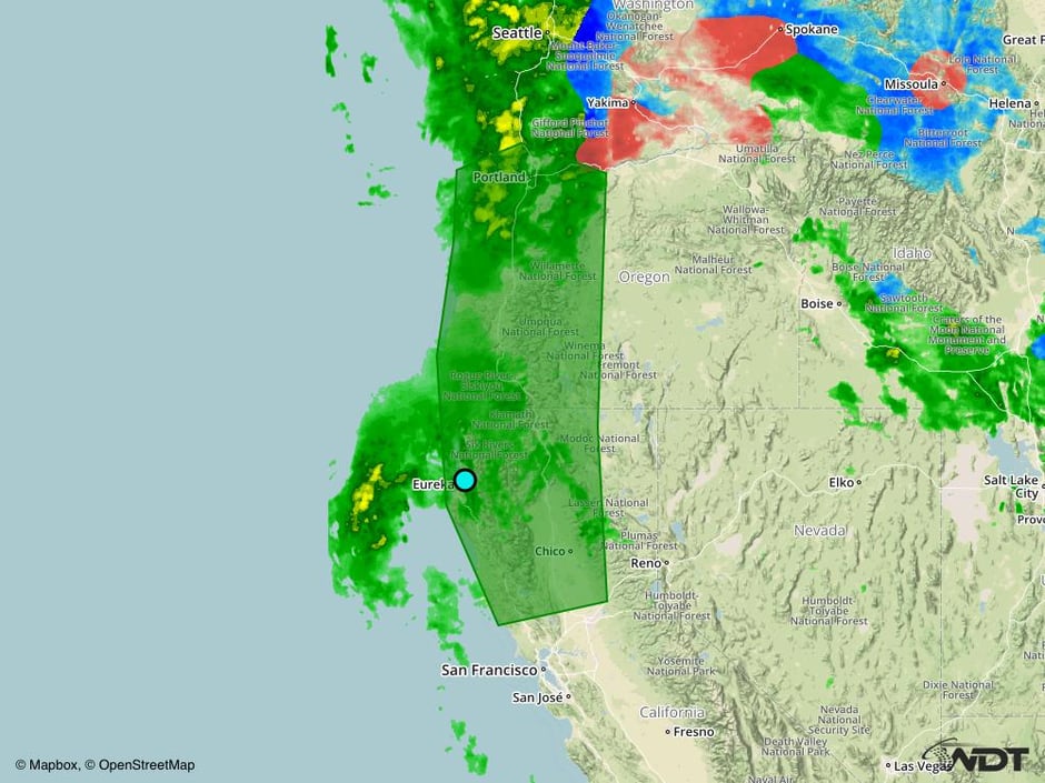 Excessive Rainfall Risk Outline for Thursday
A Look Ahead
Snow and gusty winds will wind down across the Northeast early Friday as an area of low pressure moves out of the region. The system bringing excessive rainfall to portions of the Pacific Northwest on Thursday will bring snow to the higher elevations on Friday. Snow will continue across the Mountain West into the weekend. An area of low pressure may bring some light snow to portions of the Northeast on Monday. By Tuesday, an area of low pressure will track into the Southeast, allowing for the potential for thunderstorms.
This is just a brief look at current weather hazards. We can provide you site-specific forecast information for the purpose of protecting your personnel and assets. Try a 7-day demo right away and learn how timely precision weather information can enhance your bottom line.


