


by David Moran, on Feb 8, 2018 10:16:51 AM
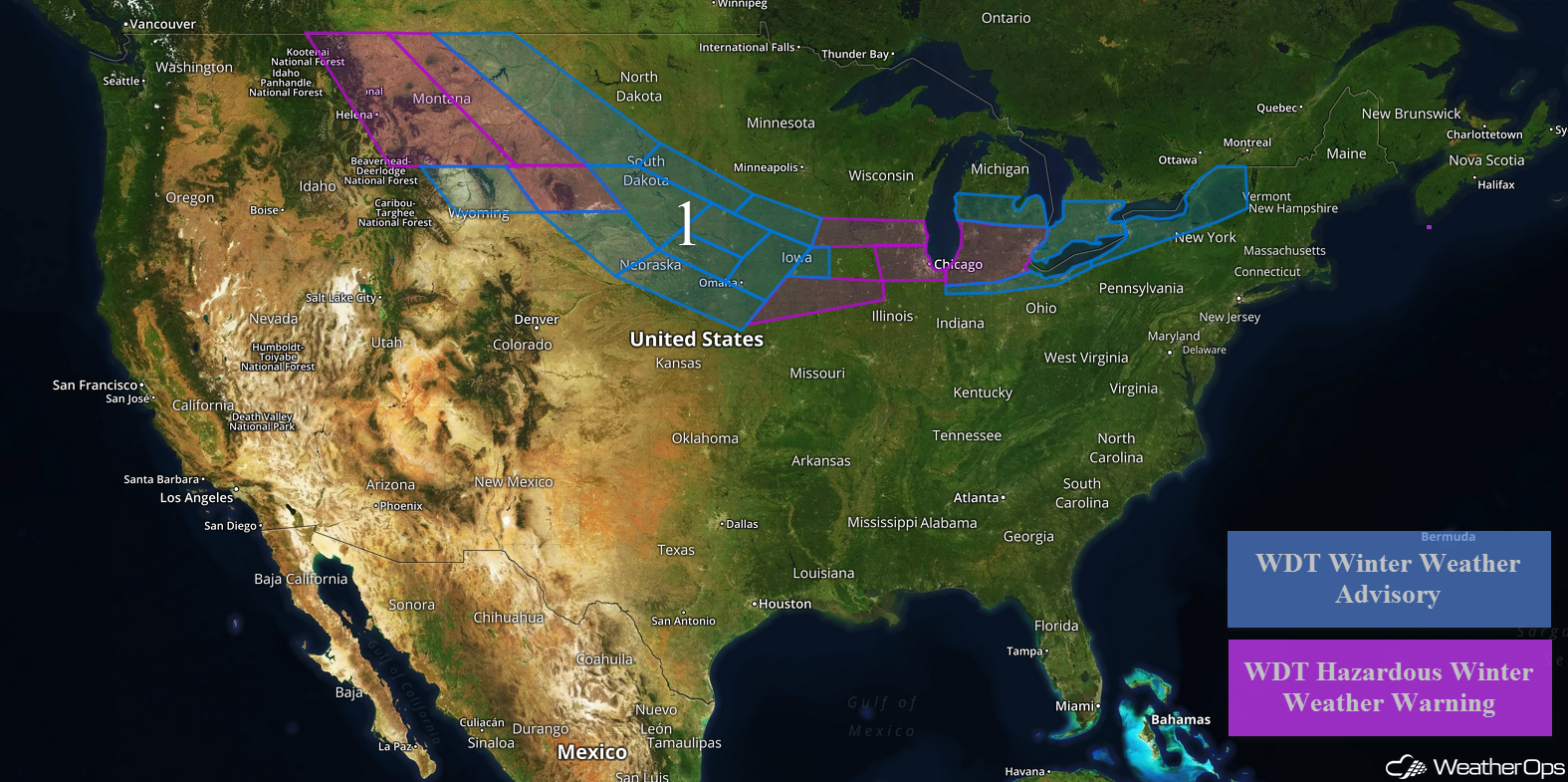
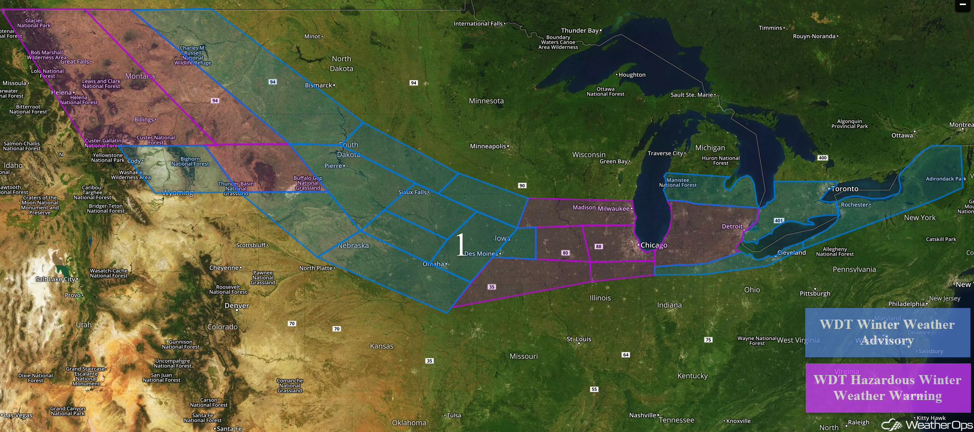
Wintry precipitation will continue across the Northern Rockies and Plains on Thursday before spreading into the Great Lakes and Northeast through Sunday behind a cold front.
- Wintry Precipitation Expected from Montana into the Northeast through Sunday
 US Hazards

Wintry Precipitation Expected from Montana into the Northeast through Sunday
Snow will continue across portions of Montana and the Plains through Friday behind a cold front. In the lower elevations of Montana, 5-10 inches of snow are expected. Across the higher elevations, 12-20 inches are forecast. For southern portions of Montana and northern portions of Wyoming, 3-5 inches of snow with locally higher amounts are expected. In addition, winds of 30-40 mph will allow for wind chills below zero, blowing snow, and low visibilities. Across eastern portions of Montana and Wyoming, 4-6 inches of snow with locally higher amounts in excess of 7 inches are expected. For portions of Nebraska and South Dakota into western Iowa, snow accumulations will range 2-5 inches. From eastern Iowa into southern Wisconsin and northern Illinois, 4-7 inches of snow are expected with locally higher amounts through Saturday afternoon.
Across northeastern Illinois into northwestern Indiana, snow accumulations of 5-9 inches with locally higher amounts in excess of 10 inches are forecast. For central Michigan, snowfall amounts will range 2-4 inches with locally higher amounts in excess of 6 inches. Further south across southern Michigan, northern Indiana, and northwestern Ohio, 6-9 inches of snow are expected with locally higher amounts in excess of a foot. South of this band across portions of northern Indiana into northern Ohio, 2-4 inches of snow with locally higher amounts in excess of 6 inches are forecast. Across western and northern portions of New York, 4-8 inches with locally higher amounts in excess of 10 inches are expected from Friday morning through Sunday afternoon. In addition, some light icing will be possible.
Major Cities in Region: Helena, MT, Great Falls, MT, Billings, MT, Rapid City, SD, Pierre, SD, Sioux Falls, SD, Omaha, NE, Des Moines, IA, Milwaukee, WI, Chicago, IL, Detroit, MI, Cleveland, OH, Buffalo, NY, Rochester, NY, Syracuse, NY
 Region 1
A Look Ahead
Early next week, high pressure will build across the central and eastern US. A weak system may bring some light snow to portions of the Northern Rockies into the Northern Plains on Monday. This snow may continue into Tuesday.
That is a brief look at current weather hazards. We can provide you site-specific weather forecast information to protect your staff and assets and to assess your weather risk. Try a 7-day demo right away and learn how timely precision weather information can enhance your bottom line.
