by David Moran, on Feb 25, 2016 10:33:59 AM

by David Moran, on Feb 25, 2016 10:33:59 AM
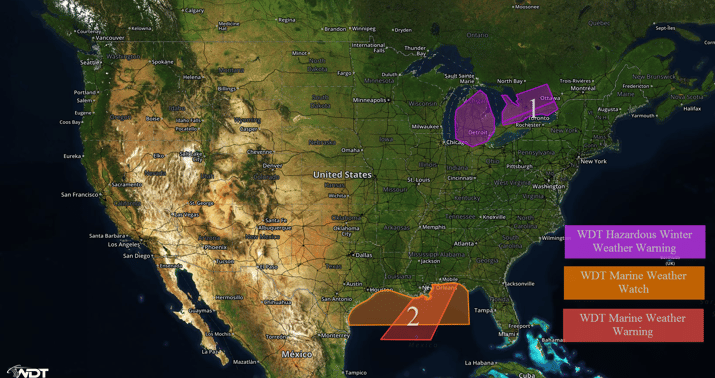
Periods of heavy snow, gusty winds, and low visibilities will continue across the Great Lakes on Thursday. Across the northern Gulf of Mexico, strong northerly winds of 20-25 knots will be possible through early Friday morning in the wake of a frontal passage.

US Hazards
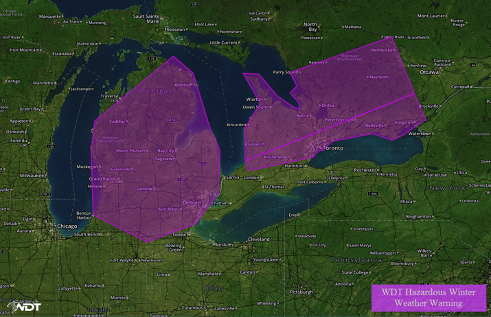
Snow will taper off across Region 1 through the afternoon hours on Thursday. Snowfall accumulations of 6-10 inches with locally heavier amounts in excess of 12 inches will be possible. In addition, breezy winds could produce areas of blowing snow and reduced visibilities. As a result, hazardous travel conditions will be possible on Thursday.

Region 1
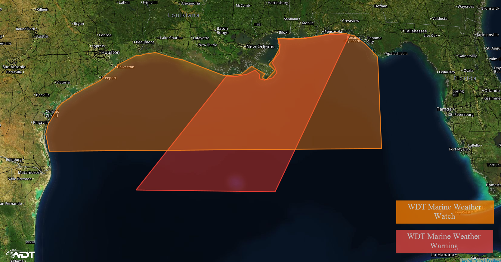
A weak cold front will move off the Northern Gulf Coast Thursday evening. The frontal passage will be accompanied by a shift to strong northerly winds of 20-25 knots. At this time, shower and thunderstorm activity is not expected. Winds are expected to decrease on Friday.

Region 2
This is where you give the visitor a brief introduction to both this blog and your company. Keep it short. More →