


by David Moran, on Feb 21, 2019 10:42:40 AM
Excessive rainfall is forecast over the Lower Mississippi Valley through Friday as a front stalls over the region. Snow will continue across the Four Corners region through Friday as an area of low pressure develops. Fog is expected along portions of the Gulf Coast Thursday morning through Friday.
- Excessive Rainfall through Friday across the Lower Mississippi Valley
- Snow for the Four Corners Region through Friday
- Fog Thursday Morning through Friday along the Gulf Coast
- Thunderstorms from Texas into the Lower Mississippi Valley Friday
- Potential for Snow Friday across the Northern Plains
- Risk for Thunderstorms from the Mississippi Valley into the Tennessee Valley Saturday
- Excessive Rainfall Saturday across the Lower Ohio Valley
- Snow from the Central Plains into the Midwest on Saturday
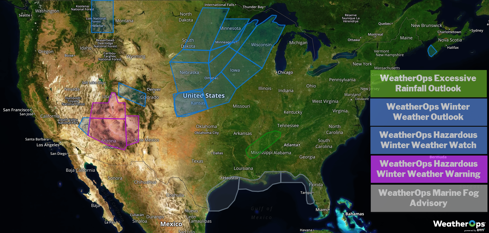
US Hazards
Excessive Rainfall through Friday across the Lower Mississippi Valley
A stalled frontal boundary associated with a developing area of low pressure will be the focus for heavy rainfall across the region. Two day rainfall totals will range 2-4 inches with locally higher amounts in excess of 5 inches; the heaviest rainfall will likely extend from northern Louisiana northeastward into central Tennessee. Given recent rainfall, there will be an increased risk for flooding.
Major Cities in Region: Monroe, LA, Memphis, TN, Nashville, TN
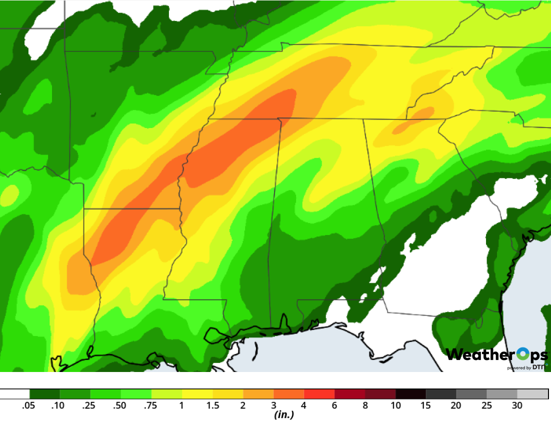
Rainfall Accumulation through Friday
Snow for the Four Corners Region through Friday
A developing area of low pressure is expected to bring snowfall to the Four Corners region through Friday. Accumulations will range 5-10 inches with locally higher amounts in excess of a foot. In addition, wind gusts in excess of 30 mph will allow for blowing snow and hazardous travel conditions.
Major Cities in Region: St. George, UT, Flagstaff, AZ, Farmington, NM, Durango, CO
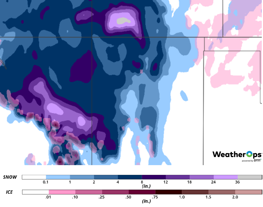
Snow Accumulation through Friday
Fog Thursday Morning through Friday along the Gulf Coast
Winds will weaken along the coast through Friday. With the weak winds and abundant moisture, fog will develop along the Gulf Coast. Visibility will be less than half a mile at times.
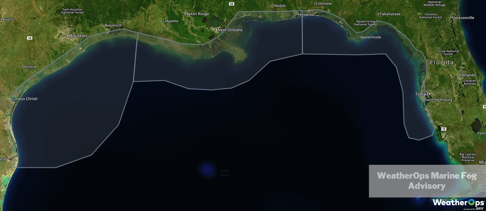
WeatherOps Marine Fog Advisory
Thunderstorms from Texas into the Lower Mississippi Valley Friday
As a developing area of low pressure and cold front tracks into the southern states on Friday, thunderstorms may develop across eastern Texas into portions of Arkansas and Louisiana. Storms will likely be linear, yet scattered in nature. They are expected to move northeastward and intensify. Damaging winds, large hail, and an isolated tornado or two will be potential hazards with these storms.
Major Cities in Region: Dallas, TX, Fort Smith, AR, Shreveport, LA, Jackson, MS
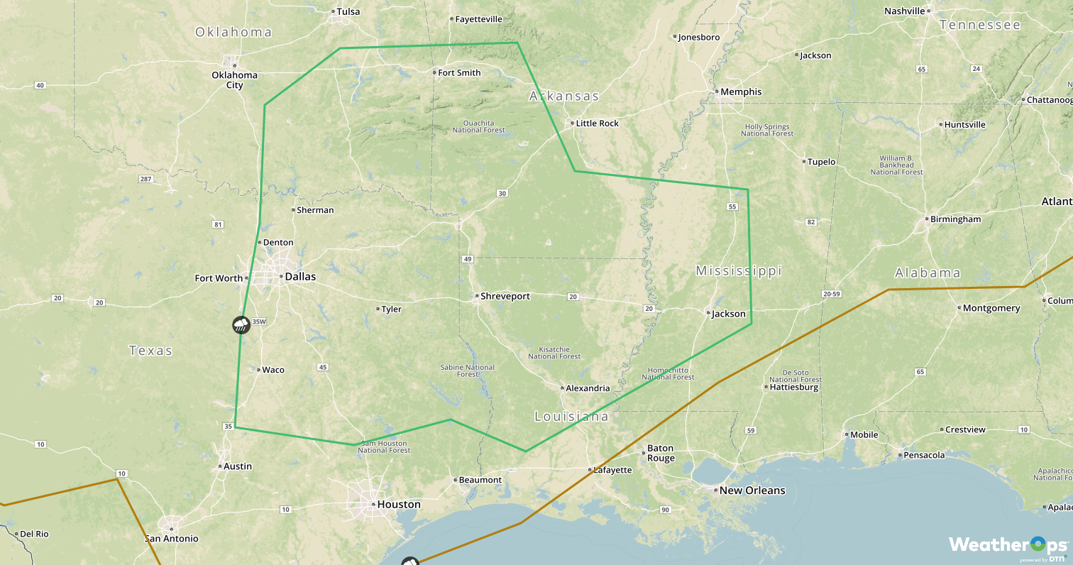
SPC Convective Outlook for Friday
Potential for Snow Friday across the Northern Plains
As a deep trough develops to the southwest, the potential for significant snowfall across the Northern Plains will increase. Accumulations of 4-8 inches are forecast as the low moves northward.
Major Cities in Region: Pierre, SD, Grand Forks, ND, Sioux Falls, SD
Snow Accumulation for Friday
Risk for Thunderstorms from the Mississippi Valley into the Tennessee Valley Saturday
As an area of low pressure continues to develop and bring warm, moist air northward, there will be a potential for severe thunderstorms on Saturday. Some activity may develop along the warm front as it tracks northward through the Tennessee Valley. A secondary and stronger line of thunderstorms is likely along the cold front as it stretches from the southern Gulf States northward into Kentucky. Damaging winds, small hail, and tornadoes will be potential hazards with these storms.
Major Cities in Region: Little Rock, AR, Memphis, TN, Jackson, MS, New Orleans, LA, Birmingham, AL, Nashville, TN, Louisville, KY, Knoxville, TN
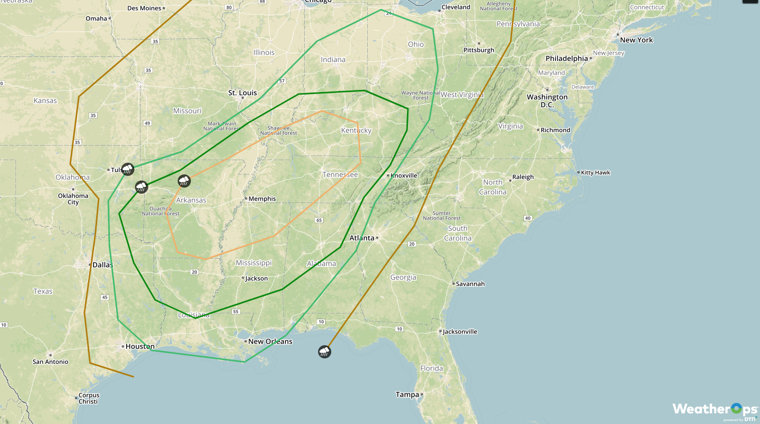
SPC Convective Outlook for Saturday
Excessive Rainfall Saturday across the Lower Ohio Valley
The area of low pressure described above will bring the potential for excessive rainfall to the Lower Ohio Valley on Saturday. Rainfall amounts will range 1-3 inches, leading to a potential for flooding. The highest rainfall totals are expected from eastern Kentucky into West Virginia.
Major Cities in Region: Paducah, KY, Louisville, KY, Charleston, WV
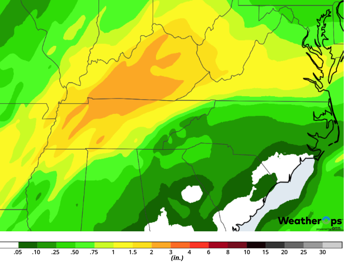
Rainfall Accumulation for Saturday
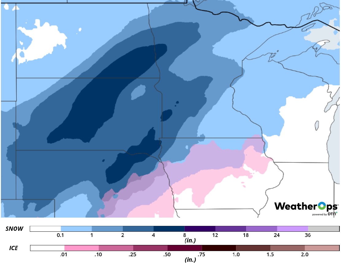
Snow from the Central Plains into the Midwest on Saturday
As an upper level trough continues to intensify across the Central Plains on Saturday, wintry precipitation is expected across the Plains and Midwest. Snowfall amounts of 4-8 inches are expected, with a broad area of freezing rain and sleet expected further to the south and east. Freezing rain and sleet accumulations up to 0.15 inch are expected. This precipitation will briefly transition to rain before the back end of the system pulls in colder air to produce snow.
Major Cities in Region: Dodge City, KS, Topeka. KS, Omaha, NE, Kansas City, MO, Des Moines, IA, Minneapolis, MN, Wausau, WI, Green Bay, WI, Milwaukee, WI
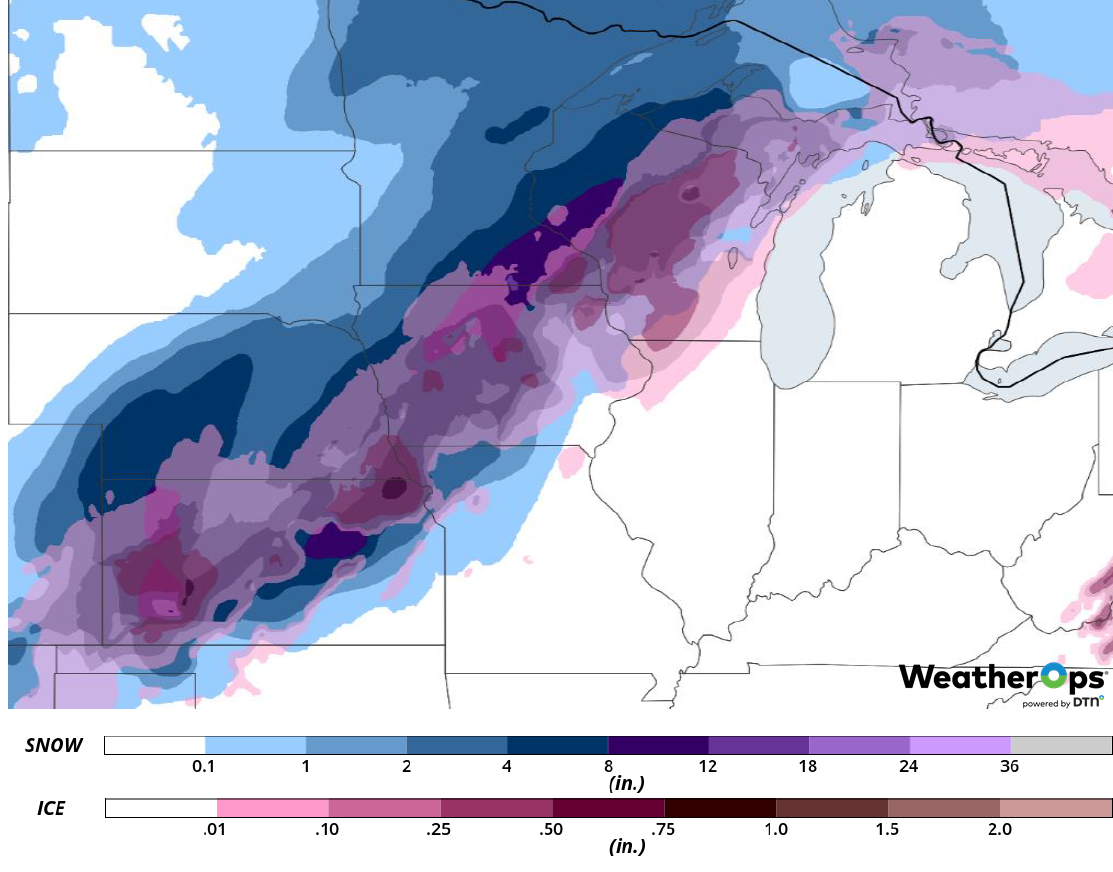
Snow and Ice Accumulation for Saturday
A Look Ahead
Snow will continue across the Great Lakes on Sunday as an area of low pressure moves northeastward. Light snow may move into the Northern Plains and Upper Midwest on Monday. This activity will spread into the Great Lakes on Tuesday. Freezing rain and snow are forecast Wednesday across portions of the Plains and Midwest.
