National Weather Summary for Thursday, December 21, 2017
by David Moran, on Dec 21, 2017 10:59:30 AM
Snow is expected to continue from the Rockies to the Great Lakes on Thursday as an area of low pressure moves across the Northern Plains.
- Snow from the Rockies to the Great Lakes through Early Friday Morning
- Potential for Snow Friday into Saturday Morning for the Northeast
- Excessive Rainfall from Northeast Texas into Kentucky Friday into Saturday Morning
 US Hazards
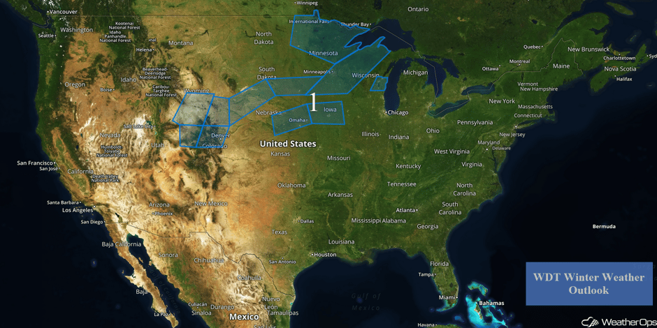
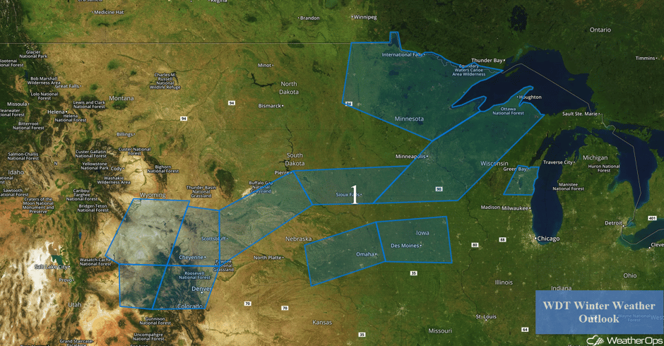
Snow from the Rockies to the Great Lakes through Early Friday Morning
Snow will continue across the Central Rockies northeastward into the Plains and Great Lakes as an area of low pressure moves through the region. Across the Rockies, snowfall accumulations of 2-4 inches are expected in the valleys with locally higher amounts in excess of 6 inches. In the higher elevations, 5-10 inches with locally higher amounts in excess of a foot are forecast. Winds 20-30 mph with gusts in excess of 40 mph will allow for blowing snow and low visibilities. Further east across the Plains, 2-4 inches of snow are forecast from western Nebraska into Wisconsin. From central Nebraska into central Iowa, snow accumulations will generally be less than an inch. In addition to the snow across central Nebraska into central Iowa, there is the potential for some light freezing rain; accumulations are expected to be less than a tenth of an inch. Snow accumulations across eastern North Dakota and northern Minnesota will range 3-5 inches.
Major Cities in Region: Denver, CO, Cheyenne, WY, Sioux Falls, SD, Omaha, NE, Des Moines, IA, International Falls, MN, Minneapolis, MN, Green Bay, WI
 Region 1
Potential for Snow Friday into Saturday Morning for the Northeast
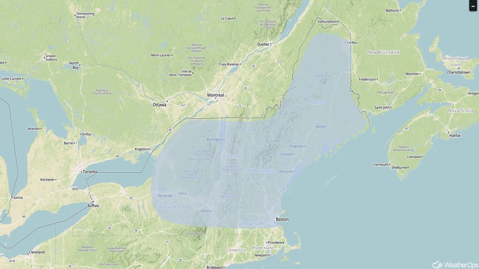
The same area of low pressure mentioned above will move into the Great Lakes early Friday, with a warm front extending eastward. Moist air will be moving northward to the east of the low. Snow is expected to continue from the Great Lakes into New England through Saturday morning. Accumulations of 2-4 inches with locally higher amounts in excess of 5 inches are expected. Some light freezing rain may also develop from southern New York into portions of Massachusetts and Connecticut.
Major Cities in Region: Syracuse, NY, Albany, NY, Boston, MA, Portland, ME, Bangor, ME, Caribou, ME
 Snow Risk Outline for Friday and Saturday
Excessive Rainfall from Northeast Texas into Kentucky Friday into Saturday Morning
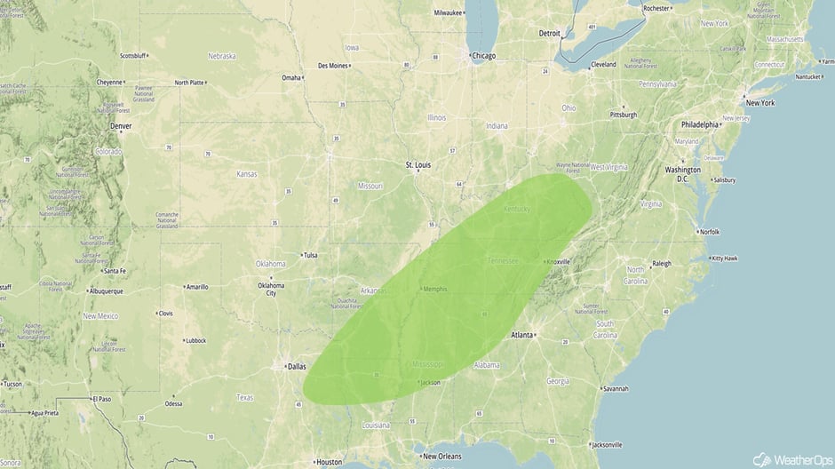
Late Friday, an upper level system will move across the Central US. With warm, moist air moving northward ahead of a slow-moving cold front and the upper level system moving over the region, widespread showers and thunderstorms are expected along the front. This activity could produce very heavy rainfall, especially from northeast Texas across adjacent parts of Arkansas and Louisiana into Tennessee and south central Kentucky. Rainfall amounts of 2-4 inches are expected with locally heavier amounts in excess of 5 inches in locations that receive multiple rounds of thunderstorms. This will result in a flash flooding threat. The heaviest rainfall is expected to continue overnight into Saturday morning.
Major Cities in Region: Shreveport, LA, Memphis, TN, Birmingham, AL, Lexington, KY
 Excessive Rainfall Risk Outline for Friday and Saturday
A Look Ahead
Model guidance is indicating a surface low well underway in the Northeast by early Christmas morning. Snow is likely to develop to the north and northwest of this low, and some of this snow could be heavy. The low is forecast to move rapidly to the northeast, however, which should limit accumulations. Uncertainty remains high in regard to exact placement of the low.
This is just a brief look at current weather hazards. We can provide you site-specific weather forecast information for the purpose of protecting your personnel and assets and to assess your weather risk. Try a 7-day demo right away and learn how timely precision weather information can enhance your bottom line.


