National Weather Summary for Thursday, August 4, 2016
by David Moran, on Aug 4, 2016 11:30:15 AM
A cold front will be the focus for the development of thunderstorms across portions of the Central Plains and Upper Midwest on Thursday. Monsoonal rains will continue across the Desert Southwest. Heavy rain will be possible across the Southeast along a stationary front. On Friday, monsoonal rains will continue across the Desert Southwest and Southern Rockies. Into the weekend, thunderstorms will be possible across the Northeast ahead of a cold front. Monsoonal rains will continue across the Four Corners region.
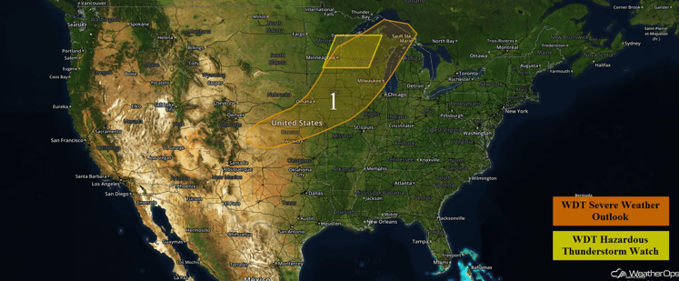
US Hazards
Region 1
Thunderstorms are ongoing this morning across portions of the Upper Mississippi Valley, but will likely weaken by late morning. A cold front moving into the region will act as a focus for new thunderstorm development later this afternoon. Conditions will be favorable for some of these thunderstorms to become severe, with hail in excess of one inch and damaging winds in excess of 60 mph the primary hazards. Farther southwest over the Central Plains, thunderstorms are expected to be more isolated in nature, but a few could be strong and produce gusty winds and small hail. The severe weather threat should diminish across the region during the evening hours.
Update 11:46am: Severe thunderstorms capable of hail and damaging winds are moving across portions of Northern Iowa.
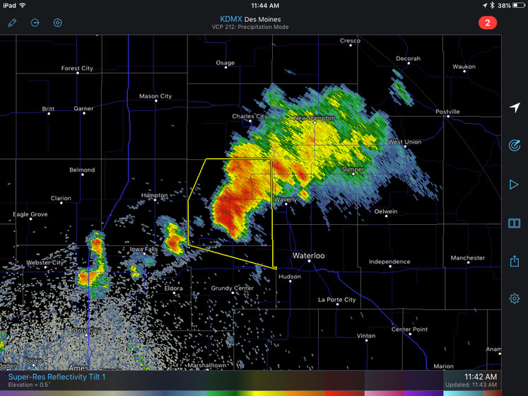
Des Moines Radar 11:42am CDT
Update 12:16pm CDT: Line of thunderstorms capable of damaging winds in excess of 60 mph moving across Wisconsin.
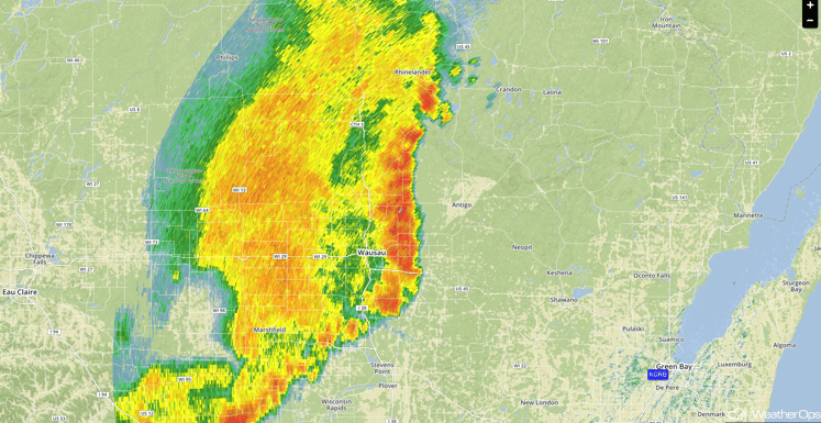
Radar 12:16pm CDT
Major Cities in Region: Dodge City, KS, Kansas City, MO, Des Moines, IA, Omaha, NE, Minneapolis, MN, Milwaukee, WI
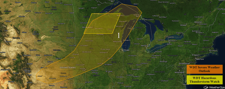
Region 1
Excessive Rainfall Possible Thursday Across the Desert Southwest
Monsoonal rains are forecast to continue with a stationary front across the region. With the continued rainfall, flash flooding will be possible. Rainfall amounts of 1-2 inches with locally higher amounts in excess of 3 inches will be possible.
Major Cities in Region: Flagstaff, AZ, Phoenix, AZ, Grand Junction, CO
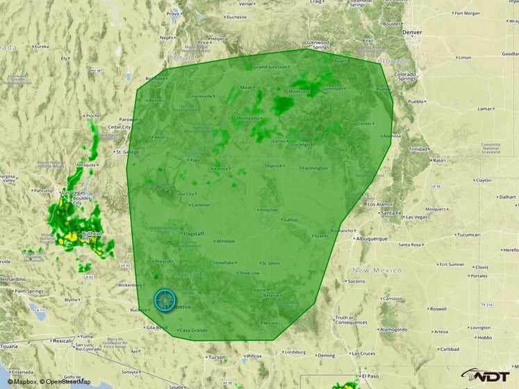
Excessive Rainfall Outline for Thursday
Excessive Rainfall Possible Across Portions of the Southeast Thursday
With a stationary front draped across the Carolinas and Virginia, and rich moisture at the surface, moderate to heavy rain is forecast across the region on Thursday. Rainfall accumulations of 1-2 inches will be possible.
Major Cities in Region: Nashville, TN. Knoxville, TN. Chattanooga, TN, Asheville, NC
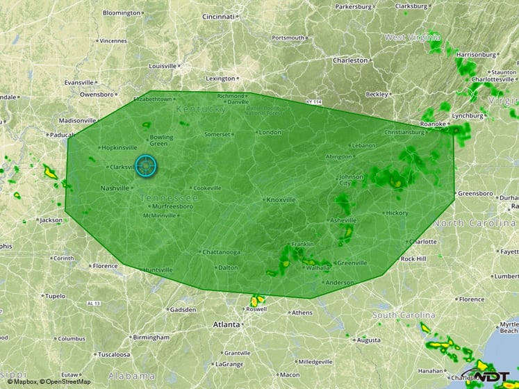
Excessive Rainfall Risk Outline for Thursday
Excessive Rainfall Possible Friday Across the Southern Rockies and Desert Southwest
The main focus for the monsoon rains is forecast to shift northeastward into the Southern Rockies on Friday. Heavy to excessive rainfall will be possible across the region due to the monsoonal rains and thunderstorms expected to develop across the region. Total rainfall accumulations of 2-3 inches will be possible over the area leading to flash flooding due to previous rainfall across the region.
Major Cities In Region: Flagstaff, AZ, Albuquerque, NM, Denver, CO
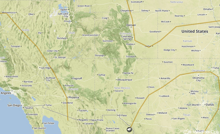
SPC Convective Outlook for Friday
Strong to Severe Thunderstorms Possible Across the Northeast on Saturday
Thunderstorms will be possible across the Northeast on Saturday ahead of a cold front. An upper level trough moving through the region will provide additional support for the development of thunderstorms into the afternoon. Strong winds will likely be the primary hazard with any storms that develop.
Major Cities in Region: Philadelphia, PA, New York, NY, Boston, MA, Augusta, ME
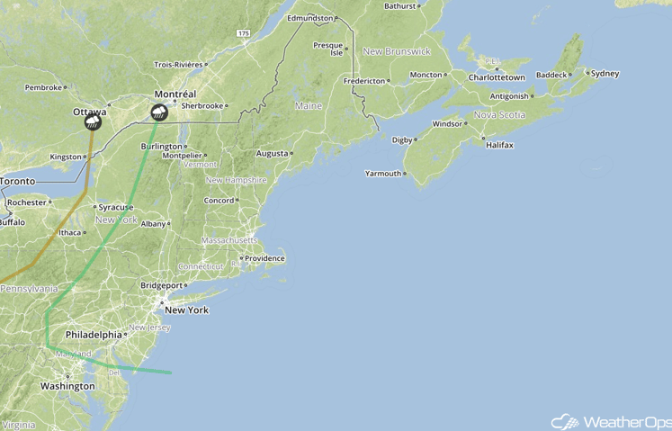
SPC Convective Outlook for Saturday
Excessive Rainfall Possible for Sunday Across the Four Corners Region
Monsoonal rains are forecast to continue once again into Saturday, with the Four Corners region the primary focus for heavy rainfall. An additional 1-2 inches of rainfall may be possible. Flash flooding will be a possibility due to saturated soil.
Major Cities in Region: Albuquerque, NM, Grand Junction, CO, Denver, CO
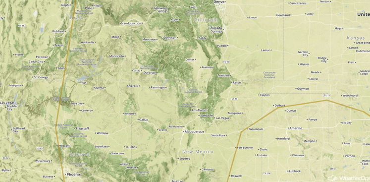
SPC Convective Outlook for Saturday
This is just a brief look at current weather hazards. We can provide you site-specific forecast information for the purpose of protecting your personnel and assets. Try a 7-day demo right away and learn how timely precision weather information can enhance your bottom line.


