National Weather Summary for Thursday, August 31, 2017
by David Moran, on Aug 31, 2017 10:42:17 AM
Excessive rainfall and isolated tornadoes will continue Thursday across the Mid Mississippi and Tennessee Valleys as the remnants of Harvey continue to move northeastward.
- Excessive Rainfall and Thunderstorms for the Mid Mississippi and Tennessee River Valleys on Thursday
- Potential for Excessive Rainfall Friday for the Ohio Valley and Mid Atlantic
- Thunderstorms for the Tennessee Valley on Friday
- Risk for Thunderstorms Saturday along the Mid Atlantic Coast
- Tropical Update
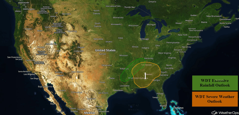 US Hazards
Excessive Rainfall and Thunderstorms for the Mid Mississippi and Tennessee River Valleys on Thursday
Excessive rainfall will continue across the Mid Mississippi and Tennessee River Valleys on Thursday as the remnants of Harvey continues to move across the region. Rainfall amounts of 3-6 inches with locally higher amounts in excess of 8 inches are forecast, leading to the potential for flash flooding through Friday.
In addition, there will be a potential for thunderstorms across the region. The primary hazards will be heavy rainfall, lightning, and isolated tornadoes. The peak tornado potential will be during the mid-afternoon over eastern Mississippi, northern Alabama, and southeastern Tennessee. Some storms may also produce winds in excess of 45 mph.
Update 11:20am CDT: Tornado Watch for portions of Alabama, Mississippi, and Tennessee until 8pm CDT.
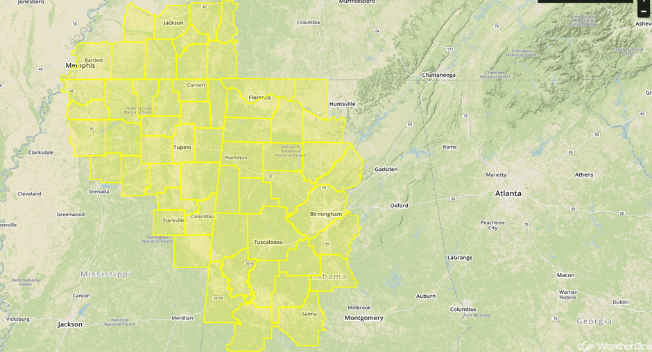 Tornado Watch
Update 11:45am CDT: Several Tornado Warings in effect across Mississippi.
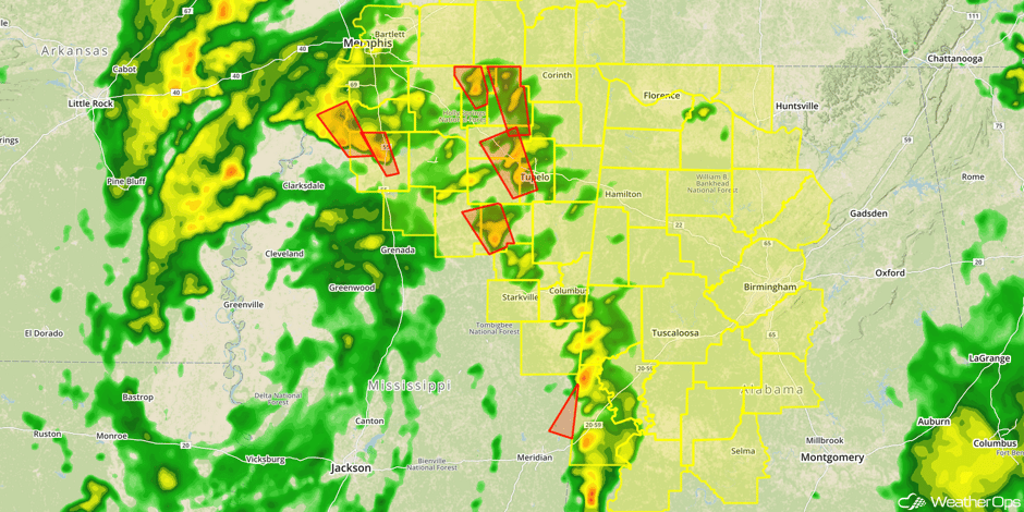 Radar 11:45am CDT
Update 12:23pm CDT: Tornado Warnings east of Memphis, TN.
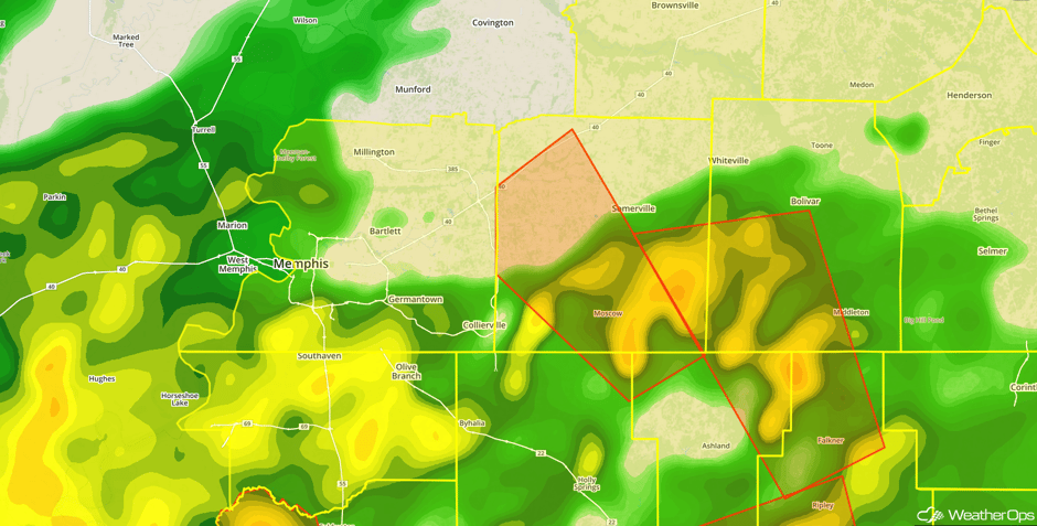 Radar 12:23pm CDT
Major Cities in Region: Little Rock, AR, Memphis, TN, Mobile, AL, Birmingham, AL, Atlanta, GA, Knoxville, TN
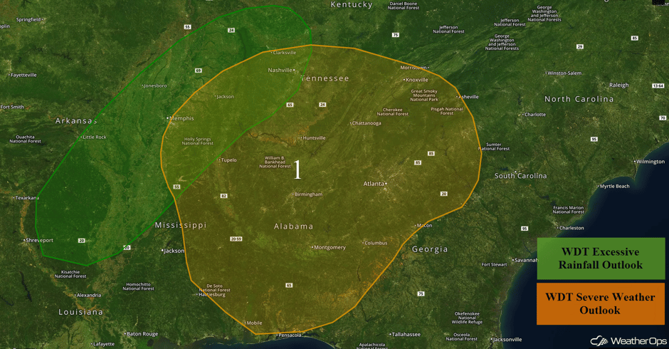 Region 1
Potential for Excessive Rainfall Friday for the Ohio Valley and Mid Atlantic
By Friday, the more significant rainfall will likely come to an end, but the remnants of Harvey may produce 1-2 inches across portions of the Ohio Valley and Mid Atlantic. Areas along the northern Kentucky border may see accumulations in excess of 3 inches.
Major Cities in Region: Memphis, TN, Nashville, TN, Louisville, KY, Knoxville, TN, Charlotte, NC, Raleigh, NC, Richmond, VA, Norfolk, VA
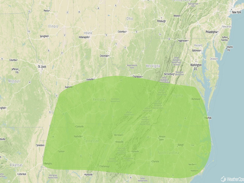 Excessive Rainfall Risk Outline for Friday
Risk for Thunderstorms Saturday along the Mid Atlantic Coast
The excessive rainfall threat will come to an end on Saturday, but there will be a risk for severe thunderstorms along the Mid Atlantic coast on Saturday. Damaging winds and an isolated tornado or two will be the primary hazards.
Major Cities in Region: Atlantic City, NJ
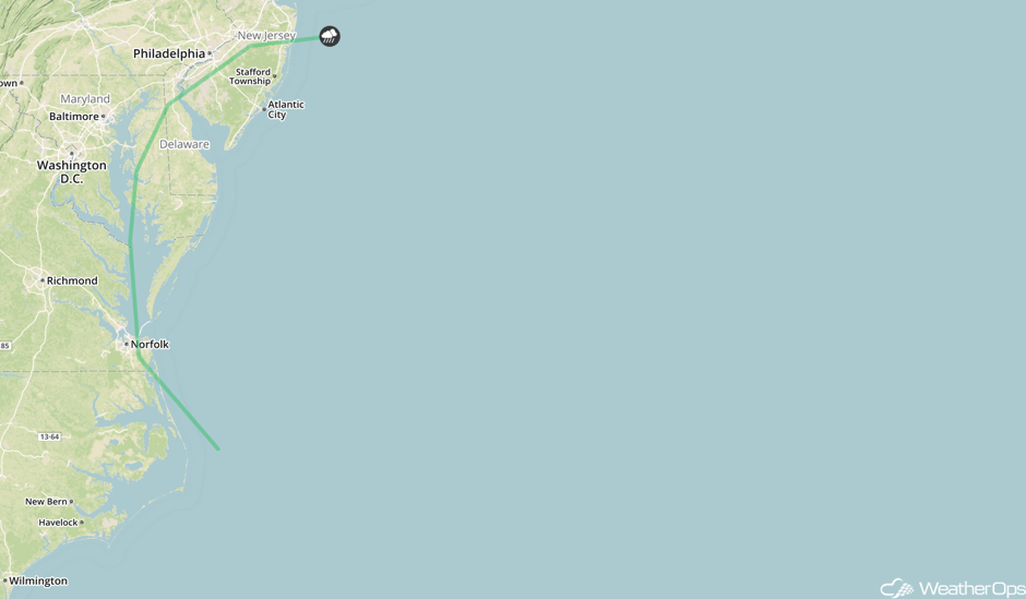 SPC Convective Outlook for Saturday
Tropical Update
Tropical Depression Harvey (green oval) has weakened and will continue to bring flooding rains to portions of the Lower Mississippi Valley and the Tennessee Valley through Friday.
Irma (red oval) has become a hurricane and is located 650 miles west of the Cabo Verde Islands. West-northwestward motion is expected to continue through Friday, becoming westward on Saturday. Sustained winds have increased to 100 mph with higher gusts. Irma is expected to become a major hurricane by tonight.
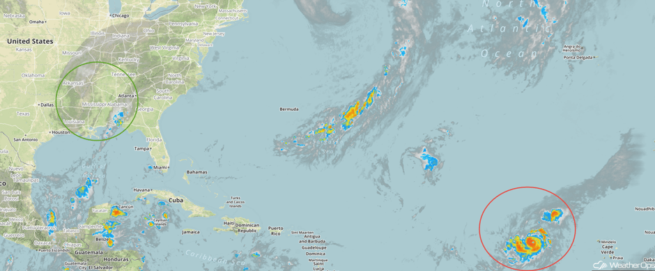 Enhanced Infrared Tropical Satellite
A Look Ahead
High pressure will build across much of the country on Sunday. A few showers and thunderstorms may develop across the Northeast on Sunday, but no severe activity is expected.
This is just a brief look at current weather hazards. We can provide you site-specific weather forecast information for the purpose of protecting your personnel and assets and to assess your weather risk. Try a 7-day demo right away and learn how timely precision weather information can enhance your bottom line.


