National Weather Summary for Thursday, August 3, 2017
by David Moran, on Aug 3, 2017 10:56:13 AM
Thunderstorms may develop across the Midwest on Thursday as an area of low pressure and cold front continue to progress eastward. A few thunderstorms may be possible across New Mexico and the Texas Panhandle at the tail end of the aforementioned cold front. Monsoonal moisture moving into the Desert Southwest will allow for the risk for heavy rainfall. A stalled front along the Gulf Coast will be the focus for the development of thunderstorms capable of producing excessive rainfall.
- Thunderstorms across the Midwest on Thursday
- Risk for Thunderstorms Thursday for New Mexico and the Texas Panhandle
- Potential for Thunderstorms across Portions of the Northeast on Thursday
- Thunderstorms Continuing Thursday for the Gulf of Mexico
- Continued Excessive Rainfall Risk for the Desert Southwest on Thursday
- Excessive Rainfall Thursday for the Gulf Coast
- Thunderstorms from the Northeast to the Tennessee Valley on Friday
- Thunderstorm Potential Friday for the Central High Plains
- Strong to Severe Thunderstorms for the Northeast on Saturday
- Thunderstorms Saturday for the Central Plains
- Tropical Update
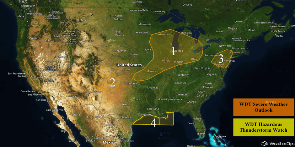 US Hazards
Thunderstorms across the Midwest on Thursday
An area of low pressure moving across the Great Lakes will be the focus for severe thunderstorm development. Some cloud cover and ongoing thunderstorms could hinder development, but new storms are expected during the afternoon. Large hail and damaging winds will be the primary hazards, but a few tornadoes cannot be ruled out across Wisconsin.
Update 1:47pm EDT: Thunderstorms capable of large hail and damaging winds developing across southern Michigan and northern Ohio.
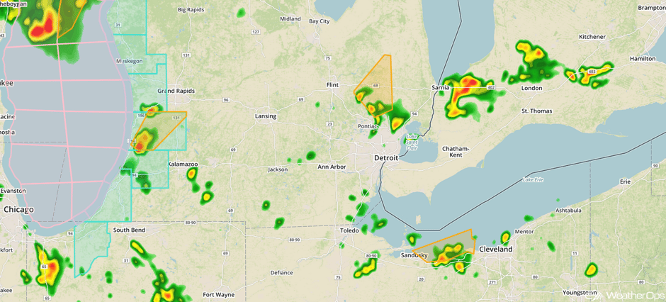 Radar 1:47pm EDT
Update 1:39pm CDT: Severe thunderstorm producing large hail northwest of Milwaukee.
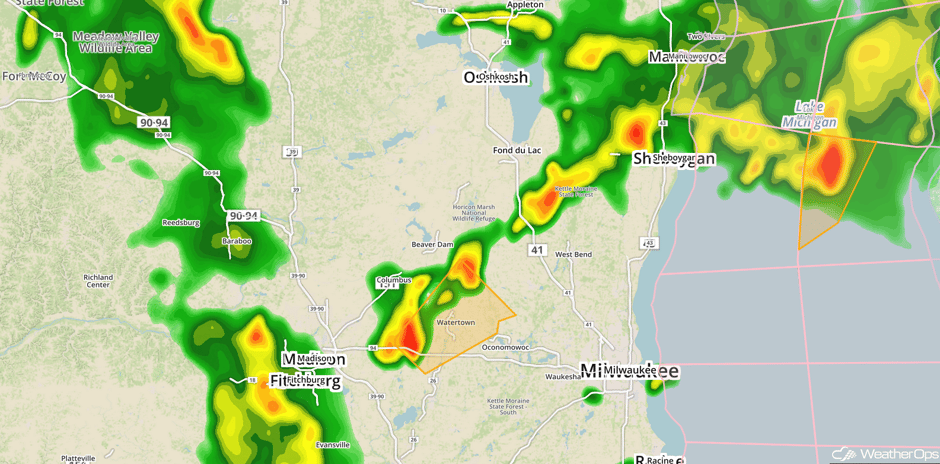 Radar 1:39pm CDT
Major Cities in Region: St. Louis, MO, Madison, WI, Green Bay, WI, Milwaukee, WI, Chicago, IL, Indianapolis, IN, Detroit, MI, Cleveland, OH
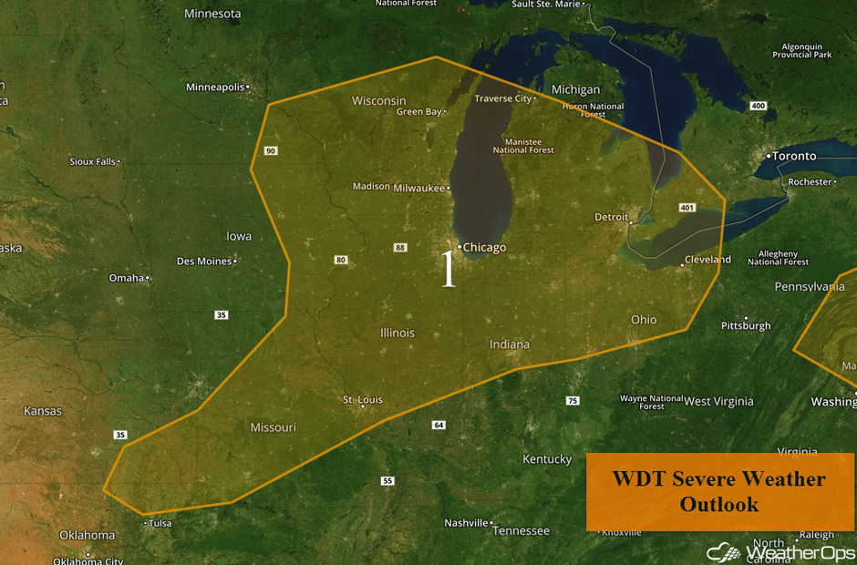 Region 1
Risk for Thunderstorms Thursday for New Mexico and the Texas Panhandle
A cold front moving southward will be the focus for thunderstorm development across the South Central High Plains. Strong wind gusts and hail will be the primary hazards with these storms.
Major Cities in Region: Santa Fe, NM, Colorado Springs, CO, Amarillo, TX
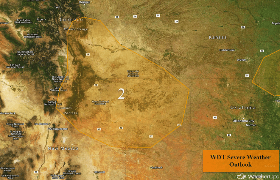 Region 2
Potential for Thunderstorms across Portions of the Northeast on Thursday
Another round of thunderstorms due to daytime heating is expected across the Mid Atlantic into the Northeast. As thunderstorms develop, damaging winds will be the primary hazard. Activity should weaken and diminish as the sun sets.
Update 2:21pm EDT: Severe thunderstorm capable of hail and damaging winds in southern Delaware.
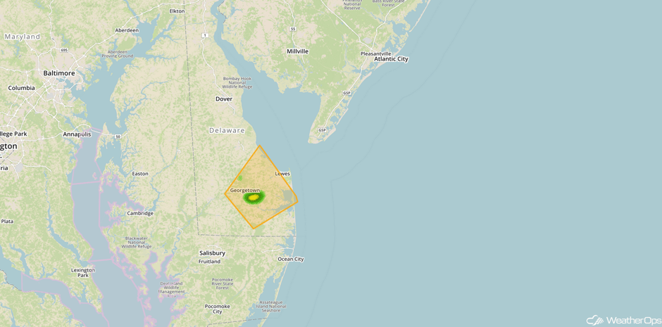 Radar 2:21pm EDT
Major Cities in Region: Baltimore, MD, Philadelphia, PA, New York, NY
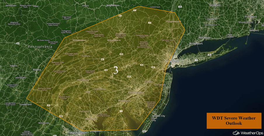 Region 3
Thunderstorms Continuing Thursday for the Gulf of Mexico
A shortwave trough is forecast to track across the Deep South and Southeast this morning. With ample instability and moisture spread across the region and this upper level level trough producing ample forcing across the northern Gulf of Mexico, scattered showers and thunderstorms are expected to increase in coverage and intensity. Some of these storms could produce heavy rain, frequent lightning, hail in excess of 0.50 inch, and wind gusts in excess of 40 knots.
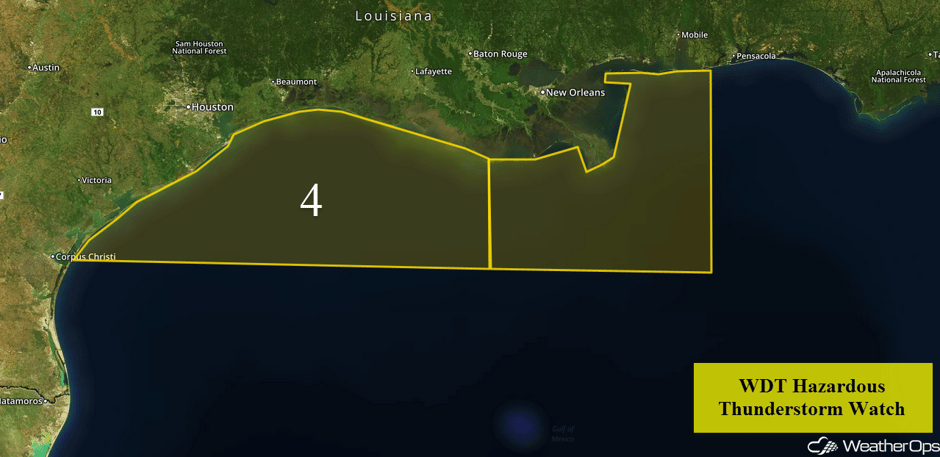 Region 4
Continued Excessive Rainfall Risk for the Desert Southwest on Thursday
Monsoonal moisture continues to stream into the region, allowing for the development of isolated to scattered showers and thunderstorms later this afternoon and evening. While rainfall amounts should remain below an inch, locally heavier downpours may produce minor flooding and local runoff.
Major Cities in Region: Palm Springs, CA, Las Vegas, NV, Phoenix, AZ
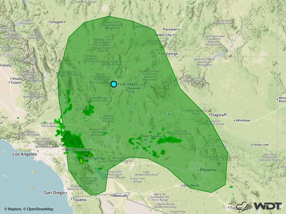 Excessive Rainfall Risk Outline for Thursday
Excessive Rainfall Thursday for the Gulf Coast
The presence of a stalled front along the Gulf Coast will promote numerous showers and thunderstorms on Thursday. Deep moisture along the front will support showers and thunderstorms with a threat for excessive rainfall. Amounts ranging from 0.50-1.50 inches will pose a threat for flooding and local runoff into the evening and overnight hours.
Major Cities in Region: Corpus Christi, Houston, TX, New Orleans, LA, Tallahassee, FL, Savannah, GA, Myrtle Beach, SC
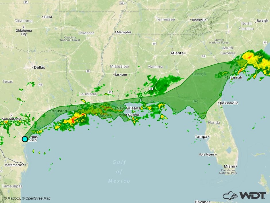 Excessive Rainfall Risk Outline for Thursday
Thunderstorms from the Northeast to the Tennessee Valley on Friday
A cold front is forecast to move across the Northeast, allowing for the development of thunderstorms capable of producing strong winds. Some storms may produce large hail and a few tornadoes during the afternoon and evening, but the wind threat may continue after dark.
Major Cities in Region: Nashville, TN, Cincinnati, OH, Cleveland, OH, Pittsburgh, PA, Albany, NY
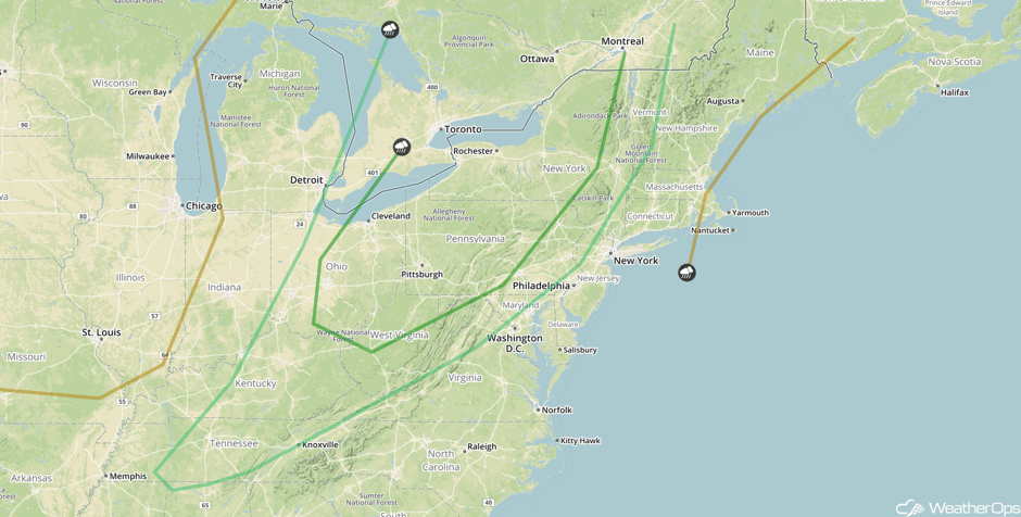 SPC Convective Outlook for Friday
Thunderstorm Potential Friday for the Central High Plains
Conditions may be favorable for the development of thunderstorms across the Central High Plains on Friday. Strong winds and hail will be the primary hazards with any storms that develop. Activity could evolve into a complex of storms after dark with an increased threat of severe winds.
Major Cities in Region: Denver, CO, Colorado Springs, CO, Cheyenne, WY, Rapid City, SD
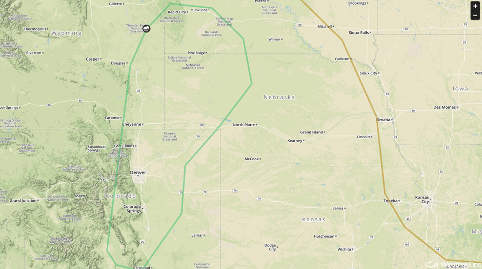 SPC Convective Outlook for Friday
Strong to Severe Thunderstorms for the Northeast on Saturday
As the area of low pressure described above continues to lift northward on Saturday, the cold front will stall across the Northeast. Thunderstorms will likely develop ahead of the front during the afternoon. Large hail and damaging winds will be the primary hazards with any storms that develop.
Major Cities in Region: Albany, NY, Boston, MA, Portland, ME, Augusta, ME, Bangor, ME
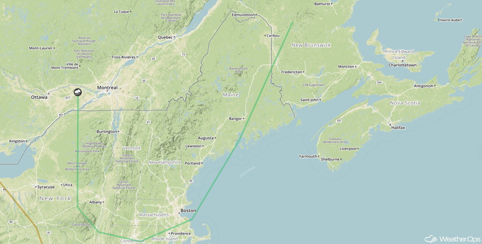 SPC Convective Outlook for Saturday
Thunderstorms Saturday for the Central Plains
A developing area of low pressure will move southward across the Central Plains on Saturday, bringing a risk for thunderstorms during the late evening and after dark. Severe winds and hail will be the primary hazards with these storms.
Major Cities in Region: Billings, MT, Cheyenne, WY, Pierre, SD, Oklahoma City, OK, Tulsa, OK, Omaha, NE, Kansas City, MO
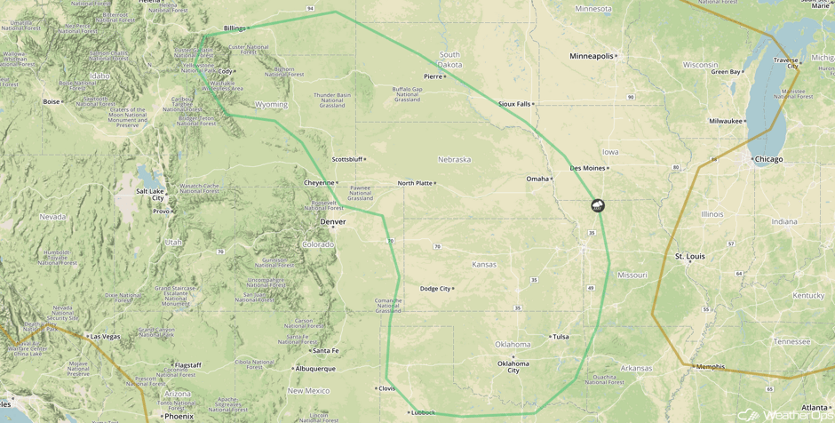 SPC Convective Outlook for Saturday
Tropical Update
A large area of showers and thunderstorms centered about 500 miles southeast of the Cabo Verde Islands is associated with a strong tropical wave. Environmental conditions are forecast to be conducive for gradual development. A tropical depression could develop over the eastern or central Atlantic early next week. This system is forecast to move toward the west or west-northwest at 10-15 miles for the next several days.
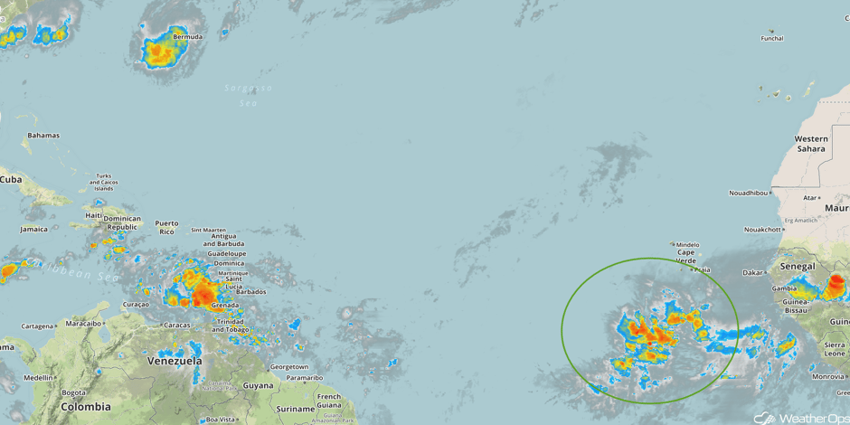 Enhanced Infrared Tropical Satellite
A Look Ahead
Showers and thunderstorms may develop across the Central Plains and Midwest on Sunday along a stalled front. Severe weather is not currently anticipated. Early next week, showers and thunderstorms may develop ahead of a cold front extending from the Ohio Valley into Texas.
This is just a brief look at current weather hazards. We can provide you site-specific weather forecast information for the purpose of protecting your personnel and assets and to assess your weather risk. Try a 7-day demo right away and learn how timely precision weather information can enhance your bottom line.


